 Portuguese
  English
  Spanish
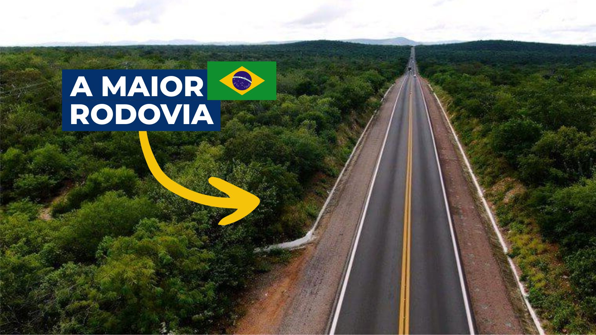


With Almost 5 Thousand Kilometers, The BR-116 Crosses Brazil from End to End, Revealing Geographical, Cultural, and Social Contrasts That Escape Traditional Itineraries and Surprise Even the Most Experienced Travelers.
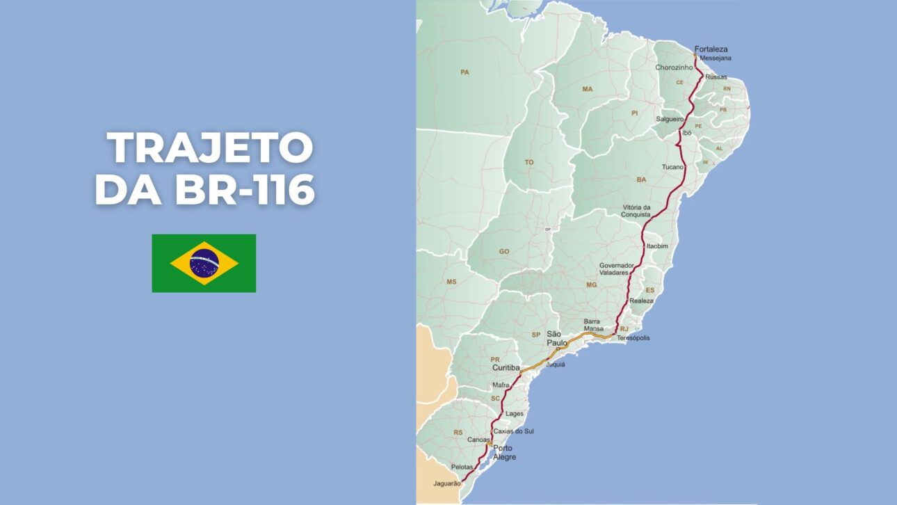
The BR-116, the main highway entirely national, extends for about 4,660 kilometers between Ceará and Rio Grande do Sul, connecting 10 states and merging urban, rural, and cultural realities rarely depicted in traditional tourism.
It starts in Fortaleza (CE), on the northeastern coast, and ends at the border with Uruguay, in Jaguarão (RS).
Along the way, it crosses capitals such as Salvador (BA), Rio de Janeiro (RJ), Curitiba (PR), and Porto Alegre (RS), as well as small towns and almost isolated stretches — depicting Brazil in all its diversity.
-
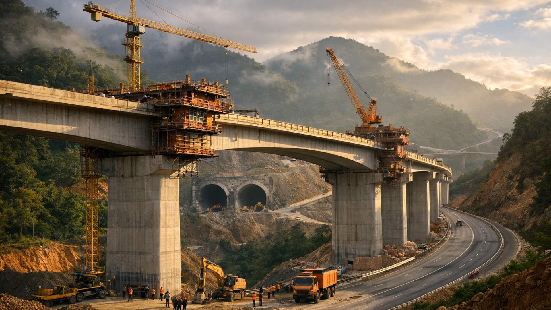
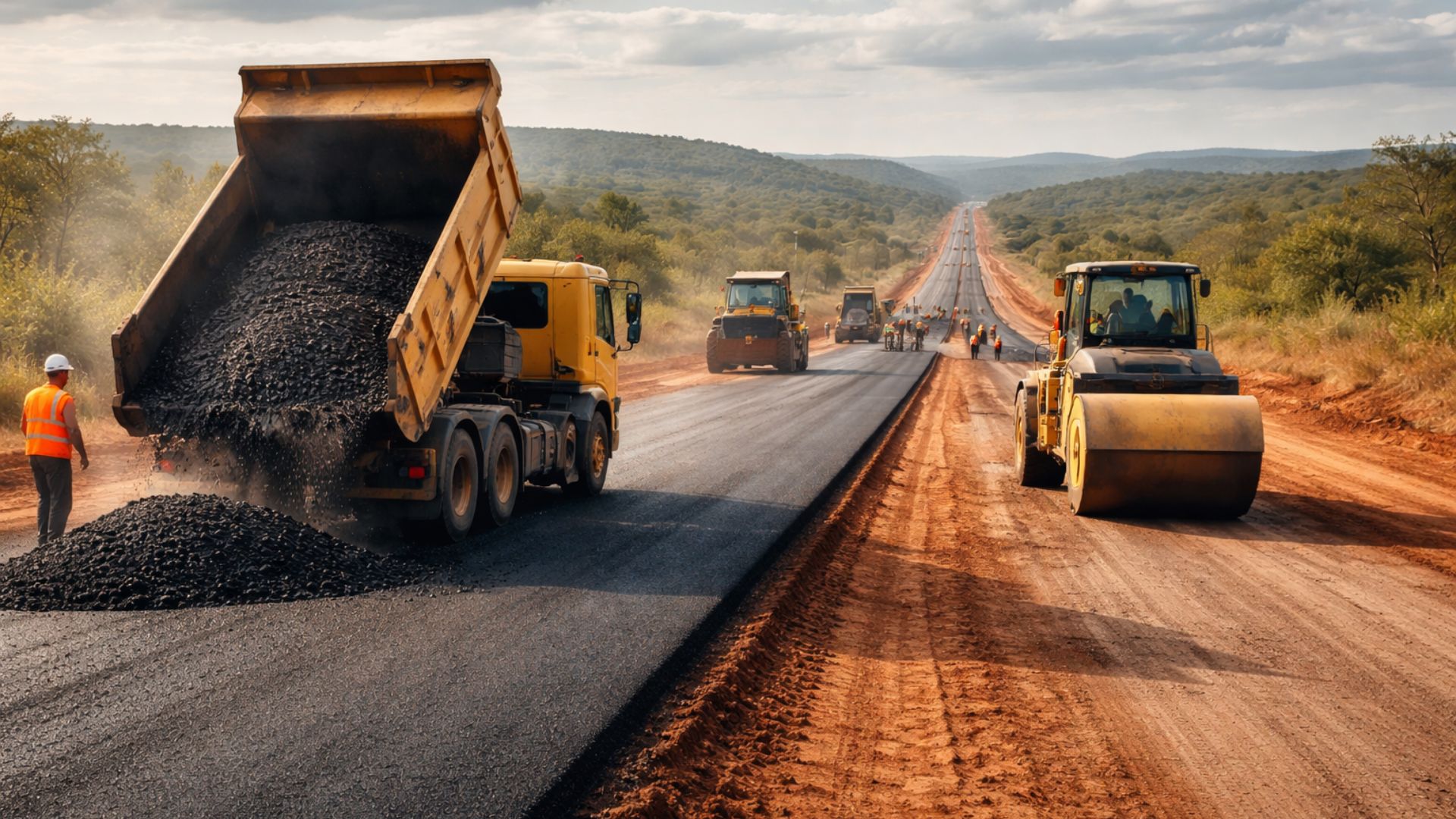
The government puts R$ 8.6 billion on the table to change the highway (BR) with 50 overpasses, 28 bridges, 4 tunnels, and 40 km of bike lanes in 180 km of historic duplication.
-
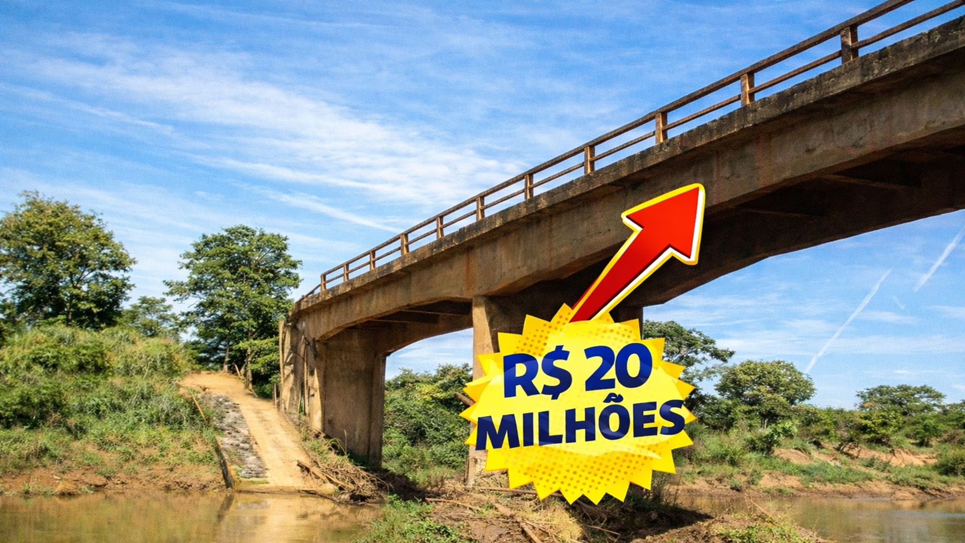
BRL 20.1 Million Bridge Project Kicks Off: 200-Meter Construction to Improve Access in Three Cities in Minas Gerais
-
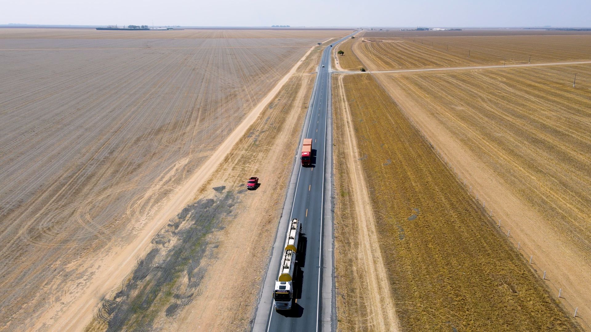
‘Endless Road’ In Brazil Is One of The Largest In The World: 145 Km Stretch On An Important Highway (BR) Crosses The West Of Bahia And Had 135.9 Km Revitalized With R$ 35.3 Million
-
Engineer From ITA Who Worked at Embraer Leads Free Flow Expansion With National Artificial Intelligence and Technology for Toll Without Barriers in Brazil


The BR-116 as a Strategic Axis of Brazil
Since its opening in different stages throughout the 20th century, the highway has established itself as an essential axis for the flow between the North, Northeast, Southeast, and South regions.
In the segments between São Paulo and Rio de Janeiro, as well as in the Southern Region, it is considered one of the busiest highways in the country, especially for freight transport.
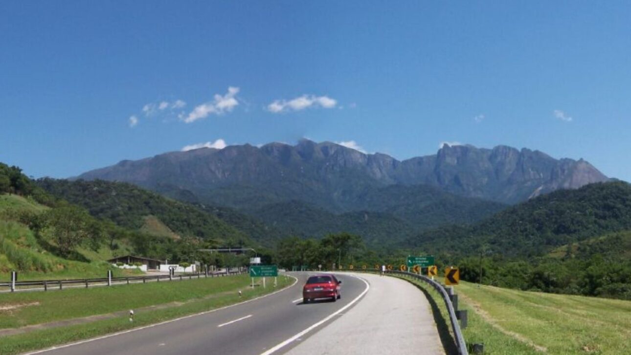
The stretch known as Serra do Cafezal, linking São Paulo and Curitiba, features winding curves and heavy truck traffic, making it a critical point for road safety.
The segment linking Governador Valadares (MG) to Feira de Santana (BA) is historically known by the nickname “Highway of Death,” due to the high rates of fatal accidents recorded.
A Portrait of Brazil Outside the Tourist Circuit
Although it is an expressive route for trade and services, the BR-116 also offers unique cultural and scenic experiences.
In the South, it appears in regions with strong influence from German and Italian colonization, highlighting the typical cuisine of these communities.
In the Southeast, it traverses industrial poles and urban agglomerations, reflecting the accelerated and urban Brazil.
In the Northeast, the road crosses areas of caatinga, sertão, and coastline, showcasing contrasts between arid areas and lush landscapes.
The Road Attracts Backpackers and Travelers
The tourist use of the road is increasing among travelers and backpackers interested in getting to know the country outside of standardized itineraries.
Along the route, it is possible to find everything from environmental protection areas and traditional communities to historical sites and popular markets.
Although there is no official survey, reports on blogs and videos indicate a variety of accents, climates, and ways of life based on the small stops.
Challenges in the Infrastructure of the BR-116
From a logistical standpoint, there are challenges.
Various stretches still lack duplication, have potholes, deficient signage, and a scarcity of support stations or emergency services.
Despite this, federal and state agencies have promoted modernization works, with duplications and pavement recovery, especially in areas with higher vehicle circulation.
The infrastructure, although imperfect, supports a trajectory that goes beyond transportation: the BR-116 functions as a geographical line that stitches together different layers of Brazil, often invisible to those who only transit between large urban centers.
The Highway as a Link for National Integration
In economic terms, the highway is responsible for a significant portion of road freight transport between the South and the North, according to indicators from the DNIT, which point to a large concentration of traffic between São Paulo and Curitiba, in addition to the Southern Region.
In social aspects, the road reveals varied realities. In the capitals, it witnesses the urban and industrial pace.
In the villages, it approaches rural communities and local traditions. In the Northeast, it impacts areas with lower population density. In the South, it is inserted into territories historically shaped by European immigration.

Tourism and Discoveries Outside the Obvious
Among the less publicized episodes, initiatives in ecotourism and community tourism stand out.
There are natural parks near the route, reserves of native forest, and stopping points in villages that hold historical secrets.
As for the exact extension of these points, there are no official numbers available — the experiences are based mainly on records from those who travel the route.
The contrasts of the BR-116 — urbanity and isolation, integration and abandonment, safety and risk — reflect Brazilian complexity.
Each stretch reveals distinct lives and ecosystems, connected by a single road.
Although it is often associated with freight transport and economic progress, the BR-116 also records phases of neglect — evidenced in stretches still not duplicated, unstable slopes, and insufficient support stations.
In recent years, federal programs and state investments have been working to address these deficiencies.
Duplication works advance in high-demand areas, while targeted reforms seek to improve conditions in degraded stretches.
When reflecting on its significance, the BR-116 emerges as something beyond a road: it is a living way that reveals the authentic, plural, and transforming country.
Those who traverse it from end to end witness a chain of stories, challenges, and discoveries — photographs of a profound Brazil.
Have you passed through any of the 10 states crossed by the BR-116? What did you think of the experience, reader?


Conheço vários trechos da BR-116, especialmente no Nordeste e Sudeste, mas desconheço e contesto que ela corte ou passe em algum trecho em Salvador-BA. Ela passa sim na cidade de Feira de Santana-BA, que fica a aproximadamente 115Km da capital Salvador.
A br 116 não passa por Salvador/Ba e sim em Feira de Santana/Ba
Já percorri de carro toda a BR116 várias vezes e posso dizer que só tem melhorado ao longo dos anos. Pode-se viajar por ela sem temer buracos inesperados ou trechos sem pavimentação.