 Portuguese
  English
  Spanish


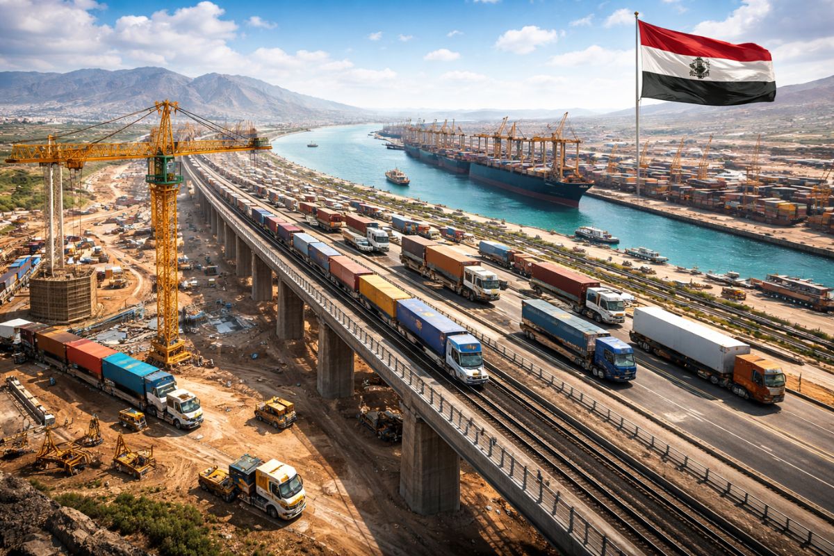
The Proposed US$ 50 Billion Canal by Nicaragua Combines 278 Km of Extension, a Crossing of About 105 Km Through Lake Nicaragua, Giant Locks, Two Ports, an Airport, a Railroad, and a Pipeline in an Attempt to Challenge the Panama Canal and Reposition the Country in the Trade of the Americas and the World.
The US$ 50 billion canal envisioned by Nicaragua is not just a passage between the Pacific and the Caribbean. According to the proposed layout, the project would cross 278 km, absorb about 105 km of Lake Nicaragua, and create space for ships much larger than those that currently still bump against the physical limitations of the Panama Canal.
Behind this ambition lies more than concrete, dredging, and locks. The project touches on global trade, geopolitical disputes, seismic risk, freshwater, and disproportionate financing for an economy with an annual GDP of about US$ 15 billion. It is this mix of logistical calculation and strategic wager that makes the proposal seem simultaneously powerful and fragile.
A Route Designed to Be Larger Than Panama

The US$ 50 billion canal was designed to impress right on the map. While the Panama Canal is about 82 km long, the Nicaraguan proposal speaks of 278 km, more than three times that length.
-
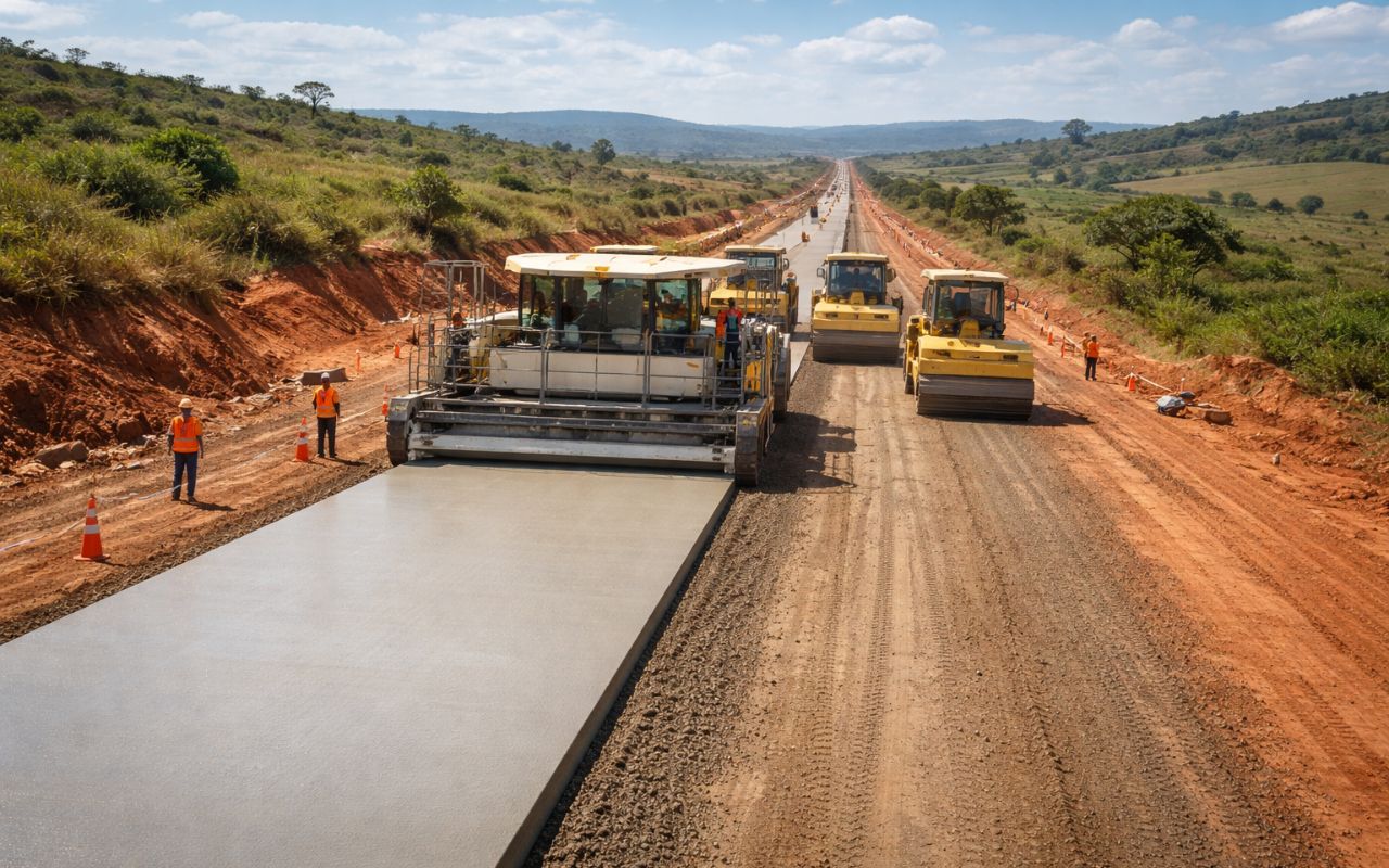
New CCR concrete paving technology promises roads up to 3x more durable, less maintenance, and cost reduction in Brazil.
-
Made from recycled plastic, plastic wood is gaining space in the construction industry because it does not rot, resists moisture, and reduces maintenance costs over the years.

-
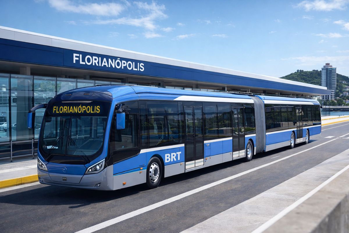
Florianópolis will receive a million-dollar BRT that will begin construction in 2026 with nearly 400 million in funding from the federal government and the Inter-American Development Bank, and the map already shows the routes for the exclusive bus corridors.
-
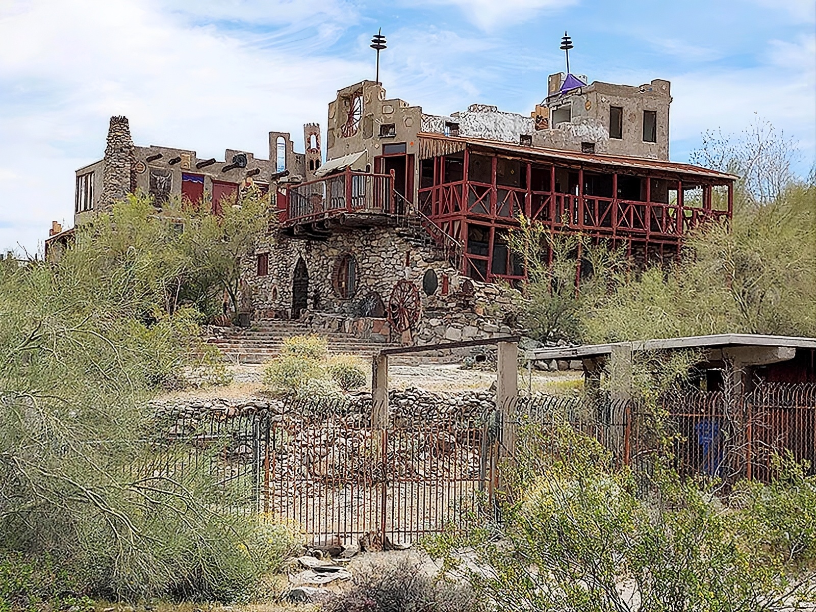
Without a blueprint, without an engineer, and using scrap from the dump, a father spends 15 years building an 18-room castle for his daughter, featuring tram tracks, 13 fireplaces, and over 700 m², which may now be demolished.

The planned average depth would range between 27 and 30 meters, with a width of more than 500 meters in some sections, enough to accommodate ships with up to 400 thousand tons of displacement, including supertankers and large container ships.
This design changes the scale of the project. It is not just about creating an alternative route, but about setting up an interoceanic corridor capable of receiving vessels that have grown faster than traditional infrastructure.
Nicaragua did not want to copy Panama; it wanted to offer an even larger route, aligned with the increasing size of ships and the pressure for wider routes in maritime trade.
The route does not end at the canal itself. The plan included two deep-water ports, an international airport, industrial zones, a parallel pipeline, and complementary railway infrastructure.
In other words, the project was presented as a continental logistics complex, not just as a simple navigable trough dug between two oceans.
This is where the project gains political density. A small country with limited resources would position itself as a new axis of global circulation.
When a maritime corridor is accompanied by ports, industry, railroads, and energy, it ceases to be just a construction and becomes a project of power.
The Idea Is Old, but the Context Has Changed

The Nicaraguan ambition did not just arise now. Long before Panama consolidated its position, Nicaragua was already appearing as a viable option for a link between the Atlantic and the Pacific.
Lake Nicaragua was seen as a natural advantage because it reduced the need for continuous excavation and offered a large internal shortcut within the territory.
During the 19th century, engineers and foreign interests studied this possibility seriously. The route seemed promising, but the strong volcanic activity in the region weighed against the choice.
Volcanoes like Momotombo helped crystallize the image of geological risk, and Panama ultimately assumed the place that would shape logistics in Central America over the following century.
Nicaragua’s return to the scene came when the growth of maritime transport made the physical limitations of Panama more evident.
Even after being expanded in 2016, the Panama Canal remains stuck to an operational ceiling that no longer accommodates the entire scale desired by the shipping industry, especially with the expansion of ships exceeding 20,000 TEUs.
It was in this gap between growing demand and limited capacity that Nicaragua reappeared as a competitive hypothesis.
In 2013, the government of Daniel Ortega granted a 50-year license, renewable for another 50, to HKND Group, led by Chinese businessman Wang Jing.
The announcement had an immediate effect because the estimated value of the project, US$ 50 billion, represented more than three times the entire annual economy of the country. And there was an even more sensitive ingredient: Chinese capital in an interoceanic infrastructure within Central America.
When Engineering Begins to Challenge Geology Itself
If the alignment is ambitious, the execution is even tougher. Preliminary studies indicated the removal of more than 5 billion cubic meters of earth and sediment. For comparison, the recent expansion of the Panama Canal removed about 150 million cubic meters.
The Nicaraguan volume would be more than 30 times greater, equivalent to hundreds of millions of truck trips if all the material were transported by conventional means.
The problem is not just digging extensively. The proposed route crosses dense tropical forests, marshy areas, unstable soils, zones near seismic faults, and Lake Nicaragua itself.
Each section requires different engineering, and the entire set requires coordination that few projects in the world have managed to sustain for so long without collapsing in cost, schedule, or risk.
The planned locks also help to gauge the scale. Each set would be about 520 meters long, 75 meters wide, and up to 30 meters deep.
The operation would be comparable to or exceed that of Panama, but with one sensitive detail: each passage would consume around 190 million liters of freshwater. If the canal operated with 15 ships per day, the daily use could approach 3 billion liters.
This consumption weighs even more because Nicaragua does not start from a water system as consolidated as Panama’s to sustain operations of this scale during dry periods.
The project would not only need to move ships; it would need to ensure enough water to continue functioning without collapsing its own environment.
The Lake That Provides Viability Also Concentrates the Greatest Risk
Lake Nicaragua is the project’s physical heart and also its most vulnerable part. The plan envisioned that about 105 km of the route would pass through this body of water, the largest natural reservoir of freshwater in Central America. This transforms the lake into a logistical advantage, but also into a critical point of ecological impact.
Any significant alteration in the sediment dynamics could increase turbidity, alter aquatic ecosystems, and compromise water quality. Added to this is the operation of large vessels with heavy fuels.
A single spill in an environment of this scale would not be just a localized accident; it could spread effects across thousands of square kilometers.
There is also the human factor. Along the proposed route, communities could be displaced, impacting fishing, agriculture, and supply. Thus, the canal would not only change shipping routes. It would change the territorial organization of entire areas, including where freshwater is already part of everyday survival.
This type of cost is often hidden behind the grandeur of the project. But in a project like this, what seems like an environmental detail can become the greatest factor of political instability, because it affects territory, production, and the permanence of populations living exactly where engineering wants to advance.
The Promised Money and the Reality That Stalled the Project
In the official account, the US$ 50 billion canal promised to transform the Nicaraguan economy. During the construction, estimates suggested 40,000 to 50,000 direct jobs, in addition to thousands of indirect positions in services, transportation, food, and logistics.
For a country with about 6.5 million inhabitants, this indicated a structural reconfiguration of the labor market and GDP over the years.
There was also the promise of reducing global dependence on Panama and increasing competitiveness for routes capable of using larger vessels.
If the corridor functioned as planned, Nicaragua would not just operate as a transit territory but as a continental platform for circulation, industry, and storage. In theory, it was the kind of project capable of changing the geoeconomic weight of a whole country.
But the initial enthusiasm did not withstand the combination of massive financing, regulatory instability, environmental doubts, and the need for long-term political support.
Projects of this magnitude only move forward when there is solid capital, institutional predictability, and confidence that the project will outlast governments, crises, and external shocks without falling apart along the way. It was precisely this set that began to fail.
In 2024, the original concession was officially canceled by the Nicaraguan Congress. The great promise did not open the first large plot of land and entered a more uncertain zone, where megaprojects are not technically dead but also no longer manage to convince enough to come to fruition.
The canal continued to exist as a strategic ambition but lost its status as a project in motion.
In the end, Nicaragua tried to present itself as a structural rival to the Panama Canal with a proposal of 278 km, giant ships, crossing the largest lake in Central America, and an estimated investment of US$ 50 billion.
The idea put the country back on the map of major logistical disputes, but also exposed the limit between geopolitical vision and real capacity for execution.
If this canal had progressed, what would weigh more in your reading: the chance of reducing dependence on Panama, the environmental risk over Lake Nicaragua, or the use of a project of this size as a piece of dispute between the United States and China? And, looking at the end consumer, do you believe that a corridor of this scale would genuinely lower global costs or just change who controls the route?


They should put a railway system in place . It would be an alternative to the panama canal
That would be a train over 120 km long for one container ship
No es Nicaragua, son los chinos que lo están haciendo
Primeiro, por ser uma obra gigantesca, cerca de 300 bilhões de reais e o tempo de execução, dificilmente iria reduzir custos e valores.
Segundo, por motivos geopolíticos e de execução complexa, dificilmente sairá do papel.