 Portuguese
  English
  Spanish
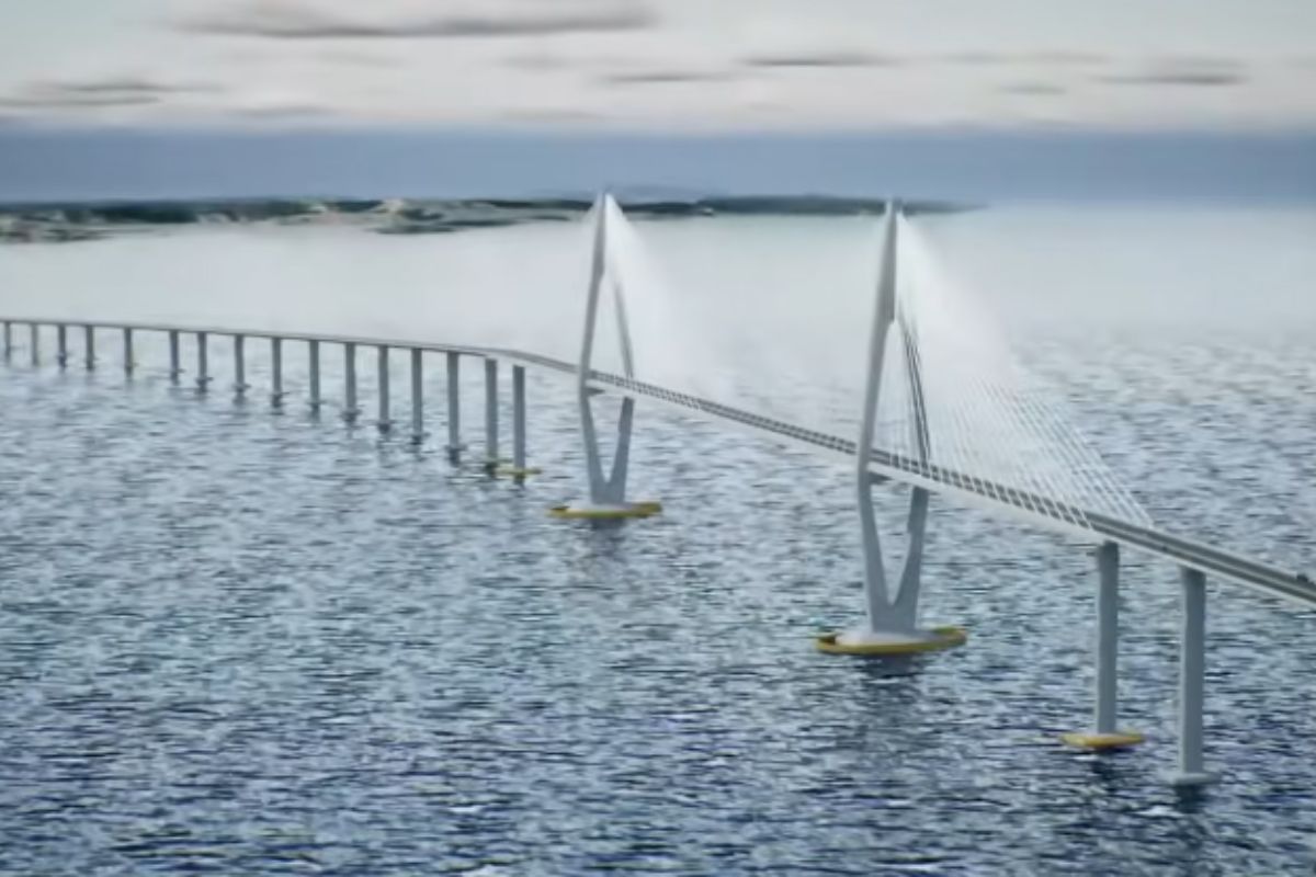


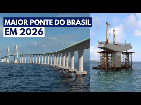
The Salvador-Itaparica Bridge Reaches 2026 with Deep Drilling Completed, Logistics Base Set Up in All Saints Bay, and Official Forecast for the Start of Heavy Construction This Semester.
In January 2026, after years of contractual adjustments, licensing, and geotechnical studies, the Salvador-Itaparica Bridge ceases to be just an ambitious line on the map and enters the stage where cranes, platforms, and piles appear at sea, or the project loses credibility. With the system ready for a crossing of about 15 minutes over 12.4 km of bridge, the challenge now is to turn technical preparation into visible work.
At the same time, the Salvador-Itaparica Bridge bears the weight of being Brazil’s largest bridge project and promises a new road axis for Salvador, the Recôncavo, and the Lower South. Deep drilling, subsurface modeling, and a logistics base of hundreds of thousands of square meters are already part of the project’s history, but it is the heavy construction anticipated for this semester of 2026 that will determine whether the schedule goes into cruising mode or enters another cycle of doubts.
A Whole Corridor, Not Just A Bridge

From the beginning, the Salvador-Itaparica Bridge was designed as the most visible part of a complete road corridor, not as an isolated work.
-
The lack of welders, electricians, and operators becomes a structural threat in 2025, with the construction industry and manufacturing already suffering from delays, cost pressures, and labor shortages in Brazil.
-
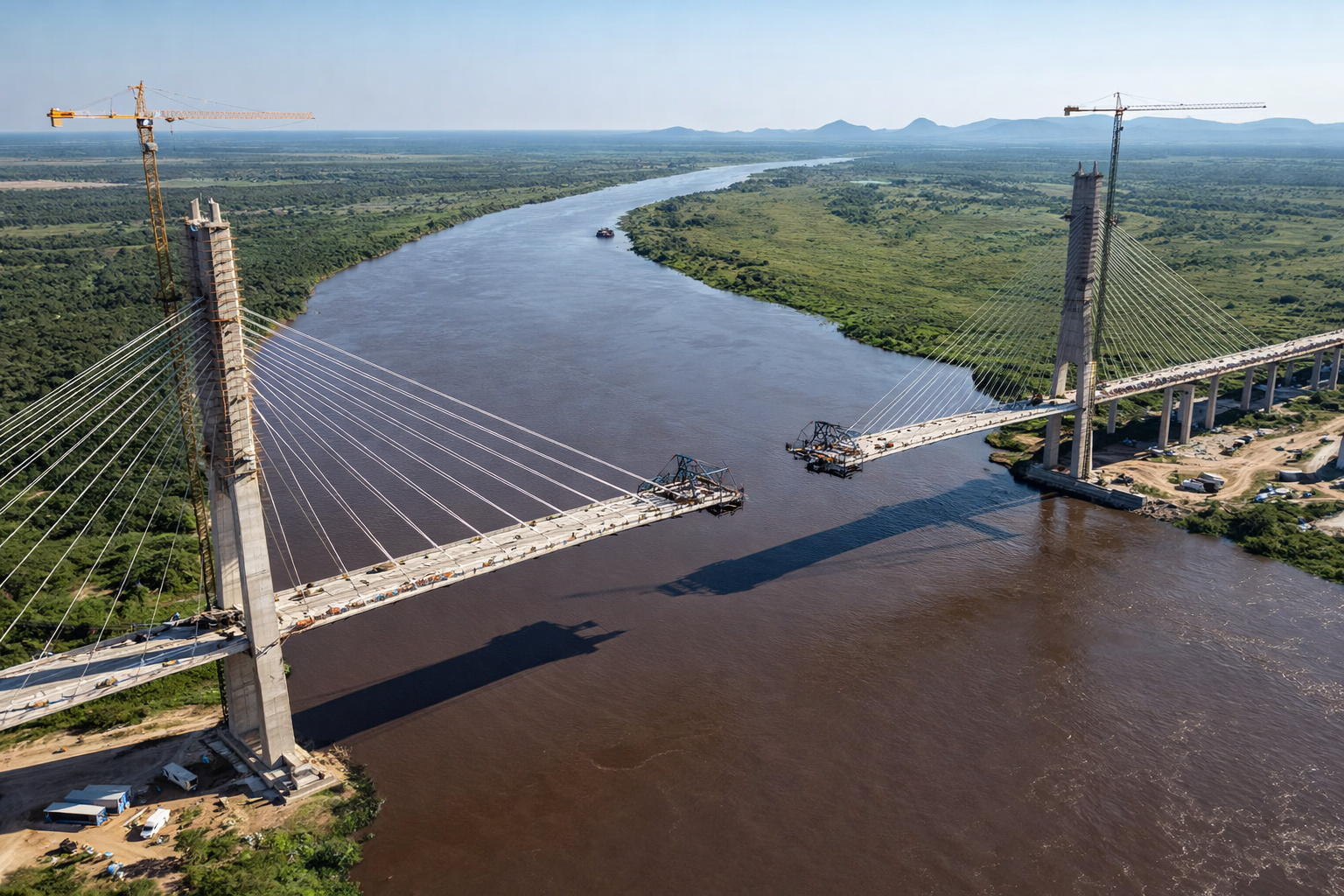
Brazil and Paraguay are just 46 meters away from a historic union on the bioceanic bridge that promises to revolutionize trade between the Atlantic and the Pacific.
-
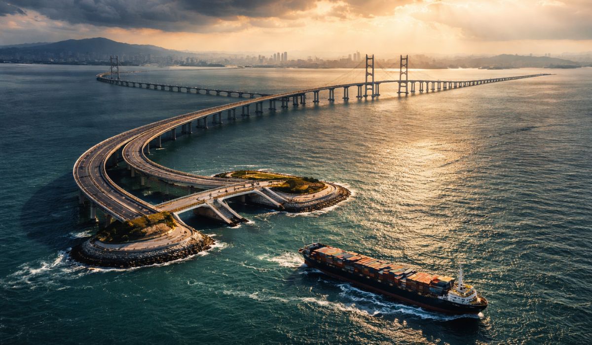
With 55 km over the sea, a cost of US$ 20 billion, and enough steel to build 60 Eiffel Towers, China’s largest project has connected Hong Kong, Zhuhai, and Macau in a colossal bridge that defies the logic of engineering.
-
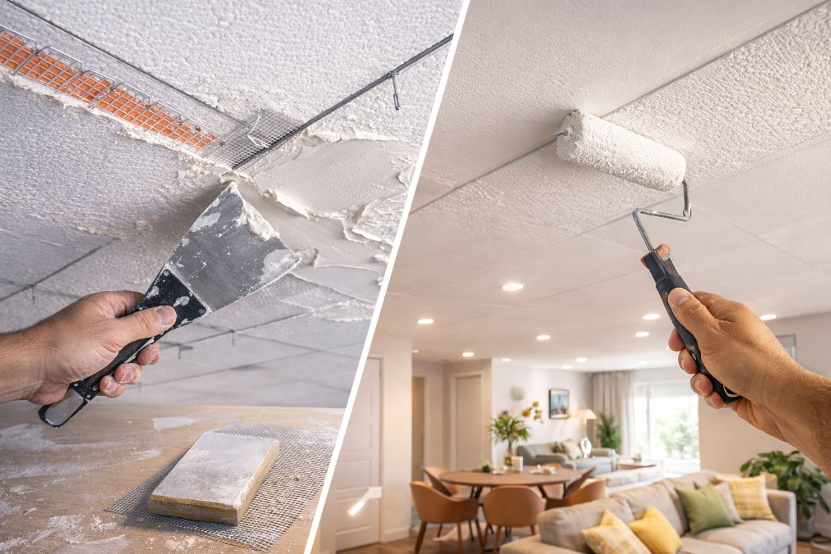
A trick with joint compound transforms a Styrofoam ceiling into a plaster-like ceiling: leveled panels, wires and mesh at the joints, sand, paint, and change the environment while spending little today.

The layout in Salvador connects to the Comércio area, near the ferry and the São Joaquim Market, with a direct connection to the expressway and port routes to prevent heavy trucks from crossing residential neighborhoods before gaining speed.
On the other side, the terminus reaches the Gameleira area in Vera Cruz, where the system connects to BA-001, with new stretches and links aimed at redistributing traffic towards the funil bridge and other inland sections.
The main crossing has 12.4 km over All Saints Bay, modularized with varying pillars and spans to speed up construction and reduce interference with the marine environment.
In the central navigation channel, where the most sensitive maritime traffic is concentrated, the project provides for a large span of 450 m with a clearance height of 85 m, designed to maintain safe navigation for large vessels.
The central promise is simple and powerful: to transform a crossing that today can take up to an hour by ferry and up to four hours by land into a car trip of about 15 minutes via the Salvador-Itaparica Bridge.
The Government of the State of Bahia (official communications at ba.gov.br) and the Salvador–Itaparica Bridge Concessionaire (PPP/concession). Learn more here.
How the Idea Went from Desire to Contract
The idea of linking Salvador to the island with a fixed crossing is old, appearing in planning proposals as far back as the last century, when Bahia discussed how to reorganize its logistics corridors around All Saints Bay.
For decades, however, the Salvador-Itaparica Bridge remained in the realm of desire. There was a lack of applied technology, structured financing, and a clear demand that could sustain a billion-dollar investment in a complex marine environment.
The turning point begins in the 2010s. In 2010, the government of Bahia initiates a formal decision-making process, and in 2011 interested companies present preliminary studies.
In 2012, these studies are deepened with the support of consulting firms, and in 2013 the State creates specific instances to organize premises and prepare the project for a long-term PPP, in which a concessionaire would assume construction, operation, and maintenance, while the public power would provide countermeasures and governance.
The clearest public milestone comes on December 13, 2019, during the B3 auction that defines the winning consortium for the Salvador-Itaparica Bridge.
In November 2020, the contract is signed amid the pandemic, in a scenario of rising costs and interest, which later required formal renegotiation in 2025, with amendments that adjust conditions and restart timelines.
It is this renegotiation that paves the way for 2026 to be the year of transition from paper to heavy execution.
Deep Drilling: The Invisible Construction Site of All Saints Bay
Before any pile is placed in the sea, the Salvador-Itaparica Bridge needed to treat the bottom of All Saints Bay as a large invisible construction site. Bathymetry, geophysical studies, and deep drilling were treated as markers of viability, not as bureaucracy.
Still in 2022, the concessionaire registers the completion of the geophysical studies and bathymetry, steps that allow for an understanding of the morphology and characteristics of the soil along the route before drilling.
This technical package gives rise to a geological-geotechnical model that shows where to support, when to embed in rock, what the risks of weak pockets are, and which method reduces surprises in the sea.
In 2025, the drilling cycle of the Salvador-Itaparica Bridge concludes with 105 investigated points, crossing stretches on land, shallow waters, and the central channel with a water depth of 67 m, including material collection in some points at 200 m depth.
This depth is not an exaggeration; it is the difference between foundations designed with realistic margins and foundations hastily redesigned with the construction site already mobilized.
Even the shallow water stage anticipated the heavy construction logic. In various stretches, the drillings have already used jackup-type platforms to maintain stability during the holes, signaling the standard of maritime operation that the Salvador-Itaparica Bridge should follow when entering the serial production phase of piles and pillars.
Logistics Base, Heavy Construction, and Construction Method
Alongside the underground work, the project needed to create “firm ground” for producing and moving components. A maritime bridge of this scale does not arise with an improvised truck by the water; it is born with a planned industrial base.
The temporary occupation of 445,000 m² in Maragojipe for the establishment of construction sites for the road system is an example of this strategy.
The use of the São Roque shipyard as construction support reinforces the idea of a rear capable of concentrating prefabrication, heavy storage, and preparation of maritime fronts without relying on small fragmented plots.
On the management and project side, 2026 marks the moment when the executive project of the Salvador-Itaparica Bridge and governance leave the abstract plan and begin to organize the physical work.
The hiring of FIP’s technical consultancy for R$ 18 million, lasting 36 months, and the declared use of BIM methodology makes up an arrangement aimed at reducing incompatibilities between foundations, deck, navigation, and accesses before the concrete reaches the sea.
In execution, the “how” starts with provisional structures that hardly show up in models. The design envisions:
- Navigation channels 400 m wide and 85 m high in the main channel,
- Auxiliary channels of 40 m,
- Passages close to the shores of 15 m by 13.3 m to maintain artisanal fishing,
- Temporary platforms estimated at about 7.2 km on the Salvador side and 4.8 km on the Itaparica side, providing access and productivity along the route.
The foundation of the Salvador-Itaparica Bridge follows a typical logic of heavy maritime works, with driving metal tubes with sleeves, internal excavation by hydraulic drills, insertion of steel cages, and underwater concreting from the bottom up, ensuring filling even with water and sediments.
This method is designed to control alignment, maintain structural integrity, and reduce surprises at the base of the pillar.
With piles and pillars being produced at a steady pace, the deck ceases to be a line in the drawings and becomes a sequence of repetitive pieces assembled using an industrial method.
The basic project mentions technology of successive cantilevers with 6 m segments, a solution that avoids extensive bracing and allows progress from the pillars, balancing the deck in stages.
In the central cable-stayed section, the highlight is the combination of a clearance height of 85 m with a cable-stayed set of 922 m, necessitating large floating equipment and segmented assembly without blocking the central navigation span.
This is why the construction of the Salvador-Itaparica Bridge seems slow at first but tends to accelerate later: the real pace depends on repetition, prefabrication, and secure windows for maritime operation.
Costs, Controversies, and Narrative Disputes
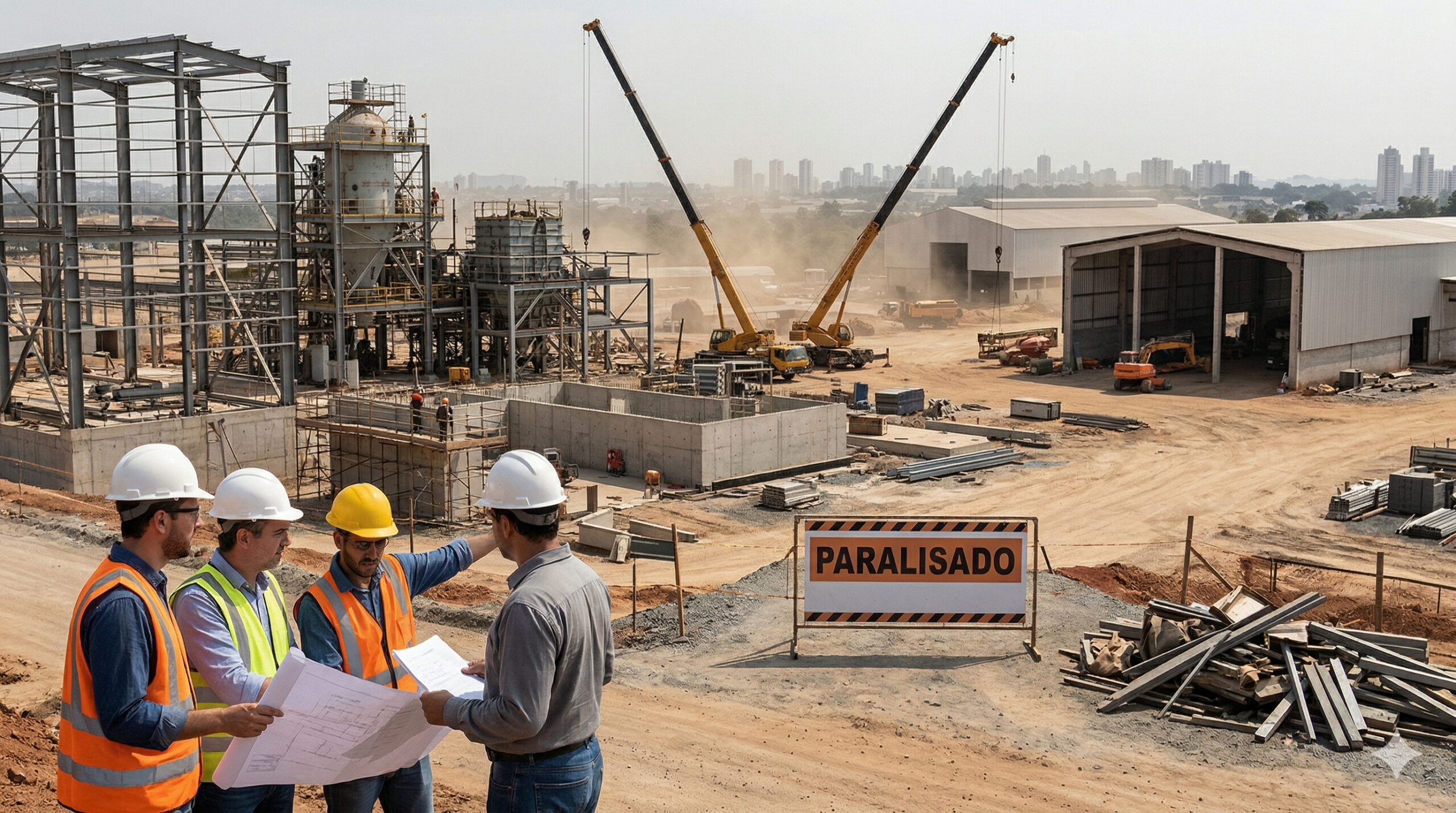
No project of this scale escapes controversies. In the case of the Salvador-Itaparica Bridge, the main tension arises precisely from the invisible phase. For years, the public saw announcements, speeches, and models, while the bulk of the work was in contract restructuring, licenses, deep drilling, and logistics assembly, stages that do not yield impactful aerial images.
It is in this mismatch that the narrative of delay is born, in contrast to the official defense that a maritime bridge of this scale does not start with concrete; it begins with thorough study and planning of the subsurface and All Saints Bay.
In 2026, this dispute enters a critical phase as the project reaches the point where discourse needs to be supported by heavy construction, fronts at sea, and pillars appearing on the horizon.
The second axis of controversy is cost. Over the years, various numbers have circulated as the Salvador-Itaparica Bridge has navigated through the pandemic, rising input costs, changes in interest, and renegotiations.
The more the estimated value fluctuates, the greater the demand for transparency and a narrative that proves the project is an investment and not just a showcase.
Cost shifts from being merely a technical figure to becoming a political argument, especially in a state facing urgent demands in other areas.
The third axis is environmental and social. All Saints Bay is a living system of fishing, tourism, and maritime circulation, making licensing, conditions, and consultation with traditional communities a mandatory gate between project and execution.
When this gate delays, the bridge appears stalled. When it advances, construction can accelerate. It is in this area that debates with the Public Prosecutor’s Office, social movements, and opposition come into play, defining under what rules the Salvador-Itaparica Bridge can indeed occupy the sea.
What Changes When the Salvador-Itaparica Bridge Finally Becomes Reality
If the 2026 schedule is confirmed and the heavy construction of the Salvador-Itaparica Bridge starts operating this semester, the project enters a new logic.
From a mobility standpoint, the crossing in about 15 minutes creates an immediate shortening between Salvador, Itaparica, Recôncavo, and Lower South, altering tourism routes, cargo logistics, and daily commutes.
In the medium term, the road corridor associated with the Salvador-Itaparica Bridge is expected to shift the growth axis of the Metropolitan Region of Salvador, bringing new municipalities closer to productive chains and reducing exclusive dependence on the current ferry system and longer land routes.
The real impact, however, will depend on how land connections, land use, and public policies will keep pace with the new layout.
At the same time, the bridge becomes a case study in maritime engineering, PPP management, and the use of technologies like BIM and heavy prefabrication in coastal environments.
What works in the Salvador-Itaparica Bridge becomes a reference for other complex infrastructure projects, and what goes wrong will join the list of lessons on planning, risk, and transparency.
In the end, 2026 is less the year of inauguration and more the year of credibility testing. Either the Salvador-Itaparica Bridge transforms deep drilling and models into piles, pillars, and decks, or it reinforces the sense that grand infrastructure promises can remain eternally stuck in the invisible phase.
And you, do you think the Salvador-Itaparica Bridge will finally get underway with the heavy construction this semester, or do you still see the risk of the project stalling between announcements and delays?


CADÊ OS MILHÕES QUE FORAM GASTO NOVAMENTE COM PROJETO?? E NADA FOI FEITO!!
SÓ PORQUE DAS ELEIÇÕES ESTÃO ENGANANDO O POVO? O PT NUNCA VAI FAZER ESSA PONTE !!!
Projeto de engano,já faz 50 anos o pt prometendo essa ponte e já foram gasto milhões que daria para fazer 2 pontes!!