 Portuguese
  English
  Spanish
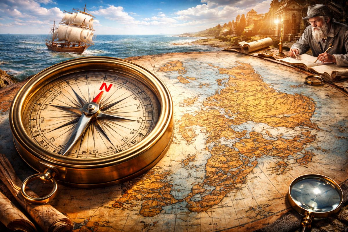

For Millennia, Different Civilizations Drew the World with the South, the East, or Even the Religious Center on Top, but It Was the European Navigations of the Age of Discoveries That Fixed the North as “Up” and Spread This Convention Across the Whole Planet.
For Most of Human History, Maps Did Not Have an Obvious “Up”. Clay tablets in Mesopotamia, maps with the south highlighted in Egypt, Chinese charts with the north on top due to the imperial throne, Arab maps with the south on top because of Mecca, and Christian European maps with the east on top to honor Eden. Each culture projected on the map what it considered most sacred, central, or useful.
The Turning Point Comes When European Navigations at Sea Begin to Depend Directly on the Compass and Mercator Projection. By Aligning World Maps to the Needle Pointing North, Cartographers like Gerardus Mercator Created a Model that Made Life Easier for Captains, but Also Brought Cartographic Distortion, Making Northern Countries Appear Larger and More Important on the Map than They Actually Are.
Before European Navigations: The World Upside Down

In the Earliest Cartographic Records from Mesopotamia, Around 2300 BC, Maps Were Administrative Tools.
-
Friends have been building a small “town” for 30 years to grow old together, with compact houses, a common area, nature surrounding it, and a collective life project designed for friendship, coexistence, and simplicity.

-
This small town in Germany created its own currency 24 years ago, today it circulates millions per year, is accepted in over 300 stores, and the German government allowed all of this to happen under one condition.

-
Curitiba is shrinking and is expected to lose 97,000 residents by 2050, while inland cities in Paraná such as Sarandi, Araucária, and Toledo are experiencing accelerated growth that is changing the entire state’s map.

-
Tourists were poisoned on Everest in a million-dollar fraud scheme involving helicopters that diverted over $19 million and shocked international authorities.


Hand-sized Clay Tablets Depicted Rivers, Fields, and Cities, Helping Temples and Palaces Control Lands and Resolve Border Disputes with Neighbors. There Was No Standard Orientation. Each Scribe Drew According to Their Own Logic.
In Ancient Egypt, the Criterion Was Almost Emotional. The Egyptians Placed the South on Top Because the Nile Came from the South and Was Viewed as the Source of Life, Fertility, and Agriculture.
Placing the South “On Top” Was a Way to Honor the Source of Survival. This Vision Influenced Other African Peoples.
In China, the Map Reflected Imperial Protocol. The Emperor Sat Facing the South, and the Throne Was at the North Side of the Hall.
Maps Began to Be Drawn as If the Emperor Were Looking at His Territory, with the North on Top and the Rest Opening Below Him. This Was a Political and Ceremonial Choice.
In the Islamic World, During the Golden Age, Cartographers like Al-Idrisi Produced Some of the Most Accurate Maps of the Period, with the South on Top and Africa Highlighted.
Mecca Was to the South of Many Important Regions, and This Direction Gained Symbolic Weight. These Maps Were Used by Navigators from Various Cultures, Long Before the Great European Navigations Gained the Prominence You Learn About in School.
In Christian Europe, the So-Called T-O Maps Placed The East on Top, Jerusalem in the Center, and Christ Above All, Blessing the World.
They Were Theological Maps, Not Navigation Tools. The Goal Was to Convey a Religious View of the World, Not Help Ships Cross Oceans.
Ptolemy, Compass, and Reencountering a World in Coordinates
The Mathematical Basis of the Modern Map Comes from Claudius Ptolemy, a 2nd Century Geographer Who Lived in Alexandria. In His Work “Geography”, He Compiled Coordinates of Thousands of Localities, Defined Latitude and Longitude, and Proposed a Systematic Way to Represent the Earth.
Ptolemy Lived in the Northern Hemisphere, Primarily Knew Lands North of the Equator, and Treated This Part of the Globe as More Relevant and Detailed.
It Is No Coincidence That the Areas Known by Greeks and Romans, Concentrated in the North, Gained Space at the Top of the Map.
But Medieval Europe Lost This Knowledge for Over a Thousand Years. The Work Survived in the Islamic World and the Byzantine Empire.
Only in 1406, When Jacopo d’Angelo Translated “Geography” into Latin, Did the European Intellectual Elite Regain Access to This Method.
During This Same Period, Another Piece Entered the Board: The Compass, Likely Coming to Europe Through Arab Merchants. The Needle Consistently Pointed North.
The Navigators of Genoa and Venice Realized That If the Map Were Drawn with the North Up, It Would Be Much Easier to Align the Chart with the Compass at Sea.
The Portolan Charts, Used on Coastal Routes, Began to Be Made with the North on Top for Pure Practicality. It Was Quicker to Read the Map, Spin It Less, and Make Fewer Mistakes.
From Then on, the North Begins to Consolidate as the Preferred Direction Up, Even Before the Era of Major European Oceanic Navigations Exploded.
European Navigations: When the North Rises Never to Descend Again
The Definitive Turning Point Happens with the Explosive Combination of Three Factors: Compass, Maritime Ambition, and European Navigations at Sea.
European Kingdoms Entered the Era of the Great European Navigations Driven by Trade, Faith, and Power. Portugal, Spain, and Later Other Powers Wanted Routes to New Lands, Spices, Metals, and Markets. However, the Nautical Charts Did Not Keep Up with the Ambition of the Ships.
Navigating for Weeks Without Seeing Land Required Charting a Straight Course on the Map and Following That Direction with the Compass. Yet the Earth Is a Sphere, and the Map Is Flat.
A Straight Line on Paper Did Not Correspond to a Simple Route on the Curved Surface, and Navigators Needed to Recalculate Position All the Time. An Accumulated Error Could Mean Hundreds of Kilometers of Deviation.
It Is in This Context of Risky European Navigations, Ships Getting Lost, and Fleets Disappearing That Gerardus Mercator Steps In.
He Studies Portuguese and Spanish Charts, Analyzes Errors, and Realizes That He Needs a Projection Tailored for Those Who Live with a Compass in Hand.
Mercator: The Orphan Who Aligned Maps, Compass, and European Navigations

Gerard de Kramer, Son of a Cobbler, Orphaned at 14, Becomes Gerardus Mercator by Latinizing His Name. He Studies Latin, Philosophy, History, Geography, Is Imprisoned for Heresy, Released Due to Pressure from the University, and, By 40, Opens His Cartographic Workshop.
He Spends Years Studying Charts from Portuguese and Spanish Navigators, Right in the Midst of the Great European Navigations. The Problem Is Clear: The Map Does Not Correspond Well with the Compass.
It Is Necessary to Create a Projection in Which It Is Possible to Draw a Straight Line Between Two Points and Follow a Constant Course on the Surface of the Earth.
In 1569, at 57 Years Old, Mercator Publishes His Great World Map, with the Title Defining It as “Correct for Use in Navigation”.
In It, Lines of Latitude and Longitude Cross at Right Angles, Forming a Rectangular Grid, a Map Full of Squares.
The Great Insight Is This: A Straight Line on Mercator’s Map Corresponds to a Route of Constant Course Towards the North, Something the Compass Can Maintain.
A Navigator Could Position the Map with the North Up, Draw a Line from Point A to Point B, Measure the Angle in Relation to the North, and Follow That Course at Sea, Without Seeing Land.
The North Is Up Because The Projection Was Designed to Work Alongside the Compass, and the Compass Points North. The Map Becomes a Precision Tool for European Navigations, and Not Just an Illustration of the World.
With Ships, Weapons, and Colonial Power, The Europeans Begin to Redraw the Entire World Using Mercator’s Projection.
When They Arrive in a New Territory, They Do Not Adopt Local Maps. They Ignore African, Chinese, or Arab Traditions and Rewrite Everything Aligned with the North.
The Standard That Served Maritime Navigation Would Slowly Become the Standard Governing School Maps, Government Maps, and Today, the One on Your Phone.
Distortions That Make the North Seem Larger and More Important
The Mercator Projection Solves a Navigation Problem but Creates Another: It Distorts the Size of Countries, Especially at High Latitudes.
Since It Is Impossible to Flatten the Curved Surface of the Earth Without Distorting Anything, Mercator Chooses to Preserve Angles and Directions at the Expense of Area.
The Result Is Clear. Greenland Appears Gigantic, Almost the Size of Africa, When in Reality It Is Much Smaller.
Northern Countries Are Stretched and Enlarged, Gaining Disproportionate Visual Presence. Regions Near the Equator, Many of Them in the Global South, Become Compressed and Visually Diminished.
These Distortions Are Not Just Technical. They Influence the Way We Perceive Importance, Power, and Centrality in the World, Symbolically Inflating the Global North.
A Projection Created to Serve the European Navigations Ended Up Graphically Reinforcing the Idea That the North Is Larger, Occupies More Space, and Therefore Deserves More Attention.
When You Open Google Maps, You See a Digital Version of This Logic: Rectangular Grid, North On Top, Large and Comfortable Northern Countries on the Screen.
The Standard Survived Empires, Technological Revolutions, and Reached Your Pocket Without You Ever Voting on It.
Seeing the World Through Other Maps
None of This Means That Mercator’s Projection Is “Wrong”. It Is Brilliant for What It Was Created For: Guiding Constant Course Navigation Routes, Integrated with the Compass, During the Age of European Oceanic Navigations.
The Problem Begins When a Specific Map Is Treated as If It Were the Only “Natural” Way to View the Planet.
You Can Look at Other Projections That Better Preserve the Areas of Countries, That Reposition the Equator, or Even That Place the South on Top, Just Like the Egyptians and Arabs Did.
Switching Projections Is, in a Way, Switching Perspectives on the World. By Changing the Map, You Also Change the Narrative About What Is at the Center, What Is on the Margins, and Who Seems Larger or Smaller.
The Next Time You Open a Map, Remember That You Are Not Seeing an Absolute Truth. You Are Seeing the Planet Through the Eyes of a 16th Century Orphan, Surrounded by Religious Wars, Who Spent His Life Trying to Draw the Earth to Assist in Navigation.
His Name Was Gerardus Mercator, and It Was the Need for Alignment Between Maps, Compass, and European Navigations That Placed the North on Top Forever.
And You, After Learning This Story, Think We Should Continue Using Maps with the North on Top or Worth Popularizing Other Projections That Challenge This Standard?


A verdade deve ser preservada, quando não temos outra em discussão.