 Portuguese
  English
  Spanish
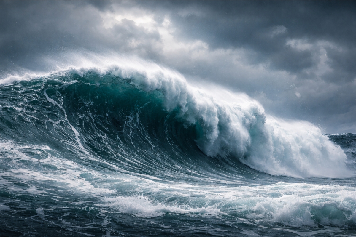


The Detection of 35 Meters in Open Sea Expands the Capacity to Anticipate Dangerous Areas and Strengthens Safety for Navigation and Structures in the Ocean
The technology in orbit is revealing extreme sea behavior in the Pacific Ocean. Satellites have identified waves reaching 35 meters, a size far above what is usually observed in day-to-day situations.
The data is striking because this type of event occurs far from common human observation routes. Even so, the measurement allows for transforming a rare risk into useful information for maritime safety.
In addition to alerting mariners, the advancement opens up opportunities to improve forecasts and planning for structures at sea. This involves everything from transport operations to infrastructure projects that need to withstand severe conditions.
-
While the world looks at oil, the war with Iran is already disrupting helium supply from Qatar, affecting car and iPhone chips, threatening AI expansion, and putting pressure on aluminum packaging at the highest value in four years.

-
Global warming will expose a treasure hidden under the ice of Antarctica and may spark an international dispute over gold and valuable minerals.
-
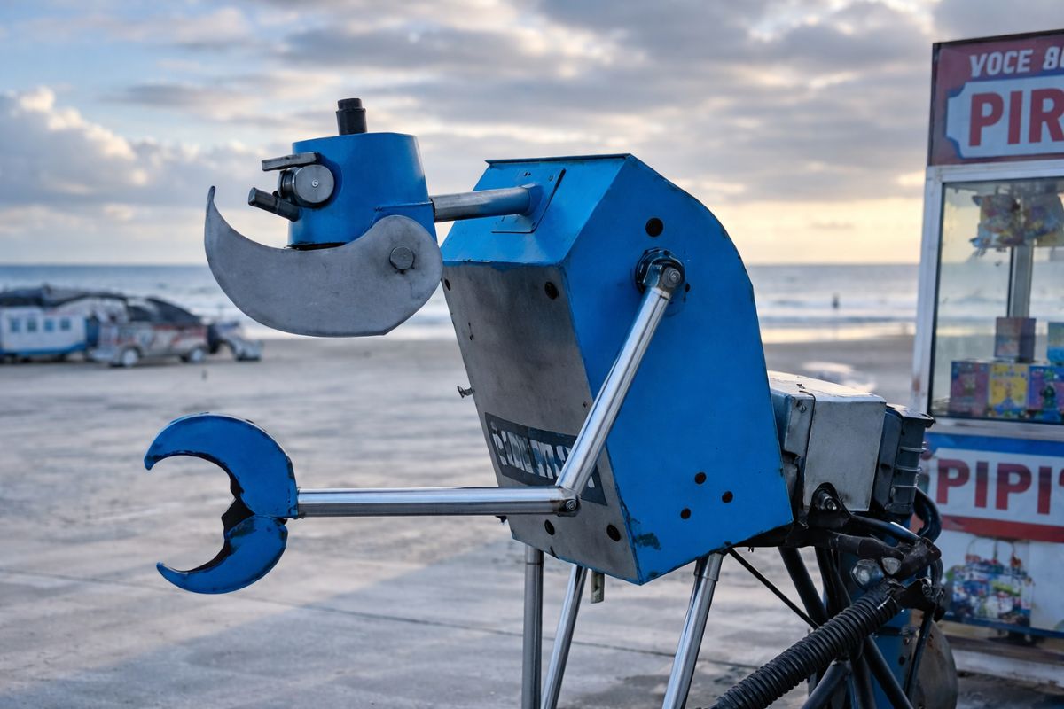
A street vendor from Praia Grande built a robot made of scrap from scooters and washing machines that pulls his popcorn cart on the beach, emits sounds, and interacts with customers, becoming an attraction on the coast of São Paulo.
-
The specifications of the Xiaomi 18 Pro Max have been leaked, and the highlight is a dual 200 MP camera with a new 22-nanometer technology that promises to consume less energy and capture details in shadows and bright areas using LOFIC HDR.


What Happened and Why It Caught Attention
A record made on a night in December, in the region between Hawaii and the Aleutian Islands, showed a water spike that rose abruptly. The reading captured a large wall of water, detected at the moment the satellites passed through the area.
The central point is the difference in scale. While common waves can reach 15 meters, these formations reached 35 meters, placing the phenomenon at a much more challenging level for operations at sea.
The fact that it occurs in open sea also weighs in. A large portion of these giant waves does not advance to the coast, remaining far from the view of those on land.
How Satellites Can Measure Such High Waves

Observation occurs through measurements at the surface of the sea. With instruments capable of identifying changes and variations in water level, satellites can quantify extreme events even in remote areas of the ocean.
This changes the scenario because records no longer depend solely on isolated reports. Continuous measurement allows for spotting patterns that were previously unnoticed.
The result is a clearer picture of the conditions that favor out-of-pattern waves, with data that can be applied in monitoring and planning.
Why These Giant Waves Form in the Pacific
These waves do not appear by chance. They arise when storms and winds accumulate energy over large expanses of water, stacking force repeatedly until generating enormous formations.
The combination depends on the alignment of factors, with strong winds acting persistently and concentrating energy in the wave system.
The final effect is an abrupt rise, capable of creating a wall of water in open ocean routes, where observation by orbital instruments becomes decisive.

What Changes Practically for Mariners and Operations at Sea
The precise detection of these waves can help forecast the impact of storms more reliably. This improves decisions on long journeys, where the route needs to consider areas with a higher chance of extreme seas.
For maritime transport companies, the ability to anticipate critical areas allows for adjusting routes and reducing exposure to rare but very dangerous events.
In practice, the information transforms risk into planning. This can mean greater safety for crews and less vulnerability in operations in open sea.
Impact on Maritime Infrastructure and Projects in the Ocean
Knowledge of 35-meter waves also influences the design of structures. Energy platforms and ports need to withstand severe conditions, and a more accurate reading of the environment helps in sizing solutions.
The topic gains importance because infrastructure at sea depends on safety margins. Understanding what can happen in extreme events changes the basis of calculations and the type of protection adopted.
The focus shifts to reducing damage and increasing resilience in areas where the sea may display unexpected behavior.
What Can Happen From Now On
With the capacity to identify waves of this magnitude, the landscape of marine meteorology expands. Monitoring can indicate areas where extreme events are more likely to form.
This tends to favor early decisions, with more robust planning for navigation and for coastal communities that need to better prepare for indirect impacts of major storms.
The advancement also reinforces the idea that the ocean holds significant risks even when the surface appears stable, and that technology can make these risks more predictable.
Satellites can now detect 35-meter waves in the Pacific Ocean, recording events that were previously difficult to verify in detail. The information changes how we view open sea, with data applicable to safety and planning.
With better-targeted forecasts and more prepared infrastructure, the chance of protecting lives and reducing losses in maritime operations exposed to extreme conditions increases.


Estão observando aonde era impossível, agora quem sabe vão encontrar coisas que nao era para encontrar. Muitas revelações apareceram ultimamente o cometa atla, as Torres embaixo da pirâmide, o mar zumbido um som estranho agora essas ondas etc. Muito coincidência
Excelente
Esses fenômenos haveria de acontecer cedo ou mais tarde, o planeta está cansado, e sem contar que as profecias estão se cumprindo isso é fato.
A observação é de grande importância para salvar vidas