 Portuguese
  English
  Spanish
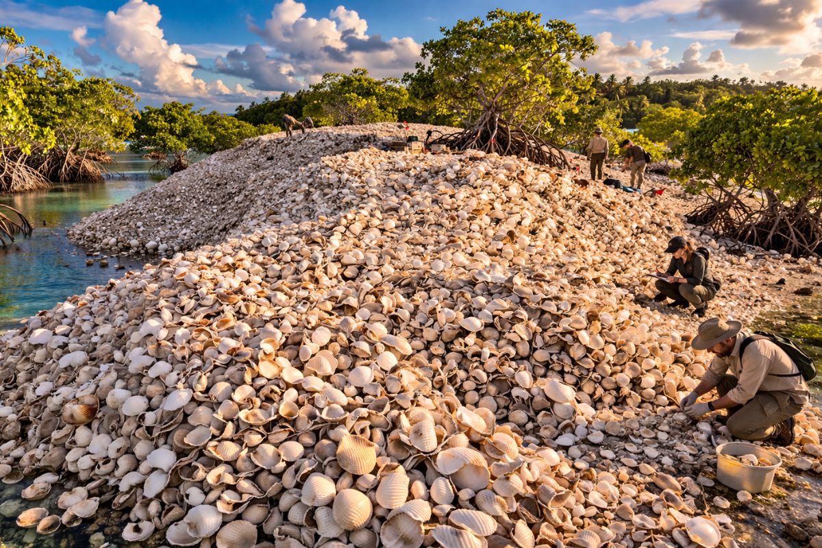
The island of 3 thousand square meters surrounded by mangroves near Culasawani, in Fiji, is composed of 70% to 90% of discarded edible mollusk shells by ancient inhabitants around 760 AD, according to a study published in the journal Geoarchaeology, and represents the first shell mound recorded in this region of the Pacific.
In the southwest Pacific Ocean, near the coast of Vanua Levu, the second largest island of Fiji, there is a piece of land of 3 thousand square meters that rises only 60 centimeters above sea level at high tide. Surrounded by mangroves, this island appears, at first glance, completely ordinary. Until it is discovered that between 70% and 90% of its composition is made of shells discarded by humans over 1,200 years ago. The island is, in practice, a giant mound of ancient food remains.
The study, published in the scientific journal Geoarchaeology, was conducted by researchers from Fiji and Australia led by Patrick D. Nunn from the University of the Sunshine Coast. The team concluded that the island is likely a “shell mound,” the archaeological term for a deposit of mollusk remains accumulated by human action. If the conclusion is correct, this island near Culasawani is the first shell mound ever found in the South Pacific east of Papua New Guinea. And the story of how it formed reveals much about how the first inhabitants of Fiji lived, ate, and transformed the surrounding landscape.
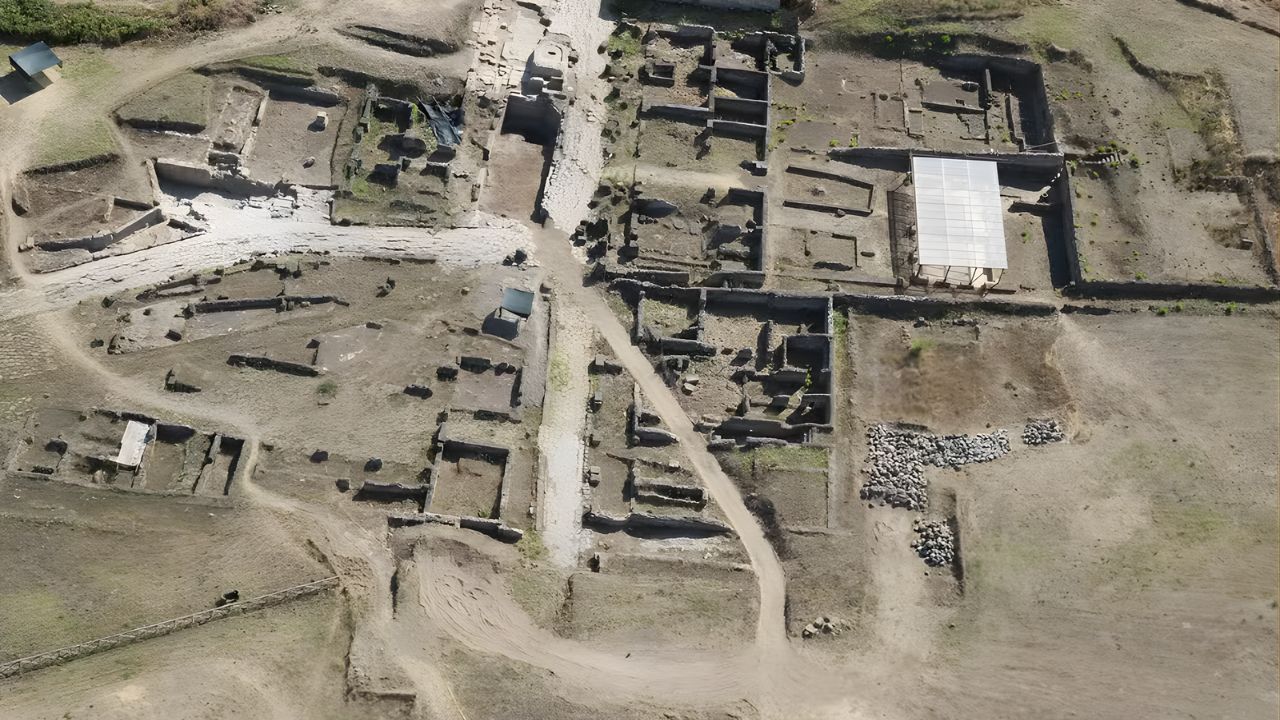
How scientists discovered that the island is made of food remains

Image: scientific journal Geoarchaeology
Two of the study’s authors spotted the island for the first time in January 2017 during geoarchaeological surveys along the northern coast of Vanua Levu. What caught their attention were the crabs.
-
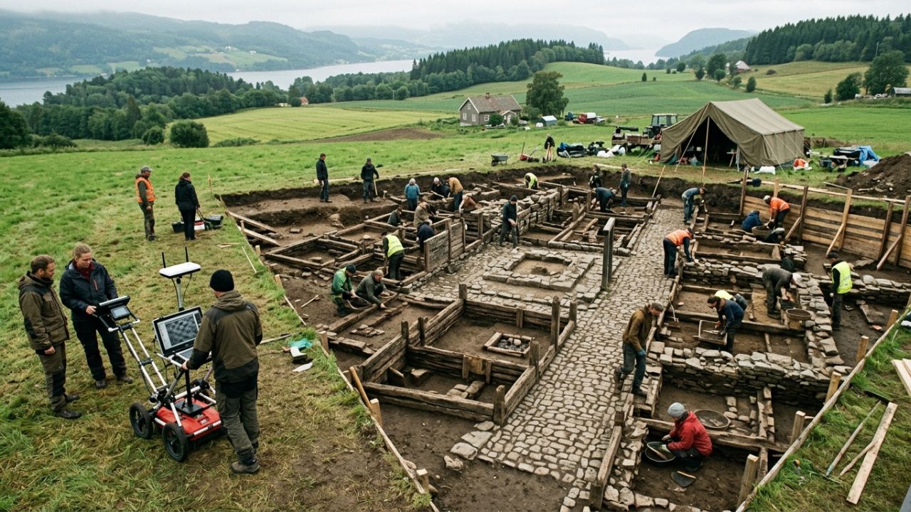
No one was able to prove for over 500 years that this medieval city existed, until ground-penetrating radar mapped streets, houses, and entire structures beneath the soil of Norway, and the excavation confirmed a complete preserved city where there was once only legend.
-
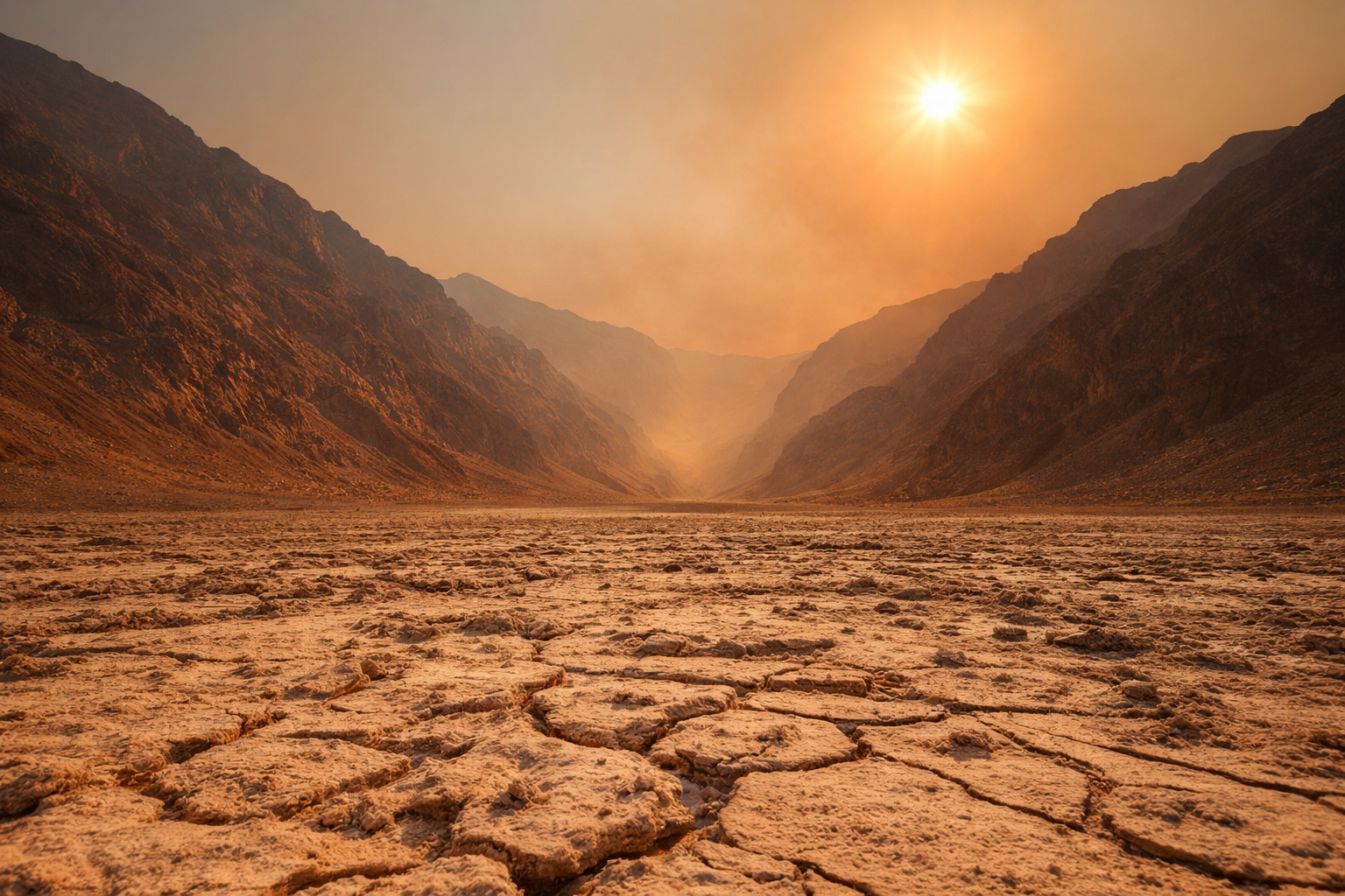
In the United States, a valley 86 meters below sea level has reached 56.7°C and remains the place with the highest air temperature ever recorded on Earth, a direct result of a terrain that traps heat between high mountains in the midst of the desert.
-
Goodbye clothes with odors from use: Samsung’s device uses high-temperature steam, eliminating up to 99.9% of bacteria, removing dust mites, and neutralizing odors directly in the wardrobe without the need for washing.

-
Embraer arrives in Mexico with 7 new E190-E2s in 2026, after 5 jets have already been delivered, while Mexicana surpasses 1 million passengers, plans a fleet of 20 aircraft, and expands strategic routes across the country.

Burrowing crabs were bringing material from the subsoil, from depths between 30 and 50 centimeters, to the surface, and this material was almost entirely composed of edible mollusk shells. The analysis confirmed that the entire island, and not just the surface, was formed by shell remains in a matrix of sand and clay.
Two research teams returned to the site, the first in February 2024 and the second in July of the same year. Four trenches of 1 meter by 1 meter were opened, and 10 samples of shells of the genus Anadara were collected for radiocarbon dating.
The results indicated a median age of 1,190 years, placing the formation of the island around 760 AD, with a range between 420 and 1,040 AD. In addition to the shells, small fragments of undecorated pottery were found, indicating the presence of pre-modern Fijian pottery. No traces of fish bones or stone tools were identified.
Shell mound or tsunami deposit? The investigation that decided the answer
When researchers first analyzed the island, two competing theories emerged. The first: the island would be a shell mound formed on-site when a group of colonizers processed enormous amounts of edible shellfish over several hundred years.
The second: the absence of distinct stratigraphic layers and the relatively thin thickness of the deposit suggested that all of it could just be a pile of shells dragged by tsunami waves.
To test the tsunami hypothesis, the team analyzed the sediment layers beyond the island’s boundaries. A deposit formed by waves would extend eastward and become progressively thinner.
But no evidence of this pattern was found. The absence of a decreasing sediment layer, combined with the fact that all the shells belonged to species commonly consumed by humans, led researchers to conclude that the island is indeed a large shell mound. This conclusion transforms what seemed to be just another island in Fiji into an unprecedented archaeological discovery for the entire South Pacific region.
Who lived on this island and how it formed
Radiocarbon dating places the formation of the island in the post-Lapita period. The Lapita are the archaeological culture associated with the first inhabitants of Fiji, and during this time it was common for settlements to be built on stilts near open coasts.
Researchers believe that the shell island formed under a stilt settlement, where residents processed large amounts of shellfish and threw the shells directly into the shallow water below.
Over the centuries, the vertical accumulation of shells combined with the relative fall of sea level caused the deposit to emerge above water, forming the island that exists today. When the settlement was abandoned, the mangroves surrounding the current island did not exist.
These forests only grew later, fed by sediments released by deforestation caused by humans in the more inland areas, creating the perfect base for the colonization of the mangroves around the shell island. In other words, it was not just the island that humans created: the entire landscape around it is also an indirect result of human activity.
Why this island matters for Pacific archaeology
Fiji has about 330 islands. Another island surrounded by mangroves does not seem, at first glance, something extraordinary. But this particular island rewrites part of what was known about ancient human presence in the region.
Vanua Levu, despite being the second largest island in the Fiji archipelago, has been much less studied by archaeologists than other parts of the country. The discovery of the Culasawani shell mound fills an important gap in this map.
For the peoples of the Pacific, seafood has been an essential food source for over 3,000 years. In some modern communities in Fiji, mollusks still represent 15% of the diet.
Shell mounds in this region are valuable because they help reconstruct ancient landscapes, revealing how land and sea have been shaped over the centuries.
The authors of the study highlighted that the most important aspect of the discovery is the possibility of having identified an island created “fortuitously by the combined effect of the relative fall of sea level and the vertical accumulation of shells.” An island that literally emerged from the waste of human meals.
An island made of food remains. What do you think about that?
Humans have built cities, deforested forests, dammed rivers, and even prevented seas from covering entire countries. Now, we know that they also created an entire island by discarding shells for centuries.
This island in Fiji is yet another reminder that Homo sapiens transforms landscapes in ways that are not always obvious, and sometimes only appear 1,200 years later.
And you, have you ever imagined that food remains could create an island? Did you know what a shell mound was before reading this article? Let us know in the comments.


Seja o primeiro a reagir!