 Portuguese
  English
  Spanish
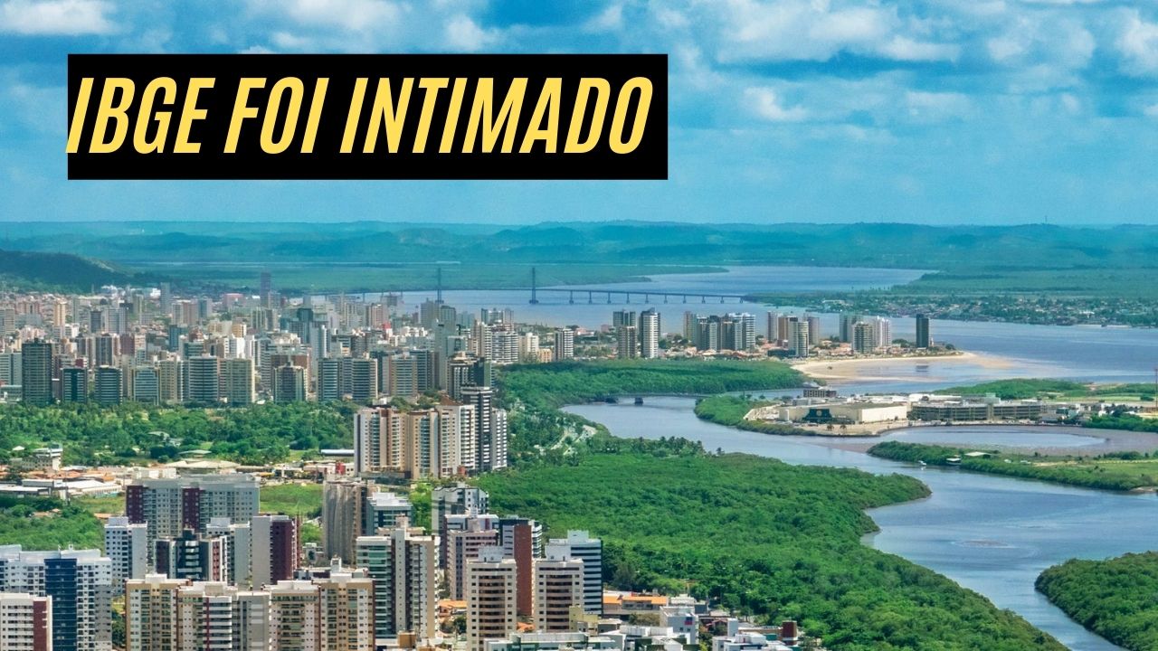
The Decision Establishes That Aracaju Must Return 20.78 km² of Its Territory to São Cristóvão After a Decades-Long Territorial Dispute Over Areas Annexed by the Capital in 1989 and 1999.
In a historic decision by the Federal Court of Sergipe, Aracaju will have to return an area of 20.78 km² – approximately 11.4% of its territory – to the municipality of São Cristóvão.
Judge Pedro Esperanza Sudário, from the 3rd Federal Court of Sergipe, ordered the Brazilian Institute of Geography and Statistics (IBGE) to carry out a new demarcation of the territorial limits, based on state legislation prior to the 1989 Constitution.
The decision was made based on a ruling from 2012, which went through several instances and reached a final verdict.
-
Italian researchers have detected what appears to be a second Sphinx buried under the sands of Egypt, and satellite scans reveal a gigantic underground megastructure hidden beneath the Giza Plateau for over 3,000 years.

-
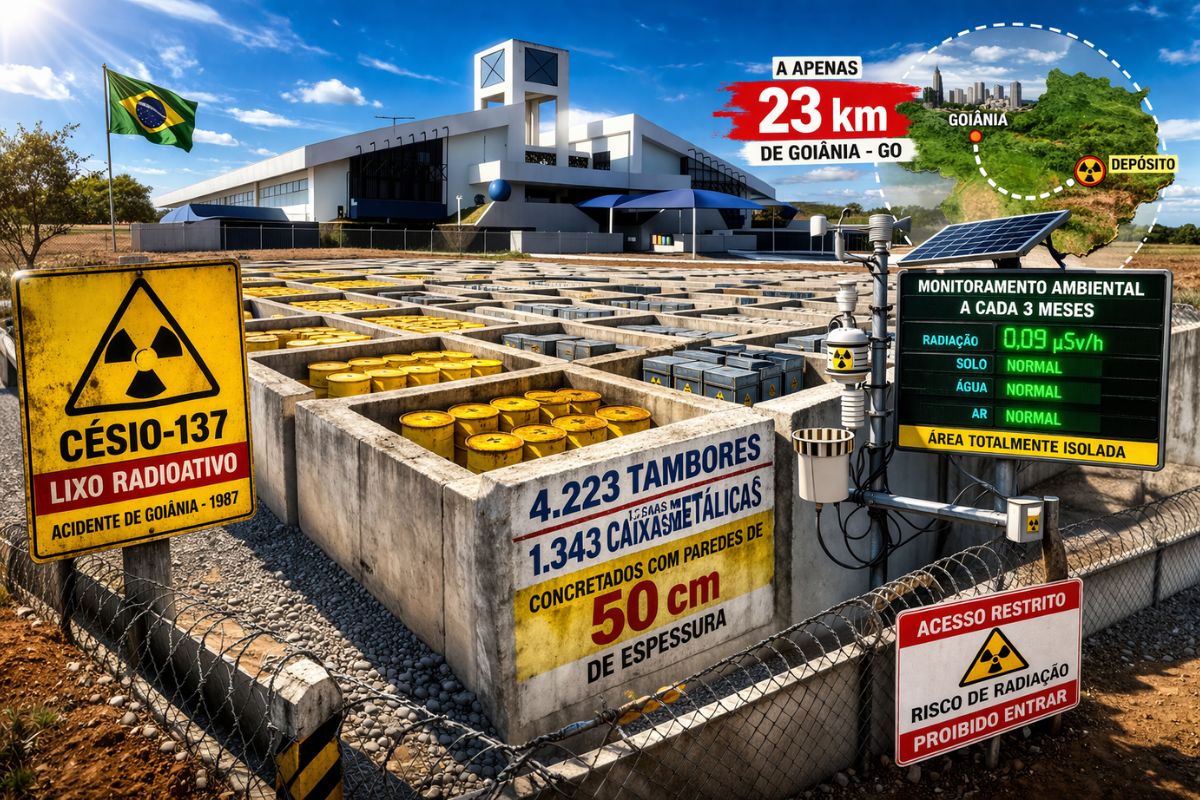
There are 4,223 drums and 1,343 metal boxes concreted with 50-centimeter walls that store the radioactive waste from Cesium-137 in the worst radiological accident in Brazil, just 23 kilometers from Goiânia, with environmental monitoring every three months.
-
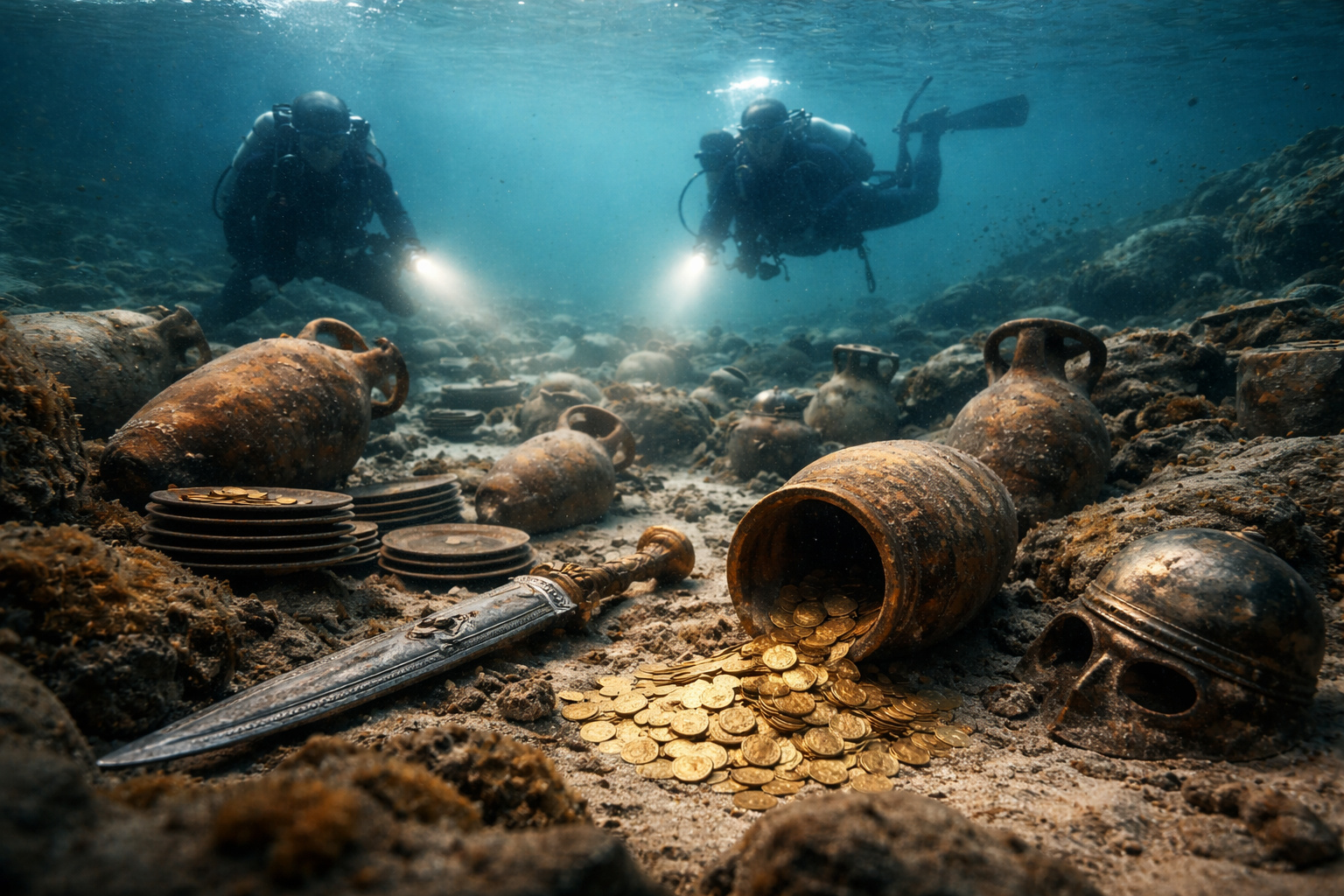
Giant Roman treasure found at the bottom of Lake Neuchâtel in Switzerland reveals an advanced trade system, circulation of goods, and armed escort in the Roman Empire about two thousand years ago.
-
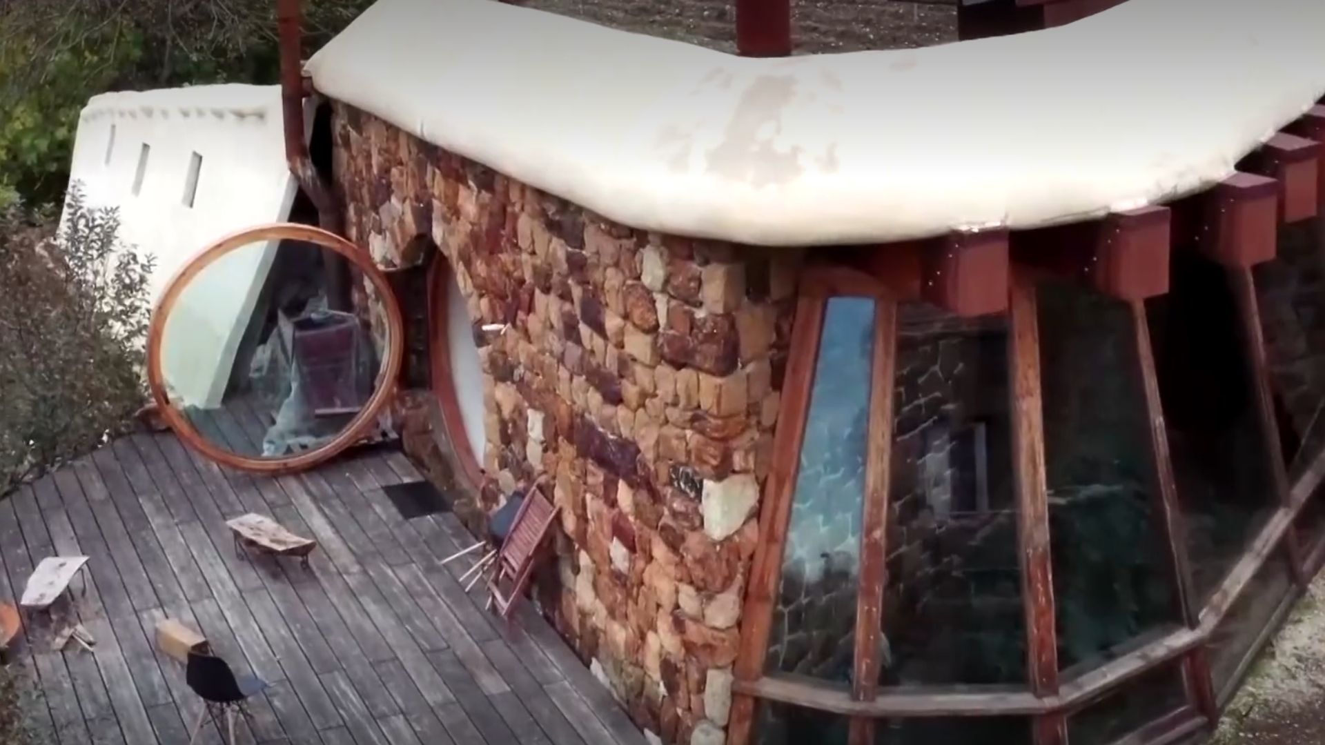
He buried 1,200 old tires in the walls to build his own self-sufficient house in the mountains with glass bottles, rainwater, and an integrated greenhouse.

According to the court order, in addition to the IBGE, the audit courts will also be notified to make adjustments to tax transfers, directly affecting the resources that Aracaju received for the disputed areas.
The ruling brings significant changes for both cities, especially for Aracaju, which will lose part of its population and infrastructure, now integrated into São Cristóvão.
Change in Territory Affects Local Population and Infrastructure
With the new demarcation, about 30,000 people currently living in the region will officially reside in São Cristóvão.
Data provided by the City Hall of Aracaju indicates that a total of 6,727 constructions, 14 schools with more than 6,400 enrolled students, three healthcare units serving 32,837 patients, and 3,334 public lighting points will be transferred to São Cristóvão, in addition to 31 km of paved roads and six areas considered at risk.
These areas, which were under Aracaju’s administration, were annexed to its territory in 1989 and 1999, through the state constitution and a constitutional amendment, respectively.
The transfer of these services and infrastructure will have significant impacts for both the population and the public agencies of the two cities, which will need to adapt their budgets and local policies to the new territorial reality.
Dispute Over Territorial Limits
The municipality of São Cristóvão based its action on the argument that the boundary changes made in 1989 and 1999 were unconstitutional, as they occurred without a specific complementary law and without public consultation.
The city requests that the original territorial limits, defined by Law 554 of 1954, be respected. This original legislation established a border line further east, from the mouth of the Vaza-Barris River to the Jabotiana neighborhood in the north, according to the IBGE’s delineation.
The City Hall of Aracaju opposes the decision and argues that the 1954 delimitation, used as a reference, did not incorporate modern georeferencing techniques, essential to ensure accuracy in the limits.
Additionally, the administration claims that the alteration will harm the local population’s sense of belonging and could cause damage to the community of Aracaju, which sees part of its urban structure transferred to São Cristóvão.
New Phase in the Territorial Dispute
With the judicial decision finalized and no possibility of appeal, Aracaju will have to start the process of transitioning the areas and services.
The territorial and social impact of this change will bring logistical and administrative challenges, with São Cristóvão absorbing a significant portion of the infrastructure and public services previously under Aracaju’s responsibility.
The outcome of this dispute represents a victory for São Cristóvão, which has sought recognition of its territorial rights over these areas for decades.
The decision reflects the need for greater regulation in the processes of defining and altering municipal boundaries, aiming to prevent future conflicts and ensure that local populations are adequately consulted on territorial issues that directly impact their lives.
Now, the expectation is that the IBGE will complete the update of the maps and the new demarcation of the territory between Aracaju and São Cristóvão, formally officializing the redistribution of the disputed area and ensuring that taxes and public services are realigned according to the new configuration of the limits.


Seja o primeiro a reagir!