 Portuguese
  English
  Spanish
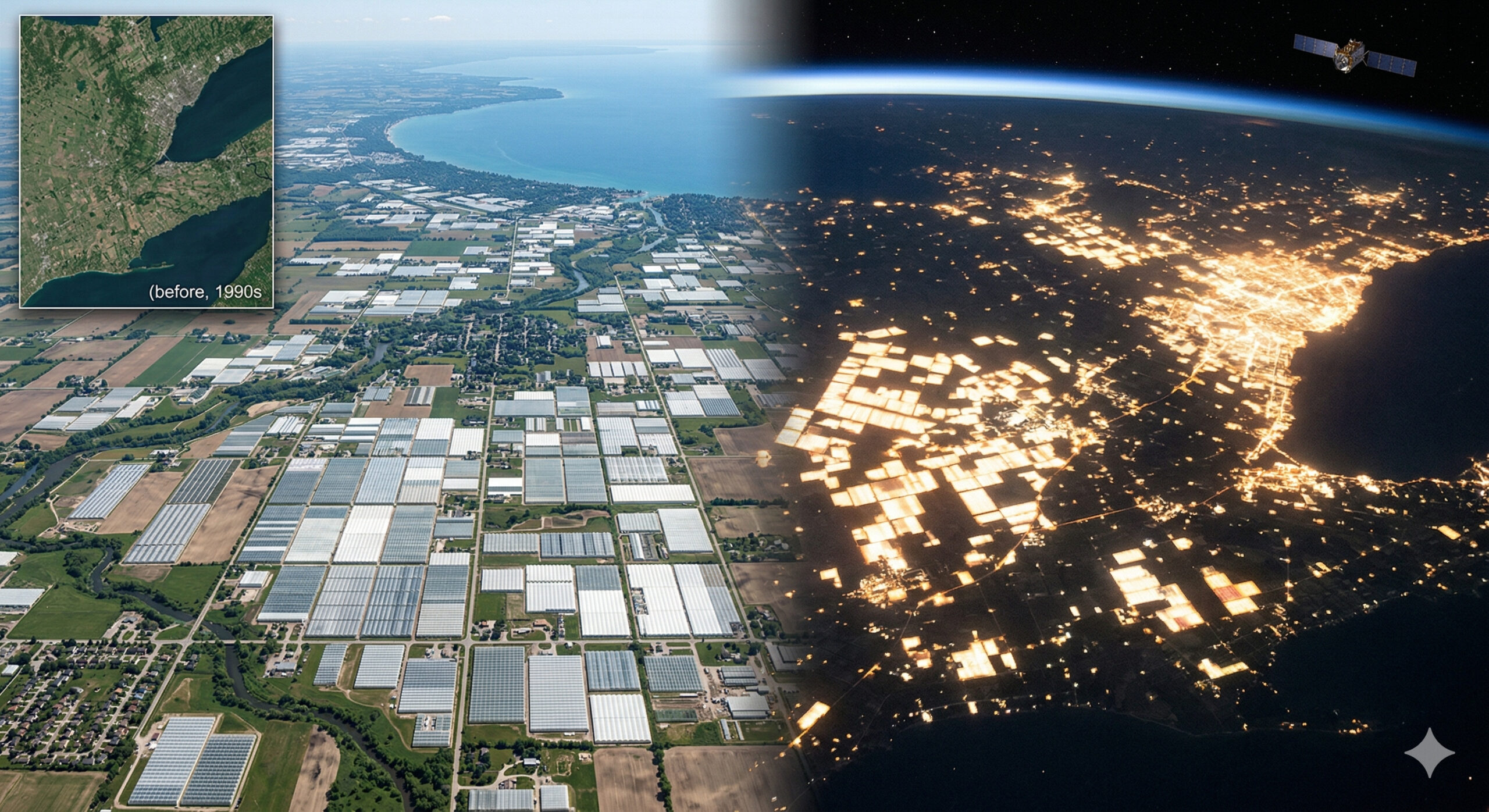
Greenhouses in southern Canada alter the soil and even nighttime brightness, creating one of the most visible agricultural scenarios in space.
In 2026, images released by the NASA Earth Observatory highlighted a silent yet visually stunning transformation in the southern part of Ontario, Canada. The region, especially around Leamington and Kingsville, has undergone intense expansion of agricultural greenhouses over the past decades, forming such a dense concentration of structures that the landscape has become easily identifiable in satellite images. According to an analysis published on the official NASA Earth Observatory website, the comparison between images from 2015 and 2025 shows the multiplication of the light-colored greenhouse covers, particularly advancing to the north and west of Leamington.
According to the publication itself, greenhouses occupy almost 8 square kilometers in the Leamington area, a figure cited based on municipal data, making the region the largest concentration of greenhouses in North America. The growth of these structures has not only altered the visual pattern of the soil: NASA highlights that the supplemental LED lighting used to maintain production throughout the year has also begun to influence the night sky, producing visible glows from tens of kilometers away under certain observation conditions.
This phenomenon places southern Ontario among the most striking examples of how modern agriculture can reshape territory on a regional scale, not only during the day, through the reflected geometry of agricultural covers, but also at night, when the productive infrastructure becomes perceptible even outside the cultivated area.
-
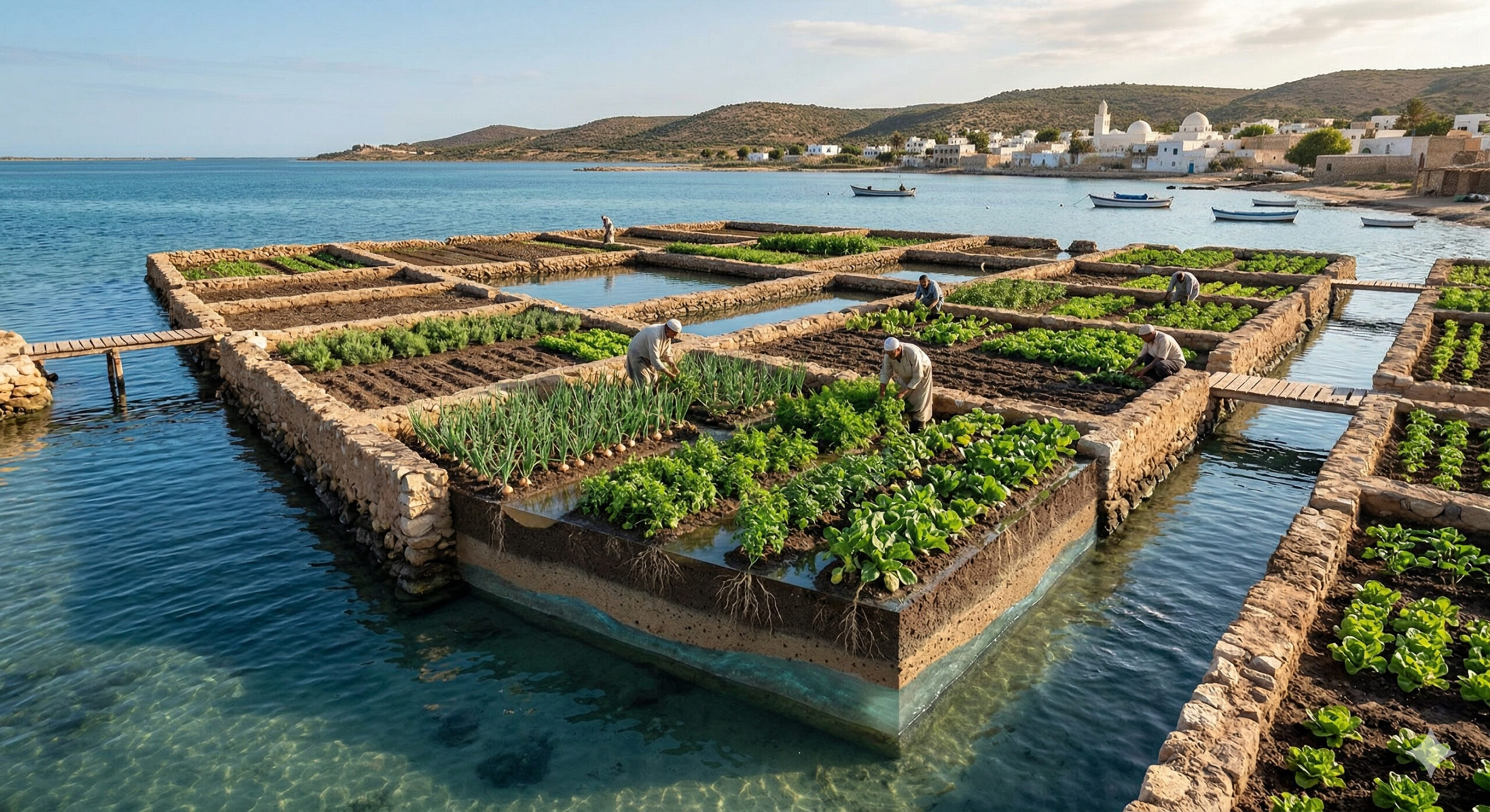
Almost nobody imagines it, but farmers in Tunisia grow food in the sand and make the roots drink fresh water that floats on top of seawater in an agricultural system considered unique in the world.
-
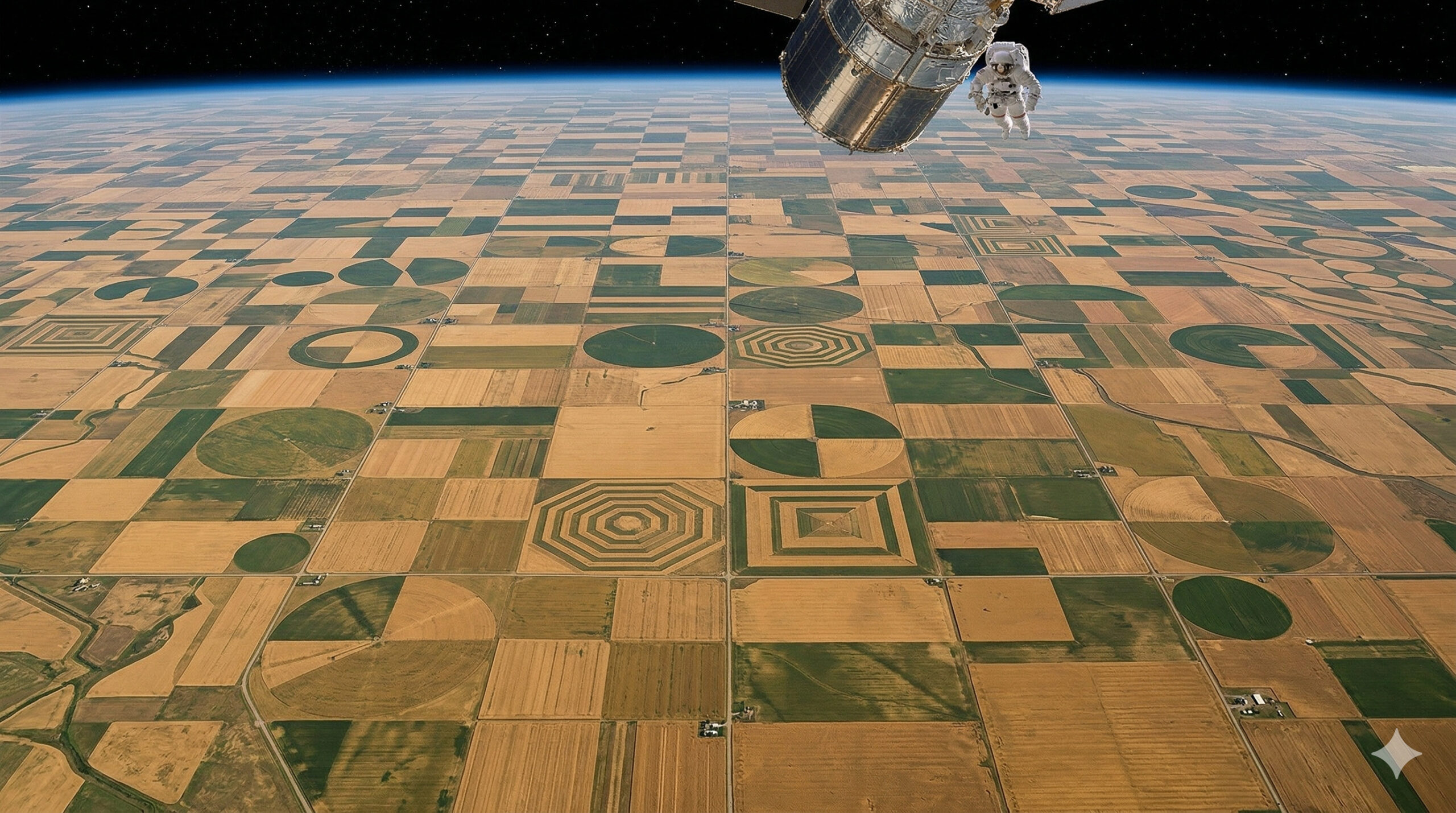
More than 20,000 km² of wheat fields form nearly perfect lines and geometric shapes in Montana, creating an agricultural pattern so symmetrical that the landscape looks like an abstract artwork visible from space.
-
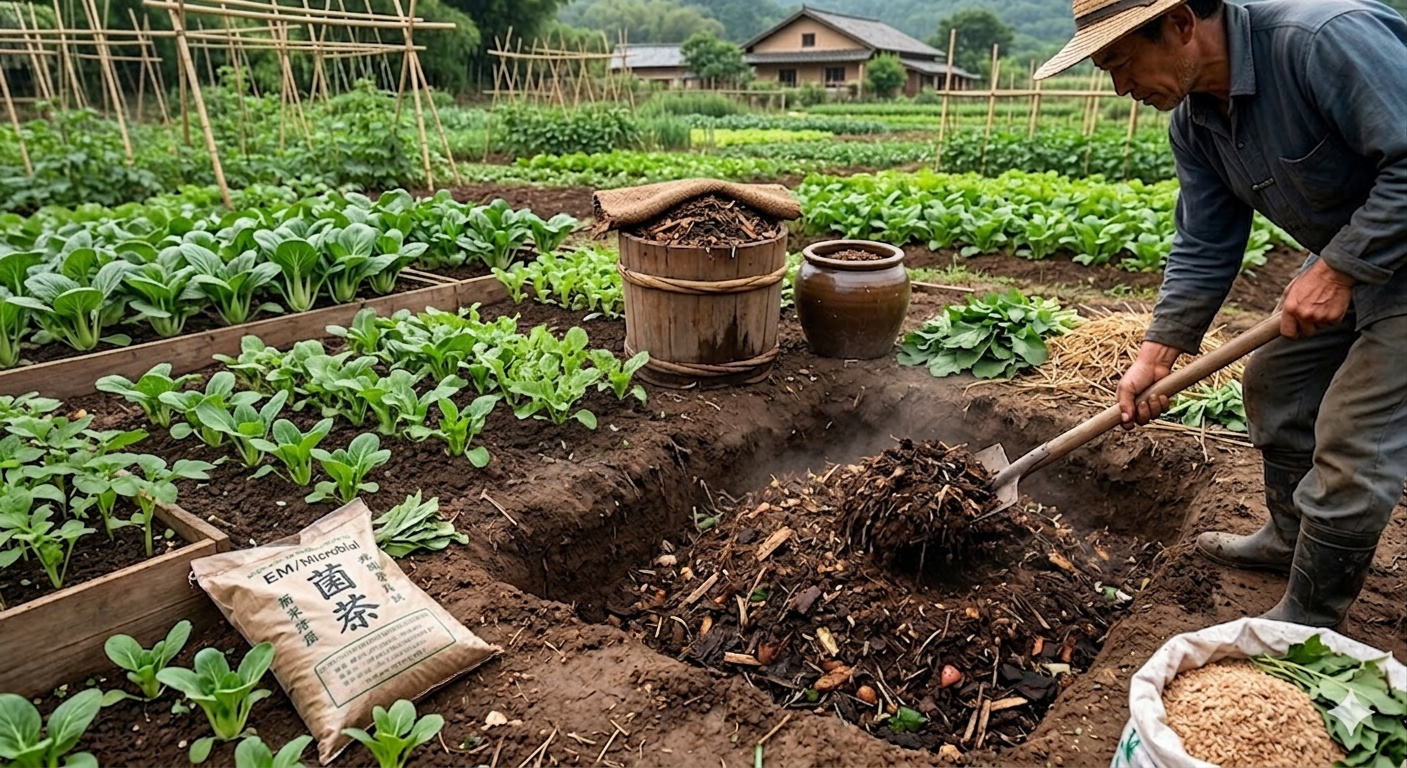
Bokashi, an Asian-origin fertilizer, is formed through the fermentation of husks, organic matter, and microorganisms, gaining traction in agriculture for strengthening beds and accelerating soil life.
-
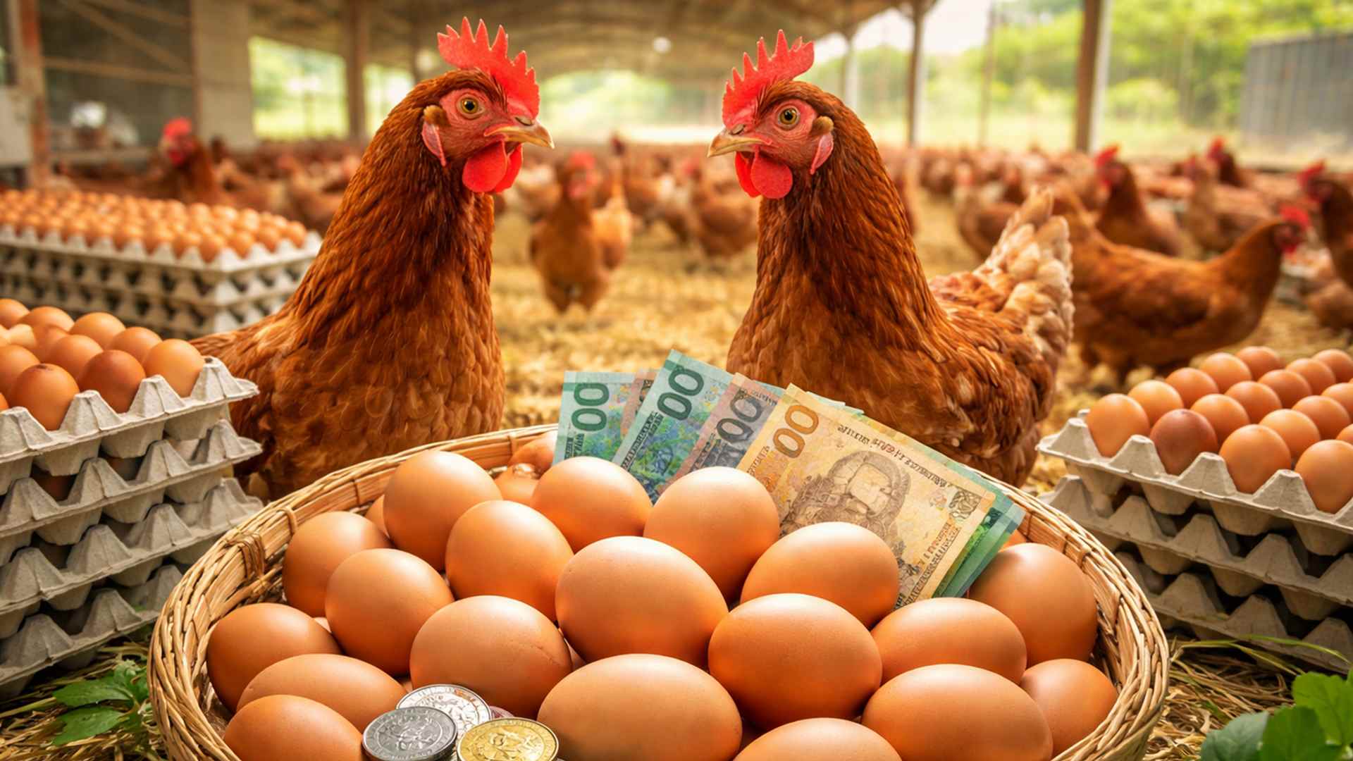
Money with chickens: how much can 200 laying hens yield per month with eggs at R$ 12 per dozen?

Concentration of greenhouses creates a continuous pattern that completely modifies the landscape seen from above
What makes the region so striking in satellite images is the way the greenhouses are organized. Unlike traditional agricultural areas, where the visual pattern depends on the type of crop, the plastic and translucent cover of the greenhouses creates a uniform and highly reflective surface.
As thousands of structures were installed side by side, the original soil became practically hidden. The result is a continuous block of cover that stands out visually when compared to neighboring areas.

This concentration creates an effect similar to that observed in other intensive regions of the world, but with its own characteristics, especially due to the combination of temperate climate and high agricultural technology.
Leamington region establishes itself as one of the largest greenhouse hubs in North America
The epicenter of this transformation is in the region of Leamington, often described as the “tomato capital of Canada”. The area concentrates one of the largest continuous stretches of greenhouses on the continent, with production primarily focused on high-value vegetables such as tomatoes, peppers, and cucumbers.
The choice for greenhouse production is linked to factors such as:
- climate control in cold regions
- increased productivity per area
- continuous production throughout the year
This model allows the region to maintain high competitiveness in supplying local and international markets, even facing adverse weather conditions during part of the year.
Artificial lighting of greenhouses alters night brightness captured by satellites
One of the most unusual aspects observed by NASA is the impact of greenhouses on the nighttime brightness of the region. To maintain production during periods with lower solar incidence, many greenhouses use artificial lighting systems.

This practice generates a visible effect from space: agricultural areas that emit light at night, creating luminous spots that can be captured by satellites.
According to analyses from the Earth Observatory, this phenomenon highlights how modern agriculture not only modifies the landscape during the day but also alters nighttime visual patterns, something traditionally associated only with urban areas.
Intensive production in a controlled environment increases efficiency and reduces climatic variables
The growth of greenhouses in southern Ontario is directly linked to the pursuit of greater control over the production process. Within these structures, it is possible to regulate factors such as temperature, humidity, ventilation, and irrigation.
This control allows for:
- more predictable production
- reduction of losses due to climatic events
- greater efficiency in the use of water and nutrients
Moreover, the protected environment facilitates the use of technologies such as fertigation and biological pest control, making the system more efficient compared to traditional methods in open fields.
Continuous expansion transforms the region into a global reference for protected agriculture
In recent decades, the area occupied by greenhouses in Ontario has grown consistently. This advancement has been driven by investments in agricultural technology and the growing demand for food produced in a controlled environment. The region has become a reference in:
- intensive vegetable production
- use of technology in greenhouses
- integration between agriculture and innovation

This positioning has attracted the interest of researchers, companies, and investors, consolidating southern Ontario as one of the leading hubs of protected agriculture in the world.
Visual transformation of the landscape evidences the direct impact of modern agriculture on the territory
The case of Ontario demonstrates how contemporary agriculture can profoundly alter the appearance of a region. The replacement of open areas with covered structures creates a new visual pattern, which can even be identified in orbital analyses.
This type of transformation is not only aesthetic but also functional, reflecting changes in the way food is produced on an industrial scale.
The combination of technology, scale, and spatial organization makes these areas easily recognizable when viewed from space, reinforcing the agricultural sector’s impact on the configuration of the territory.
Model shows how agriculture can influence even visible patterns outside of Earth
The ability to modify not only the soil but also light emission at night places the case of Ontario at a differentiated level within global agriculture. Few productive activities present this level of visual impact in satellite images.
This phenomenon reinforces the idea that modern agriculture, especially when based on technological structures, can generate effects that go beyond the field, becoming perceptible on a planetary scale.
The advancement of greenhouses in Canada shows how agriculture can completely transform a region, both during the day and at night.
In your opinion, does this type of intensive agriculture represent the future of food production or does it bring challenges that still need to be addressed? Leave your comment.


Seja o primeiro a reagir!