 Portuguese
  English
  Spanish
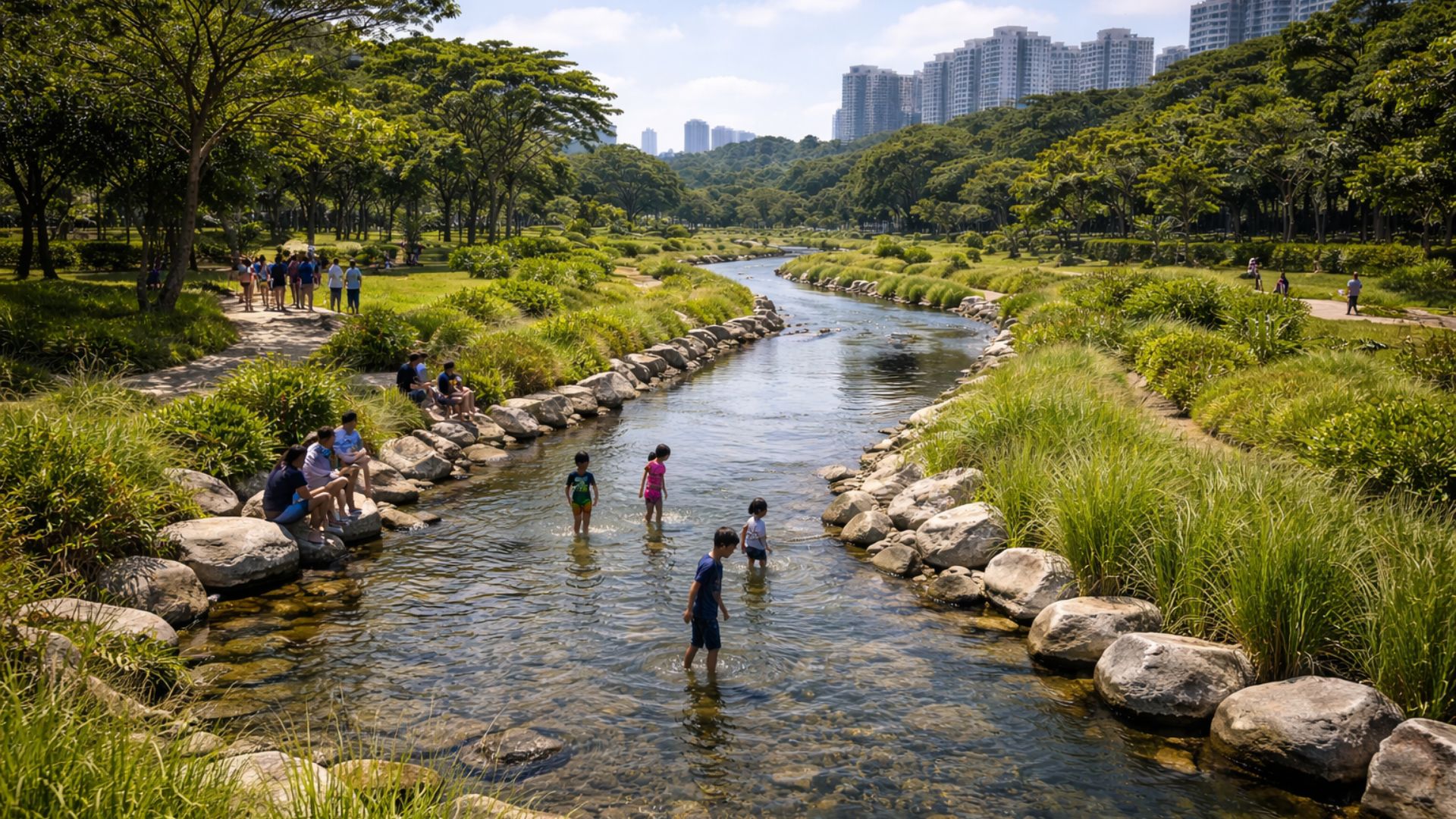


Concrete Canal Transformed into Naturalized River, Changed Urban Drainage, and Became a Habitat for Wildlife in One of the Densest Areas of Singapore, Altering Public Space Use, Community Relationship with Water, and Flood Control Logic Without Losing Hydraulic Efficiency.
What was once a rigid concrete corridor, designed to efficiently drain rainwater, has now functioned as a living river within one of Singapore’s busiest parks.
The intervention was designed to improve urban drainage and reduce flooding risks, but the practical result included a visible change in space usage, people’s interaction with water, and the return of species occupying the banks of the watercourse.
Urban Park and Flood Control
The transformation took place in Bishan–Ang Mo Kio Park, where the Kallang River flows through a densely urbanized area.
-
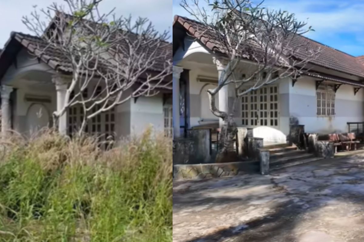
Abandoned house for 15 years disappears in the woods, shocks owner with unrecognizable scenery and is reborn in an intense transformation after almost 90 hours of work in just 10 days.
-
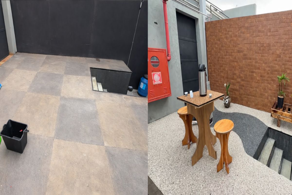
In just three hours, a natural stone floor transforms the entrance of the house with an organic effect, immediate drainage, and a sophisticated non-slip finish that doesn’t puddle water, dries quickly, and impresses with the final result.
-
‘Interlocking brick’ made of earth arrives in the construction industry with cost reductions of up to 40% on the project.

-
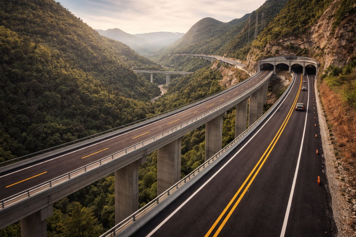
Espírito Santo will receive the largest engineering project in its history with the duplication of BR 262, which will have 50 viaducts, 28 bridges, and 2-kilometer tunnels cutting through the most challenging mountainous region of the entire state.

The project was carried out in collaboration between PUB, Singapore’s national water agency, and NParks, responsible for the country’s parks, under the Active, Beautiful, Clean Waters program, an initiative that combines water infrastructure and urban design to bring the community closer to water bodies.

For decades, concrete drainage channels were a direct response to flooding and the need to convey large volumes of water quickly.
This type of solution, while increasing drainage capacity, tends to reduce habitat complexity and keep water separate from public space.
In the case of the Kallang section around the park, the remodeling aimed to preserve the drainage function while restoring to the watercourse characteristics of a natural river, with curves, varying depths, and vegetated banks.
Integrated Water Engineering with Landscape
Instead of treating the canal and park as independent structures, the project integrated landscape and hydraulics into a unified functioning logic.
PUB describes that the proposal transformed the old canal into a naturally appearing river, with edges softened by plants, rocks, and bioengineering techniques applied to stabilize the soil and reduce erosion.
The adoption of these techniques required prior testing.

The agency reports that approximately ten different methods were evaluated over about 11 months in an effort to adapt solutions to local climate and conditions.
Floodplain as Part of the Solution
The change became evident in how water began to occupy the space.
Instead of a narrow, straight bed, the design was conceived to work with the concept of a floodplain.
In dry periods, the flow remains concentrated in a narrower channel within the larger bed.
When heavy rains occur, the adjacent area of the park acts as a passage and cushioning corridor for the extra volume, gradually directing the water downstream, as described by PUB.
The result is infrastructure that alternates between a daily use river and a flood containment device during heavy rain events.
Biodiversity as a Side Effect
C40, an international network that brings together cities and catalogs urban policies, details that the project transformed a straight drainage canal of about 2.7 kilometers into a longer, winding watercourse, with wider sections than the original canal.
This redesign was accompanied by vegetated solutions that act as filters for surface runoff before it reaches the river, reducing sediment load and improving system quality.
The same source reports that part of the concrete from the old canal was reused in elements of the new park and the watercourse itself, reducing material waste and construction impacts.
Although the structural goal is flood control, the environmental alteration created conditions for the continuation of species.

PUB points out that, with the naturalized river, wildlife has been observed more frequently, citing dragonflies and damselflies associated with freshwater environments as direct indicators of ecological change.
Wildlife Returning to the Urban Environment
In the same vein, C40 reports a 30% increase in biodiversity in the park and mentions regular sightings of otters and herons among other species.
This data reinforces that the impact goes beyond visual aspects.
By replacing vertical walls and hard surfaces with slopes and vegetated banks, the project multiplied microenvironments and created gradual transitions between water, soil, and green areas, enhancing shelter, food, and movement opportunities for wildlife.
Bridging People and Water
For visitors, the most immediate change is the physical proximity to the river.
NParks describes the Kallang section in the park as a winding watercourse integrated with the landscape, replacing a confined canal.
In an urban environment where rivers are often viewed from a distance, behind fences or steep embankments, the new topography has opened up space for direct observation, recreational activities, and greater awareness of natural water cycles.
This combination of engineering and landscaping has also altered how the community interprets flooding events in the area.
When the space is conceived as part of the hydraulic system, the temporary presence of water is no longer seen as a failure but rather understood as the expected behavior of the infrastructure.


This is a most comforting story of how past wrongs may be corrected. Bringing people and nature back together. My hope is that many other rivers will receive this kind of rehabilitation.