 Portuguese
  English
  Spanish
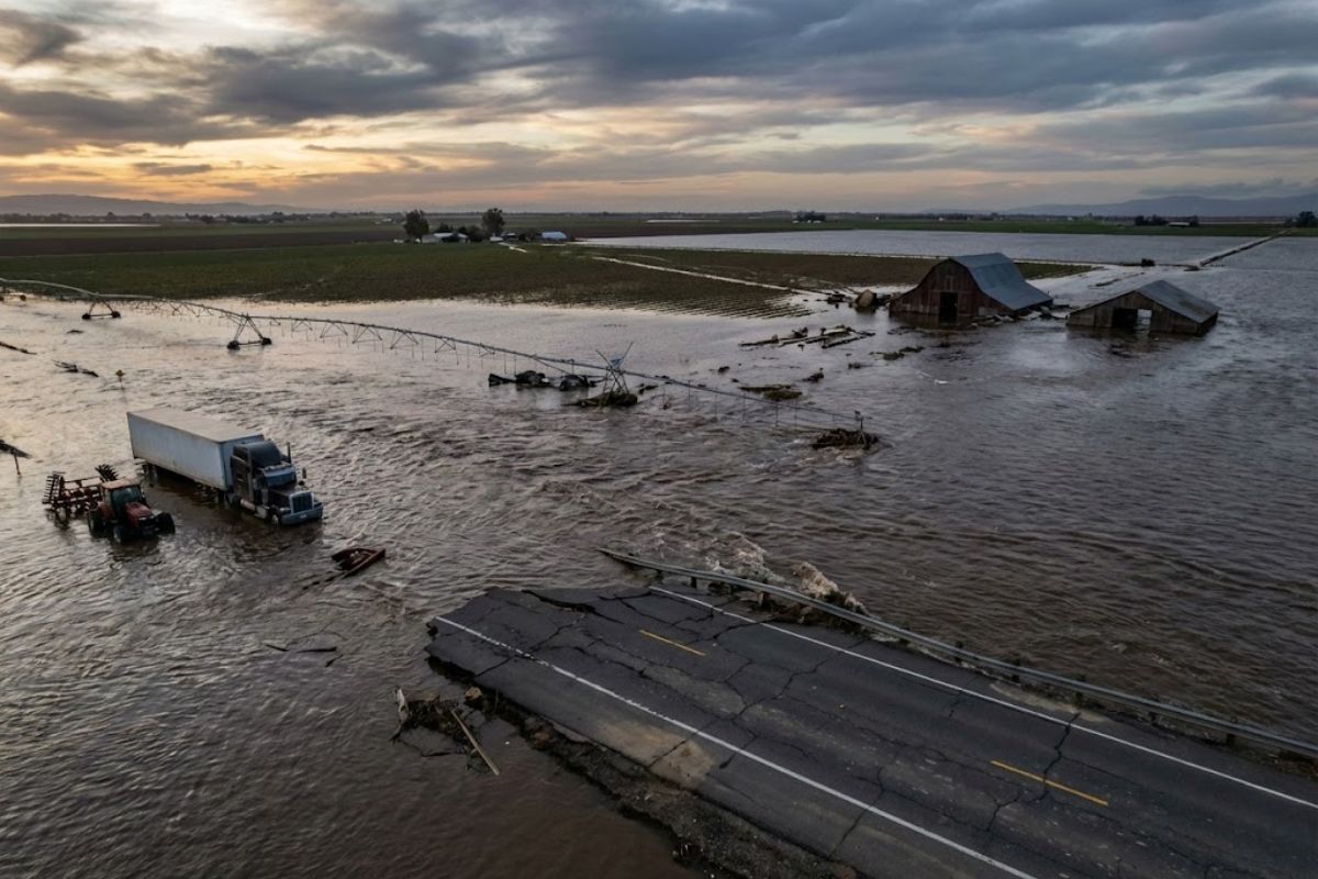
Called Tulare Lake, the Water Mirror That Disappeared in 1898 Returned in 2023 When Storms and Melting Snow Flooded the Final Basin of the Kings, Kawa, Tule, and Kern Rivers. With Dikes and Canals, the Valley Became a Bathtub. In Weeks, 114,000 Acres Were Flooded and the Cost Exceeded US$ 140 Million.
A lake that had vanished for 130 years reappeared in California practically overnight and became the scene of a rapid shock: almond, tomato, and cotton fields transformed from dry land into a sea of water, while roads and highways were blocked by a newly formed lake.
The nickname zombie lake is not superstition. Water returned because the valley was transformed into a bathtub without a drain, with the old natural basin still functioning as a drainage endpoint when the dike and canal system is overloaded. And when that happens, the cost can explode again.
Tulare Lake Is Not a New Lake: A Giant That Once Dominated the Central Valley

Calling Tulare Lake “new” distorts the scale of what existed there. Before the 20th century, it was already described as the largest freshwater lake west of the Mississippi River. At its highest level, it would have been about 160 km long and nearly 48 km wide, with area varying from 1,300 to over 1,800 km² depending on the year.
-
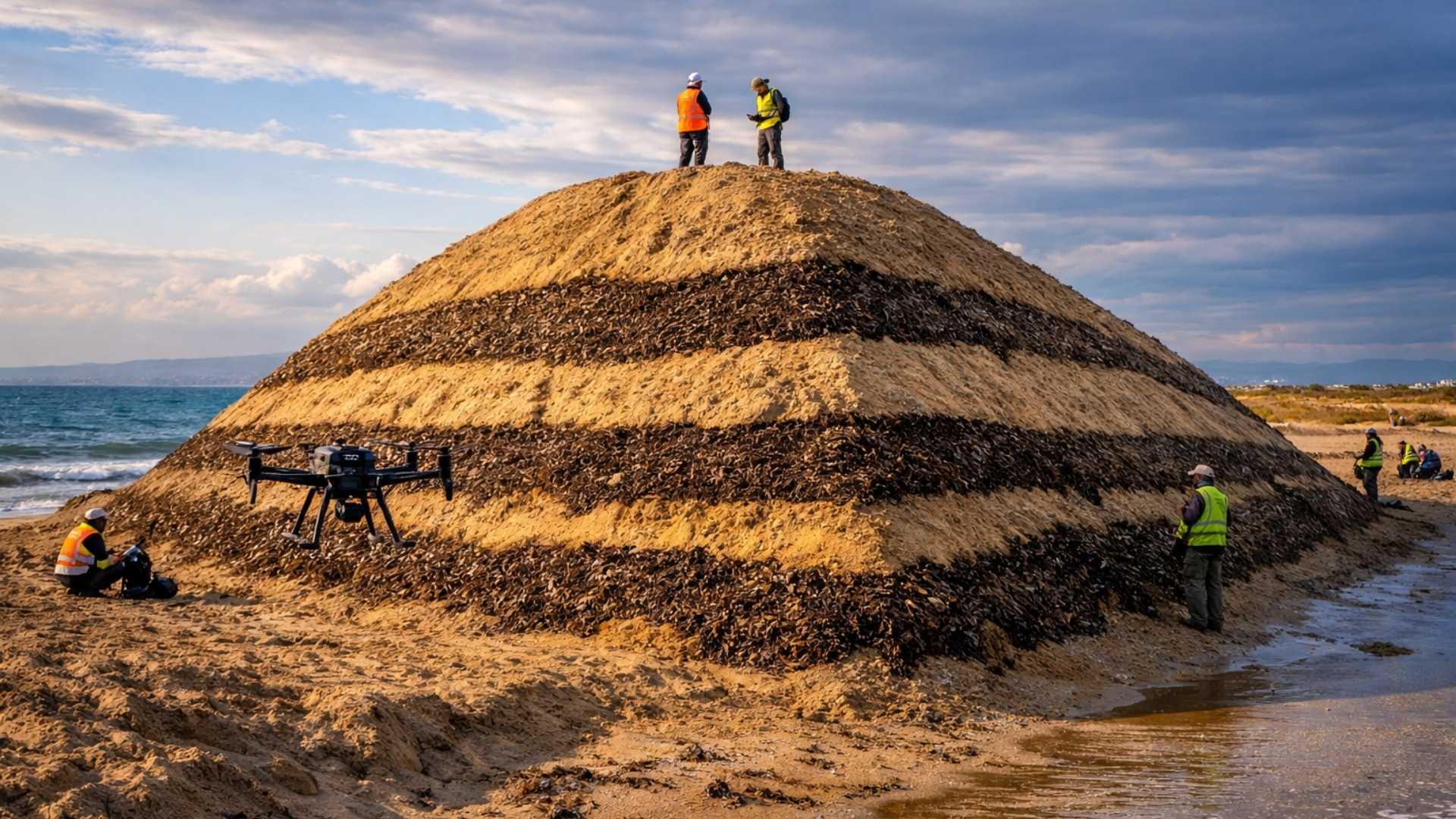
Spain surprises the world by erecting 62 artificial dunes, mixing sand with natural remains of posidonia, and causing the structure to lose only 1.4% of its volume in 1 year.
-
With 16 Bulava missiles, improvements in acoustic stealth, and a design focused on silent patrols, Russia’s nuclear submarine was born to ensure Moscow’s invisible retaliation and has become one of the pillars of its maritime strength.

-
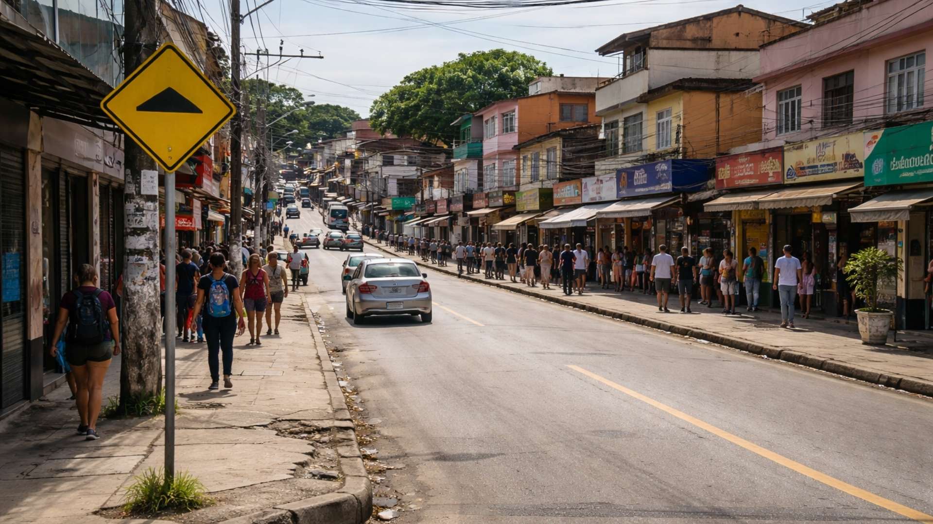
‘Populous’ city in Rio among the worst in Brazil in national ranking and exposes silent development crisis.
-
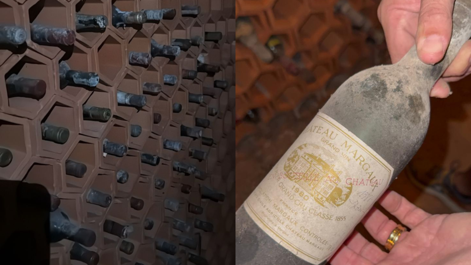
Couple buys house in the South Zone of São Paulo, opens a hidden door in the garage, and finds a secret wine cellar with dozens of old wines forgotten since the 1970s.
To visualize, Tulare Lake is presented as almost twice the size of Lake Tahoe. The waterline changed with rain, snowmelt in the Sierra Nevada, and long-term climate cycles. In some years it advanced dozens of kilometers; in others it receded and exposed fertile mudflats, reinforcing the idea of a lake without a fixed form.
A Lake with 600,000 Years: From Prehistoric System to Survival Center
The history of the lake goes far beyond recent records. Tulare Lake is described as existing for at least 600,000 years, a remnant of the ancient Mega Lake Corkran, a prehistoric system that covered nearly the entire Central Valley.
The temporal contrast is part of the impact: Homo sapiens is believed to have emerged about 300,000 years ago, placing the lake as present long before modern humans. When Indigenous peoples arrived, Tulare Lake became a survival center.
Tribes such as the Yokuts, Mono, and Pyute lived around the lake for thousands of years, using canoes and rafts made of tule reeds, a plant that grew densely along the coast and gives rise to the name Tulare.
Life was described as abundant: fish like kingfish, salmon, perch, trout, and sturgeon, along with clams and freshwater mussels in the shallow waters. Archaeologists still find shell mounds along the old lakebed, and Europeans reportedly called the area Musullau, “clam canal.”
How the Lake Was ‘Killed’ in the 19th Century and Why the Water Never Went Away
In the 19th century, the Central Valley began to be seen as an “agricultural gold mine.” Wheat, cotton, almonds, and tomatoes needed water, and Tulare Lake, with billions of cubic meters of freshwater, became the target. Dams, canals, and irrigation ditches were built, rivers were diverted for agriculture, and Indigenous tribes were forced to leave their lands.
The lake was recorded in 1898 as completely drained, but this formulation is described as misleading: the water did not disappear, it was forced to take other paths.
Some water was diverted for irrigation and did not return to the natural system. Another portion penetrated deeply into the soil, contributing to subsidence. And a part remained trapped within the natural basin of the old topography, like water “stored” at the lowest point.
With the lake off the surface, aggressive pumping of groundwater from the old lakebed exacerbated the situation. Throughout the 20th century, many areas of the Central Valley sunk more than 9 meters relative to the original level, with satellite data and ground benchmarks.
This subsidence distorted and cracked canals, disrupted essential irrigation gradients, and also reduced the drainage capacity of the region, a central element in understanding why the lake returns.
The Bathtub Without a Drain: The Valley as Final Drainage for Rivers That Have Nowhere to Go
The determining detail is geographical: the Tulare Lake basin is described as the convergence endpoint of several important rivers, including Kings, Kawa, Tule, and Kern.
Under normal conditions, dams and canals can control the flow. But during heavy rainfall or rapid snowmelt, when the system is overloaded, water does the basic nature: it flows to the lowest place.
As the lake no longer has a natural outlet to the sea, the basin functions as a container. When volumes of water exceed the capacity of the artificial system, the valley behaves like a bathtub with a clogged drain, receiving water without being able to drain it at the same speed.
The Return of the Lake in 2023: Storms, Extreme Snow, and Atmospheric Rivers
The recent reappearance of the lake is linked to the winter of 2022 to 2023. During this period, California was hit by more than 30 storm systems in less than 4 months. In the Sierra Nevada, many areas recorded snow accumulation at 200 to 300% of the historical average, with snow depths reaching 4 to over 5 meters in some measurement stations.
The text points out an additional factor that pushed the system to its limits: atmospheric rivers, called “rivers in the sky.” A strong atmospheric river can carry water vapor equivalent to the flow of the Mississippi River.
In 2023, California would have been hit by multiple events rated level 4 to level 5, the highest category on the mentioned scale, capable of causing widespread flooding, breaking dikes, and reshaping landscapes in a short time.
The worst combination would have occurred when snowmelt coincided with spring rains. After a long, cold winter, temperatures rose exceptionally fast in early 2023.
The snow had not yet completely melted when heavy rain arrived, increasing runoff and forcing dams to urgently release water to prevent structural failure. At this point, the water headed toward the old basin, and the lake “woke up.”
In Hours, Plantations and Roads Became Open Water and Highways Were Closed
The description of the impact is immediate: fields that had been cracked and dry from drought turned into open water as far as the eye could see. Hundreds of kilometers of rural roads were flooded, and sections of major highways were temporarily closed due to water crossing the pavement.
At its peak, Tulare Lake reportedly expanded to nearly the same area as the city of Los Angeles, again compared to about twice the size of Lake Tahoe.
Water surrounded pumps, warehouses, and power lines. Many people had to move livestock, and farmers lost an entire growing season in a single spring.
In several places, the water reached the edge of homes, not as a violent flood, but widespread and too persistent to be treated quickly.
The Direct Cost in the Field: 114,000 Acres Submerged and Initial Losses Exceeding US$ 140 Million
In the first weeks, water submerged more than 114,000 acres of farmland, about four times the area of Manhattan.
Of that total, more than 90,000 acres in Kings County, known for tomatoes, pistachios, and cotton, were flooded to depths of approximately 1.5 to 1.8 meters, described as chest height for an adult.
The economic shock is tied to two weighty numbers. The Central Valley generates more than US$ 50 billion per year in agricultural production.
And in Kings County, agriculture represents more than 25% of total employment, one in four people dependent on planting, harvesting, and exporting. When the lake covered fields and machinery, the entire chain was interrupted, from transportation and packaging to export.
Initial damage estimates exceeded US$ 140 million in the first weeks of the event, not including costs for repairing dikes, resettlement, crop losses, and damages to personal livelihoods.
The Emergency Response: Reinforced Dikes, 1.88 Million Sandbags, and Raised Roads
To contain the advance of the lake, emergency teams rebuilt dozens of kilometers of earth barriers, deployed more than 1.88 million sandbags, and constructed nearly 3.7 km of temporary wall with more than 26,000 tons of rock and sand to reinforce dikes and drainage canals.
Rural roads turned into temporary rivers. Sections like Avenue 56 in Tulare County were completely submerged, and roadways were raised by approximately 1.8 to 2.4 meters to restore traffic.
Nearly 225 locations with severe damage to roads and bridges were identified as needing urgent repair.
The pressure also hit livestock. Cattle and sheep were moved to higher ground, and pig and poultry farms also needed to be relocated.
With animals concentrated in dry areas and water rising, conditions favorable to disease arose. Families reported losses and even dozens of dairy cows falling ill, along with exhaustion caused by repeated relocations.
The Ecological Side of the Lake: Recharge, Migratory Birds, and the Return of Habitats
Despite the damage, the return of the lake brought effects described as significant. When water returns to the old basin, it helps to replenish severely depleted groundwater from decades of pumping for irrigation, a process that also damaged roads and canals.
There is a technical caveat: a thick layer of clay limits infiltration. Still, restoration projects are cited, including a reservoir idea with a capacity of 500,000 acre-feet, approximately 620 million cubic meters, combined with 2,280 acres of restored wetlands to allow slow infiltration in surrounding areas.
The lake also reactivated the Pacific migratory route. Diving ducks, doves, and large herons have been seen using shallow waters for resting, feeding, and breeding. Small fish and aquatic organisms returned first, attracting waterfowl and, subsequently, predators like hawks.
Refuges were directly benefited. The Kern National Wildlife Refuge has over 11,000 acres and received significantly more water in years when the lake reappears.
The Pixley National Wildlife Refuge, with nearly 7,000 acres, became a destination for more than 100 bird species and six species of reptiles during migration and breeding.
For the Tachi Yokut tribe, the return of the lake has cultural significance. Elders organized ceremonies along the shoreline, revitalizing traditional fishing and harvesting practices.
According to the cited tradition, the people would have originated from the sediments of the lake bed, and each wave that returns is seen as a sacred part of the ancestral land, with a desire to preserve at least a portion of Tulare Lake as a living cultural heritage.
The Lake Has Returned Before and Can Return Again: The History from 1906 to 1997 and Persistence into 2024
The 2023 reappearance is not treated as unprecedented. A notable episode occurred in 1906, when, after a long rainy season, water returned and the lake remained for 5 years, until 1911. Other reappearances are noted between 1937 and 1938, as well as 1969, 1983, and 1997.
Each return brought significant losses. The flooding of 1997 is described with direct agricultural loss estimated at over US$ 300 million, a figure compared to be greater than the total construction cost of the Empire State Building at the time it was built, not including levee repairs, resettlement, and additional losses.
After the major floods of 2023, water remained for many months and extended into the following year, as had already occurred in 1983.
Initial models predicted that the surface of the lake could persist for one to two years before receding completely, and this prediction is presented as accurate. By early 2024, more than 4,500 acres were still submerged in the old basin.
The current debate is straightforward: to allow part of the lake to remain as a natural buffer and support for recharge, or to continue draining it to recover agricultural land.
Both options come with a cost. Keeping the water sacrifices valuable land; preventing the return means accepting the risk of sudden repeated flooding and high costs, as demonstrated in 2023.
A Warning About ‘Erasing’ a Lake: Tulare and the Mirror of the Aral Sea
The case of the lake in California is presented as an example of what researchers call human failure in trying to reshape nature. Tulare Lake bears similarities to the Aral Sea in Central Asia, also cited as a large-scale intervention with deep consequences.
The Aral Sea is said to have had an area of about 68,000 km², almost 90 times larger than Lake Tahoe, and more than four times the size of the island of Corsica. Starting in the 1960s, Soviet authorities diverted water from the Syr Darya and Amu Darya rivers for cotton irrigation.
In about 30 years, the area shrank by over 90%, down to approximately 5,000 km² by the end of the 1990s, with water levels dropping nearly 30 meters in many areas.
The exposed bed turned into a salt desert, with dust carrying salt and agricultural chemicals to nearby towns. Cited medical studies indicate liver and lung cancer rates in some areas two to three times higher than national averages, along with a sharp increase in respiratory diseases, especially in children.
Do you think that when the lake reappears, California should accept a piece of Tulare Lake as a natural buffer or insist on draining everything and risk another explosive bill?


-

2 pessoas reagiram a isso.