 Portuguese
  English
  Spanish
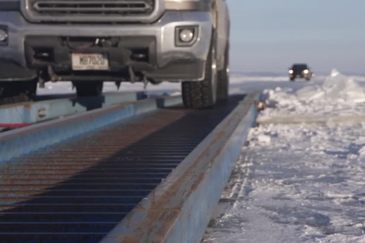
Created by Volunteers, the Ice Highway Linking Oshkosh and Quinney Over Lake Winnebago Reduces a Journey of About an Hour to Approximately 20 Minutes, Reorganizes Winter Logistics, Facilitates Rescues and Exposes the Delicate Balance Between Rapid Mobility, Safe Ice and Collective Responsibility in the Entire Region.
In the heart of winter in Wisconsin, an ice highway traced over Lake Winnebago shortens distances, connects communities and transforms a frozen body of water into an essential traffic corridor. The improvised route by locals, using simple machines and trees as landmarks, reduces travel time and changes how the lakeside cities view the lake itself.
At the same time, the initiative keeps a constant alert alive. Beneath the tires, there lies a naturally unstable surface, subject to cracks, localized thawing and rapid changes in thickness. Each season, those who maintain the highway know that there is no 100% safe ice and that each crossing continues to depend on careful reading of conditions and prudent individual decisions.
From a One-Hour Route to a 20-Minute Shortcut Over the Lake

In the winter routine of the Oshkosh and Quinney region, the traditional route around Lake Winnebago can take about an hour via conventional roads.
-
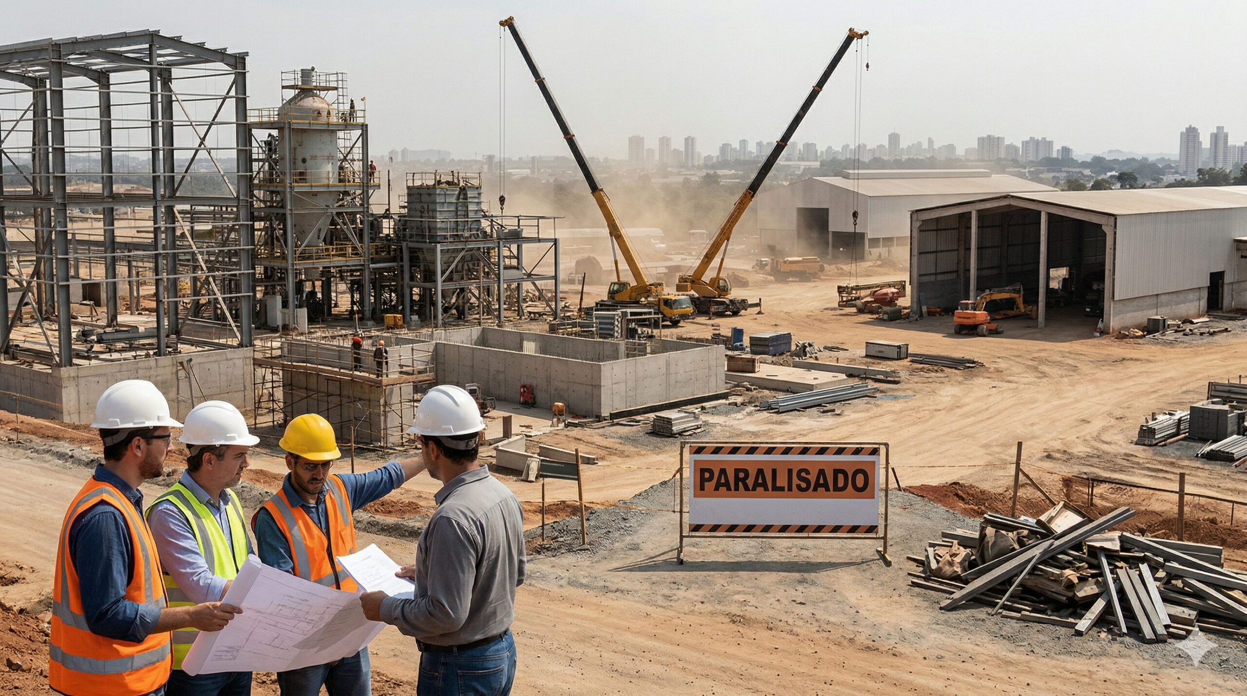
The lack of welders, electricians, and operators becomes a structural threat in 2025, with the construction industry and manufacturing already suffering from delays, cost pressures, and labor shortages in Brazil.
-
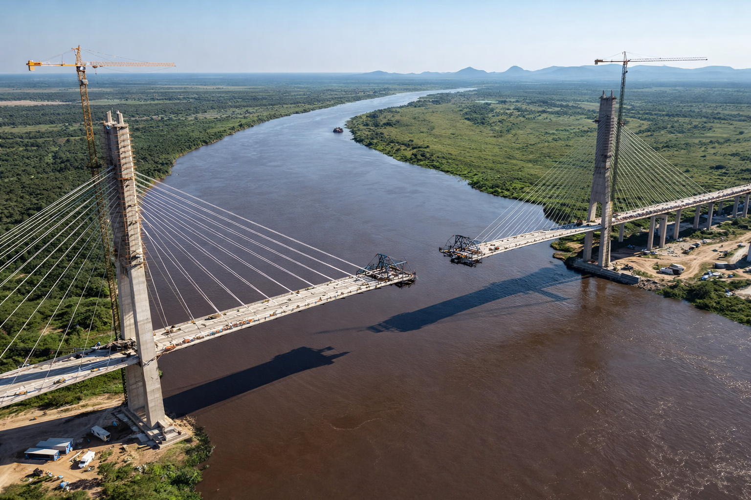
Brazil and Paraguay are just 46 meters away from a historic union on the bioceanic bridge that promises to revolutionize trade between the Atlantic and the Pacific.
-
With 55 km over the sea, a cost of US$ 20 billion, and enough steel to build 60 Eiffel Towers, China’s largest project has connected Hong Kong, Zhuhai, and Macau in a colossal bridge that defies the logic of engineering.

-
A trick with joint compound transforms a Styrofoam ceiling into a plaster-like ceiling: leveled panels, wires and mesh at the joints, sand, paint, and change the environment while spending little today.


With the ice highway open, this journey drops to around 20 minutes, shortening daily commutes, family visits and the route for those who work on one shore and live on the other.
The time difference is enough to reorganize schedules, reduce fuel costs and alleviate already overloaded land routes in the cold.
The change is not only practical. Seeing vehicles crossing the lake in a line, guided by trees planted in the ice, changes the perception of space and the local geography itself.
What in summer is a liquid barrier becomes, in the peak of winter, a viable surface for traffic, albeit temporary.
In just a few days, what was only a point on the map transforms into a structured corridor with visual guidance, entrances, exits and informal coexistence rules.
How the Ice Highway is Opened, Marked and Used by the Community
The ice highway arises from a combination of accumulated experience and volunteer labor. Locals with tractors and work vehicles plow the snow and clear a cleaner strip over the lake, creating a visually distinct bed.
This strip helps to better distribute the weight of vehicles, avoids uneven snow accumulation and allows the ice to be more exposed to the cold, preserving the necessary strength to support cars and trucks.
Marking is done with simple yet functional elements. Trees planted along the route indicate the axis of the ice highway and serve as distance references to the shore.
At each sequence of trees, drivers can estimate how much they have advanced or how much further they have to go to reach solid ground.
These visual landmarks are crucial in low visibility scenarios, blown snow and fog, when the distinction between ice, horizon and sky becomes more difficult.
Safety, Rescue and the Memory of Vehicles That Are Still at the Bottom
Leading the operation, experienced names from ice rescue, such as the owner of a local specialized company, remind that the lake holds its own history of accidents.
There are records of vehicles that sank about eight kilometers from the shore and still remain at the bottom, as a silent reminder of seasons when reading conditions failed.
For those who know these cases closely, the ice highway is both a logistical solution and a constant reminder of risk.
Therefore, even with the route open and marked, the recommendation remains clear. No segment of the ice highway should be interpreted as an absolute guarantee of safety.
The thickness of the ice varies, cracks appear overnight and any rapid warming can weaken sections previously considered reliable.
The volunteers themselves monitor cracks, more critical areas and, when necessary, close parts of the route, emphasizing that the final decision to enter or not with the vehicle always belongs to the driver.
Intermittent Operation in a Constantly Changing Environment
The ice highway does not function as a traditional road open all year round. The operation is intermittent, adjusted daily to the behavior of the lake. On some days, the structure remains active, with a continuous flow of vehicles.
On others, new cracks, thawing spots or forecasts of higher temperatures lead to the suspension of use. This constant re-evaluation is part of the informal protocol of those who monitor the lake throughout the season.
With each change in weather, volunteers return to the ice to check the surface, observe signs of stress, measure thickness and decide if the ice highway can remain in use. There is no automatism or guaranteed routine.
What exists is constant monitoring, combined with alerts to the population and a local culture that mixes tradition, caution and practical reading of conditions.
In weeks of intense cold, thousands of people can cross the lake following this path, but always with the awareness that the scenario can change the following week.
Shortened Logistics, Empowered Community and New Technical Discussions
From a logistical point of view, the ice highway shortens routes, reduces travel costs and facilitates the movement of goods and services between the two shores of Lake Winnebago.
Small businesses, workers commuting daily and families maintaining ties in opposite cities benefit from the seasonal shortcut.
Instead of an hour on the road, the 20-minute crossing frees up time, reduces vehicle wear and expands visiting windows on short winter days.
At the same time, the initiative strengthens the sense of community. The construction of the ice highway directly depends on volunteers who offer equipment, time and knowledge of the lake.
It is not just about opening a quick route, but organizing a collective effort to make winter more manageable for everyone.
Each tree planted, each section of snow removed and each orientation passed verbally reinforces the idea that the infrastructure there is shared.
Limits of the Solution and Challenges for Future Winters
The experience at Lake Winnebago also shows the limits of the solution. A winter with irregular temperatures, frequent thawing or intense storms can reduce the operation window of the ice highway or even prevent its opening in certain sections.
In these situations, the efforts of the volunteers are constrained by factors that cannot be controlled, such as the pace of regional weather or the frequency of out-of-season heatwaves.
This reality fuels technical debates about how far community initiatives can replace permanent infrastructure works in extreme environments.
The ice highway is, in essence, an adaptive response to a specific context of harsh winter, vast lake and communities accustomed to ice.
It shortens paths, but does not eliminate the need to plan land alternatives, rescue routes and rapid closure protocols when the surface no longer meets minimum safety requirements.
When the Community Shortcut is Worth the Calculated Risk
At the end of the season, the ice highway disappears along with the ice of Lake Winnebago, but leaves marks in the memory of the population.
There remain the stories of crossings that took 20 minutes instead of an hour, the accounts of rescues averted and the awareness that the combination of volunteering, tradition and caution can transform winter logistics for a few weeks each year.
In the face of an ice highway that shortens distances, strengthens local ties and, at the same time, requires constant attention to safety, to what extent do you think it is worth trusting seasonal community solutions in extreme environments, or would you prefer to rely solely on conventional land routes throughout the winter?


-

-

-

5 pessoas reagiram a isso.