 Portuguese
  English
  Spanish
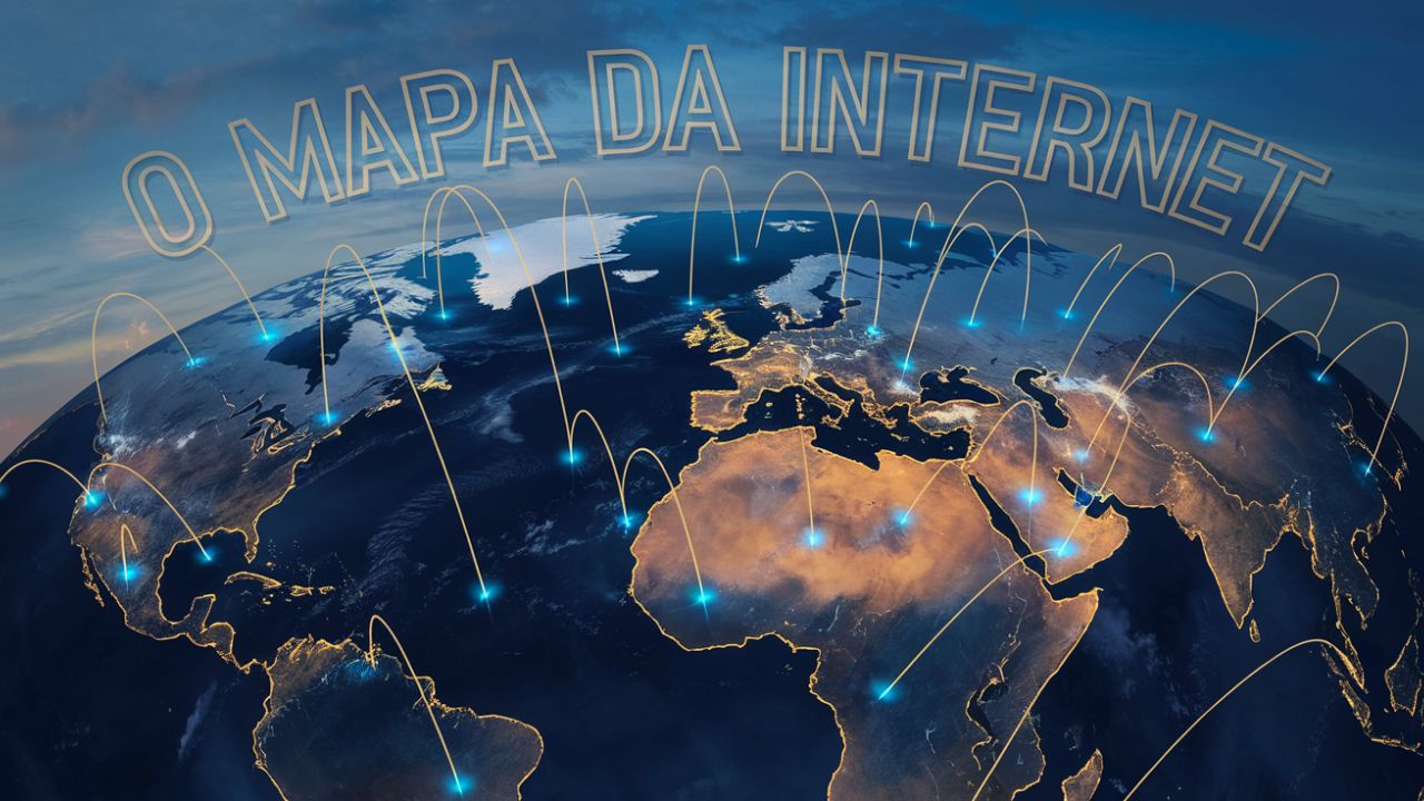
Explore How Submarine Cables Connect Almost All Countries in the World, Forming a Network of More Than 1.3 Million Kilometers of Underwater Optical Fiber, Essential for 99% of Global Communications.
How does the internet connect entire continents in a matter of seconds? The answer lies beneath the surface: submarine cables. These giant wires form the backbone of global communication, supporting nearly 99% of data transmissions between countries. Now, with an interactive map, we can literally “navigate” through this fascinating infrastructure and understand how the modern world is interconnected.
The Essential Role of Submarine Cables
Submarine cables act like the planet’s digital arteries, transporting essential data for everything from video calls to movie streaming. They are so numerous that, combined, they could circle the Sun. The difference between them goes beyond length: some are as thin as a computer wire, while others have the diameter of a garden hose.
If today you can send a message to someone in Europe in seconds, thank submarine cables. Countries like the United States and Japan have dense networks, but even more isolated regions like French Polynesia are connected. However, this dependency also creates vulnerabilities: geopolitical threats and natural disasters can disrupt crucial connections.
-
Millions of people have been eating yam for centuries without knowing that this humble tuber contains a compound called diosgenin, which scientists have now discovered can improve memory and help control blood sugar levels.

-
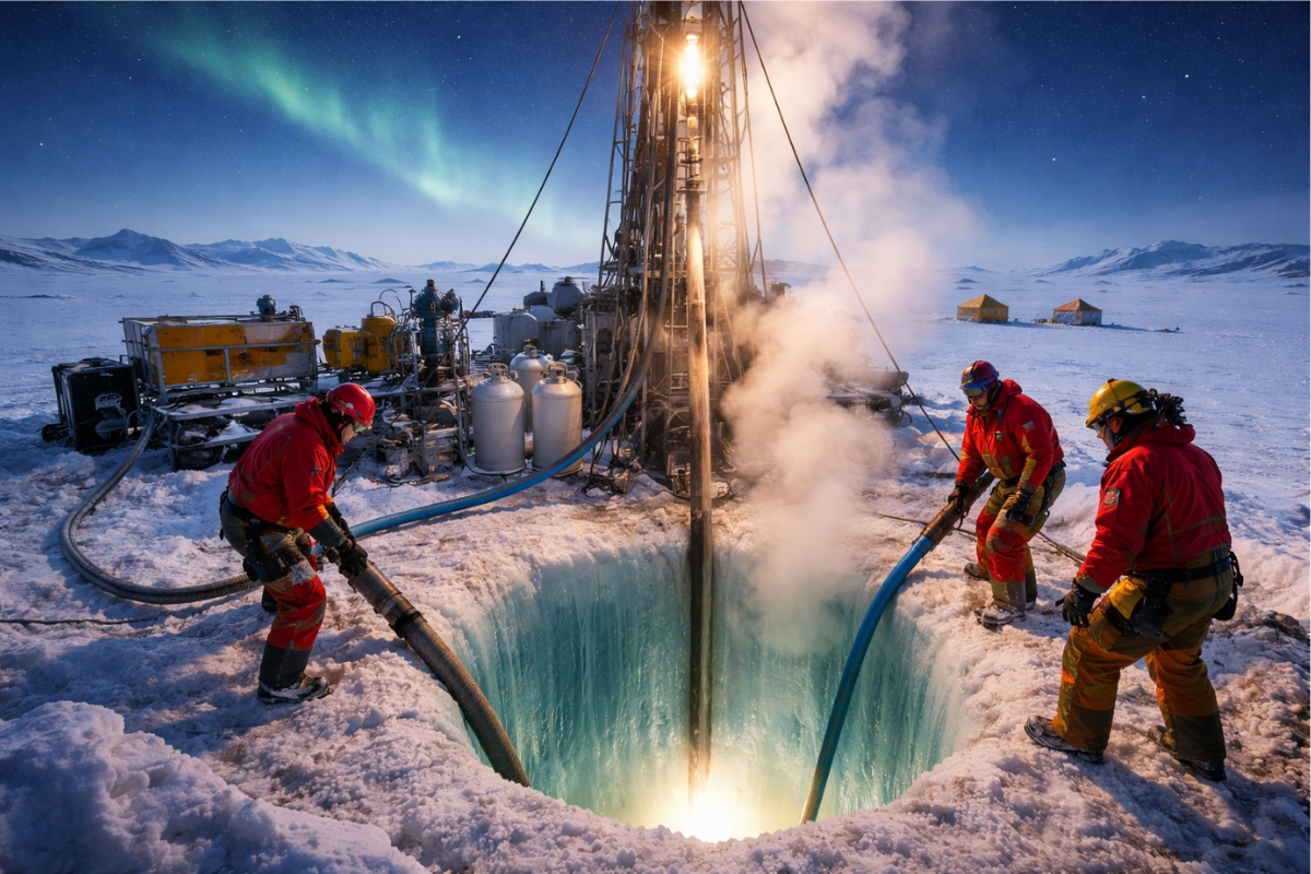
Scientists from an international project drill 1,800 meters of ice in Antarctica using hot water and discover details about one of the most intriguing places on planet Earth.
-
Seen from space, a colossal volcano nearly 5,000 meters high in Russia has released 1,600 km of smoke over the Pacific, forming “devil’s horns” of lava and revealing the brutal force of the Ring of Fire.

-
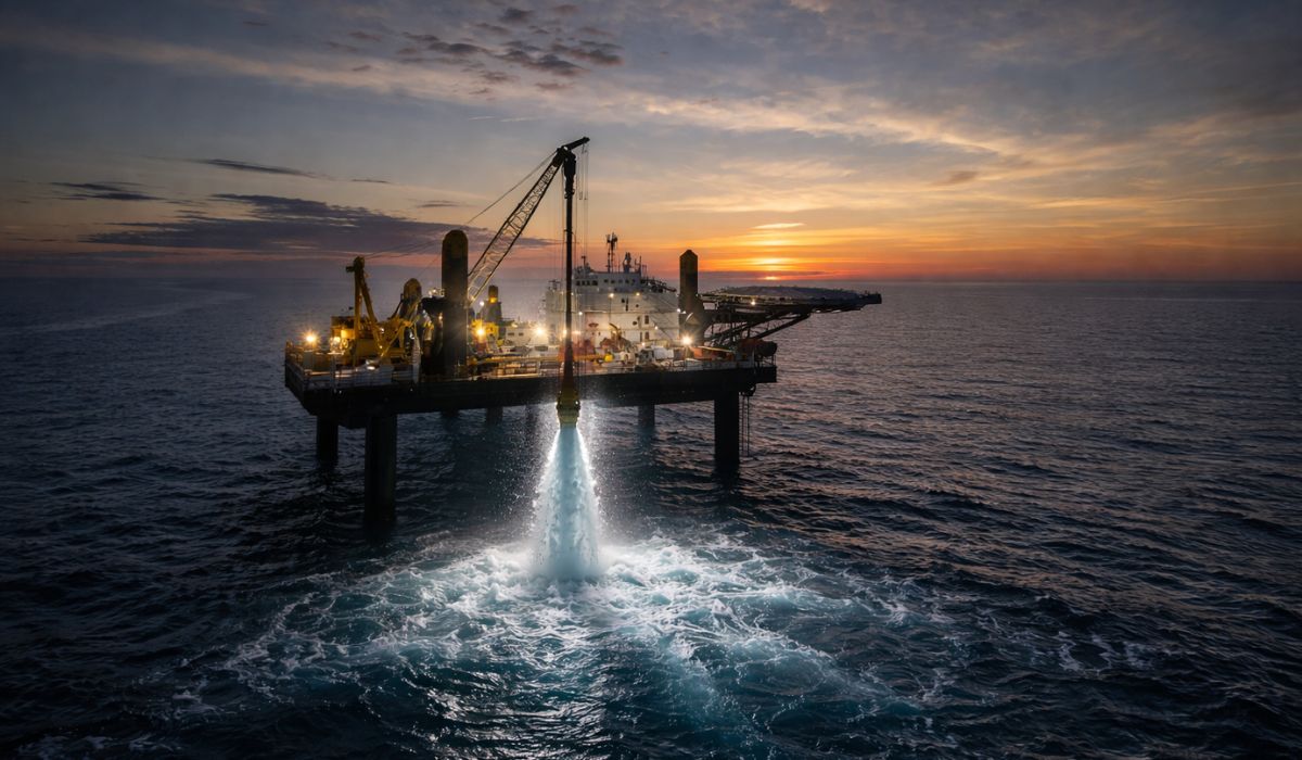
Expedition 501: Scientists drill into the ocean floor and discover a giant reserve of fresh water hidden beneath the sea, extracting nearly 50,000 liters and revealing an invisible system that could reshape the map of water scarcity.

How It Works and What It Shows

This interactive map is a true “Google Maps” of submarine cables. It details where they are located, who the owners are, and when they were installed. It’s like seeing the invisible “skeleton” that supports our daily digital interactions.
Some areas on the map stand out as true underwater highways. The North Atlantic, for example, connects the northeastern United States to Europe with cables like Marea and Grace Hopper, while the Suez Canal is a crucial crossroads for communications between Europe and Asia.
The North Atlantic is one of the busiest routes. Cables like Marea, connecting Bilbao to Virginia, and Grace Hopper, which runs from the U.S. to England, show how major technology companies are heavily investing in this infrastructure.
In Asia, the density of cables is impressive. The SeaMeWe-5, with 20 thousand kilometers, connects from France to Singapore. Meanwhile, in the Pacific, the Pacific Crossing-1 interlinks Japan, Hawaii, and the U.S., forming one of the most extensive data bridges on the planet.
The 2Africa project, covering 45 thousand kilometers, is one of the largest ever built. It not only circles the entire African continent but also connects Europe and Asia. This infrastructure promises to revolutionize connectivity in still underexplored regions.

Exponential Growth and Technology Needs
Between 2023 and 2025, more than 300 thousand kilometers of new cables will come into operation, resulting from a 10 billion dollar investment. With the advancement of artificial intelligence and streaming, the demand for this infrastructure is only increasing.
Although they are essential, submarine cables are subject to intentional cuts and political disputes. Regions like North Korea remain isolated, while countries like Cuba rely on a few cables to connect to the rest of the world.
Submarine cables are the veins that keep our digital world alive. The interactive map not only reveals this crucial infrastructure but also makes us reflect on the complexity and interdependence of the modern world. Next time you watch a video or send a message, remember: behind this simplicity, there are thousands of kilometers of cables working to connect you to the world.


-

-

-

-

-

15 pessoas reagiram a isso.