 Portuguese
  English
  Spanish
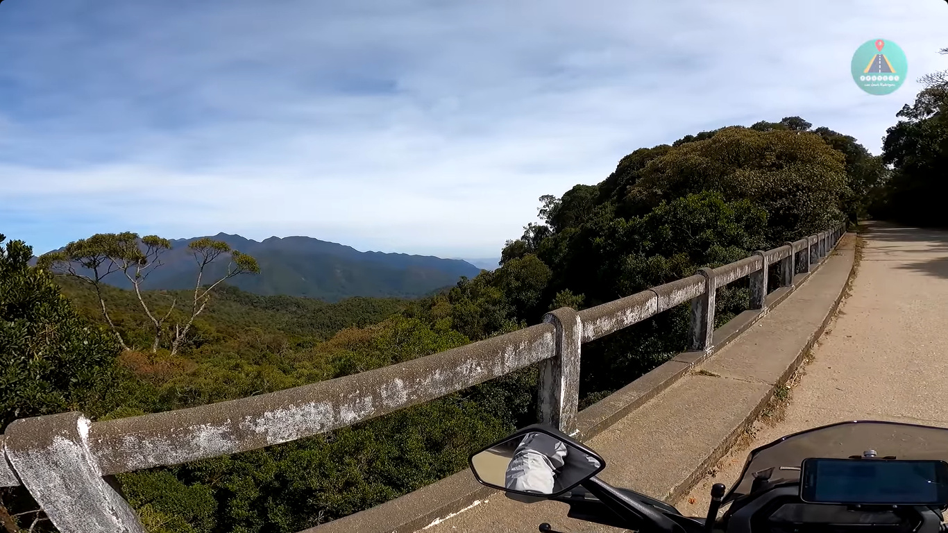


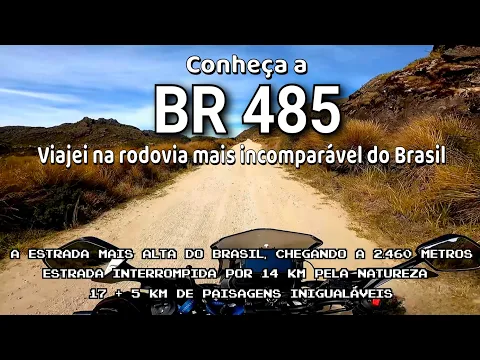
Highway BR-485 Connects Itatiaia to the Plateau of the Park in 15 Km with Unstable Weather, Slippery Cobblestones, and Access Rules Controlled by ICMBio
Highway BR-485 is described as a short but essential road for those heading to the high area of the Itatiaia National Park. It covers about 15 kilometers and connects BR-116 to the plateau where high mountain areas of the Mantiqueira Range are located.
This route has gained importance because it facilitates access to the Agulhas Negras Massif and other spots that attract tourists, researchers, and mountaineers interested in the high-altitude environment.
The journey begins in Itatiaia and ends at the Plateau Gate, the maximum area allowed for vehicles inside the park.
-
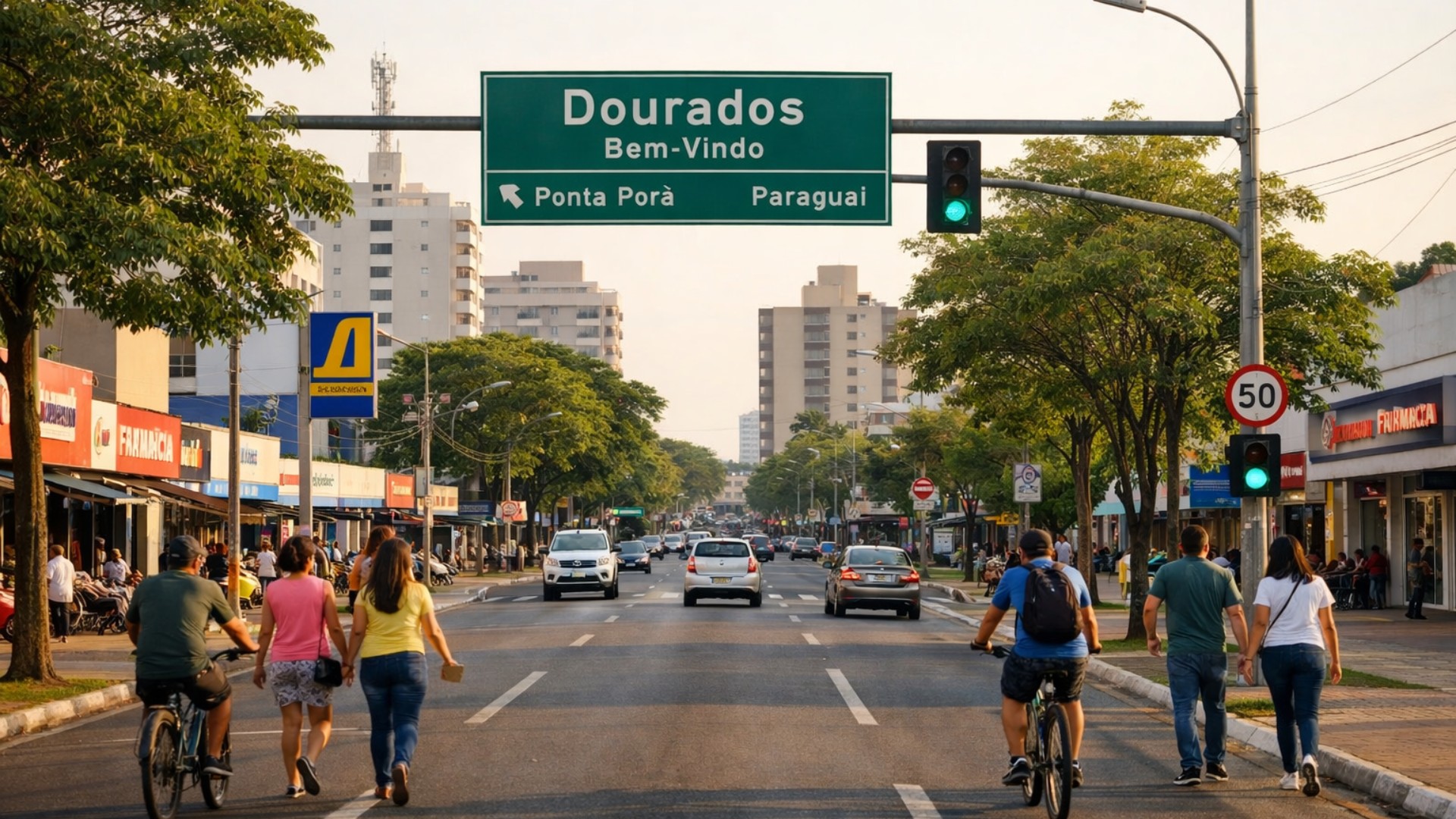
Brazilian city neighboring Paraguay becomes a ‘magnet’ for people seeking quality of life and high standards with exceptional growth and commutes of up to 15 minutes.
-
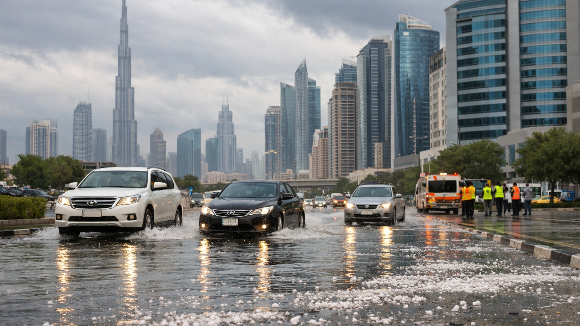
A rare storm transformed part of the Gulf into an unlikely scene of hail, extreme rain, and tornado risk in the middle of the desert, with volumes that exceeded the annual average in a single day.
-
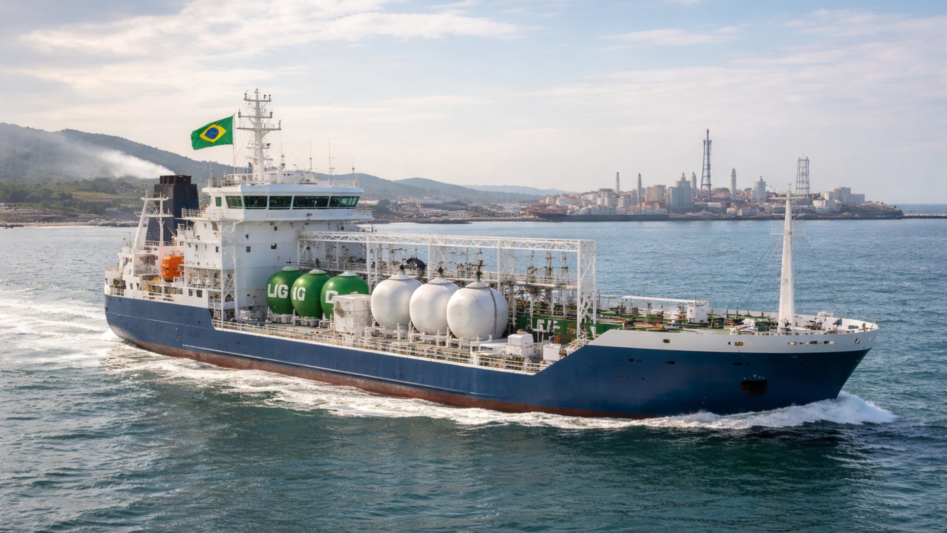
Brazil catches the world’s attention with ships powered by ethanol and biodiesel that have lower emissions, an unprecedented certification with advantages in chartering, and a revolution in cabotage.
-
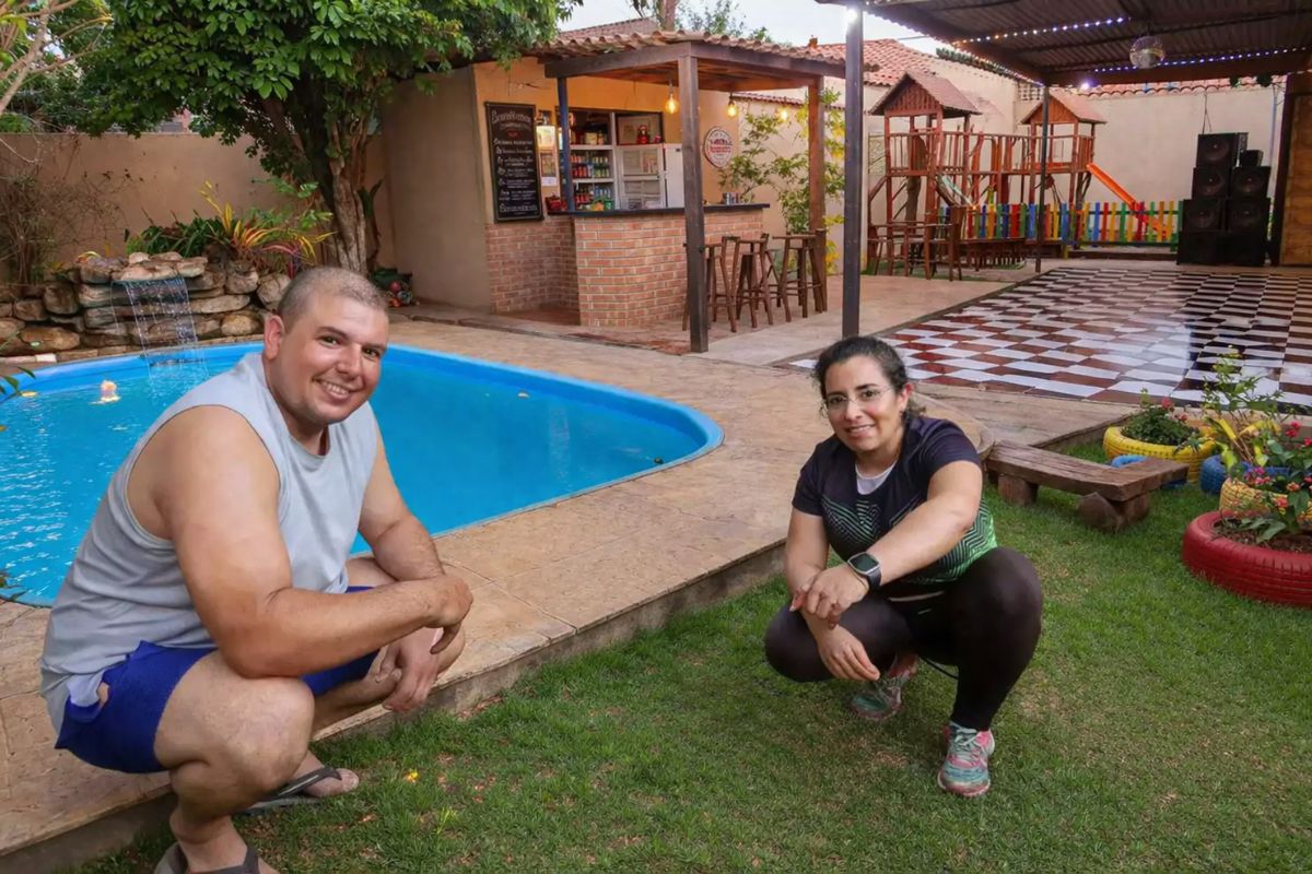
A couple who only has Sundays free has built a hand-dug pool, a hamburger joint, a dance hall, and a playground in their own home without hiring a mason, and even with breaks due to accidents and the pandemic, the work has never truly stopped.

The road crosses small communities, areas of preserved vegetation, and sections that experience rapid weather changes.
ICMBio controls hours and traffic, so circulation follows defined rules to protect the sensitive territory.
The opening of the road coincided with the creation of the park in 1937. It allowed the arrival of scientists and maintenance teams, as well as encouraging tourism in the high area.
Over time, this dynamic has impacted Itatiaia, Penedo, and surrounding areas, as ecotourism has driven inns, restaurants, and support services.
This economic relationship remains active and reinforces the highway’s role in the regional daily life.
Mountain Characteristics That Affect Driving on the Highway
The profile of BR-485 demands constant care. It is narrow, straightforward, and has no divider. In several sections, only one vehicle safely passes.
There are long climbs that require serviced engines because overheating can occur on continuous inclines.
Part of the road remains paved with cobblestones. When there is rain, frost, or ice, this surface becomes slippery, creating a risk for those who do not reduce speed in time.
The existing asphalt also suffers wear due to the harsh winter. Small faults increase with the cold and require frequent maintenance.
This reinforces the recommendation for heightened attention, as tight curves appear after sections with little visibility.
The altitude reaches about 2,400 meters. This alters the weather rapidly. Fog can appear in minutes.
The driver may encounter a clear sky and then total low visibility shortly after. Winter has constant frost formation and occasional ice presence.
These factors result in slower driving and schedule planning, as the park closes access outside the authorized period.
Limited Structure and Points That Require Planning
The road practically has no shoulder. The pull-out areas are limited. Stopping in inappropriate spaces increases risks, so drivers need to assess the route before climbing.
Signage meets basic standards and provides only essential guidance.
Fuel must be purchased while still in Itatiaia. The road does not offer gas stations, repair shops, or stores. Those who depend on food or water must bring it beforehand.
Services are located in the town or in Penedo. The park’s visitor center serves as a support point but does not replace complete infrastructure.
There is an environmental entrance fee according to ICMBio’s regulations, and this needs to be planned ahead.
BR-485 continues as a single lane along its entire length. There is no duplication. This format reduces environmental impacts in the surroundings while maintaining flow rules compatible with preservation.
However, holiday periods and unstable weather can cause slowdowns because the volume of cars increases and the conditions become more challenging.
Traffic jams occur near the control gates. Demand increases when the forecast indicates rain or cloudiness, as many visitors try to enter earlier.
This movement shows that the road, even though short, operates with intense dynamics.

Highway Conservation, Natural Risks, and the Climbing Experience
Severe weather affects the conservation of the road. Loose cobblestones and potholes frequently appear. Cracks expand after cold cycles.
Vehicles without maintenance may experience brake failures on descents. Accidents occur due to loss of control, excessive speed, or difficulty seeing the curves.
Although not common, they reflect the typical challenges of a mountain route.
The lack of immediate support reinforces basic precautions. Drivers need to check tires, fuel, and safety items before the trip.
This avoids unexpected situations in areas without room for maneuvers. Additionally, updated information from the park helps plan entry times and reduces risks from adverse weather.
Traveling along BR-485 becomes memorable by uniting nature, altitude, and the park’s history. Its 15 kilometers condense factors that require attention and preparation.
The visitor finds beauty but also strict access rules and challenges that change over time. This combination defines the routine of those who cross the road and maintains its importance in the mountainous region.
With information from Usezapay.


Bom dia José. A Br 485 tem início em Itatiaia próximo ao Pedagio, ao lado do Terminal Rodoviário. Pelo que sabemos essa área au nao tem bada a ver com a BR 485. Procure se informar junto ai DNITT. Abs. Hildebrando 24 998545799. 24 98116-7521.