 Portuguese
  English
  Spanish
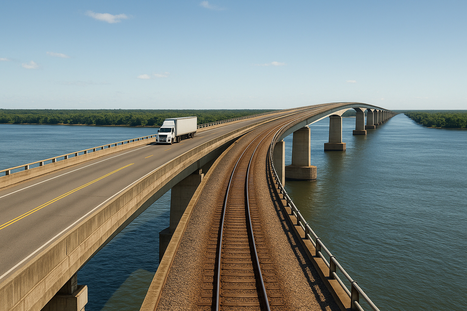


Inaugurated in 1998, the Rodoferroviária Bridge over the Paraná River Materializes an Idea Advocated Since 1901 and Integrates São Paulo with Mato Grosso do Sul via Highway and Railroad
One of the most relevant infrastructure projects in the national territory crosses one of the most imposing rivers in the country. The Rodoferroviária Bridge over the Paraná River is approximately 3.7 kilometers long. Furthermore, it is recognized as the largest river bridge in Brazil. The structure directly connects São Paulo with Mato Grosso do Sul. Therefore, it plays a central role in national logistics.
From the outset, the bridge stands out not only for its size. It also stands out for its strategic function. By crossing the Paraná River, one of the widest and most voluminous rivers in Brazil, the structure enables the integrated movement of goods and people. This strengthens the logistical corridor between the Southeast and the Midwest. This, in turn, enhances the efficiency of national transportation.
An Idea Conceived at the Beginning of the 20th Century
Although it was inaugurated only at the end of the last century, the conception of this connection is old. In 1901, the writer and engineer Euclides da Cunha already advocated for overcoming the Paraná River. In his technical and geographical studies, he pointed to the river as an obstacle to national integration. According to his analysis, the development of the country would depend on the expansion of railways and highways.
-
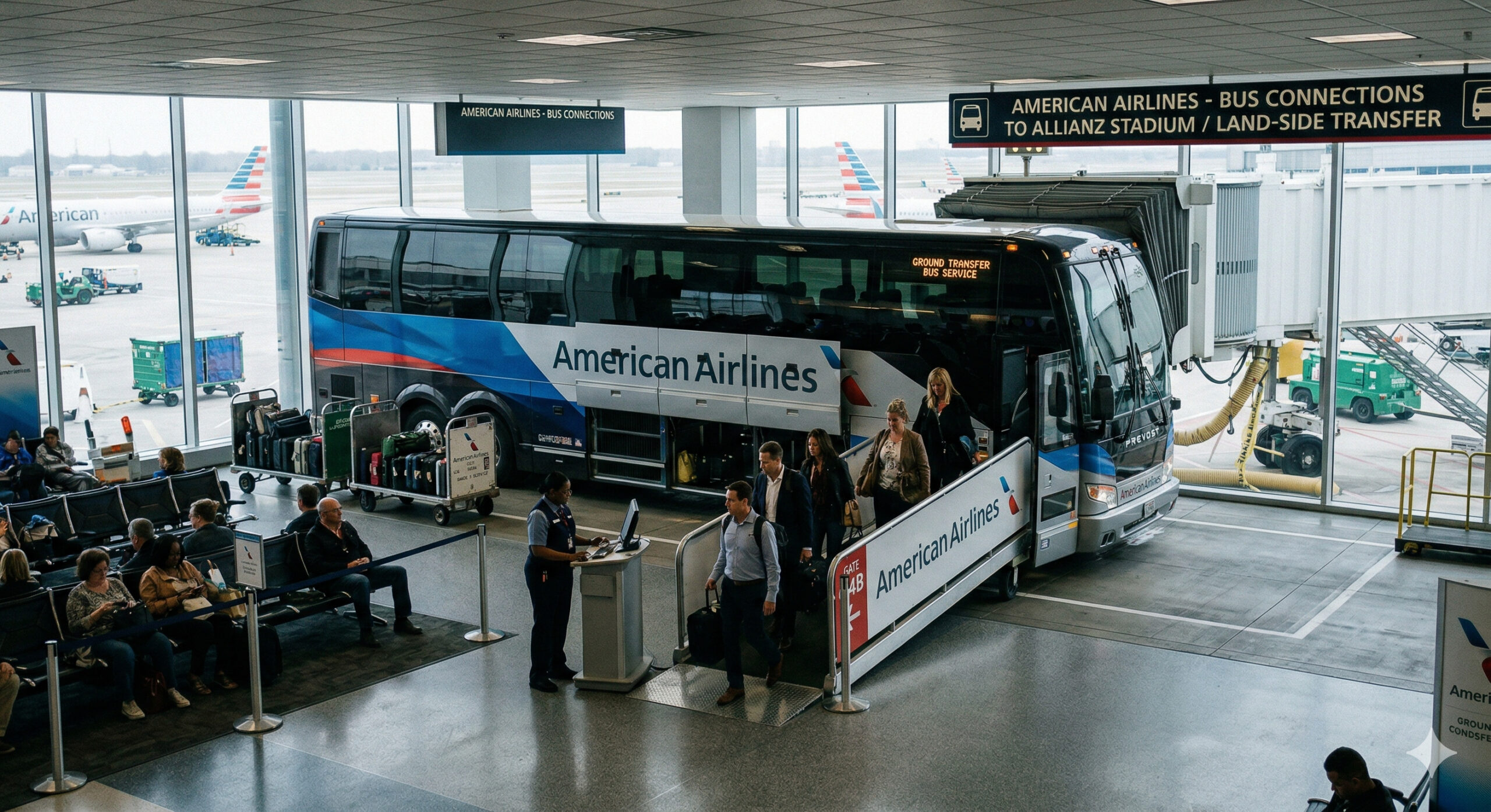
American Airlines starts selling trips as if they were flights, with check-in and baggage check at the airport, but on short routes, passengers board luxury buses connecting cities to major hubs in the U.S.
-
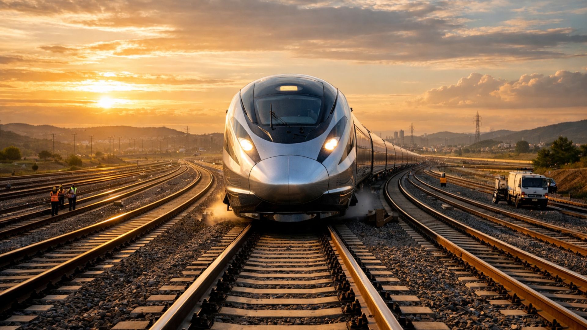
São Paulo surprises the world with a colossal railway network project that promises over 1,000 km of tracks, R$ 194 billion in investments, and 40 projects connecting the capital to the interior with fast and sustainable trains.
-
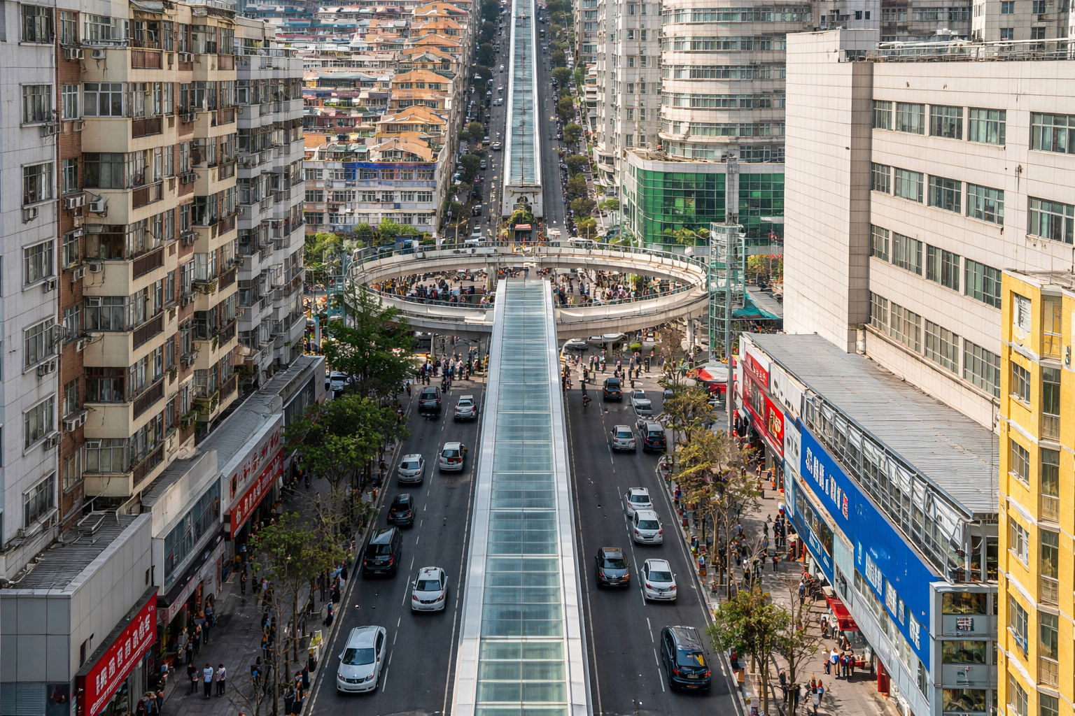
The world’s largest escalator, measuring 905 meters in China, reduces urban travel time from 1 hour to about 20 minutes and transforms mobility in mountainous regions with an engineering solution adapted to the terrain.
-
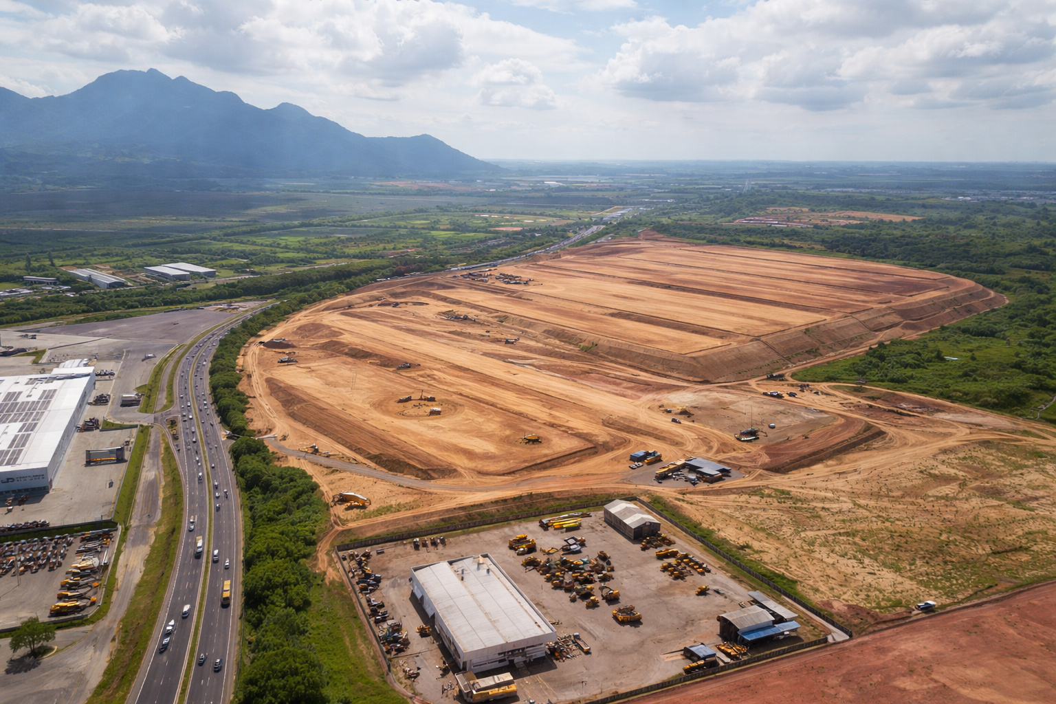
A R$ 300 million logistics giant is taking shape in Serra with over 100,000 m² and raises a question: how can this transform e-commerce and distribution in the state?

Still, despite the clarity of this vision, the project was paralyzed for decades. Only many years later did the proposal gather technical and economic conditions. This advancement occurred in the face of structural changes in the Brazilian economy. Thus, the idea finally came to fruition.
Construction Driven by the Growth of Agribusiness

The start of construction occurred in the 1990s. This period was marked by the strong expansion of agribusiness in the Midwest. At the same time, the need to expand the logistical corridor towards the Port of Santos was growing. This port was consolidating as the main export route of the country.
In this context, an idea considered bold was adopted. The bridge was designed as a mixed structure. It combines roadway and railway side by side. In this way, it allows for the simultaneous traffic of trucks, cars, and trains. Thus, it established itself as one of the main multimodal corridors in Brazil.
Inauguration in 1998 and Technical Characteristics
The inauguration took place in 1998. This milestone represented a significant advance for national engineering. From a construction perspective, the work combines metal and concrete sections. These sections are supported by deep pillars. The pillars were implanted directly into the bed of the Paraná River.
Furthermore, the structure was designed to support the weight of railway compositions. At the same time, it was prepared to withstand variations in the river level. During flood periods, the water volume can rise considerably. Therefore, advanced foundation and assembly techniques were employed.
Economic and Logistical Impacts of the Bridge
With its completion, the logistical effects were immediate. The bridge began to integrate Mato Grosso do Sul with São Paulo’s railway network. This facilitated the flow of soybeans, corn, meat, cellulose, wood, and manufactured products. Thus, transportation became faster and more efficient.
Cities like Três Lagoas in Mato Grosso do Sul and Castilho in São Paulo gained regional prominence. Both came to integrate the export corridor of the Midwest. Currently, this corridor is one of the most dynamic in the country. As a consequence, there was a reduction in transportation costs. Moreover, new industrial investments occurred.
A Symbolic Landmark of National Engineering
In addition to practical impacts, the Rodoferroviária Bridge over the Paraná River has a strong symbolic value. After all, almost a century after 1901, the work fulfills the vision of Euclides da Cunha. His proposal advocated the integration of Brazil’s interior through engineering.
Thus, by connecting states, modes, and productive chains, the largest river bridge in Brazil remains as a lasting landmark of national engineering. In this way, it supports an essential part of the logistics that drives the country’s economy.
In light of this historical, economic, and logistical impact, to what extent can works of this magnitude still redefine regional development and the integration of Brazil in the coming years?


A ponte rodoferroviaria sobre o rio Paraná no município de Rubineia SP à Aparecida do Taboado MS, não é paralela, a ferrovia na parte de baixo e rodovia em cima, eu trabalhei na construção mecânica da ponte no trecho de São Paulo pela Usiminas Mecânica durante mais de um ano, se estivermos falando da mesma ponte, vocês cometeram um equívoco grotesco.
Acho que foram claros na matéria dizendo que é entre Três Lagoas MS e Castilho SP
Na minha opinião acho justo pois não é um preço abusivo como os pedágio e outros pontos turísticos no Brasil que pra você ver uma cachoeira cobra um absurdo e por pessoa eu pagaria com gosto
AA