Portuguese
  Spanish
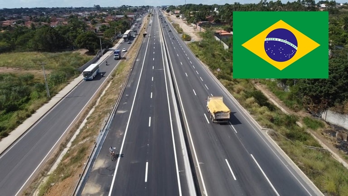
Discover The Impressive Journey Of BR-116, A Road That Connects Cultures, Solves Logistical Bottlenecks, And Transformed Brazil Since The 1930s
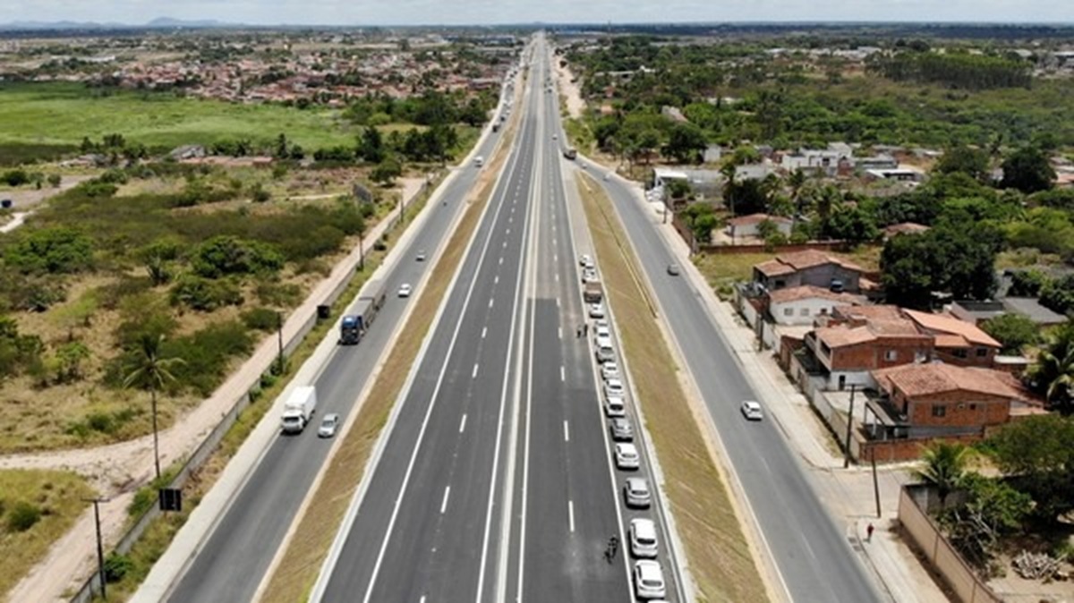
BR-116 is the main longitudinal highway of Brazil, connecting the extremes of the North and South of the country. With about 4,600 km in length and passing through 10 Brazilian states (Ceará, Paraíba, Pernambuco, Bahia, Minas Gerais, Rio de Janeiro, São Paulo, Paraná, Santa Catarina, and Rio Grande do Sul), it links the capital of Ceará, Fortaleza, to the municipality of Jaguarão in Rio Grande do Sul (on the border with Uruguay).
Alongside BR-101, BR-116 forms one of the main road axes in the country, being the longest fully paved highway in Brazil.
By traversing diverse biomes (such as the Atlantic Forest, Cerrado, and semi-arid areas of the Northeast) and strategic regions, the highway plays a vital role in territorial integration and national economic development.
-
New Helmet Rule in Brazil Requires Inmetro Digital Seal and QR Code from July 1, 2026, But Existing Helmets Are Exempt — Here’s What Changes and How to Verify Authenticity

-
Bus Strike in Rio Disrupts Public Transport, but Court Ruling Ensures 50% of Fleet Remains Operational
-
Driver who “holds” the left lane can receive a hefty fine and 4 points on their driver’s license even if they think they are going at the correct speed for the road.
-
São Paulo Government puts R$ 343 million on the table and releases 31 km of duplication, 9.84 km of third lanes, 4 reinforced viaducts, and 8 grade-separated returns.


Planning And Construction
The BR-116 project originated in the 1920s, as part of a national integration policy. During Washington Luís’s government (1926-1930), the Commission of Federal Roads (CERF) was created to articulate a federal road plan.
In 1927, the Union took on the task of planning major highways, one of which aimed to connect the North to the South of the country, linking major capitals (Minas Gerais, Curitiba, São Paulo, and Rio de Janeiro).
However, there was a reversal of priorities: the initial section was opened in the Northeast. In 1933, the Fortaleza (CE)–Feira de Santana (BA) connection was inaugurated, part of what would become BR-116.
During the Estado Novo (1937-1945), with the creation of the National Department of Roads (DNER), paving accelerated: in the 1940s, the segment from Feira de Santana (BA) to Rio de Janeiro was opened, then called the “Santos Dumont Highway.”
In the 1950s, the connection between Rio de Janeiro and São Paulo (Presidente Dutra Highway) was opened by President Dutra, becoming one of the busiest segments to this day.
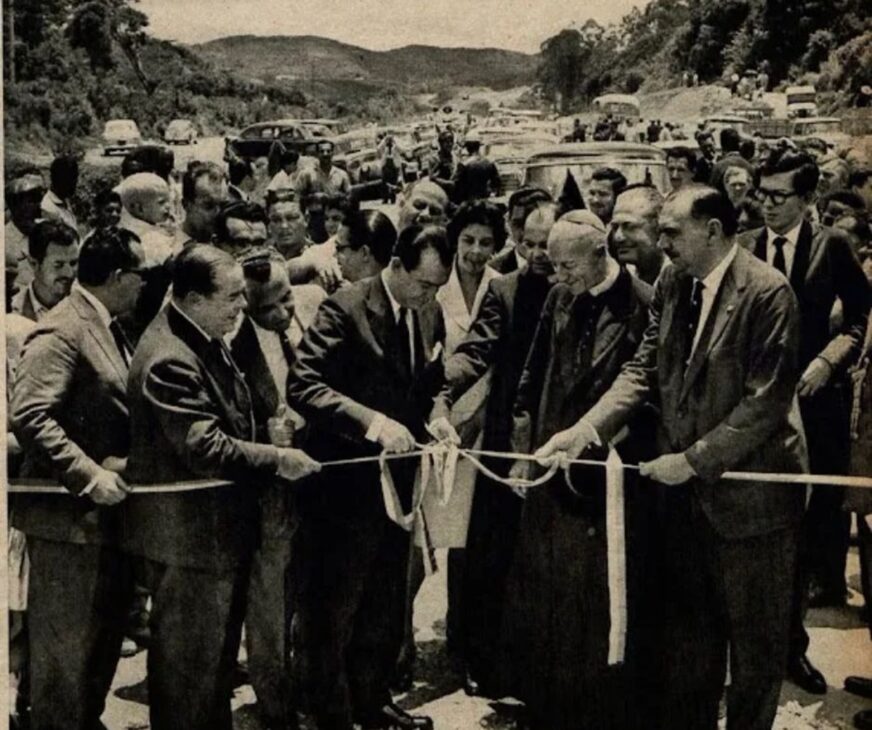
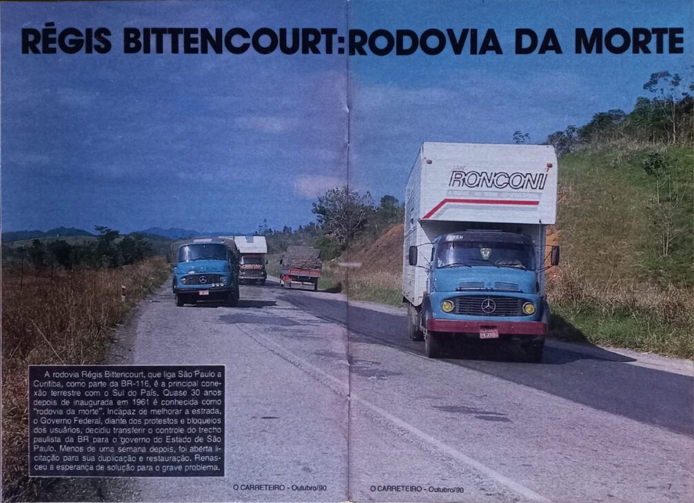
In 1961, the segment between São Paulo and Curitiba (Régis Bittencourt) was delivered. Starting in 1967, duplication began on several stretches, transforming BR-116 into the country’s main highway.
In the 1970s and 1980s, the network expanded toward Rio Grande do Sul, including segments of the Southern Plateau (PR-SC) and Serrana Highway (PR-RS).
The construction of the highway involved, over the years, urban bypasses and overpasses to avoid the old urban crossings, as well as cutting through mountains and heavy engineering works in mountainous regions.
Motivations For Its Creation
The main motivation for BR-116 was to unify and develop the Brazilian territory. Since the 1920s, the government saw highways as a means of national integration and an engine for economic development.
The highway addressed strategic interests: to transport agricultural and mineral production from the interior to ports and to bring industrial centers in the South and Southeast closer to the North/Northeast regions.
For example, it connected the wealthy Triângulo Mineiro (MG) to the capitals of the Southeast and to the port of Rio.
Throughout its expansion, its construction was justified by encouraging the growth of emerging hubs in the interior (Cachoeiro do Itapemirim, Santa Maria de Jetibá, etc.), as well as consolidating the Rio–São Paulo–Porto Alegre axis.
In summary, BR-116 was designed to meet infrastructure deficits and promote balanced regional development.
States And Regions Crossed
BR-116 traverses three major regions of Brazil (Northeast, Southeast, and South) and 10 states. Broadly, it follows this sequence from north to south:
- Northeast: it starts in Fortaleza (CE) and crosses the interior of Ceará; it passes through an extreme point in Paraíba (rural area of Cachoeira dos Índios); traverses the sertão of Pernambuco (Salgueiro) and enters Bahia, linking cities like Feira de Santana.
- Southeast: in northern Minas Gerais, it crosses rural areas toward Rio de Janeiro; in the Southeast itself, it follows the Presidente Dutra Highway linking the city of Rio de Janeiro to São Paulo.
- South: it enters Paraná (BR-116/Régis Bittencourt) up to Curitiba, continues through the Southern Plateau (between PR and SC), and culminates in Rio Grande do Sul, reaching Jaguarão on the border with Uruguay.
This route interlinks major capitals (Fortaleza, Salvador, Belo Horizonte, Rio, São Paulo, Curitiba, Porto Alegre) and major industrial and agricultural hubs. In practice, the highway acts as a logistical backbone between the regions, passing through metropolitan areas, agricultural zones, and mining districts.
Logistics
BR-116 is considered the “backbone” of Brazilian logistics. It integrates major industrial, agricultural, and port hubs: supplying centers like São Paulo, Curitiba, Porto Alegre, and Rio de Janeiro and receiving commodity outflow from producing areas.
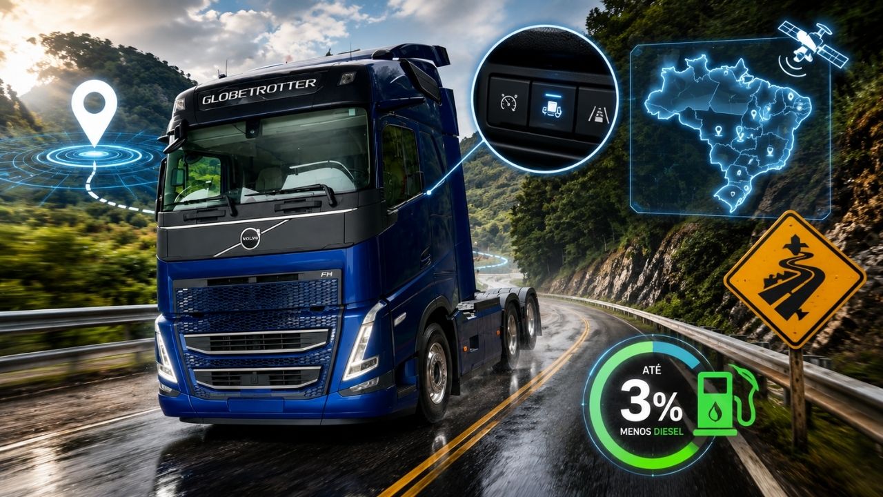
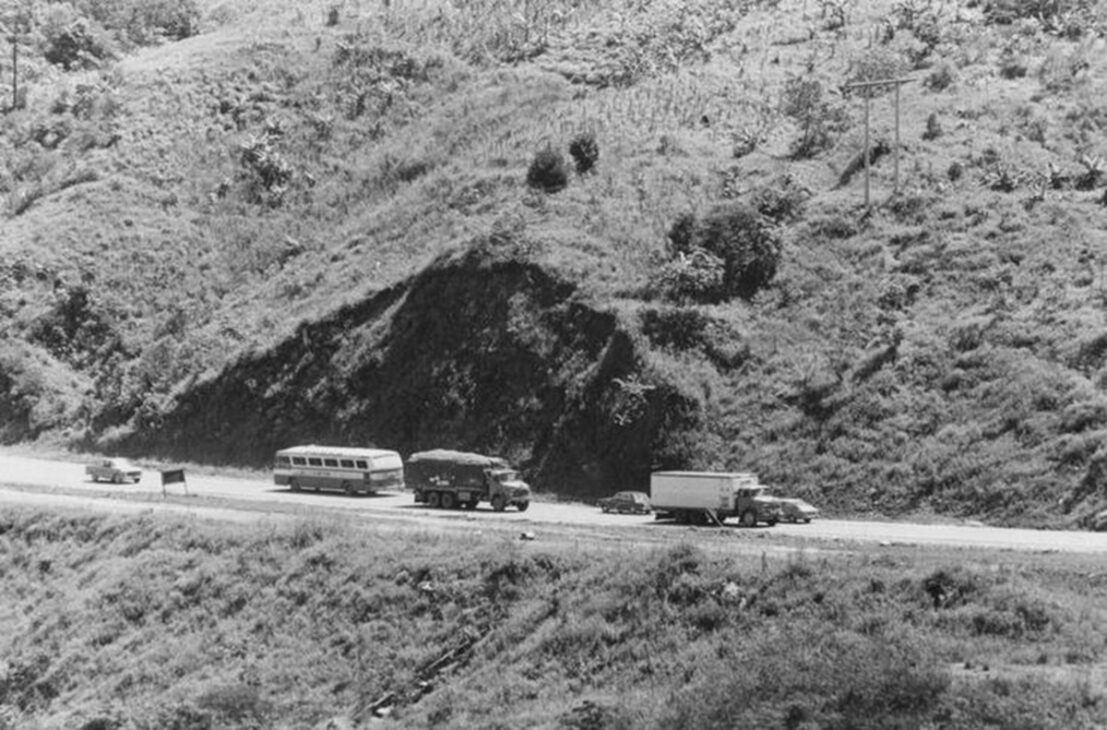
It is essential for road freight transport, being one of the routes with the highest truck traffic in Brazil.
In stretches near major cities and industries, daily traffic can reach tens of thousands of vehicles. It is estimated that, only on Régis Bittencourt (SP-PR), over 35,000 vehicles per day circulate – about 27,000 trucks.
Even in rural stretches in the South, there is a significant flow of freight: for example, between Guaíba and Pelotas (RS), about 3,800 trucks transit per day.
Socially, BR-116 energizes local populations, connecting isolated communities to urban centers. Intermediate cities along the highway have grown due to the road, as they received services (gas stations, restaurants, hotels) aimed at users.
However, the high traffic volume also generates noise and air pollution in metropolitan regions, along with occasional isolation of small localities cut by the highway. Overall, though, circulation on BR-116 is vital for ensuring a consumer market and job opportunities in sectors such as transportation, commerce, and tourism.
Duplication Works, Concessions, and Modernizations
Since the second half of the 20th century, there has been intense duplication of lanes on BR-116. Systematic implementation of dual lanes began in critical sections in 1967.
In the 1970s and 1980s, major segments near São Paulo, Curitiba, and Porto Alegre were duplicated. However, many mountain stretches remained bidirectional until the early 21st century. The last and most challenging of these, the Serra do Cafezal (SP), was only completed in 2017 after long investments and complex works.
With this phase completed, the road was fully duplicated on the São Paulo–Curitiba–Rio de Janeiro axis.
In the 1990s and 2000s, several high-demand segments began being granted to the private sector. In 1996, the Presidente Dutra Highway (RJ–SP section of BR-116) was granted to CCR (NovoDutra).
In 2007/2008, the section between São Paulo and Curitiba (Régis Bittencourt) was auctioned (granted to Autopista Régis Bittencourt).
Starting in 2009, other sections were taken over by concessionaires: ViaBahia in part of Bahia, Autopista Planalto Sul (now Arteris) in PR/RS, etc. These concessions involved toll coverage and commitments to duplicate or restore segments.
Recent modernizations include the construction of urban overpasses, the implementation of additional lanes at critical points, and technologies such as electronic toll collection systems. In 2021–2022, for instance, DNIT resumed abandoned sections (the exit of ViaBahia) to continue works and ensure road maintenance.
Even with concessions, a good part of the highway – especially stretches in mountainous areas – still requires heavy engineering works (bridges, tunnels, and reinforced slopes) to meet the increasing traffic.
Environmental And Social Impacts
The construction and expansion of BR-116 caused significant environmental impacts, given its extension through fragile biomes. In the segment of Serra do Cafezal, for example, the highway crosses remaining areas of Atlantic Forest, which increased the costs and timelines of duplication works.
This environmental concern forced licensing agencies to require stringent mitigation programs. In the duplication of 211 km between Guaíba and Pelotas (RS), for instance, IBAMA only granted a license after a comprehensive environmental management plan.
Among the measures adopted are fauna monitoring, protection of riparian forests, and recovery of degraded areas. Additionally, social programs were implemented during the construction, such as support for affected Mbyá-Guarani indigenous communities and quilombolas along the route.
Compensation for expropriations was also foreseen: properties and lands were indemnified, and rural settlements received technical assistance and infrastructure.
In the surroundings of the highway, intense traffic generates air and noise pollution in metropolitan regions. Small communities along BR-116 also face social risks due to increased accidents and changes in local dynamics.
On the other hand, the highway has fueled regional economic growth but required careful management of land and water resources to prevent erosion.
In summary, BR-116 represents a significant logistical advance but comes with socio-environmental challenges: the need to balance development with environmental preservation and social justice in the impacted areas.
The BR-116
BR-116 has played a decisive role in national development, acting as an integrative axis that allowed the circulation of people and goods between the North and South of Brazil.
Constructed in phases over nearly a century, it mirrored the changing priorities of each government and followed the evolution of road transport in the country.
Today, it remains essential for the flow of production, providing competitiveness to regional economies.
At the same time, its maintenance and modernization are ongoing challenges. New duplications, investments in conservation, and management of concessions are needed to support increasing traffic and improve safety.
In the future, addressing climate delays (floods, landslides), deepening environmental mitigation, and expanding road technologies (electronic controls, smart highways) will be priority tasks. In short, BR-116 remains one of Brazil’s major growth vectors but requires integrated planning to ensure it continues to connect the country securely and sustainably.
Sources: Official documents and specialized reports on BR-116