 Portuguese
  English
  Spanish
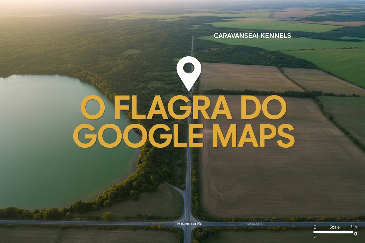
A Rare And Impressive Satellite Record Reveals Something Never Seen Before On Google Maps Images Showcasing A Surprising Space Phenomenon Involving High Speed, Advanced Technology And A Growing Constellation In Low Earth Orbit.
An astonishing record on Google Maps caught the attention of internet users and experts by showing, for the first time, an object moving at an impressive 27,000 kilometers per hour in low Earth orbit.
In the early hours of November 30, 2024, a European observation satellite captured images revealing a phenomenon previously unseen on publicly accessible satellite imagery platforms.
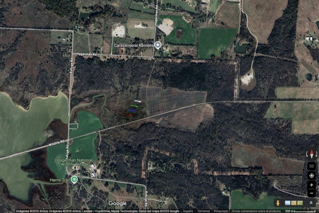
According to user reports on Reddit, the scene was recorded at coordinates 33°44’39.0″N 96°44’46.2″W, in a rural area in Texas, near Dallas.
-
More than 20,000 positions could be opened, and thousands of technicians are starting to be trained in Brazil, as the expansion of data centers creates an urgent race for professionals to keep the internet, cloud, and artificial intelligence running 24 hours a day.

-
China approves the 15th Five-Year Plan 2026-2030 to become a global power: prioritizes brain implants, 6G with AI, humanoid robots, flying cars, quantum technology, and nuclear fusion, while strengthening defense and the economy.

-
Goodbye iron: new technology from Xiaomi promises to revolutionize the way we iron clothes with 500 kPa steam, continuous flow of 120 g/min, heating in 65 seconds, and six smart modes for different fabrics.

-
Rio Pardo, the most mysterious city in Rio Grande do Sul: untouched Pampas castle, the missing treasure of the Devil Boy, bride’s saint, invisible tunnels, and a 200-year curse today.

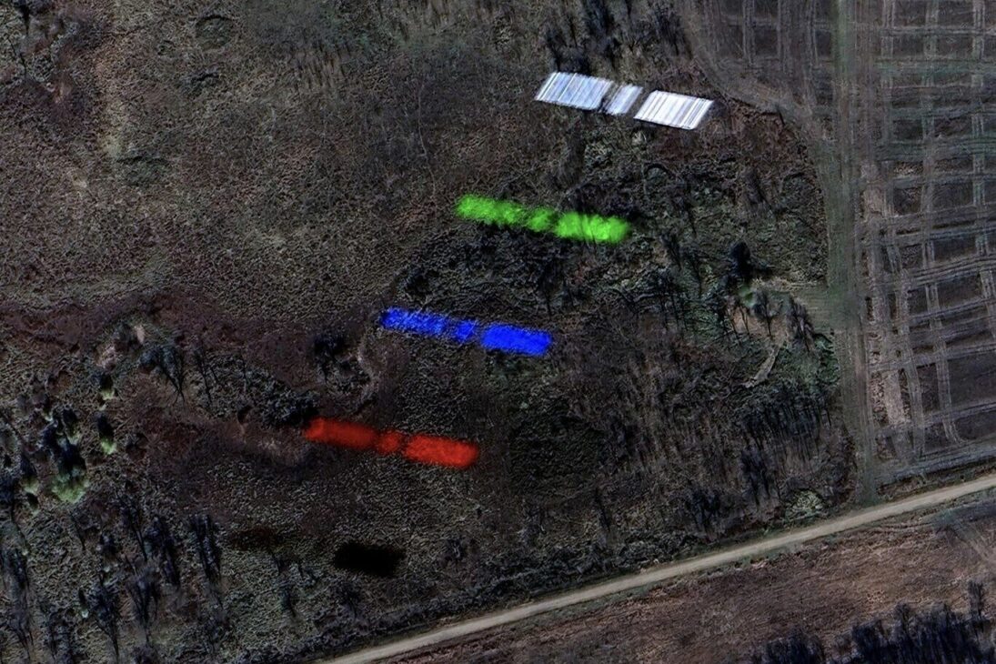
Amid the images, five colorful silhouettes of the same fast-moving object stand out against the static ground, revealing unique details about satellite capture in low Earth orbit.
A Satellite Moves At A Stunning Speed
It’s not uncommon to find airplanes recorded on Google Maps or Google Earth, as about 100,000 aircraft cross the skies daily.
Even military stealth planes, such as the B-2 bomber, have been caught in mid-flight by the satellite cameras that feed Google Maps.
However, nothing compares to the speed of this unusual object, which far exceeds the average speed of an airplane.
The satellite in question was traveling at nearly 27,000 km/h, a speed equivalent to approximately 7.5 km per second, a characteristic typical of satellites in low Earth orbit.
This pace makes the fastest airplane appear almost static in comparison.
The Five Silhouettes: An Intriguing Visual Phenomenon
The image obtained by the Pleiades satellite, developed by Airbus, showed the same satellite captured in five different spectra.
As explained by experts, the five images represent different spectral bands: near-infrared, red, blue, green, and finally, a panchromatic image in shades of gray.
Each colorful silhouette corresponds to one of these bands, captured at distinct moments during the satellite’s rapid passage.
This unique visual effect occurs because observation satellites do not take a single photograph but a series of captures in various light frequencies, which are then combined to form detailed and colorful images.
In the case of this high-speed satellite, the rapid movement during the captures made it appear in five consecutive positions, creating an effect of “colorful ghosts” that impress those who observe.
What Is This Satellite?
Both Reddit users and astrophysicist Jonathan McDowell, a recognized expert on space objects, indicate that the object caught is a SpaceX Starlink satellite.
Unlike the earlier Starlink models, which had only one solar panel, the new V2 mini satellites have two large side panels, with a wingspan of about 30 meters.
According to McDowell, the captured satellite is likely Starlink number 31147, part of SpaceX’s second-generation constellation.
The Phenomenon Of Starlinks In Space And On Earth
It is no coincidence that the first satellite detected in public Google Maps images is a Starlink.
Unlike most satellites that orbit at altitudes above 500 km to reduce drag with the atmosphere, Starlink satellites are launched into lower orbits, around 340 km to 570 km.
This position allows for global internet service with low latency, ideal for connecting remote areas and even urban regions with quality.
This strategy implies that these satellites have an estimated lifespan of only five years, as atmospheric resistance requires periodic replacement to keep the constellation functional.
Today, there are about 7,200 Starlink satellites in orbit, a number that already exceeds the total of satellites from other constellations combined.
This large volume was made possible thanks to SpaceX’s technological advancement, which manages to recycle its rockets by landing them precisely for subsequent launches.
The Future Of The Megaconstellation
SpaceX plans to expand this network into a true megaconstellation of up to 30,000 satellites, which promises to revolutionize global internet offerings.
As a result, it is becoming increasingly common to see Starlink satellites in the night sky, forming luminous rows that attract the attention of observers around the world.
Similarly, it is likely that this will not be the last time a Starlink satellite appears in photos from Google Maps or other public satellite image platforms.
As technology advances, new ways to capture and track these objects in orbit will make it possible to record even more surprising phenomena.
How These Images Help Science And The Public
Beyond curiosity, images like this have practical importance for astronomy and space monitoring.
Detailed captures of satellites in different spectra help researchers analyze technical characteristics, efficiency of solar panels, and even possible defects or damages.
For the general public, this discovery serves as a gateway to better understand the space around us and the dynamics of the objects that orbit Earth.
These images show that space is more accessible than ever, thanks to the democratization of data from commercial and government satellites.
Have you ever imagined how many other surprising phenomena might still be hidden in Google Maps images? What other space secrets would you like to see uncovered in satellite photos?


Seja o primeiro a reagir!