 Portuguese
  English
  Spanish
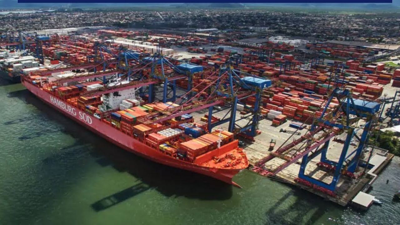
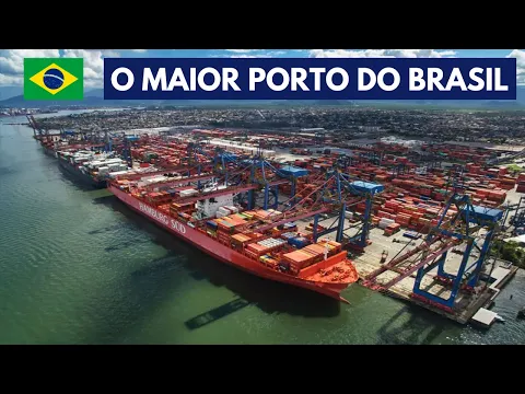
The Port of Santos Was Born on Wooden Landing Stages Staked in the Mangrove and Today Operates Almost 180 Million Tons of Cargo Per Year, in Works and Expansions That Aim to Transform It Into One of the Largest Port Hubs in the World.
From a precarious anchorage to a continuous wharf complex of 24 km, between Santos, Guarujá, and Cubatão, the port has reinvented itself with a railway, its own energy, sanitation, new terminals, and now a package of deep dredging, immersed tunnel, and digitalization that reposition the São Paulo estuary in the global competition for cargoes and maritime connections.
From the Mangrove Strait to the Heart of Brazilian Logistics
Over just over a century, a narrow piece of coastline between the estuary and the sea was carved, filled in, and deepened until it became the heart of Brazilian logistics. The Port of Santos now concentrates the largest volume of cargo in the country, connecting the interior of São Paulo, the agribusiness of the Midwest, and entire industrial chains to the rest of the world.
Each new stretch of wharf required deeper dredging, foundations driven into the mud, taller warehouses, and railways advancing to the water’s edge. Now, this same board is being redesigned once again so that the complex stops being just the largest port in Brazil and consolidates its route to establish itself as one of the largest port hubs in the world, in capacity, efficiency, and logistical integration.
-
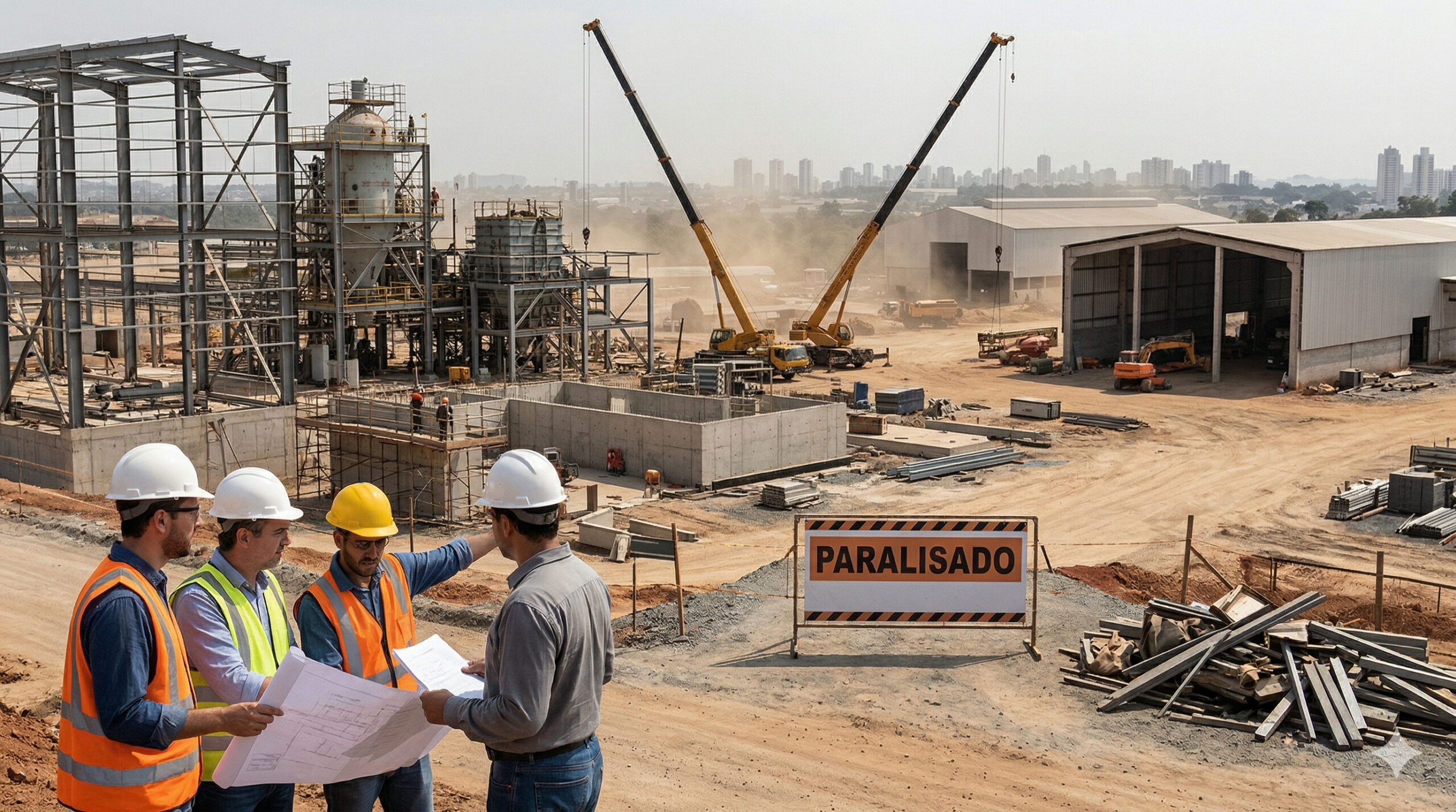
The lack of welders, electricians, and operators becomes a structural threat in 2025, with the construction industry and manufacturing already suffering from delays, cost pressures, and labor shortages in Brazil.
-
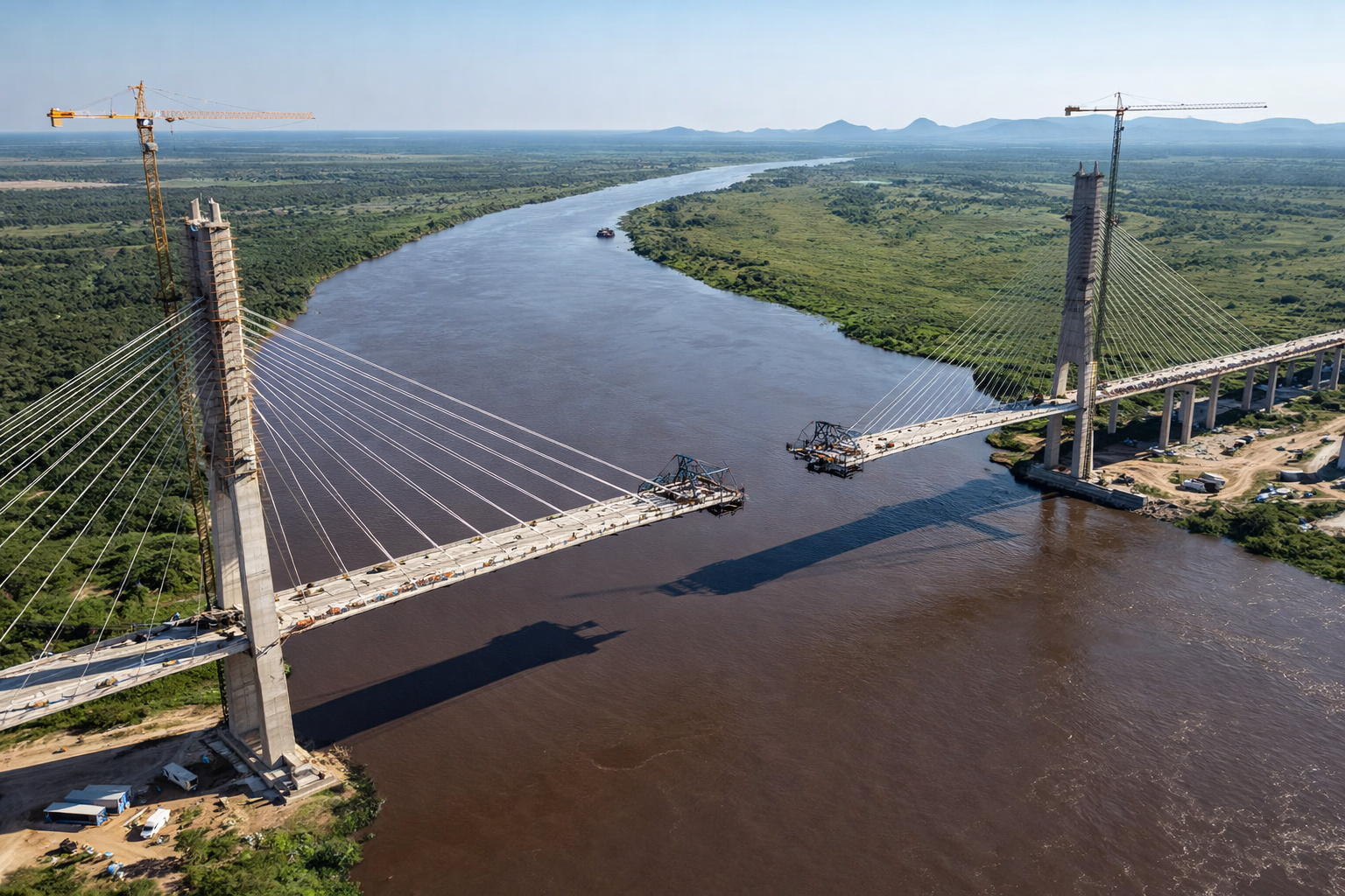
Brazil and Paraguay are just 46 meters away from a historic union on the bioceanic bridge that promises to revolutionize trade between the Atlantic and the Pacific.
-
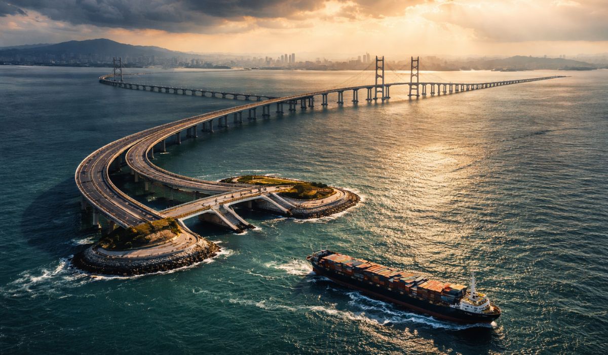
With 55 km over the sea, a cost of US$ 20 billion, and enough steel to build 60 Eiffel Towers, China’s largest project has connected Hong Kong, Zhuhai, and Macau in a colossal bridge that defies the logic of engineering.
-
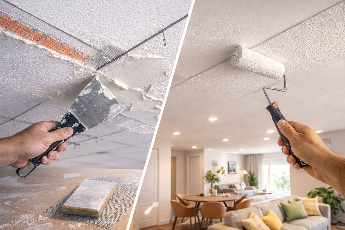
A trick with joint compound transforms a Styrofoam ceiling into a plaster-like ceiling: leveled panels, wires and mesh at the joints, sand, paint, and change the environment while spending little today.
From a Precarious Anchorage to the Largest Port in Brazil
The Port of Santos was born in the early 16th century when Santos and São Vicente began to serve as shipping points with rudimentary structures, exposed to the open sea.
With the founding of the village, Brás Cubas identifies a more protected estuary inside the Enguaguaçu lagoon, and the first section of the port consolidates at Valongo, with simple landing stages extending over the mangrove.
As the sugar economy grows in the interior of São Paulo, the Calçada do Lorena emerges at the end of the 18th century as the first paved road over the Serra do Mar, later also used for coffee.
Nevertheless, the journey remained slow and exhausting, with mule teams conquering slopes and tight curves to reach a port without a continuous wharf or standardized depth.
The potential of the Bay of Santos was already evident, but the engineering piece that would definitively integrate the productive interior with the coast was missing. This piece came with the railway. In 1859, Baron de Mauá and other entrepreneurs obtained authorization to construct the São Paulo Railway, linking Santos to Jundiaí.
In less than eight years, inclined planes, tunnels, and viaducts carved through the Serra do Mar, and in 1867, the new railway reduced the journey from the plateau to the port to about four hours.
From then on, coffee production began to flow in unmatched volume and speed, and Santos established itself as an obligatory port for the Brazilian export economy. However, a port worthy of the flow that was being consolidated was still lacking.
Docas Company and the Industrialization of the Estuary
In the 1870s, the crown began to study long-term port concessions to respond to the growth of coffee. In 1888, the government launched a competition for the exploration of the Port of Santos for 90 years, linking the grant to major infrastructure works, sanitation, and organized operation.
The winning group, led by Eduardo Guinle and Cândido Gafrée, created the Empresa de Melhoramentos do Porto de Santos, which in 1890 became the Companhia Docas de Santos.
The concession signed on November 7 of that year entrusted the company with the mission of transforming the anchorage of landing stages into a well-organized port, with defined limits, continuous wharf, storage areas, and a dredged channel to depth.
The visible leap occurred on February 2, 1892, with the completion of the first 260 meters of masonry wharf, supported by stakes driven into the mud of Valongo. On that day, the English steamer Nasmith docked at what is considered the first organized port section in Brazil, with a defined berth, fenders, bollards, and a storage back area.
What was a disordered waterfront began to follow a linear layout where ships, rails, and warehouses align in the same industrial logic. Santos ceased to be just a shipping point and transformed into structured infrastructure designed for scale and productivity.
Reclamations, Own Power Plant, and the Engineering That Shaped the City
Between the late 19th century and the early decades of the 20th, the Docas Company carried out some of the most important engineering works in the history of the port. One of the main projects was the reclamation of the Paquetá and Outeirinhos area, originally a gulf on the right bank between the current warehouses 12 and 23.
To transform this irregular area into a linear wharf with ample backland, a special railway line was opened connecting the port to the Jabaquara quarries, from which blocks of rock are transported to compose riprap and containment structures in the estuary.
The result is a longer and more stable platform, capable of receiving larger vessels and accumulating warehouses, tracks, and internal roads in a continuous design.
At the ends of this landfill, administrative buildings emerge that still mark the headquarters of port administration today.
In parallel, the group obtained authorization in 1901 to build the Itatinga hydroelectric plant, about 30 km from the port, in the Serra do Mar. Inaugurated in 1910, the plant began to supply electricity for cranes, wharf lighting, workshops, and, over time, also for Santos and Guarujá.
A support village was built to house around 70 families of employees, with its own infrastructure in the middle of the forest.
More than a century later, the historic machines and turbines of Itatinga still contribute to the energy used in port operations, highlighting how the engineering conceived in the past continues to support the present.
From the “Port of Death” to the Sanitation That Saved the City
While the port gained wharves, warehouses, and energy, Santos experienced a harsh reality in its surroundings. In the early 20th century, the municipality became one of the main entry points for immigrants, especially Italians and Japanese. But the urban infrastructure did not keep up with the flow.
The lack of sanitation, flood-prone areas, and precarious housing near the port zone turned the city into a stage for recurring epidemics of tropical diseases, earning Santos the nickname “Port of Death.”
This scenario began to change with the sanitary works led by Saturnino de Brito at the end of the 19th century, with drainage canal networks, sewage, and urban ventilation systems. The same engineering that dug canals and supported stakes in the estuary began to redesign public health and the city’s landscape, creating the foundation for the growth that would come in the following decades.
CODESP, Landlord Model, and the Explosion of Containers
The concession of the Docas Company ended on November 7, 1980. The administration of the port and all its assets returned to the federal government, which began to operate the complex through CODESP.
The state company took over an already extensive port, with thousands of employees and a significant legacy of civil works, wharves, warehouses, and systems of energy and transport.
In the early years, CODESP operated under a monopoly model, managing infrastructure and direct cargo operations. The turning point occurred in 1993, with new legislation that broke the operational monopoly and inaugurated the “landlord” port model.
The port authority began to care for common infrastructure, planning, and supervision, while private terminals took over the cargo operations under lease.
The primary and secondary areas began to define the perimeter of the organized port, operational labor was transferred to OGMO, and CODESP shrank to around 1,500 employees, concentrated in infrastructure engineering, regulation, and port security.
The complex started to receive specialized operators, new investments in terminals, and management more oriented to productivity.
Between 2010 and 2020, the Port of Santos consolidates this transformation on a regional scale. The complex began to be understood as a logistical point that includes not only wharves and warehouses on the banks of Santos, Guarujá, and Cubatão but also a network of retroport terminals and inland locations spread across the state of São Paulo.
Railway participation grew in total movement, with internal yards connected to corridors leading to the Midwest, reducing the exclusive dependence on highways.
In containerized cargo, the port surpassed the mark of 4 million TEUs per year, with constant growth, positioning Santos among the main container terminals in the southern hemisphere and paving the way to be one of the largest port hubs in the world in long-distance connections.
Deep Dredging, STS10, and Immersed Tunnel: The New Leap in Scale
Today, Brazil’s largest port is once again being cut from the inside. Along the access channel, a dredging project is advancing that aims to raise the operational draft to around 16 meters, allowing larger vessels to enter and exit with greater safety and fewer tidal restrictions.
This deepening requires high-capacity dredges operating in sensitive estuarine areas, rigorous management of the material removed, and, in parallel, a package of structural reinforcement for older wharf sections, which are being relaid, anchored, and prepared to withstand heavier cranes, new mooring methods, and much more intense operating cycles.
On the land side, the board is also changing. In the Saboó region, the STS10 project emerges as a mega container terminal designed from the beginning to operate with a strong railway component, high-density yards, and internal flows designed to reduce maneuvers and crossings.
On the other side, expansion plans for the backland, especially in Guarujá, seek to connect the port to a network of logistics centers served by highways and rail, extending the port logic beyond the waterline and creating a continuous corridor between terminals, warehouses, and the interior of the country.
Connecting both banks, the most emblematic work of this phase emerges: the immersed tunnel Santos–Guarujá, about 1.5 km long, with approximately 870 m in elements immersed at the bottom of the estuary. The tunnel combines lanes for vehicles, a reserved corridor for a future VLT, and passages for pedestrians and cyclists.
When in operation, it should alleviate dependence on ferries, shorten daily displacements, and reorganize truck circulation, better distributing access to the terminals on both banks and increasing the fluidity of a complex that aspires to be one of the largest port hubs in the world in movement and connectivity.
Physical Port, Digital Port: Sensors, Data, and Climate Risk
Alongside concrete and steel, the port is being redesigned in code and sensors. Digital systems for truck scheduling, near-real-time monitoring of ship positions, and integrated yard management seek to reduce wait times and queues.
At the same time, climate risk studies guide drainage interventions, slope containment, and elevation of areas vulnerable to higher tides and extreme events.
The expansion agenda begins to walk alongside the resilience agenda, an indispensable condition for any port that wants to compete for global cargoes in the coming decades.
By adding dredging, new terminals, an immersed tunnel, and digitalization, Santos increases its capacity in tons and TEUs, climbs steps in the international ranking, and gets closer to the league of major hubs that define the flow of world trade.
And Now, What Is the Next Step for Santos?
Looking at the trajectory that goes from landing stages in the mangrove to the annual movement of almost 180 million tons, it is clear that Santos has reinvented itself multiple times to keep pace with the Brazilian economy.
The new round of works and technology is not just another expansion but an explicit attempt to reposition the port as one of the largest port hubs in the world, connected by rail, highways, tunnel, retroport terminals, and high-performance digital systems.
The question is whether the country, the private sector, and the port itself will be able to synchronize investments, governance, and long-term planning to turn this potential into concrete reality.
And you, in your view, what still needs to be done for the Port of Santos to truly establish itself as one of the largest port hubs in the world: more rail, more governance, more technology, or another type of work that hasn’t yet been included?


-

-

-

5 pessoas reagiram a isso.