 Portuguese
  English
  Spanish
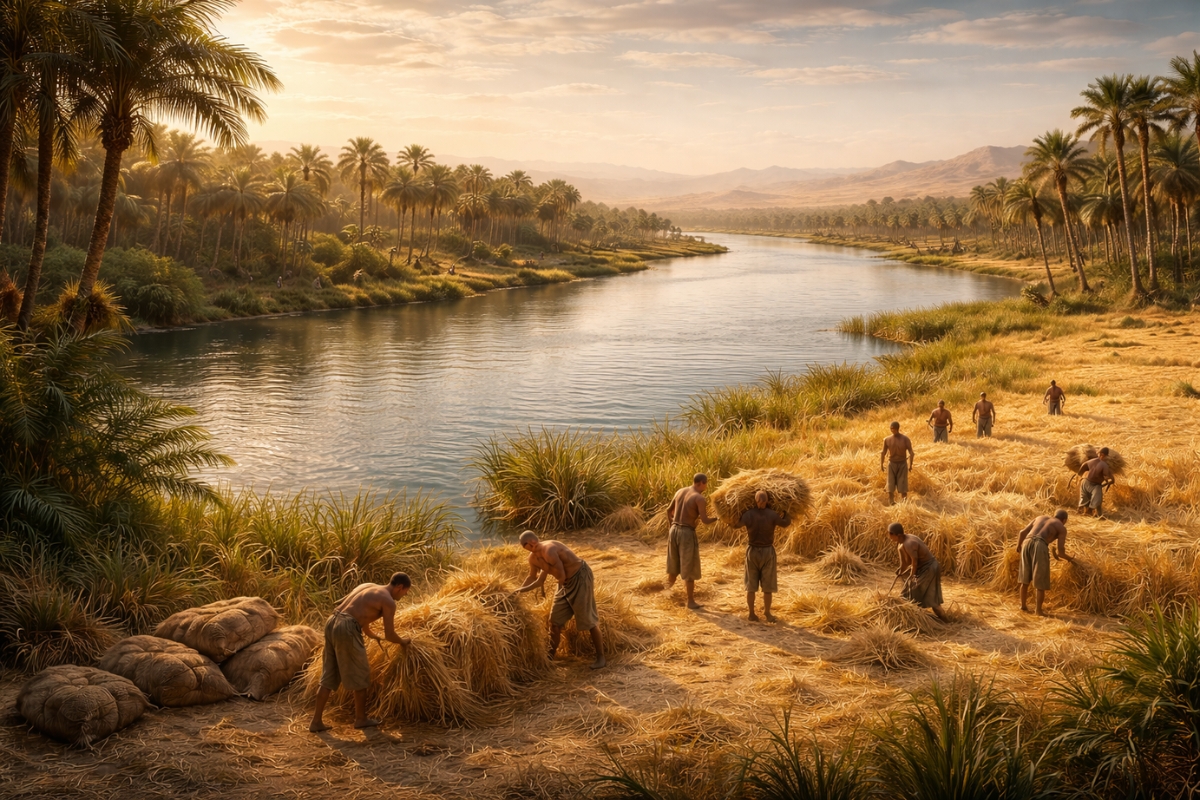
Change in the Nile’s Behavior Over 4,000 Years Expanded Fertile Areas, Stabilized the Environment, and Favored the Expansion of Political and Religious Centers
The history of ancient Egypt has always been closely tied to the Nile River. The rhythm of the floods defined harvests, settlements, and the very organization of life around the valley.
What draws attention is that the Nile, often seen as stable, underwent a profound transformation 4,000 years ago, changing the landscape and the dynamics of the banks in the Luxor region.
With the new configuration, the cultivable area increased, the terrain became more predictable, and human settlement gained better conditions to consolidate strongly.
-
The heatwave in Brazil that hit in March is set to end as a cold front arrives between Good Friday and Easter Sunday, causing a temperature drop of up to 6 degrees and rain in the Central-South region, according to the Easter weather forecast.

-
The U.S. Army has introduced its first new lethal grenade since the Vietnam War: the M111 kills using pressure shock waves that bounce off walls and can explode the enemy’s lungs without producing a single shard.

-
Engineers are replacing pressure valves with hydraulic microturbines within drinking water networks and are generating up to 1,100 MWh per year with in-pipe hydropower technology that harnesses energy previously wasted in urban pipelines.

-
Elon Musk focused on Brazil and lowered the price of Starlink, his internet service, but the question remains: is it worth it? An expert provides a detailed analysis of the internet that promises to connect any part of Brazil.


What Happened and Why It Drew Attention
A reconstruction of the valley’s past was made from over 80 sediment cores collected along the Nile Valley, including areas near the temples of Karnak and Luxor.
The signs underground point to a geological turning point that altered the behavior of the river, with a direct impact on the shape of the plain and the space available for agriculture.
This change did not only affect the course and the banks. It also redefined opportunities for settlement and construction in strategic locations in Upper Egypt.
How the Nile Was Before This Turning Point

For thousands of years, from the end of the Pleistocene to the Bronze Age, the Nile behaved like a deeper and more aggressive river, with narrow channels and several branches.
The floodplain was smaller and the environment, more unstable. The floods were powerful, eroding banks and making it difficult for permanent populations to settle very close to the water.
This scenario made life more unpredictable, with higher risks for those who depended on farming and fixed infrastructure along the river.
What Changed When the Nile Started Accumulating Sediments
About 4,000 years ago, the river ceased to deepen its bed and began to accumulate sediments in large volumes. The result was a rapid expansion of the floodplain in Luxor.
With more regular deposition of fertile silt, the cultivable surface increased, and the surroundings became more stable over time.
The banks of the Nile turned into a continuous strip of cultivation, creating better conditions for farming and permanent settlement in areas closer to the main course.
The Direct Impact on Agriculture, Cities, and Large Works
The stability brought space to build temples, housing, and tombs in strategic locations, closer to the river and with a lower risk of destructive floods.
This more predictable environment helps explain why religious and political centers gained strength in this region, notably Karnak on the east bank and the funerary complexes and necropolises on the west bank.
This phase also coincides with a period of prosperity and expansion for Egypt, from the end of the Middle Kingdom to the beginning of the New Kingdom.

The Connection with Climate and Desertification in North Africa
The turning point of the Nile is connected to what was happening in areas that feed the river. During the African Humid Period, the Sahara was greener, with lakes and vegetation.
This period gradually ended, and between 6,000 and 4,000 years ago, desertification advanced rapidly.
With less rain in the upper basin, the flow decreased. At the same time, the drier soil began to erode easily, increasing the arrival of fine sediments to the Nile.
A River with Many Channels, Very Different from What Exists Today
The surprise is that for over 7,000 years the Nile did not function as a single winding course. It formed a network of intertwined channels, which changed position, abandoned arms, and created river terraces.
This model made sedentary life and extensive agriculture difficult under the conditions that became marked in Egyptian history.
When the river reorganized and the plain expanded, the valley achieved the fertile and stable profile that transformed the region into a hub of production and power.
The change of the Nile River 4,000 years ago helped to expand fertile areas and reduce instability along the banks, especially in the Luxor region.
With more stability and sediment deposition, human occupation gained a basis to grow, and large religious and administrative centers could establish themselves more securely and continuously.


-

-

4 pessoas reagiram a isso.