 Portuguese
  English
  Spanish
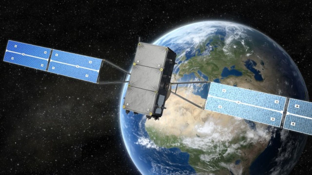
A New Era of Satellite Positioning Promises Unprecedented Accuracy, Paving the Way for Autonomous Cars and Revolutionizing Sectors of the Brazilian Economy.
Apps like Waze and Google Maps have become indispensable. However, the accuracy of meters they offer, based on standard GPS, is about to be surpassed. A new generation of satellite positioning technologies is arriving, promising centimeter-level accuracy. This evolution is what was needed to make autonomous driving a safe reality in Brazilian cities and transform key sectors of our economy.
Why Is Your Cell Phone GPS No Longer Sufficient?
The GPS that we use every day in apps like Waze and Google Maps has an accuracy that varies from 5 to 10 meters. For a human driver, who interprets the environment, this margin of error is acceptable. However, for new technologies, it is a major limitation.
In Brazilian cities, with tall buildings, tunnels, and dense infrastructure, the GPS signal suffers. The urban canyon effect occurs, where signals ricochet off structures, causing errors and making the location even less accurate.
-
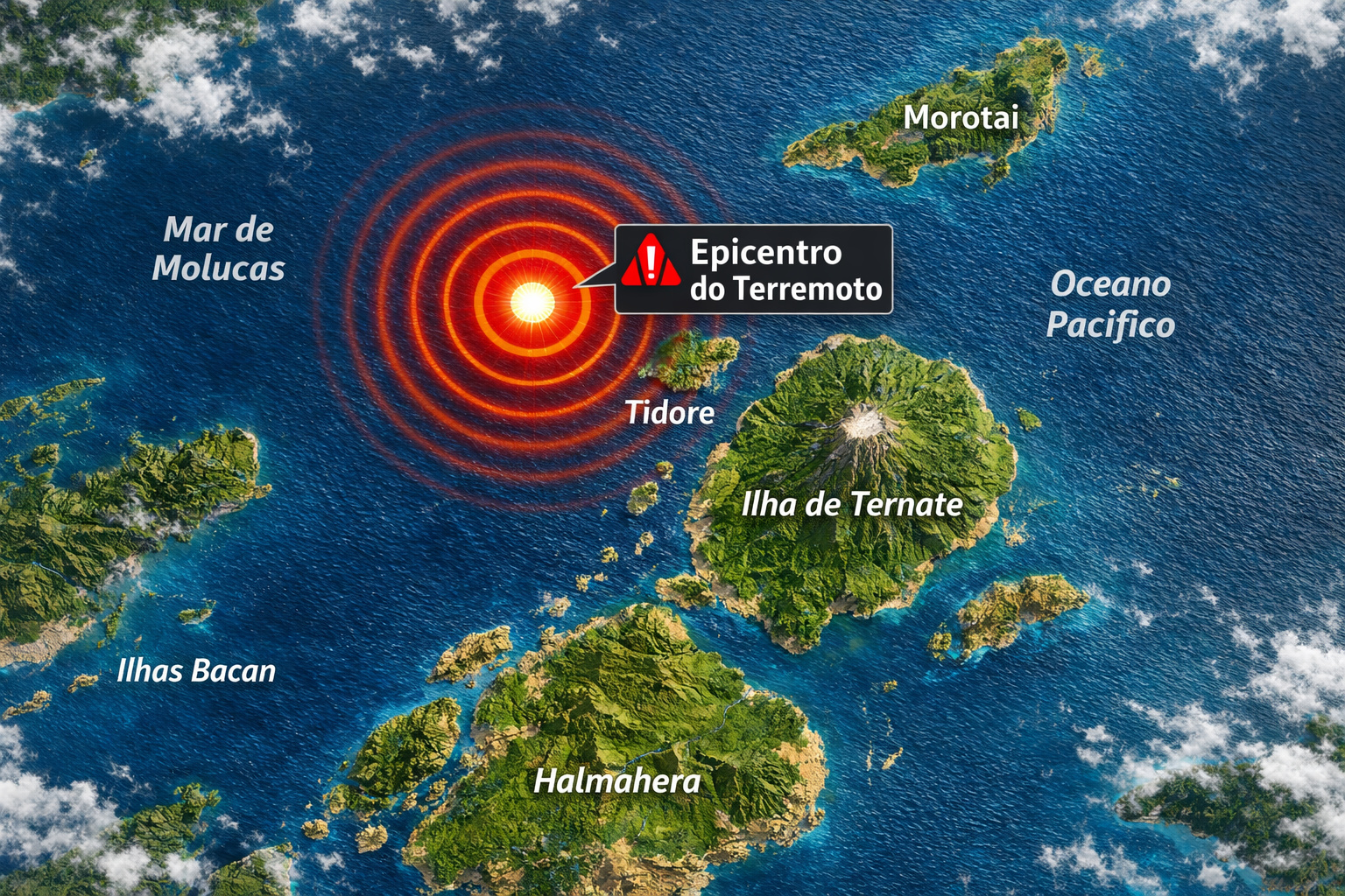
A strong earthquake in Indonesia affects houses and schools, causes panic, triggers a tsunami alert, and records a rise in sea level of up to 30 centimeters in some areas.

-
The Argentine government celebrates the lowest poverty rate in 7 years, but experts warn that the methodology has changed, real wages have fallen, unemployment has risen, and the number of people on the streets of Buenos Aires has increased by 57% since Milei took office.

-
7.8 magnitude earthquake in Indonesia frightens the population, triggers tsunami alert, and hits an island with over 200,000 inhabitants this Thursday.
-
Google will finally let you change that embarrassing Gmail address you created in your teenage years without losing any accounts, logins, or old emails: the feature is already available in the United States.


For an autonomous car, which needs to know its exact position in the lane, a meter error is unacceptable. The demand for centimeter-level accuracy is not a luxury, but a necessity for applications such as autonomous driving, precision agriculture, and infrastructure monitoring.
The Technology Behind Precision: Meet GNSS, PPP, and RTK
High precision comes not just from a new network of satellites, but from a complex technological ecosystem. The correct term is GNSS (Global Navigation Satellite Systems), which includes multiple constellations such as GPS (USA), GLONASS (Russia), Galileo (Europe), and BeiDou (China).
Using multiple systems increases the number of visible satellites, improving accuracy and reliability, especially in cities.
To achieve centimeter accuracy, advanced techniques are utilized:
- Precise Point Positioning (PPP): Uses a single receiver to achieve high precision but requires external corrections for orbit and satellite clock errors. It can take a few minutes to “converge” and reach maximum accuracy.
- Real-Time Kinematic (RTK): Considered the gold standard for real-time accuracy. It uses a base station with known coordinates to send corrections to a mobile receiver. Achieves centimeter accuracy in seconds, as demonstrated in an autonomous vehicle project in Brazil that achieved 1 cm accuracy.
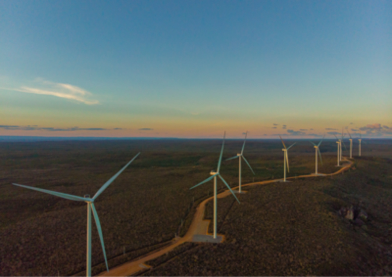
Ground infrastructure is crucial. In Brazil, the Brazilian Continuous Monitoring Network (RBMC), maintained by IBGE, has 150 stations. They provide essential data to enable these high-precision technologies throughout the national territory.
Galileo HAS: The Revolution of High-Precision GPS, Free and for Everyone
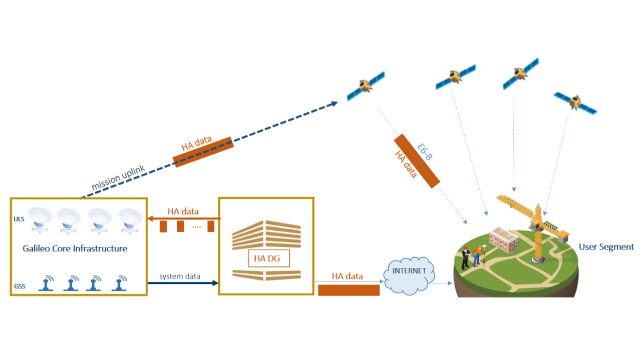
One of the biggest recent advancements is the Galileo High Accuracy Service (HAS). Officially launched in January 2023 by the European Union, it is a global and free service that provides corrections for high-precision positioning. The goal of HAS is to deliver 20 centimeters accuracy horizontally and 40 centimeters vertically.
HAS works by transmitting corrections to the errors of the Galileo and GPS satellite constellations. These corrections are sent in two ways: directly via the E6 satellite signal and also over the internet. The fact that it is a free service democratizes access to technology, which previously relied on paid subscriptions or expensive infrastructure.
For Brazil, this is especially relevant. A study from UNESP in Presidente Prudente (SP) evaluated the performance of HAS under intense ionospheric disturbances. The results showed that the service has “significant resilience”, making it a viable and robust tool for the country.
The Future Depends on Centimeter-Accurate GPS
Autonomous vehicles, especially those at Level 4 and 5 (high and full automation), critically depend on knowing their exact location. They need to position themselves within the lane, close to obstacles and other vehicles with absolute confidence. Centimeter accuracy is a non-negotiable safety requirement.
In the “urban canyons” of Brazilian cities, high-precision GPS is the anchor for all other car sensors, such as cameras and LiDAR. When the GNSS signal is good, it serves as the “source of truth” for calibrating other systems.
This sensor fusion is what will enable safe and reliable navigation in complex environments. For autonomous driving to become a reality, investment in infrastructure will be necessary, such as expanding RTK networks and guaranteed access to services like Galileo HAS.
How Agriculture and Construction Will Be Transformed
The revolution of precision GPS goes far beyond autonomous cars. Other vital sectors for Brazil are already feeling the impact:
Precision Agriculture: Equipment like the StarFire 7000 receiver already offers 2.5 cm accuracy. This allows for precise planting, application of fertilizers and pesticides without waste, and optimization of harvests. For an agricultural powerhouse like Brazil, this means more productivity with lower costs and environmental impact.
Construction and Infrastructure: The technology enables monitoring of deformations in bridges and dams with millimeter precision. On construction sites, it guides heavy machinery to execute projects with accuracy, reducing errors, rework, and costs.
Environmental Sciences: Accurate monitoring of the coastline, as done in a study in Pernambuco, is vital for managing erosion and enforcing environmental laws in a country with such an extensive coastline.


-

-

-

6 pessoas reagiram a isso.