 Portuguese
  English
  Spanish
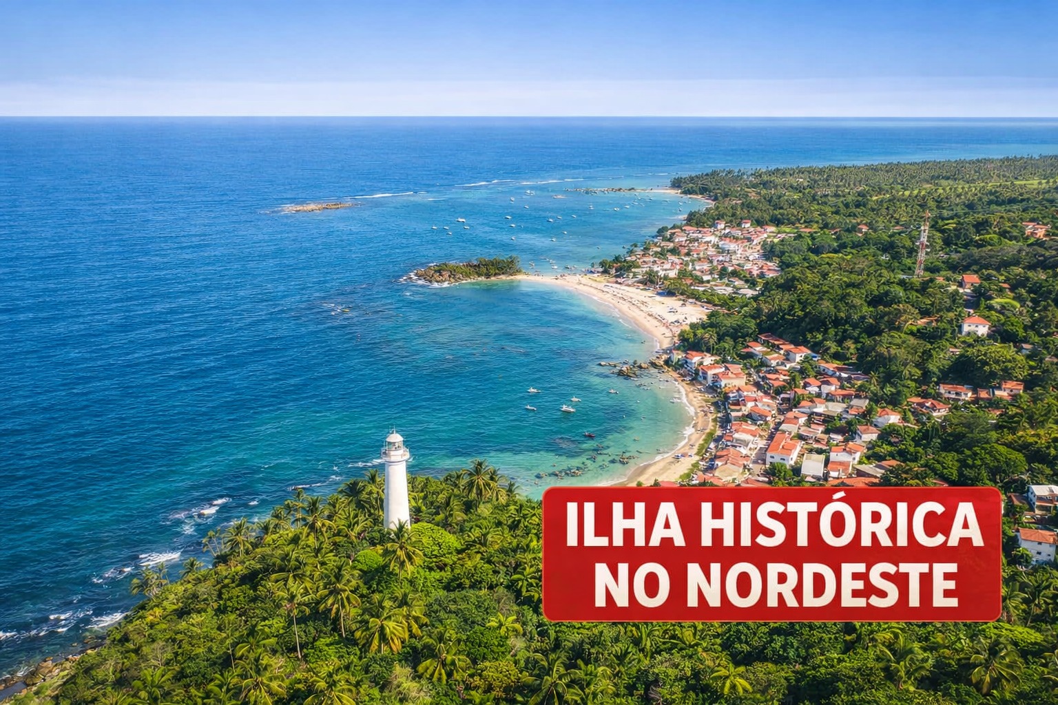


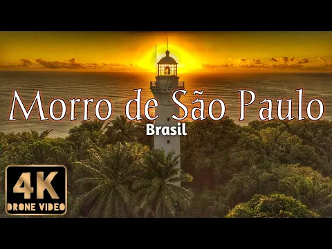
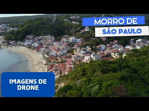
Morro de São Paulo: Car-Free Island in Bahia Features Five Numbered Beaches, 17th Century Fortress, 2h30 Crossing, and Tours to Natural Pools and Nearby Islands
The tourist destination Morro de São Paulo features five numbered beaches, colonial ruins, and car-free transportation on Tinharé Island, in Cairu. The village welcomes visitors arriving by catamaran or speedboat.
Upon arriving in the village, visitors disembark on stone streets where tourist cars do not circulate. Luggage usually follows in handcarts, and transportation happens on foot or through trails between beaches and historical sites.
The village is located on Tinharé Island, which belongs to the municipality of Cairu. The main beaches are numbered from 1 to 5 and are located on the east side of the island, with calm waters year-round.
-
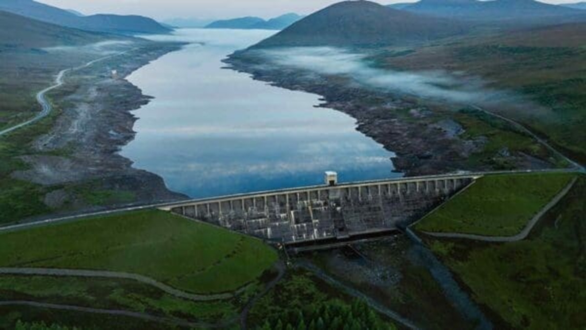
A gigantic dam project in the Himalayas could solve one crisis but silently create another for millions of people.
-
Nikola Tesla said that intelligent people tend to have fewer friends, and now science partially confirms this: a study with over 15,000 people showed that for the more intelligent, socializing too much can even reduce life satisfaction.

-
A superyacht worth US$ 17 million is delivered in impeccable condition, sets out to sail, and hits a bridge in the Bahamas just two hours later.

-
Residents of Australia woke up to a sky completely red like blood before the arrival of Cyclone Narelle, which hit the coast with winds of 250 km/h, tearing off roofs and lifting iron dust in a scene they described as apocalyptic.


The tranquil waters make the sea resemble a swimming pool almost any time of year. The scenery combines beaches, coastal vegetation, and historical remains preserved since the colonial period.
Colonial History of Morro de São Paulo
The history of the island dates back to the beginning of Portuguese colonization. In 1531, Martim Afonso de Sousa landed at the site and named the island Tinharé, a term of Tupi origin meaning “that which advances over the sea.”
The strategic position at the entrance of the Bay of All Saints attracted Dutch corsairs, French pirates, and pirates between the 16th and 17th centuries. The location began to be used as a point of access and defense for the region.
To contain invasions, the Governor-General Diogo Luiz de Oliveira ordered the construction of the Forte de Tapirandu in 1630. The complex preserves 678 meters of curtain walls and was listed by IPHAN in 1938.
In 1746, the island received the Fonte Grande, considered the largest water supply system in colonial Bahia. The historical set remains one of the old landmarks of the village.
The Five Beaches of Morro de São Paulo
The main beaches are aligned on the east side of the island. Primeira Praia is the closest to the center and has about 300 meters of sandy beach.
It is also the arrival point for the zip line that descends from the lighthouse. Segunda Praia has stalls, restaurants, and nighttime events, gathering the largest crowd of visitors.
Terceira Praia is quieter and has beachfront hostels. It also serves as a departure point for speedboat tours exploring other areas of the archipelago.
Quarta Praia features a long stretch of sand with almost deserted sections. At low tide, natural pools appear between coral reefs.
Quinta Praia, known as Praia do Encanto, is the most secluded. This location features palm trees, a few hostels, and a more tranquil atmosphere.
Tours and Activities in Morro de São Paulo
The most sought-after tour is the Island Tour, conducted in speedboats departing from Terceira Praia. The trip lasts an entire day.
During the journey, visitors stop at the natural pools of Garapuá and Moreré. The itinerary also includes a passage by Boipeba Island.
Another popular activity is the zip line installed high up on the hill. The course connects the lighthouse to Primeira Praia.
It extends 340 meters and is about 50 meters high, landing directly in the sea. The attraction allows visitors to descend the hill in a straight line to the water.
For those who prefer to walk, there is a coastal trail connecting the village to Gamboa. The path passes by a clay wall where visitors often take mud baths.
The return usually takes place by boat, as the tide rises and covers sections of the trail. The tour follows the rhythm of the natural conditions of the coast.
Cuisine and Climate of the Island
The local cuisine features traditional Bahian dishes made with seafood. Restaurants and stalls are concentrated mainly in the town center and along Segunda Praia.
Among the options are Bahian moqueca made with fish, shrimp, or lobster, as well as shrimp bobó made with cassava cream.
Also served are acarajé stuffed with vatapá, caruru, and dried shrimp, along with grilled lambretas with lemon and butter.
At the beach stalls, caipirinhas made with fruits such as cajá, soursop, cacao, and passion fruit are common among visitors.
The climate maintains temperatures above 25 °C year-round. The driest season occurs between September and March, when the sea becomes clearer.
Between April and August, rains appear more frequently but tend to be quick and do not hinder tours.
How to Get There
The most common way to access is by catamaran departing from the Nautical Tourist Terminal of Bahia, behind the Mercado Modelo in Salvador.
The crossing takes about 2h30 to reach the village pier. Another option is the semi-terrestrial route.
On this route, vans travel to Valença in about 4 hours by road. Afterward, a speedboat makes the final crossing of 15 minutes.
There are also flights to Valença Regional Airport. From there, the final access occurs by boat.
Within the island, longer distances can be covered by tractor, quad bike, or boat taxi. Still, most distances in Morro de São Paulo continue to be traveled on foot.
With information from Correio Braziliense.


Não va a Morro de São Paulo porque está repleto de vândalos que deram baixa do exército israelense e escolheram este paraíso para liberar os demônios que trouxeram e lavar as mãos sanguinárias em suas praias