 Portuguese
  English
  Spanish
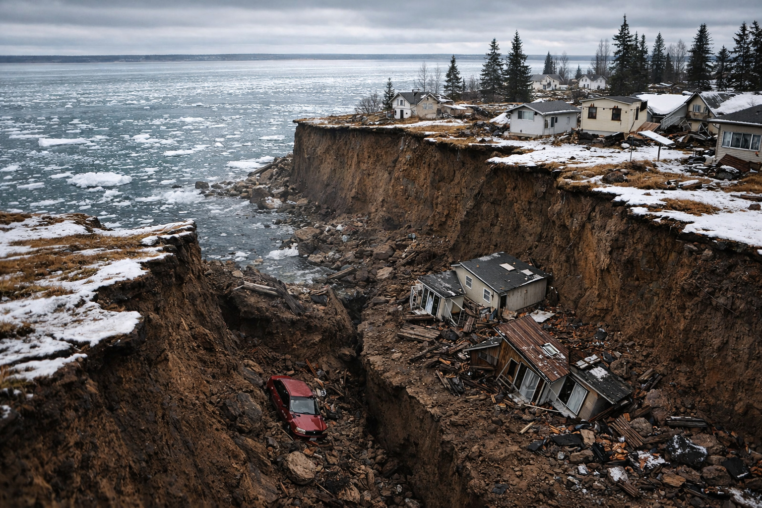
Earthquake of magnitude 9.2 in Alaska in 1964 changed the coastline in minutes, raised the seabed, and left one of the largest geological transformations ever recorded.
In March 1964, one of the most extreme geological events in modern history struck southern Alaska, in the United States. According to data from the U.S. Geological Survey, the earthquake reached a magnitude of 9.2, making it the strongest ever recorded in North America and the second largest in the world since instrumental measurements began. The event, known as the Alaska Earthquake of 1964, lasted about 4 minutes, enough time to provoke an immediate and permanent physical transformation in the geography of the region. The most impressive fact is that entire parts of the coastline were raised or sunk in a matter of minutes, abruptly and visibly altering the coastline.
Tectonic movement raised the seabed and sank urban areas
The earthquake was caused by the subduction of the Pacific Plate beneath the North American Plate, a typical process in active tectonic zones. During the event, large blocks of the Earth’s crust moved vertically, resulting in two simultaneous phenomena:
- Some coastal areas were raised by up to 10 meters
- Other regions sank several meters below sea level

This instantaneous vertical movement completely reshaped the coastline, creating new exposed areas and submerging previously dry land. Cities like Anchorage suffered severe damage, with structural collapses caused by both the tremor and soil displacement.
-
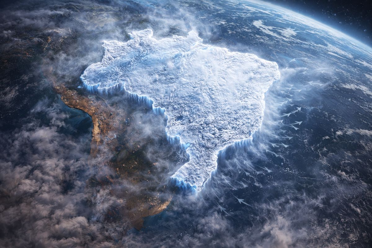
The entire Brazil is expected to face above-average rainfall in the next ten days, with accumulations reminiscent of the peak of summer, raising concerns especially for those living in the Southeast, Northeast, and Northern regions of the country.

-
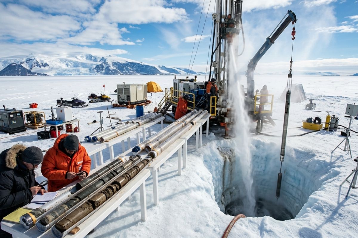
With pressurized hot water, scientists melt 523 meters of ice in West Antarctica and extract a 228-meter rock core with a record of 23 million years, revealing ice-free periods and global warnings.
-
Denmark resumes the idea of building the world’s first energy island with $30 billion, connecting several countries and changing the European energy game amid uncertainty due to the war in Iran.

-
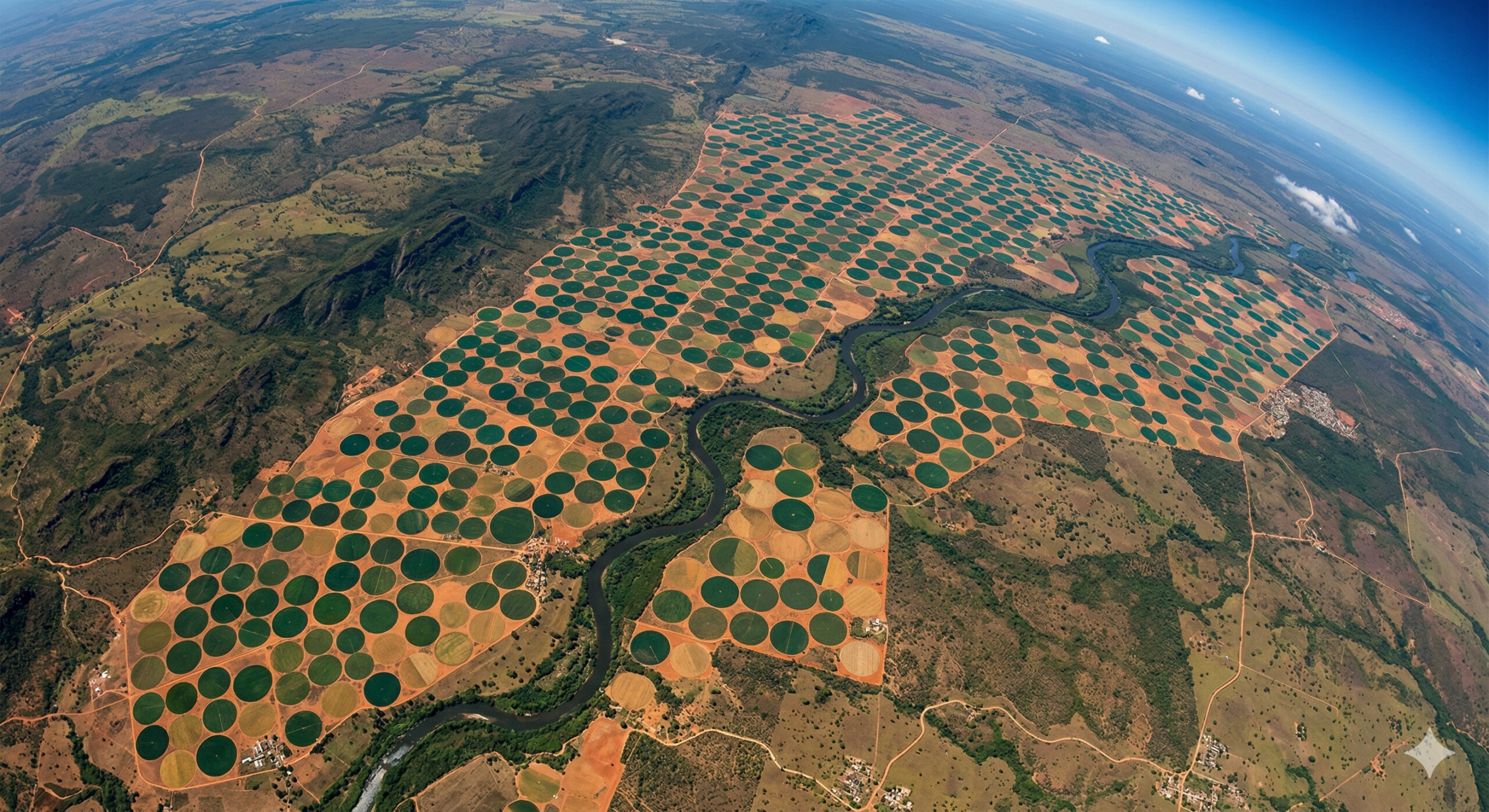
In the interior of Bahia, gigantic “perfect” circles drawn on the land appear from space as targets kilometers in diameter, revealing irrigation systems so precise that they transform crops into geometric patterns visible from orbit.

Bands of marine organisms were exposed above sea level
One of the most visible and lasting effects occurred in the areas that were raised. Regions that were previously submerged became permanently above the waterline, exposing marine organisms that were not adapted to the terrestrial environment.
These organisms died quickly, leaving clear marks on the rocks, forming a kind of “white line” visible along the coast. Decades later, these bands can still be identified, serving as direct evidence of the tectonic displacement that occurred in just a few minutes.
Tsunamis amplified the destruction and reached distant areas
In addition to the ground movement, the earthquake generated a series of tsunamis that worsened the damage. Giant waves struck various coastal regions of Alaska and even more distant areas, such as the west coast of the United States. The tsunamis were responsible for a significant part of the destruction, especially in areas close to the coast, where the energy of the waves was most intense.

The 1964 earthquake is often cited as an extreme example of how geological processes, which are usually slow, can occur abruptly. Movements that would normally take thousands or millions of years happened in a matter of minutes. This capacity for rapid transformation shows that the Earth’s surface is dynamic and can change drastically in very short intervals, especially in tectonically active regions.
USGS documented permanent changes in the geography of the region
After the event, the USGS conducted detailed studies to map the changes caused by the earthquake. The surveys confirmed that the changes were not temporary, but permanent. The new configuration of the coastline became part of the official geography of the region, altering maps, ecosystems, and patterns of human occupation.

The earthquake also had significant scientific importance. The data collected helped consolidate the understanding of plate tectonics, especially regarding subduction zones. The event provided concrete evidence of how large displacements can occur along geological faults, contributing to the advancement of modern geology.
Comparison with other major earthquakes highlights the magnitude of the event
With a magnitude of 9.2, the Alaska earthquake ranks just behind the event that occurred in Chile in 1960, which reached a magnitude of 9.5. However, the geographical impact of the event in Alaska was particularly striking due to the combination of uplift, subsidence, and tsunamis. Few events in modern history have caused such visible changes in the landscape in such a short time.
The event that occurred in Alaska in 1964 remains one of the most impressive examples of the power of nature. With uplift of up to 10 meters, sinking of entire areas, and complete reshaping of the coastline, the earthquake demonstrated that the Earth’s surface can change radically in a matter of minutes.
More than just a natural disaster, the episode revealed the deep dynamics of the planet, showing that geological processes remain active and capable of altering the world on time scales that challenge human perception.


Seja o primeiro a reagir!