 Portuguese
  English
  Spanish
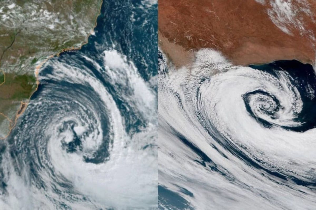
With The Arrival Of Autumn, Extratropical Cyclones Enter The Routine Of Santa Catarina, Follow Seasonal Pattern And Generally Stay Offshore, But The Rare Continentally Cases Elevate Risks.
In Santa Catarina, extratropical cyclones regain prominence with the arrival of autumn because they are part of the climatic pattern of Southern Brazil and have a well-defined seasonal behavior, with months when they are more active and organized.
Most cyclones form in association with cold fronts and remain in the ocean, having no significant effects on land. The greater alert appears when some of these systems approach the coast or advance onto the continent, potentially organizing episodes of severe weather.
When The Cyclones Become More Frequent In Santa Catarina
Extratrropical cyclones tend to become more active and organized starting in April, May, June, July, and August. After this period, the frequency decreases, with less occurrence in September, October, and November.
-
The most famous volcano in the world could paralyze one of the largest metropolises on the planet: Japan accelerates emergency plans for the eruption of Mount Fuji, which could bury Tokyo in ash for over two consecutive weeks.

-
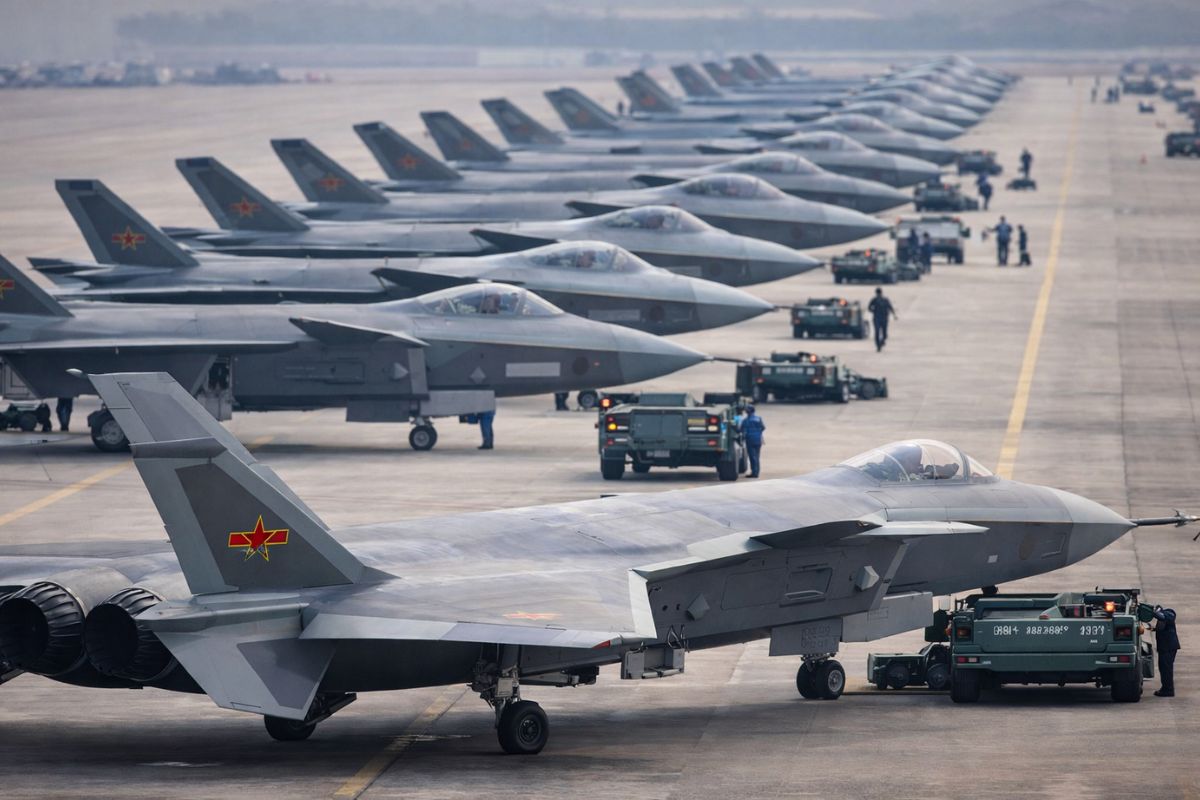
The United States has a serious problem with its F-35s: China is already producing fighters at a pace that exceeds American capacity and could manufacture up to 300 aircraft per year before the end of the decade, shifting the global military balance.
-
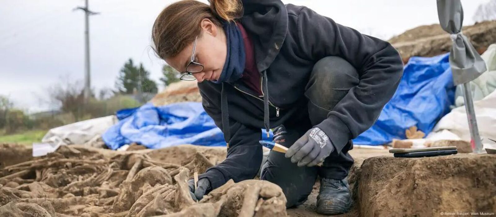
Remains with battle wounds of over 100 soldiers from the Roman Empire are found beneath a football field in Vienna, leaving everyone surprised.
-
Elon Musk notes Brazil and lowers the price of his internet, Starlink, promising to connect all corners of the country with affordable plans, 10,000 satellites, and 1 million active users in the national territory!

This “calendar” helps explain why the topic appears more in weather forecasts and in people’s conversations precisely from autumn, when the atmosphere favors better-structured systems in the Southern region.
Why Cyclones Form And Why They Almost Always Come With Cold Fronts
Extratrropical cyclones are directly linked to the advance of cold fronts. In practice, almost all cold fronts have an associated cyclone in about 98% of cases.
The most common pattern is the cyclone being positioned offshore, over the ocean.
Even when it does not bring impacts on land, it plays an important role in organizing atmospheric circulation and contributing to the rain cycle in the South of the country.
Why The Majority Of Cyclones Do Not Pose Risk On Land
Despite the name attracting attention, the rule is that cyclones do not cause significant impacts in continental areas.
Out of approximately 20 extratropical cyclones that form over the ocean, only two or three end up getting closer to the coast or continentalizing.
When they remain distant, the largest effects tend to be restricted to maritime navigation, with harsher conditions for vessels offshore, while the continent feels little or nothing at all.
When The Cyclone Becomes Dangerous And What “Continentalized” Means
The scenario that demands more attention is that of continentalized cyclones, when the system moves onto the continent. In this situation, the cyclone can organize severe storms, cause gales, and even favor the occurrence of tornadoes.
An example cited in Santa Catarina occurred on November 7, 2025, when a continentalized cyclone contributed to the formation of tornadoes, classified as mesoscale systems with destructive potential depending on the wind intensity.
Extreme Events Exist, But Are Outside The Pattern
Even with a relatively predictable seasonal calendar, some episodes fall into the category of extremes. Among the most intense events ever recorded is the bomb cyclone of June 2020, considered an outlier.
This event caused numerous disruptions in Santa Catarina, recorded fatalities in the state, and was also associated with the formation of a derecho, described as a line of instability linked to very strong and destructive winds.
The central point is that extremes attract attention, but do not represent the typical behavior of most cyclones that appear throughout the season.
What The Most Recent Forecast Indicates For Santa Catarina
In the most recent described scenario, there are no cyclones posing direct risk to Santa Catarina.
The cold front passing from Friday (16) to Saturday (17) has an associated cyclone; however, it is offshore, thousands of kilometers from the region.
There is also indication of another system for the end of the month, also distant from the coast.
The assessment is of a calm scenario, with no cyclones passing close to the state in the short term.
If a cyclone warning appears in autumn, do you prefer to track through apps and cell phone alerts or do you trust more in the daily forecasts of meteorologists?


-

-

-

-

-

-

59 pessoas reagiram a isso.