 English
  Francês
  Alemão
  Italiano
  Japonês
  Norueguês
  Portuguese
  Spanish
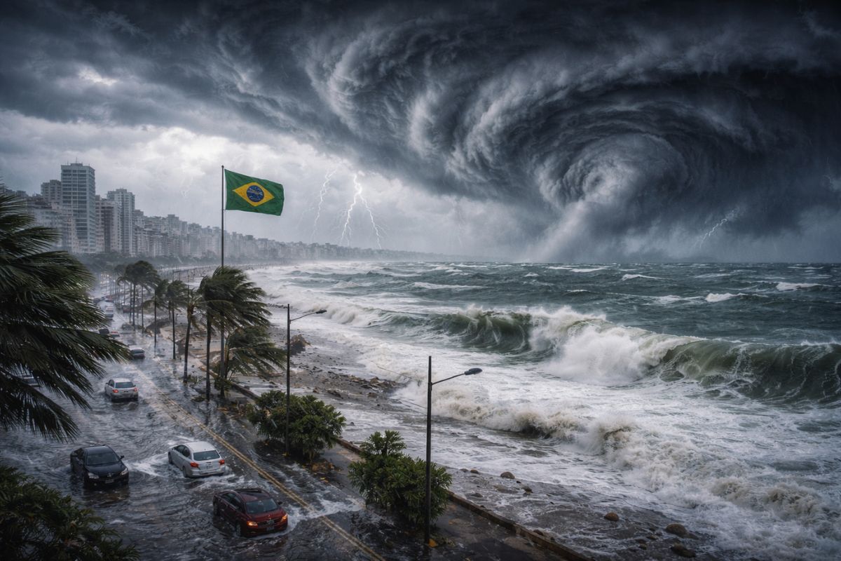
The formation of an extratropical cyclone near the coast of Rio Grande do Sul, combined with the passage of a cold front, keeps the rain and overcast weather in southern Brazil this Tuesday. In the rest of the country, intense heat and humidity sustain frequent showers and increase the risk of severe storms until the end of the week.
The combination of heat, high humidity, and the passage of a cold front accompanied by the formation of an extratropical cyclone near the coast of Rio Grande do Sul will keep the weather overcast in much of Brazil this Tuesday, March 24. In the South, rain is expected at various times throughout the day, especially in Rio Grande do Sul, with higher accumulations early in the morning. In Porto Alegre, temperatures will drop to milder levels, with a maximum around 23°C and rain interspersed throughout the day.
According to g1, while the extratropical cyclone and the cold front are acting over the South, in other regions of the country the scenario is one of intense heat combined with high humidity. This combination sustains frequent rain showers and increases the risk of severe storms in the North, Central-West, and parts of the Southeast. The sun may appear in some regions, but rain returns in the form of showers, often heavy, especially in the afternoon and evening.
What is the extratropical cyclone forming in southern Brazil
The extratropical cyclone is a system of low atmospheric pressure that arises in mid-latitudes, formed by the temperature contrast between warm and cold air masses.
-
Salaries of up to R$ 25,000, a shortage of professionals, and exploding demand in 2026 make the no-code automation specialist one of the most sought-after careers in Brazil, even without requiring a degree or programming knowledge.

-
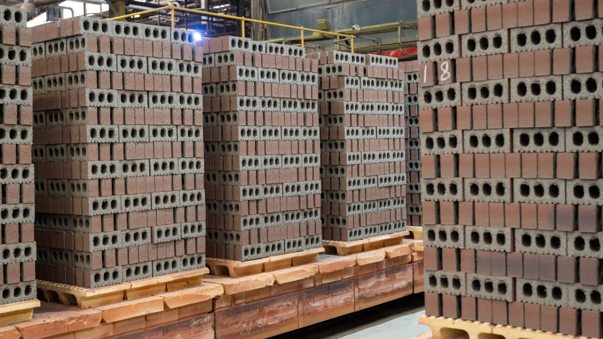
The first commercial-scale hydrogen-powered brick factory will be established.
-
Goodbye to the noisy exhaust fan: silent and smart technology transforms modern kitchens with more comfort, design, and efficiency in everyday life.

-
At just 14 years old, a boy creates a system without energy, using steel pipes buried in the ground, that irrigates seedlings with moisture from the air, to combat the water scarcity threatening reforestation in northern China.


Unlike tropical cyclones, which feed on the heat of the ocean, the extratropical cyclone is born precisely from the clash between these air masses. This type of system causes adverse weather on a large scale: strong winds, heavy rain, and rough seas are the most common effects.
In this week’s case, the extratropical cyclone is forming near the coast of Rio Grande do Sul and is acting in conjunction with a cold front moving through southern Brazil. The cold front is the advance of a cold air mass over a region where the air is warmer.
This encounter forces the warm air to rise, favors the formation of heavy clouds, and causes rain, wind, and a drop in temperature. Together, the extratropical cyclone and the cold front ensure unstable days for the people of Rio Grande do Sul.
Forecast for the South: persistent rain and falling temperatures
In southern Brazil, this Tuesday is expected to have rain at various times, especially in Rio Grande do Sul. The direct influence of the extratropical cyclone and the cold front concentrates the highest accumulations early in the day.
In Porto Alegre, the maximum temperature will be around 23°C, and rain will appear intermittently. In Curitiba, the day will mix sun and showers, with a maximum of 25°C, but instability will weaken on Wednesday when the weather clears up more.
Throughout the week, the trend in the South is for a gradual reduction in rain and a return of heat, especially from Friday. The early mornings of Tuesday and Wednesday may be cooler in southern Rio Grande do Sul, but there is no forecast for severe cold or frost.
The extratropical cyclone is expected to lose intensity as it moves away from the coast, allowing weather conditions to normalize in the second half of the week.
Southeast: heat above 30°C with showers starting Wednesday
In the Southeast, heat continues to prevail this Tuesday, with more stable weather in São Paulo and Rio de Janeiro, where temperatures are expected to be above 30°C.
However, this pattern does not last long: starting Wednesday, the combination of heat and humidity will again provoke showers, mainly in the afternoon and evening. The instability is not directly linked to the extratropical cyclone in the South, but rather to the accumulation of humidity and high temperatures that favor the formation of convective clouds.
In Belo Horizonte, rain is expected to be stronger starting this Tuesday, with higher volumes and milder temperatures around 25°C.
The Southeast is experiencing a typical pattern of late summer and early autumn, with hot afternoons followed by quick and intense showers. The recommendation is to pay extra attention for those living in areas with a history of flooding.
North and Central-West: intense heat, humidity, and risk of severe storms throughout the week
In the Central-West, rain remains frequent and, at times, intense. From early on, showers are forecasted in areas of Mato Grosso, Goiás, and Mato Grosso do Sul. The heat throughout the day reinforces the formation of heavy clouds.
In Brasília, Tuesday will have showers in the afternoon and evening, with a maximum of 25°C. In the coming days, the pattern is expected to repeat with higher volumes and a feeling of muggy weather. In Campo Grande, there is a risk of isolated severe storms, especially between Wednesday and Thursday.
In the North, the forecast is for large volumes of rain throughout the week, possibly the highest in the country. The combination of intense heat and high humidity keeps frequent showers almost daily, many of them strong, with a risk of severe storms.
States such as Amazonas, Pará, Acre, and Rondônia will concentrate the highest accumulations, with a constant feeling of mugginess. The influence of the Intertropical Convergence Zone also reinforces rain in Amapá and northern Pará. While the extratropical cyclone dominates the scenario in the South, in the North it is the humid heat that sustains the instability.
Northeast: rain concentrated in the north of the region and predominant sun in the east
In the Northeast, rain continues to be concentrated mainly in the north of the region due to the action of the Intertropical Convergence Zone. Maranhão, Piauí, and parts of Ceará continue to experience more frequent and, at times, heavy showers.
These areas receive humidity directly from the equatorial region, which maintains instability even on partially sunny days.
In the eastern Northeast, such as in Recife, the sun appears more frequently, and rain occurs sporadically, with temperatures around 30°C. This climatic division within the Northeast is typical of the period and remains throughout the week. For those in the eastern coastal areas, the week will continue with stable weather and heat.
For those in the interior and northern region, the recommendation is to be cautious with rain volumes. The extratropical cyclone in the South does not directly influence the Northeast, but the overall pattern of high humidity keeps the entire country on alert.
How is the weather in your city?


Seja o primeiro a reagir!