 Portuguese
  English
  Spanish
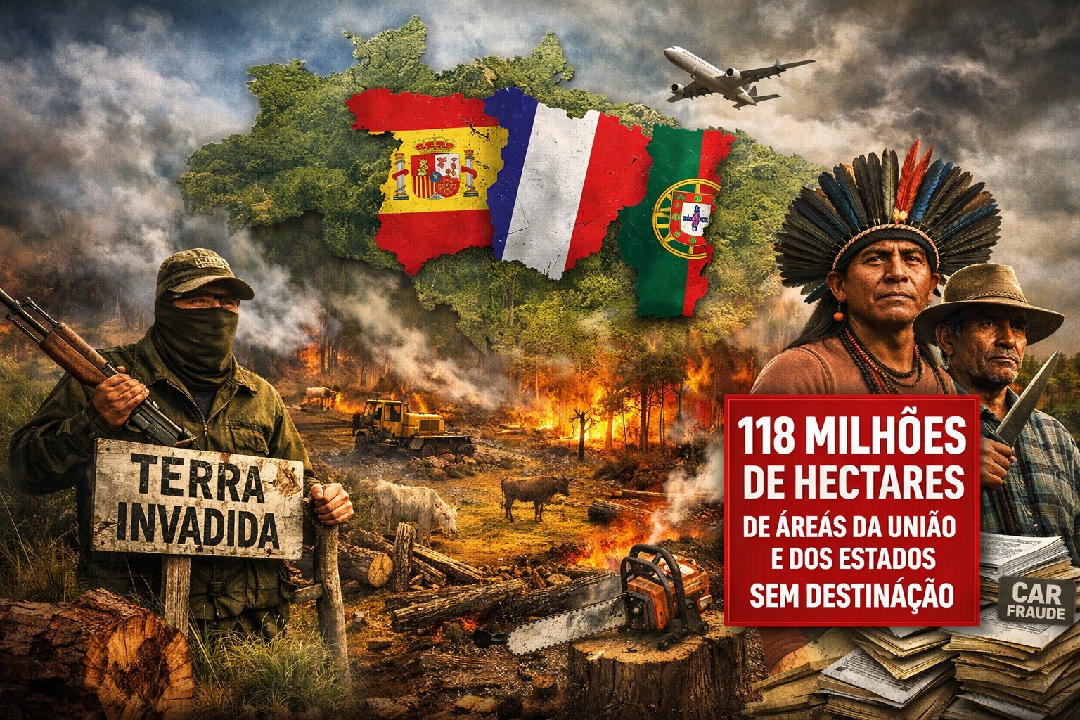


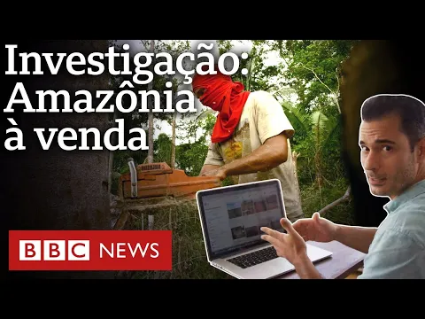
Area Equivalent to Spain, France, and Portugal Brings Together Undesignated Forests, Fragile Registrations, and Illegal Occupations, Exposing Flaws in Land Control, Deforestation Advance, and Persistent Violence in the Amazon Field
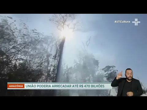
118 million hectares of undesignated public land in the Legal Amazon correspond to the sum of Spain, France, and Portugal, involving irregular CARs, 56.5 million hectares of undesignated forests, and direct impact on deforestation, land grabbing, and land conflicts.
The Legal Amazon concentrates 118 million hectares of federal and state public lands with no defined destination, spread across several states, affected by land grabbing, registration fraud, and violence in the field, a problem that exposes structural flaws in land control and threatens forests, traditional communities, and environmental policies.
The total area corresponds to the sum of the territories of Spain, France, and Portugal, according to estimates consolidated by specialists who have been monitoring land issues for over a decade.
-
More than 36,000 hectares of rice fields and aquaculture farms have transformed the Guadalquivir delta into a geometric grid visible from space, where channels, dikes, and tides operate one of the largest agro-hydraulic systems in Europe in southern Spain.
-
Dry weather accelerates soybean harvest, but threatens to devastate crops in Southern Brazil: losses already reach 50.4% and the climate scenario raises maximum alert for producers in 2026.
-
Iceland uses the heat from its volcanoes to grow tomatoes as good as Italian ones, tropical bananas, and even cocoa near the Arctic Circle, where the temperature barely exceeds 12 degrees, and almost 70% of the tomatoes consumed are already produced there.
-
Brazil sends unprecedented product to China and a ship with 62 thousand tons has already arrived at its destination: a new billion-dollar market opens for Brazilian agribusiness.

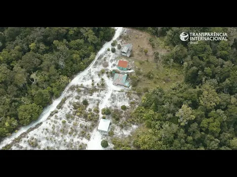
These are lands owned by the Union and the states that may be occupied irregularly but operate as if they had no owners, due to the absence of integrated registration control.
The absence of a single system prevents knowing who controls each portion of the territory, creating gaps for illegal appropriation and the advance of deforestation.
Paulo Moutinho, a scientist and co-founder of IPAM – Amazon Environmental Research Institute, states that this is public heritage losing ground to land grabbing.
According to Moutinho, many of these areas have come to be perceived as no man’s land, a condition that encourages persistent illegal occupations.
A survey by the Instituto Escolhas details the size of the problem by mapping federal and state public lands still without formal designation.
The study points to 118 million hectares, the sum of 60.9 million hectares of public plots and 57.1 million hectares classified as land vacuums.
Within this total, 56.4 million hectares already present some form of occupation, while 59.4 million hectares have no consolidated occupation.
A significant part of these areas corresponds to Undesignated Public Forests, known by the acronym FPND, recognized as public forest heritage.
The FPND are registered in the CNFP – National Register of Public Forests, but still lack formal use definition.
Once designated, they can become conservation units, forest concessions, or territories designated for traditional communities.
The most recent update of the CNFP, published in 2024 by the SFB – Brazilian Forest Service, reports 56.5 million hectares of undesignated forests in the Legal Amazon.
This significant volume increases the risk of illegal occupations, predatory logging, and social conflicts in remote areas.
How the CAR Came to Enable Land Fraud in Public Areas
One of the main engines of irregular occupation is the CAR – Rural Environmental Registry, created by the Forest Code Law of 2012.
The CAR is self-declaratory and mandatory for rural properties, originally intended to map areas of permanent preservation and legal reserves.
In practice, it has come to be used as informal proof of ownership, including in public lands without designation.
By not requiring prior proof, the registration has been used to formalize large-scale land fraud.
Moutinho estimates that about 30 million hectares of undesignated public forests are covered by CARs with signs of irregularities.
He reports cases in Amazonas with 20 to 30 CAR registrations overlapping in the same area, evidencing the fragility of the system.
This scenario directly reflects the deforestation pattern observed in public lands without designation.
According to Moutinho, about 65% of all that is cleared in these forests occurs within CARs considered fraudulent.
After the removal of the highest commercial value timber, land use changes rapidly in most cases.
Approximately 70% of the exploited areas turn into pasture, while about 25% end up abandoned later on.
Cattle ranching plays a central role in this process, with the figure of the so-called guardian bull used to give the appearance of productive use.
In this context, the herd serves to consolidate illegal occupation, not for legitimate economic activity.
In many cases, the cattle are slaughtered by slaughterhouses without proper licenses, feeding clandestine production chains.
For years, the financial system contributed indirectly to this dynamic, according to Moutinho’s assessment.
Official banks accepted the CAR as proof of ownership, allowing financing that ultimately enabled deforestation.
Investigations by Repórter Brasil pointed to the involvement of Banco do Brasil, Caixa Econômica Federal, and BNDES in this flow.
According to the findings, financing reached producers notified by Ibama, embargoed farms, and irregular slaughterhouses.
The Federal Police estimates that the cost of deforesting a hectare ranged from R$ 1,500 to R$ 3,000.
These amounts were financed by third parties, including international resources, according to investigations by the PF.
In recent years, however, there has been a change in the profile of those financing the devastation, according to Moutinho.
Financing is said to have shifted to organized crime, with resources coming from gold extraction, drug trafficking, and arms.
The combination of undesignated public lands, fragile registrations, and insufficient oversight facilitates this criminal activity.
Land Chaos Exposes Overlap and Structural Flaws of the State
Girolamo Treccani, a lawyer and professor at UFPA – Federal University of Pará, defines the scenario as land chaos.
He also serves as legal advisor to the CPT – Pastoral Land Commission, which monitors conflicts in the field.
Treccani recalls that decisions by the TCU – Federal Court of Accounts pointed to a lack of knowledge by the government about its lands.
In 2023, land governance was classified by the TCU as one of the most critical points of the Brazilian state.
According to Treccani, there is currently no system capable of providing complete control over the national land situation.
The country deals with parallel databases that do not communicate with each other, operated by different agencies.
Among them are Incra, SIGEF – Land Management System, and the CAR itself, in addition to state registrations.
There are also property records, which are not fully integrated with federal land databases.
This fragmentation generates severe distortions, such as municipalities where the sum of registered areas exceeds the actual territory.
In Amazonas, Treccani reports cases where there is more paperwork than land due to multiple registrations of the same property.
To tackle part of the problem, initiatives such as SINTER – National System for Territorial Information Management have emerged.
SINTER was regulated in 2016 and amended in 2022, with the aim of integrating land and property data.
In 2025, the CNJ – National Justice Council approved Provision 195, requiring a geospatial database managed by the ONR.
Despite this, implementation is slow and incomplete, according to Treccani, especially in Legal Amazon states.
He asserts that at least 30% of the notaries in Pará have not yet joined the ONR system.
Without total adherence, it is not possible to cross-register with areas declared in SIGEF or CAR.
Treccani emphasizes that land insecurity arises from the lack of systematization and integration of information.
Since September 2025, presenting a CAR has become mandatory to open a registration in the Property Registry.
However, the CAR does not need to be validated, allowing the use of registrations with signs of irregularity.
Historical Roots of Land Grabbing Shape Brazilian Territorial Occupation
Raoni Rajão, a professor at UFMG – Federal University of Minas Gerais, points to deep historical roots of the problem.
He headed the Department of Deforestation Control Policies at the MMA until 2024.
Rajão states that Brazil was born from a large land grabbing, historically based on the principle of occupation.
During the colonial period, those who occupied the land had authority, not those who held formal documentation.
The Land Law of 1850 attempted to organize access to land, requiring the purchase and sale of public areas.
The law’s enforcement was limited, leaving gaps for irregular appropriations over time.
In the 20th century, colonization policies expanded land disorder, according to Rajão.
He cites the westward march under the government of Getúlio Vargas and the construction of the Belém-Brasília highway.
During the military dictatorship, programs linked possession to deforestation, such as leases along BR 230.
The legislation regarding maximum sizes of private properties also varied over the decades.
In certain periods, titles above 10,000 hectares required Senate approval.
After 1964, the limit dropped to 3,000 hectares and then to 2,500 hectares after 1988.
Even so, records of private properties with much larger areas persist, inherited from old processes.
According to Treccani, many titles could only be verified through the digitization of historical land archives.
He advocates for the digitization of land grants and titles issued by state and federal governments.
Violence Grows While Lands Remain Undesignated
Land indefiniteness is pointed out as a central cause of the increase in agrarian conflicts in the Legal Amazon.
Annual reports from the CPT show that the region concentrates the majority of conflicts in the field.
Indigenous peoples, quilombolas, and traditional communities rank among the main recent victims.
Threats, evictions, and murders occur frequently in formally undesignated public areas.
Moutinho states that as land grabbing advances, fire, devastation, and social conflict increase.
Rajão agrees that without regularization and clear designation, the Amazon remains vulnerable to these cycles.
Treccani reinforces that the solution depends on political decision and effective integration of systems.
The technical chamber for land designation, recently reestablished, has resumed discussions on tens of millions of hectares.
Created during Dilma’s government, dissolved during Bolsonaro’s government, and resumed under Lula’s management, the body has yet to produce many decisions.
Treccani advocates for greater participation of states and civil society in the decision-making process.
He emphasizes the constitutional principle that all power originates from the people as the foundation for transparency.
Public land, he asserts, does not belong to governments but to the Brazilian population, whose protection remains overdue.
With information from ICL Notícias.


Quando o atual desgoverno entregar a Amazônia para a China, tudo estará resolvido.