 Portuguese
  English
  Spanish
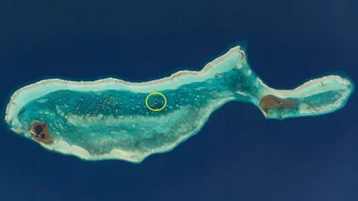


The Image Captured By An Astronaut Reveals A 42 Kilometer Atoll In The Caribbean, 80 Kilometers Off The Coast Of Belize, Whose Shape Resembles A Whale And Houses The Great Blue Hole, A Submarine Doline 318 Meters Wide And 124 Meters Deep, Visible From Space And Integrated Into The Reef Recognized By UNESCO
An Image Recorded By An Astronaut Revealed The Lighthouse Reef, In Belize, A 42 Kilometer Long Atoll Shaped Like A Whale, Housing The Great Blue Hole, A Deep Marine Doline Visited Annually By Over 10,000 Tourists And Part Of A World Heritage Site.
The Whale-Shaped Formation Observed From Space
The Photograph Shows An Unusual Tropical Structure In The Caribbean Sea, About 80 Kilometers Off The East Coast Of Belize. The Atoll Known As The Lighthouse Reef Has A Contour That Resembles A Whale, With “Head” And “Tail” Well Defined Along Its 42 Kilometer Length.
This Formation Has No Permanent Human Population But Receives Over 10,000 Visitors A Year. Many Of Them Are Divers Attracted By The Geographical Uniqueness And The Presence Of The Great Blue Hole, Located Close To The Center Of The Reef Structure.
-
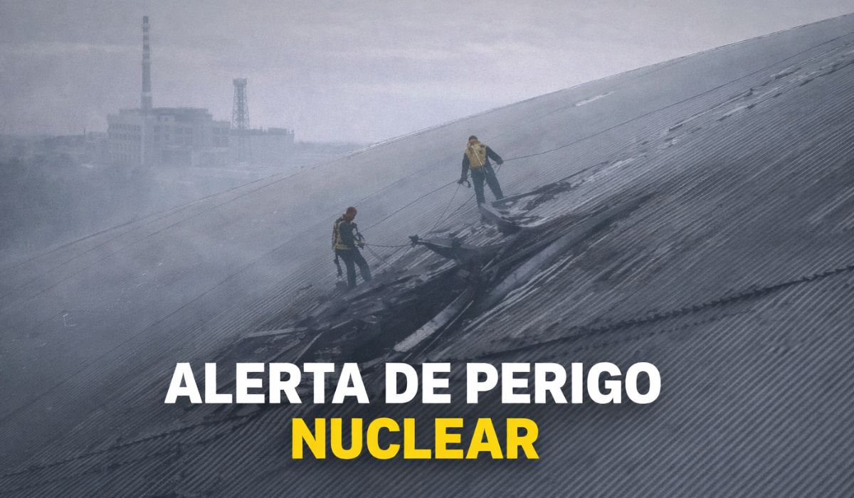
The gigantic steel shell built to contain Chernobyl for a century has been pierced by a drone, exposing a critical system and creating a hole that could cost over 500 million euros to repair.
-
Brazilian Navy reaches a new level by taking over an airport with a 1,600-meter runway used by 1,800 military personnel and autonomous attack drone testing.

-
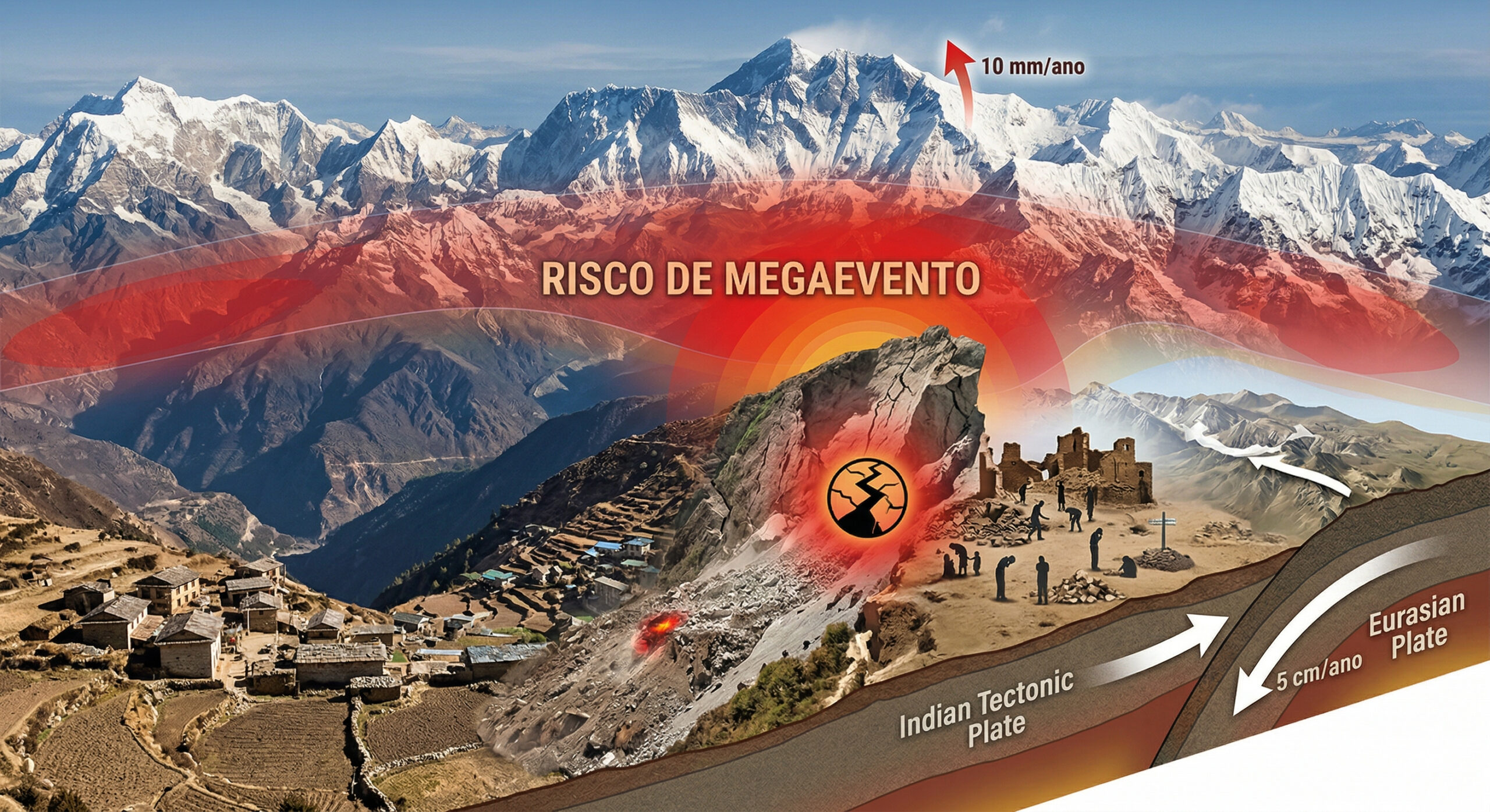
The Himalayas continue to grow to this day, with tectonic plates advancing 5 cm per year, mountains rising up to 10 mm annually, and the 2015 earthquake that killed 9,000 people may have increased the risk of an even larger seismic mega-event.
-
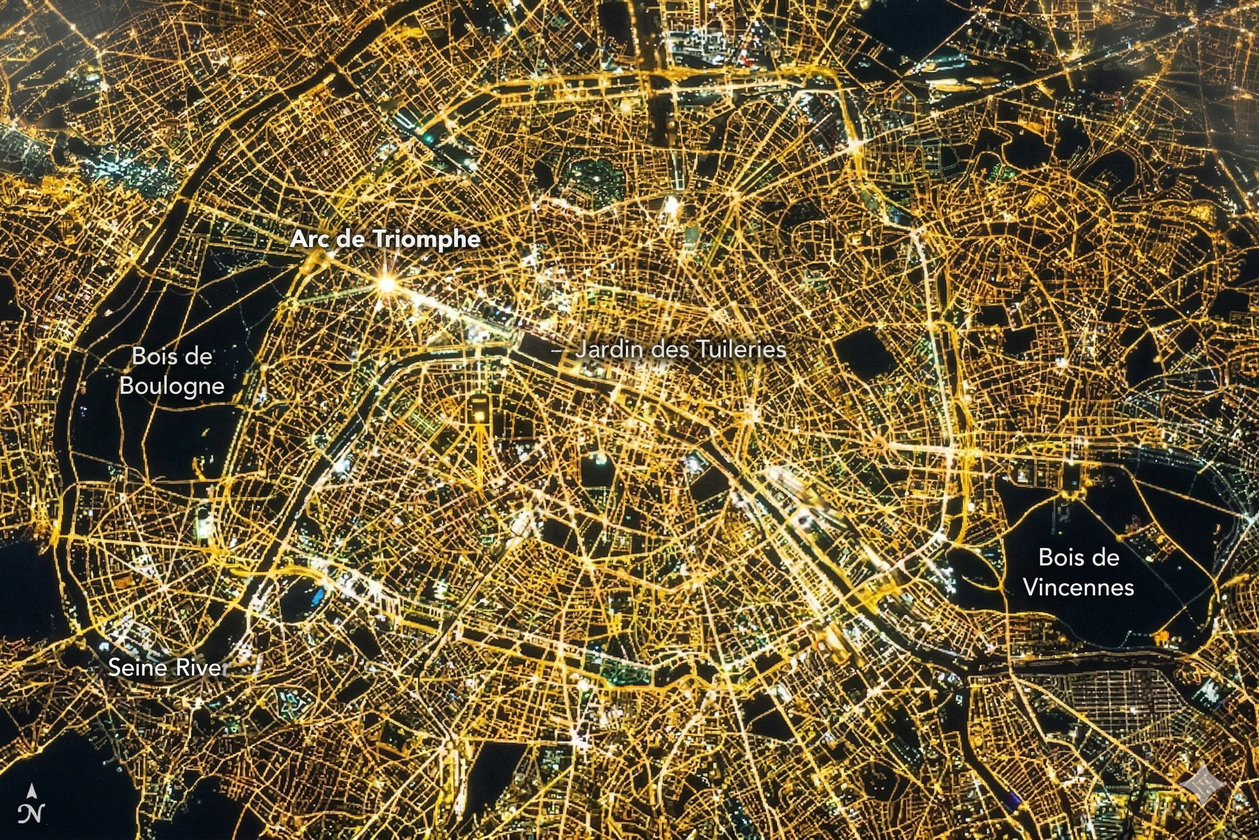
At an altitude of 400 km by astronauts from the International Space Station, Paris transforms at night into a golden mesh so precise that it reveals the outline of the Seine River, avenues, and entire neighborhoods like a luminous map drawn over the Earth.

The Atoll Is Comprised Almost Entirely Of Shallow Coral Reefs, Remaining Largely Submerged. Only A Few Sand Strips Emerge Above The Surface, Forming Small Islets Locally Known As Cayes.
The Waters Surrounding The Lighthouse Reef Feature Characteristic Turquoise Coloration And Relatively Low Depths, Ranging From 2 To 6 Meters. This Scenery Contrasts With A Dark Central Circle That Deepens Abruptly.
The Great Blue Hole And Its Extreme Dimensions
At The Center Of The Atoll Is The Great Blue Hole, A Submarine Doline With An Almost Circular Opening Stretching 318 Meters Wide. Its Maximum Depth Reaches 124 Meters, Positioning It Among The Deepest Dolines On The Planet.
Viewed From Space, This Dark Formation Stands Out In The Clear Reef, Creating The Visual Impression Of A “Breathing Hole” Of The Whale Formed By The Atoll. The Difference In Depth And Color Reinforces This Natural Illusion Observed In The Orbital Image.
The Great Blue Hole Has Only Been Properly Explored In Recent Years. The Internal Structure Includes Submerged Caves That Branch Off From The Main Doline, Revealing Details About Its Geological Formation.
Stalagmites And Stalactites Found In These Caves Indicate That The System Originally Formed Above Sea Level Before Being Flooded.
Geological Origin And Transformation Over 10,000 Years
It Is Believed That The Great Blue Hole Originated As A Complex Of Dry Caves. This System Was Submerged About 10,000 Years Ago When The End Of The Last Ice Age Caused Sea Levels To Rise.
As The Waters Advanced, The Caves Were Flooded, Preserving Mineral Formations That Are Now Submerged. These Elements Help Reconstruct The Geological History Of The Region Based On Direct Evidence.
In The 1970s, The Site Gained International Attention After The Visit Of Ocean Explorer Jacques Cousteau. From His Ship Calypso, He Began Mapping The Depths Of The Doline.
Cousteau Ranked The Great Blue Hole As One Of His Five Best Dive Sites In The World, Solidifying Its Global Reputation And Enhancing Scientific And Tourist Interest In The Site Despite Some Logistical Challenges.
Modern Expeditions, Discoveries, And Submerged Risks
In 2018, A New Expedition Was Led By Fabien Cousteau, The Explorer’s Grandson, And British Entrepreneur Richard Branson. The Mission Resulted In The First Complete 3D Map Of The Great Blue Hole.
Among The Most Relevant Discoveries Was The Identification Of A Layer Of Hydrogen Sulfide About 33 Meters Thick At The Bottom Of The Doline. This Layer Is Anoxic, With No Dissolved Oxygen, And Lethal To Most Marine Animals.
During The Expedition, The Bodies Of Two Previously Missing Divers Were Found. According To Newsweek, They Were Preserved By The Hydrogen Sulfide Layer, And The Team Chose Not To Remove Them Out Of Respect.
It Is Known That At Least One Other Diver Also Disappeared In The Crater. These Incidents Reinforce The Risks Associated With The Deep Exploration Of The Site, Even With Advanced Technology.
Biodiversity And Preserved Climatic Records
The Lighthouse Reef Is Part Of The Belize Barrier Reef, Recognized As A UNESCO World Heritage Site. The Area Houses Various Marine Species, Including Parrotfish, Snapper, Gobies, As Well As Crocodiles And Sea Turtles.
Above The Surface, Half Moon Caye, Located At The Tip Of The “Whale’s” Hump, Hosts Colonies Of Birds Nesting In Coconut Trees. The Site Also Houses Endangered Species Of Geckos And Anoles.
Earlier This Year, Scientists Analyzed Sediment Samples Collected From The Bottom Of The Great Blue Hole. The Study Allowed For The Reconstruction Of The History Of Tropical Cyclones In The Region Over Thousands Of Years.
The Analysis Indicated That These Storms Have Become More Frequent Over The Last 6,000 Years, Reinforcing The Scientific Value Of The Doline As A Natural Record Of Past Climatic Events, Even With Some Natural Errors In The Initial Interpretation.


Na minha visão parece mais uma ameba, than uma ****