 Portuguese
  English
  Spanish
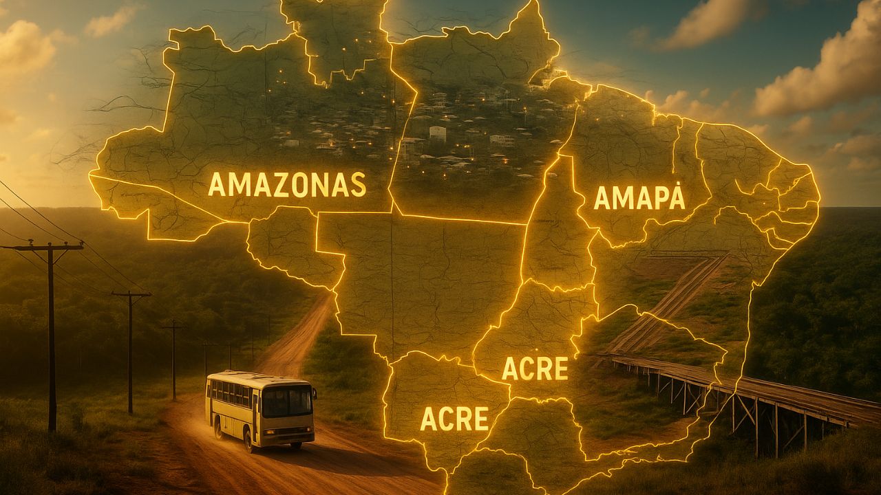
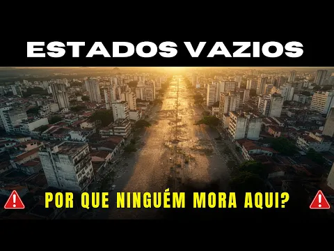
Tocantins, Roraima, Acre, Amapá, and Amazonas Form a Map of Isolated Cities, Limited Infrastructure, and Enormous Challenges, Far from the Spotlight of Brazil’s Major Urban Centers.
Brazil is known for its territorial grandeur and the strength of its metropolises, but there is another country hidden behind the official statistics. In entire regions of the national map, what prevails are isolated cities, long distances, silence in the streets, precarious roads, limited state presence, and a sense of abandonment that marks generations. While some live cramped in expensive apartments and face chaotic traffic daily, millions of Brazilians grow up in giant territories, sparsely populated and with limited opportunities.
In this parallel reality, Tocantins, Roraima, Acre, Amapá, and Amazonas appear as true “ghost states,” with low population density, fragile economies, and timid presence in national decisions. These states carry an explosive combination of economic potential, environmental wealth, and isolated cities struggling to connect with the rest of the country. Understanding what happens there is essential to view Brazil beyond the traditional axis of major urban centers.
An Overpopulated Country Coexisting with Isolated Cities
At first glance, it may seem contradictory that a populous country like Brazil has extensive nearly empty areas, with isolated cities and little circulation of people, goods, and services. But this is precisely what happens in a significant part of the Northern Region. These are places where geography, distance, and lack of investment in infrastructure shape everyday life.
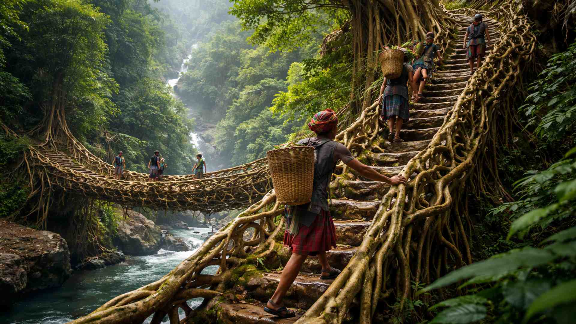
-
These living root bridges and ladders are over 700 years old and help indigenous people survive in one of the rainiest regions in the world.
-
From sertanejo star to international investor: Ana Castela invests millions in a mansion in the USA, creates a themed accommodation in Orlando, and shows that the “boiadeira” also wants to grow away from the stage.

-
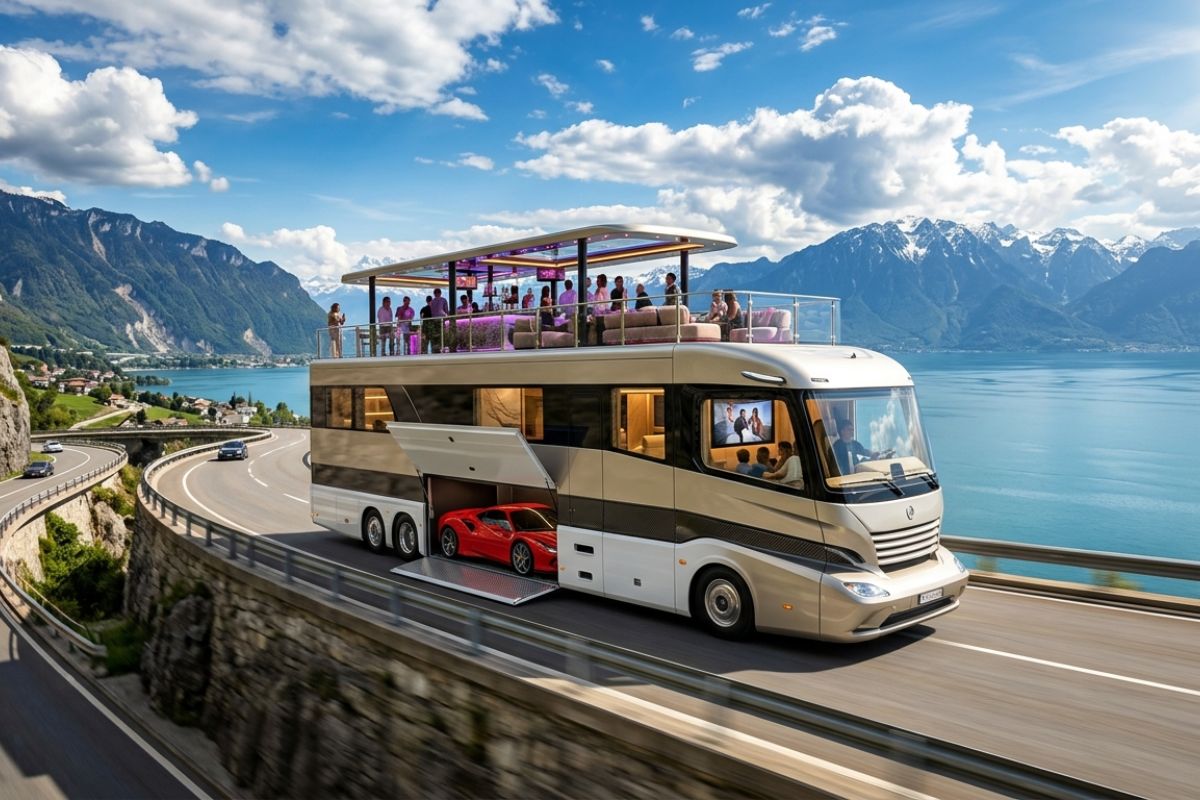
The 10 most stunning motorhomes in the world: a $3 million trailer with a rooftop nightclub and garage for a Ferrari, “palaces on wheels” with Italian marble, private cinema, and five-star hotel luxury for billionaires.
-
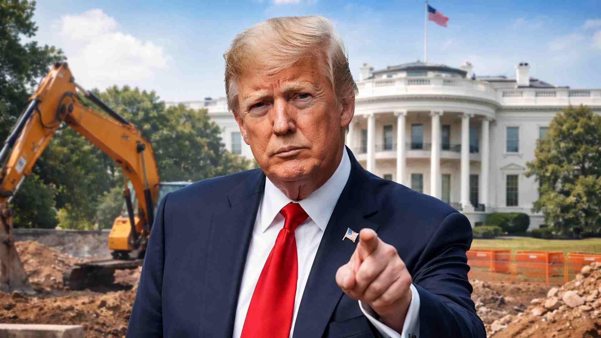
Trump wanted to spend $400 million on the White House, but the courts prohibited the million-dollar construction.

In these states, traveling between municipalities can take hours or days, public transportation is limited, logistics are expensive, and many young people leave their hometowns in search of study and employment in other regions. While some states face overcrowding issues, these territories coexist with depopulation and a constant sense of being on the margins of national development.
Tocantins: The Young Giant Still Striving to Step Out of the Shadows
Established in 1988, from the division of Goiás, Tocantins is the newest state in Brazil and is already larger than countries like the United Kingdom. Its capital, Palmas, is a planned city and symbolizes a project of modernization and growth. Still, much of the territory is marked by isolated cities, small and far apart, with long stretches of road in poor condition.
Highways like BR-153 and the North-South railway give the state a strategic position for grain export, but this has not yet translated into uniform development. The economy revolves around agriculture and extractivism, with growing production of soy, corn, and cattle, but concentrated in specific areas. Outside the capital, urban infrastructure is limited, industry is almost nonexistent, and many young people migrate to other states, reinforcing the depopulation of various regions.
Roraima: Strategic Border Surrounded by Isolation
Roraima occupies the northernmost part of Brazil, bordering Venezuela and Guyana. Despite its geopolitical importance, the state remains disconnected from most of the country. Boa Vista, its capital, concentrates the majority of the population, while the interior is made up of small communities, indigenous lands, and forest and savanna areas with low human occupancy.
Access is difficult. BR-174 connects Roraima to Manaus, crossing the Amazon rainforest, but has been known for its bad road conditions. There are no railways, the internal road network is fragile, and energy problems are recurring. In this scenario, many communities live literally in isolated cities, with little public assistance and great logistical challenges to maintain basic services. The economy is modest, with a strong focus on the public sector, limited agriculture, and an informal economy linked to illegal mining that increases social and environmental tension.
Acre: The State That Exists Beyond the Joke
In the far west of Brazil, on the border with Peru and Bolivia, Acre is one of the most remote states in the country, mostly covered by the Amazon rainforest. The capital, Rio Branco, houses a large part of the population, while the interior consists of small municipalities and communities scattered throughout the forest.
The geographical isolation helps to fuel the reputation of being a “too far” state, almost out of the imagination of many Brazilians.
Infrastructure relies almost entirely on BR-364, which connects Acre to the rest of the country but becomes difficult to navigate during rainy periods.
Air transport is expensive, there are no railways, and river transport is underdeveloped. The result is a scenario where various locations function as isolated cities, struggling to access health, education, culture, and economic opportunities.
The economy relies on the public sector, extractivism, and small agricultural activities, with a strong presence of products like rubber and Brazil nuts, but still with minimal impact on broad development.
Amapá: Between the Equator, Blackouts, and Isolated Cities
Amapá is strategically located, cut by the equator line and bathed by the Atlantic, but remains poorly integrated with the rest of Brazil.
Macapá concentrates about 70% of the population, while the interior consists of small cities and riverside communities that coexist with limited infrastructure and difficult access.
Without direct road connection to the rest of the country, the state relies on ferries coming from Pará and an airport with few connections. The internal road network is precarious, river transport is limited, and the energy supply has faced severe crises, such as the blackout of 2020.
In many areas, what can be seen are isolated cities surrounded by forest and rivers, with fragile public services, little access to formal culture, and an economy based on mineral extraction, port activities, and trade dependent on other regions.
The feeling is of a large state, rich in biodiversity and culture, but underutilized and little heard in national debates.
Amazonas: The Silent Giant of the Brazilian Map
Amazonas is the largest state in Brazil and one of the most symbolic when it comes to the contrast between territory and human presence.
With a vast area covered by the Amazon rainforest, the state has a relatively small population concentrated mainly in Manaus.
Outside the capital, communities, small towns, and areas of difficult access predominates, many of which can only be reached by boat or plane.
Logistics is one of the biggest challenges. River navigation is intense but slow, and road connections are limited, especially BR-319, which faces chronic problems during rainy periods.
In much of the Amazon’s interior, daily life is marked by isolated cities, with little infrastructure for health, education, culture, and digital connectivity.
The Free Trade Zone of Manaus ensures a significant GDP, but wealth is concentrated in the capital, while the interior struggles with poverty, informality, and social exclusion.
Ghost States or Ignored Territories?
Tocantins, Roraima, Acre, Amapá, and Amazonas form a true “map of emptiness” when it comes to state presence and integration with the rest of the country.
This is not a void of identity or culture, because these places are rich in traditions, religiosity, ethnic diversity, and stories of resistance.
The emptiness lies in infrastructure, consistent investment, and the lack of public policies that reach in a balanced way the isolated cities that punctuate these territories.
Looking at these states makes it clear that Brazil goes far beyond the most famous capitals and major economic centers.
There is an entire country living on the margins of national decisions, struggling every day to remain in territories where isolation is geographical, economic, and political.
Bringing visibility to this reality is an essential step towards thinking of a fairer and truly national development.
And you, which of these states with isolated cities surprises you the most, and which one would you choose to start a journey through invisible Brazil outside the major centers?


Seja o primeiro a reagir!