 Portuguese
  English
  Spanish
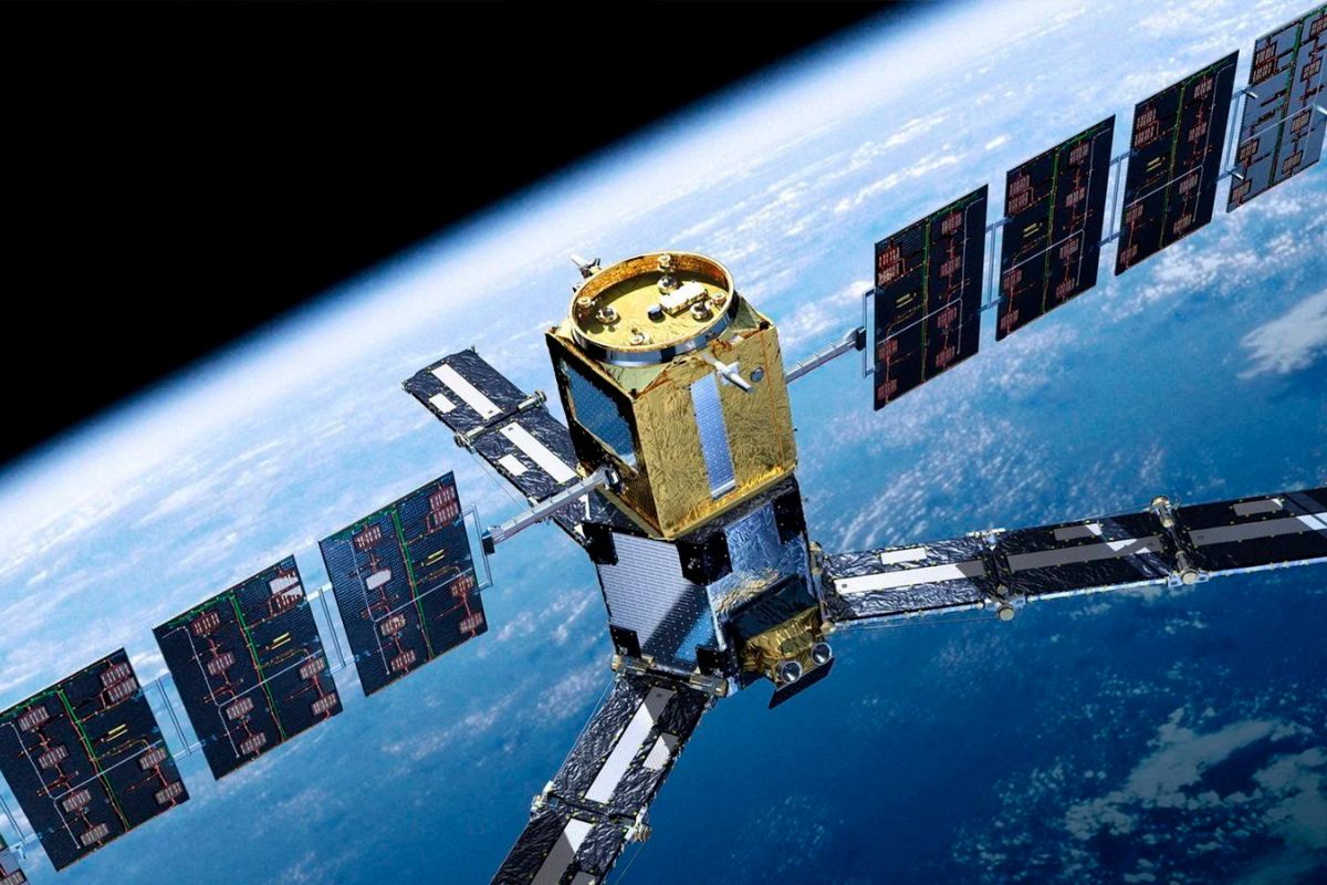
Announced in Partnership with China, Brazil’s First Geostationary Satellite Promises to Revolutionize Climate Monitoring in the Amazon and Agriculture.
Brazil has taken a decisive step to consolidate its sovereignty in space with the announcement of the development of CBERS-5, the first Brazilian geostationary satellite. The result of a historic partnership with China, the new satellite represents an unprecedented evolution for the country’s space program, enabling continuous monitoring of the entire national territory from a fixed point in space.
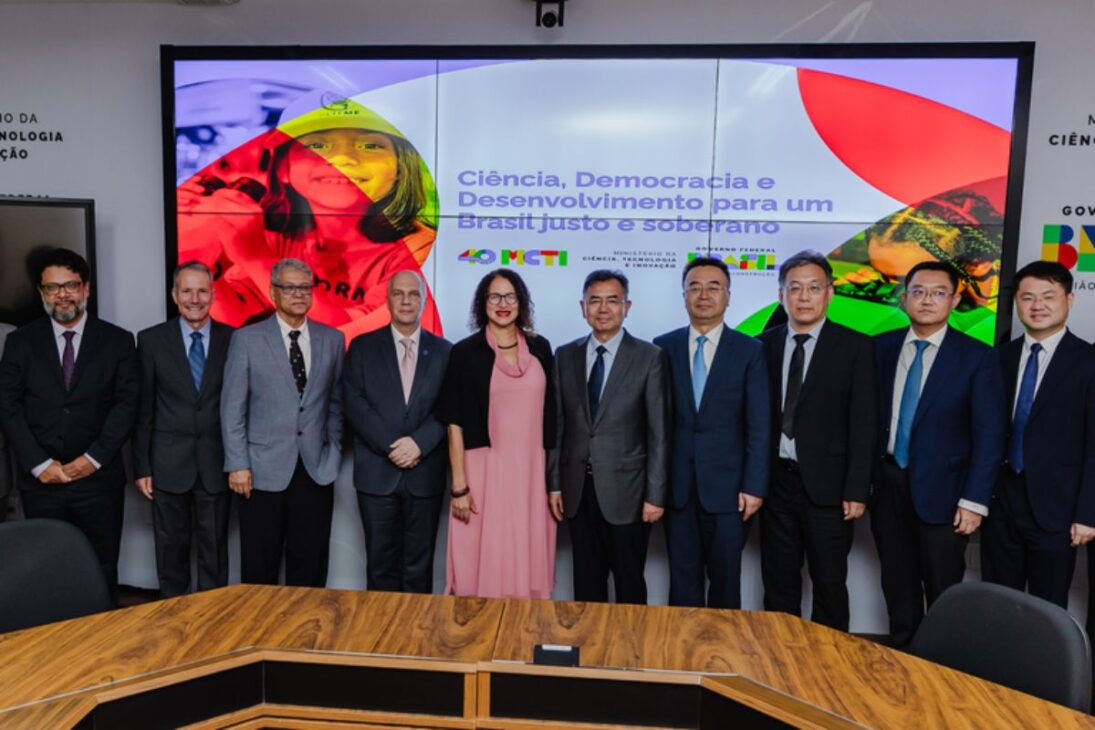
The confirmation of the project, formalized during the BRICS Summit in Rio de Janeiro in July 2025, places Brazil in a select group of nations with mastery over this technology. With CBERS-5, the country will no longer rely on data from foreign satellites for critical tasks such as forecasting extreme weather events, combating deforestation in the Amazon, and planning agricultural production, ensuring autonomy and accuracy for its public policies.
What Is a Geostationary Satellite and Why Is It So Important?
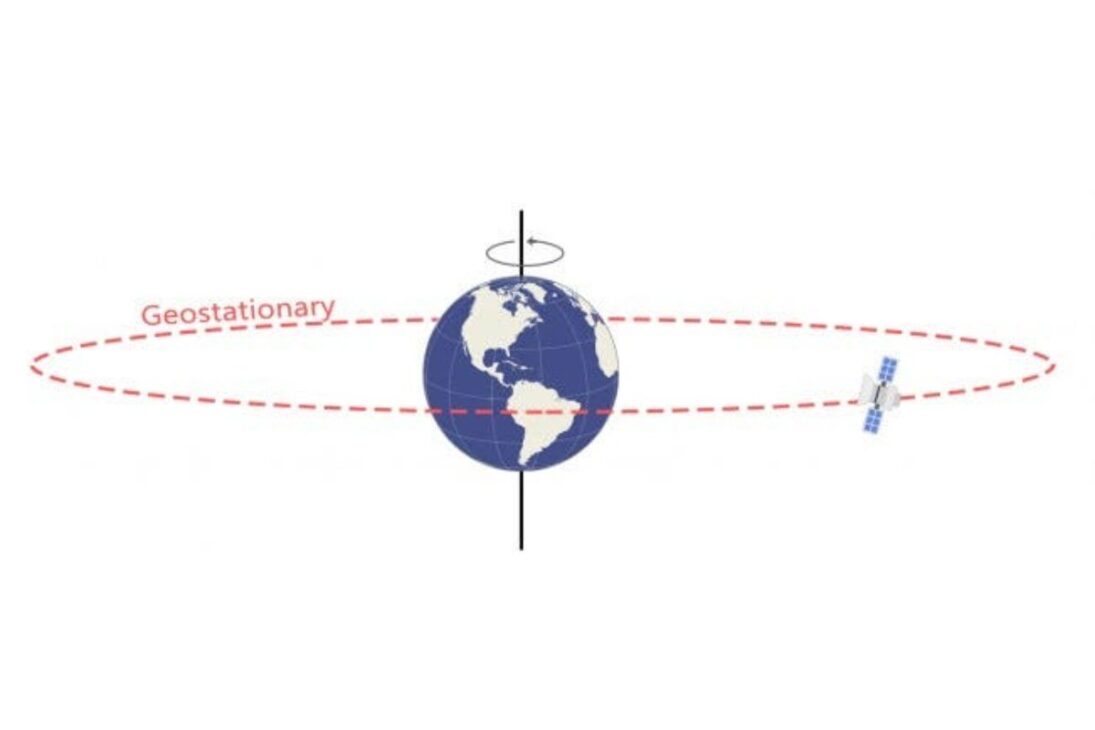
Unlike low-Earth orbit satellites, such as the previous CBERS program models that orbit around the Earth, a geostationary satellite is positioned at an altitude of approximately 36,000 km, over the equator. In this orbit, its speed of translation is the same as the rotation of the Earth, which makes it “stationary” over the same point on the planet.
-
Something is happening around the Earth: Inside the huge explosion of fireballs in 2026

-
A hot air bubble coming from Argentina expands over Brazil, causing thermometers to exceed 38 degrees with a thermal sensation of 40 degrees in late March, affecting 6 states at once.

-
The radish leaf that almost everyone throws away has more polyphenols, flavonoids, and fiber than the consumed root, and a 2025 study showed that the leaf contains compounds that protect the intestine, combat inflammation, and may inhibit the growth of cancer cells.

-
A planet that seemed to defy the laws of physics has intrigued scientists for decades, until the James Webb revealed what is really affecting Saturn’s rotation.

This characteristic is the major advantage of the first Brazilian geostationary satellite. It allows for continuous and uninterrupted observation of the national territory, 24 hours a day. While a low-Earth orbit satellite passes over the same region only a few times a day, CBERS-5 will provide a constant stream of images and data, which is crucial for monitoring dynamic phenomena.
The Legacy of the Brazil-China Partnership
CBERS-5 is the latest chapter in one of the world’s most successful space partnerships. The CBERS program (China-Brazil Earth Resources Satellite) was initiated in 1988 and has successfully launched four satellites that provided millions of free images, essential for science and environmental management in Brazil.
The new agreement, signed in June 2024, provides for a multi-billion investment and technology transfer to Brazil, with the launch of the satellite scheduled for 2030. The initiative is coordinated by the National Institute for Space Research (INPE) and the Brazilian Space Agency (AEB).
The Applications That Will Transform Brazil
The impact of the first Brazilian geostationary satellite will be felt in several critical areas for the country.
Environment and Civil Defense: With a temporal resolution of minutes (compared to hours for current satellites), CBERS-5 will allow for nearly instantaneous detection of fire outbreaks and deforestation in the Amazon. Moreover, it will be a powerful tool for forecasting heavy rains, cyclones, and other extreme weather events, issuing faster and more accurate alerts to Civil Defense, which can save lives in situations like the floods that devastated Rio Grande do Sul.
Precision Agriculture: The agribusiness, which accounts for about 25% of Brazil’s GDP, will be one of the biggest beneficiaries. The satellite will provide high-precision meteorological data, helping producers optimize planting, irrigation, and harvesting. INPE studies estimate that the technology could reduce agricultural losses by up to 20%.
Sovereignty and Development: By having its own geostationary satellite, Brazil reduces dependence on foreign systems, such as the American GOES satellites, ensuring autonomy in the collection of strategic data for national defense and development.
The Future of the Brazilian Space Program
The development of the first Brazilian geostationary satellite not only elevates the technological level of the country but also drives an entire chain of innovation, with the expectation of generating around 5,000 high-skilled jobs and strengthening the aerospace hub in São José dos Campos (SP). CBERS-5 is proof that Brazil is looking to the future and investing in science and technology to address its biggest challenges.
And you, what do you think of this significant step for the Brazilian space program? Do you believe that the first Brazilian geostationary satellite will bring the expected benefits? Share your opinion in the comments!


-

Uma pessoa reagiu a isso.