 Portuguese
  English
  Spanish
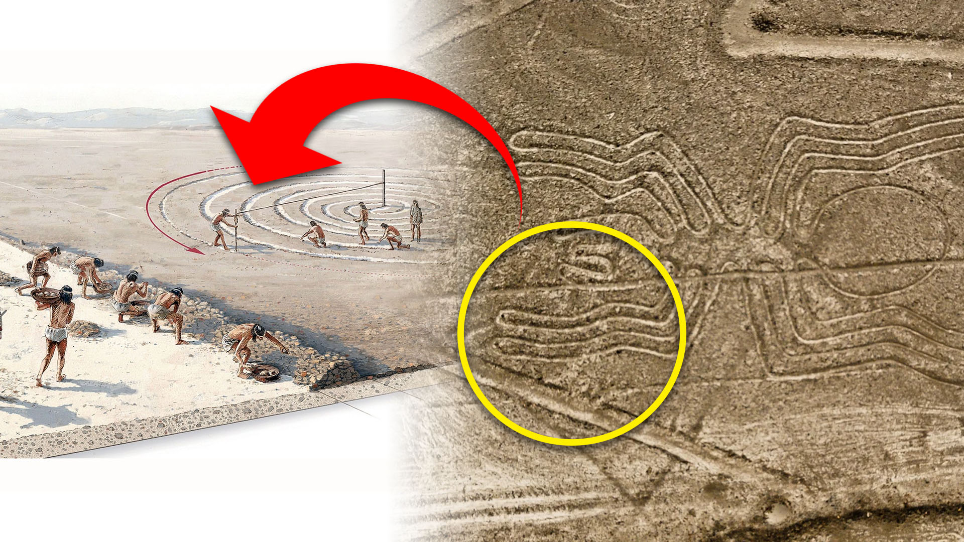


In Six Months, A Team From Yamagata University With IBM Mapped 303 New Geoglyphs In The Peruvian Desert, Almost Doubling The Known Total And Redefining Hypotheses About The Nazca Lines.
Artificial intelligence has left its mark on one of the greatest archaeological enigmas on the planet. Researchers from Yamagata University, in collaboration with IBM Research, confirmed 303 new geoglyphs in the Nazca Desert in Peru, following a field campaign guided by an AI model that prioritized areas with a high probability. The study was accepted by PNAS and published in September 2024.
The progress is significant: it took almost a century to identify 430 figurative figures; the AI added 303 in just six months, almost doubling the known set. The work employed high-resolution aerial images to locate subtle patterns and guide ground verifications.
Signed by Masato Sakai and collaborators, the article details the AI strategy and its implications for the cultural interpretation of the site, which is a world heritage site of UNESCO.
-
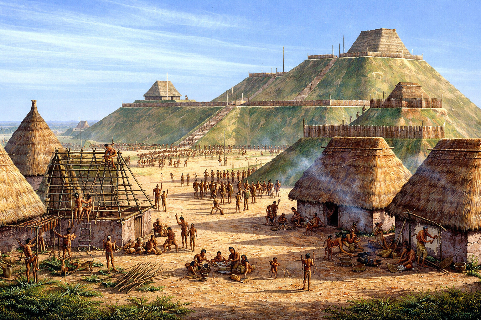
With over 14 million baskets of earth moved, an ancient North American metropolis built a monumental pyramid of 30 meters and established a city with 20,000 inhabitants nearly a thousand years ago.
-
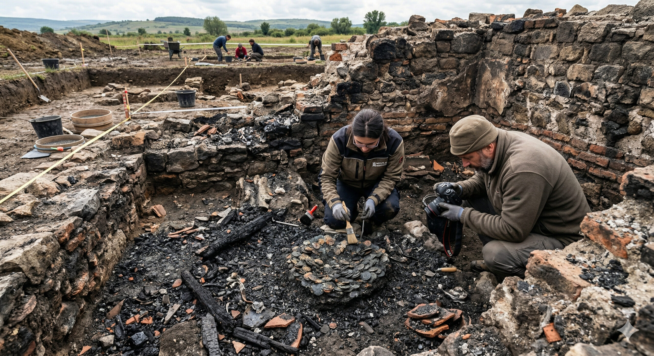
A 1,900-year-old treasure emerges from a Roman house destroyed by fire and sealed since antiquity in Romania, with coins and metals fused among the ashes.
-
The Brazilian colonial city that stopped in time and shares territory with a rocket launch base.

-
79-year-old woman challenges limits, visits 193 countries in the world after 56 years of planning and reveals the behind-the-scenes of a global journey that few have managed to accomplish.

The new figures include felines, parrots, monkeys, camelids, and human scenes, including people holding decapitated heads. Many measure 3 to 7 meters, which explains why they went unnoticed in previous surveys.
AI Accelerated The Survey Of The Nazca Desert
The team trained a model capable of operating with few examples, due to the limited number of known geoglyphs. The AI analyzed extensive mosaics of aerial images, prioritizing “candidates” that were then checked in the field by archaeologists. There were 1,309 high-probability points and 303 confirmations after the expeditions.
According to Yamagata, the approach represented a gain of 16 times in the discovery rate and shifted the focus to small figures that are difficult to distinguish with the naked eye. Drones helped with the final documentation.
For IBM, the model was able to efficiently detect geoglyphs of “relief type”, expanding the dataset and allowing for more robust spatial and iconographic analyses.
This protocol of “AI suggests, humans confirm” is pointed out as a methodological standard for extensive areas with poorly contrasted remains, without replacing archaeological verification.
What Was Found: Animals, Rituals, And “Plates” Along Trails
The study distinguishes two groups: the “line type” geoglyphs, giant, associated with networks of lines and trapezoids, and the “relief type”, smaller, visible from ancient trails. The latter depict human motifs and domesticated animals and may have served as signs for small groups on the move.
Among the motifs, attention is drawn to orca with a cutting object, camelids, and trophy heads, common in Andean contexts. The iconographic diversity reinforces the hypothesis of multiple functions over time.
For Peruvian archaeologist Johny Isla, the new figures, smaller and closer to the trails, seem to have been made “by humans for humans”, with everyday scenes, unlike the giants, “to be seen by their gods“. Typical size: 3 to 7 m.
The proposed reading converges with spatial analyses of the study, which link the small geoglyphs to trails and the large ones to ceremonial routes and meeting areas, suggesting communal versus local uses.
New Hypotheses For The Nazca Lines
The Nazca Lines have always sparked debates about their origin and purpose. By expanding the corpus with hundreds of small examples, the AI allows testing hypotheses with a representative sample and contextualized in traffic networks.
The team indicates that the relief type geoglyphs appear on average 43 m from trails, while the line type relate to the trapezoidal system in flat areas, a pattern compatible with communal rituals and local signaling.
The publication in PNAS and the institutional disclosure from Yamagata provide scientific backing to the conclusions and pave the way for new campaigns with more robust geospatial models.
For the Brazilian and South American audience, the case shows how AI and drones can accelerate diagnoses in extensive sites, without replacing field archaeology and heritage management.
The new evidence points to human “plates” alongside trails, but many still see the lines as ritual scenarios for the gods. Do you agree with this shift in interpretation guided by AI or fear that technology imposes rushed readings? Leave your comment and explain what function you think the geoglyphs served.


IA reconhece porque foi aplicado nela mesma criado antes~