 Portuguese
  English
  Spanish
The IBGE updated territorial limits in Santa Catarina using modern georeferencing, and Penha gained 0.24 km² of area that belonged to Balneário Piçarras, while Garuva incorporated 490 hectares in a boundary adjustment with Paraná in a process that affects 18 municipalities and impacts public management and property records
According to the portal ndmais, a recent review by the IBGE, based on data consolidated by the State Planning Secretariat of Santa Catarina, caused a subtle but relevant change in the map of the Northern Coast of Santa Catarina. The adjustment redefined the boundary line between Penha and Balneário Piçarras, and Penha increased from 57.75 km² to 57.99 km², an increase of 0.24 km², which is equivalent to about 24 soccer fields or more than 30 average city blocks. In practice, it is as if an entire neighborhood had changed municipalities.
The case of Penha is not isolated. In total, the IBGE updated the limits of 18 municipalities in Santa Catarina in a broad process of cartographic correction. The most significant example is Garuva, in the North of the state, which incorporated about 490 hectares into the Santa Catarina territory after a boundary adjustment with Paraná. The changes do not mean that cities “stole” territory from each other; they mean that the old maps had inaccuracies that modern technology has finally managed to correct.
Why did the IBGE change the limits of 18 municipalities in Santa Catarina
Many of the municipal limits in Santa Catarina were defined decades ago, based on less detailed maps or natural references such as rivers, hills, and roads, which over time left room for divergent interpretations.
-
The Chinese chain that surpassed McDonald’s, Subway, and Starbucks in the number of stores worldwide arrives in Brazil this Saturday with ice cream priced at R$ 3 and a billion-dollar plan to open thousands of units by 2030.

-
Spain launches a 197 million plan to reduce dependence on Europe: 97% of magnesium comes from China; drones and AI will map lithium and neodymium in the Iberian Massif by 2030.

-
Labubu’s owner, the Chinese company Pop Mart, is making a strong entry into Brazil while combating counterfeit versions of the doll that have already become a global craze and led to lawsuits against illegal sales in several countries.

-
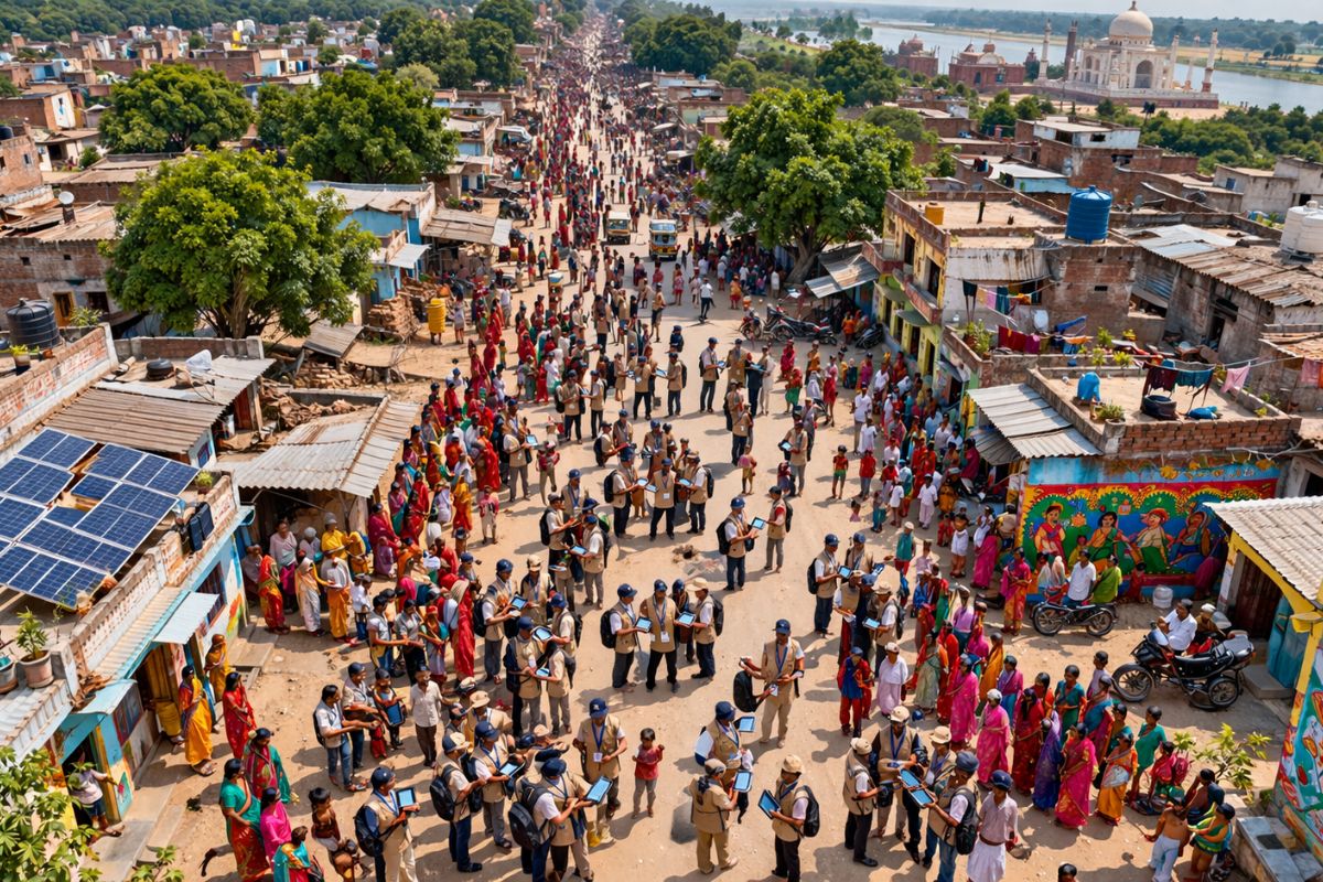
India begins to count 1.4 billion people: the census is the most ambitious in the world, mobilizing 3 million enumerators in 640,000 villages and 9,700 cities, with an app and two phases until 2027.
According to the Territorial Development Directorate of Seplan, the change made by the IBGE does not represent arbitrary loss or gain between municipalities, but rather a technical correction of inaccuracies that existed for years without anyone noticing.
With the use of modern georeferencing technologies, high-precision GPS, and detailed satellite images, the IBGE was able to update coordinates, correct areas considered “shadow zones” where the delimitation was unclear, and reinterpret old cartographic vectors.
The result is a more accurate definition of municipal boundaries, which has practical consequences for public management, urban planning, and legal security in property records.
What Penha gained and Balneário Piçarras lost in the IBGE review

image: IBGE
The increase of 0.24 km² may seem insignificant in absolute numbers, but it gains dimension when translated into everyday elements.

image: IBGE
The area that the IBGE officially transferred from Balneário Piçarras to Penha is equivalent to about 24 hectares, the size of approximately 24 standard soccer fields or more than 30 average city blocks. In terms of occupation, it is comparable to an entire small neighborhood.
For the residents of the area that changed municipalities, the practical effects depend on how the public administration absorbs the change.
Issues such as property tax (IPTU), property records, jurisdiction of public services, and even official address may be impacted by the IBGE review, although these changes do not cause immediately noticeable effects in daily life. The change is cartographic and administrative; no one needed to change houses or ZIP codes.
The case of Garuva and the boundary adjustment between Santa Catarina and Paraná

IMAGE: IBGE
The most significant adjustment revealed by the IBGE review in Santa Catarina occurred in Garuva, in the North of the state.
The municipality incorporated about 490 hectares into its territory after correcting the boundary with Paraná, an area nearly 20 times larger than what Penha gained from Balneário Piçarras. This is an interstate adjustment, which makes the process even more significant from a cartographic and jurisdictional perspective.
The incorporation of nearly 5 km² of territory by the IBGE review in Garuva demonstrates that the inaccuracies in the old maps were not small.
Areas that for decades were administered as belonging to Paraná are now officially part of Santa Catarina, and this has consequences for tax collection, service provision, and territorial planning in both states. The IBGE review, in this case, not only corrected a map: it redrew the border between two states.
What changes in practice when the IBGE redraws municipal limits
Although the changes do not cause immediately visible effects in the daily lives of residents, they have a direct impact on various spheres of public management.
The redefinition of limits by the IBGE ensures more accuracy in official data such as census, distribution of federal and state funds, and administrative organization of services such as health, education, and security. When the map changes, the calculation base for transfers from the Municipal Participation Fund can also be affected.
Legal security in property records is another sensitive point. Lands that were in a “shadow zone” with unclear ownership now have a precise definition, which facilitates deeds, financing, and real estate transactions.
For the 18 municipalities in Santa Catarina that had their limits updated by the IBGE, the review is a necessary update that transforms maps from decades ago into faithful representations of the current geographical reality.
Do you live in any of the 18 municipalities affected by the IBGE review in Santa Catarina? Did you know that the limits of your city changed? Let us know in the comments.


Seja o primeiro a reagir!