 Portuguese
  English
  Spanish
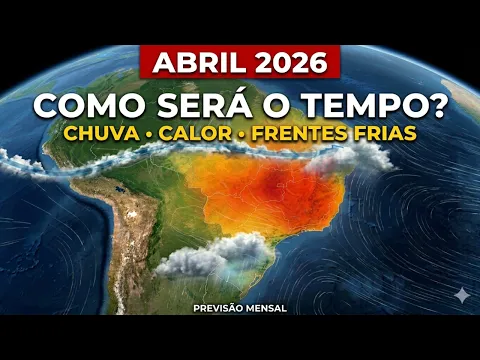
Forecast indicates the beginning of the month with high temperatures, little instability, and an atypical climatic pattern for autumn in the gaucho territory
April started without any typical signs of autumn in Rio Grande do Sul. On the contrary, the first day of the month, this Wednesday (1st), was marked by stable weather, intense heat, and low rainfall, anticipating a climatic scenario that should persist over the coming weeks.
This information was released by “Clima Tempo”, according to recent meteorological analyses, which indicate the predominance of warm air in almost the entire country for most of the month, directly impacting the gaucho territory.
In addition, atmospheric stability continues to prevail over almost the entire State. Especially in the West and Northwest regions, the sun appears strongly from the early hours of the day, contributing to the rapid rise in temperatures, which may exceed 30°C already at the beginning of April.
-
Friend or villain? See how much it costs to keep the air conditioning on for 8 hours a day in 2026.

-
In 2026, the results of a study involving 140,000 people are expected to be released regarding a blood test capable of detecting 50 types of cancer before any symptoms appear, and this could be the greatest advancement in medicine since penicillin.

-
Spring 2026 could be the most dangerous season of the year, according to Climatempo and MetSul, with the peak of El Niño between September and November, an increase in Mesoscale Convective Complexes that caused historic floods in Rio Grande do Sul, and an advancing risk for São Paulo and Mato Grosso do Sul.

-
With the wingspan of a Boeing 747 and 160 times lighter, a solar drone flies for 90 days without landing, without fuel, and without a pilot, carrying 17,248 photovoltaic panels, a 200 km radar with AI, and has already crossed storms in the Gulf of Mexico during tests for the U.S. Navy.

On the other hand, while these areas face more intense heat, the Eastern Half presents a different scenario. This occurs due to the greater presence of humidity, which favors cloud variation throughout the day. Still, there is only a possibility of light and isolated rain in regions such as the South, Costa Doce, Valleys, Metropolitan Region, Serra, and Coast, without significant accumulations.
Predominance of hot days is expected to mark April and keep temperatures above the historical average
Continuing the pattern observed in March, which was already characterized by high temperatures, April is expected to maintain this trend of persistent heat. According to meteorologist Murilo Lopes from the Federal University of Santa Maria (UFSM), there is a clear continuation of the previous climatic conditions.
Although autumn is officially in effect, which naturally opens space for the occurrence of cooler days, the expectation is that these episodes will be less frequent. In other words, hot days are expected to stand out compared to mild periods.
— The trend is that we will still have periods of very high temperatures throughout April, despite the arrival of the first masses of cooler air to the region. These systems are expected to act infrequently and for a short period — explains Lopes.
Moreover, meteorologist Eliana Veleda Klering, a professor at the Federal University of Pelotas (UFPel), emphasizes that the monthly average temperature may remain between 1°C and 1.5°C above normal in various regions of the State.
In this context, the most critical area is expected to concentrate on the border with Uruguay, covering areas from Campanha to the Western Border, where the highest records are anticipated.
Meanwhile, according to Climatempo, regions in the North are also expected to show a significant increase in temperatures. Still, there is a possibility of a more abrupt change at the end of the month or the beginning of May, when a cold front may cause a sharp drop in temperatures.
Historical average temperature in April
- Porto Alegre: maximum of 26°C and minimum of 17°C
- Caxias do Sul: maximum of 23°C and minimum of 14°C
- Passo Fundo: maximum of 25°C and minimum of 14°C
- Santa Maria: maximum of 26°C and minimum of 15°C
- Uruguaiana: maximum of 26°C and minimum of 15°C
Irregular rainfall and drought risk worry specialists throughout the month
Alongside the persistent heat, the behavior of rainfall also draws attention. The beginning of April should maintain an irregular pattern, with long periods of dry weather interspersed with isolated episodes of precipitation.
According to meteorologist Eliana Klering, this pattern has been observed since the end of last year and tends to repeat throughout this month.
— We notice this concentration of rain in short intervals, followed by several days without precipitation — highlights the specialist.
Furthermore, the occurrence of rain will be directly associated with the combination of high temperatures and humidity availability, which favors the formation of heavy clouds. Low-pressure areas over Paraguay and the eventual passage of cold fronts may also stimulate episodes of precipitation.
However, even with these factors, the forecast indicates that rainfall volumes should remain within or slightly below the average throughout the month.
While some areas in the Eastern Half may record isolated increases in accumulations, the greatest deficiency in precipitation is expected to occur in the border strip with Argentina, raising the risk of drought.
On the other hand, meteorologist Murilo Lopes points out that there may be a gradual improvement in the distribution of rains over the weeks. Still, episodes of heavy rain may occur in isolation, especially during the passage of cold fronts.
— We may have events of more substantial rain at certain moments, especially with the advance of cold fronts — he states.
Despite this, the most concerning scenario remains in the Northwest of the State. According to Klering, the persistent reduction of rains in the region may further intensify the drought process already observed.
— There has been a reduction in rain in February and March, and the trend for April also points in that direction. It is important to raise a warning signal — she concludes.
Historical average rainfall in April
- Porto Alegre: 114 mm
- Caxias do Sul: 134 mm
- Passo Fundo: 140 mm
- Santa Maria: 151 mm
- Uruguaiana: 162 mm
Source: Gauchazh


Seja o primeiro a reagir!