 Portuguese
  English
  Spanish
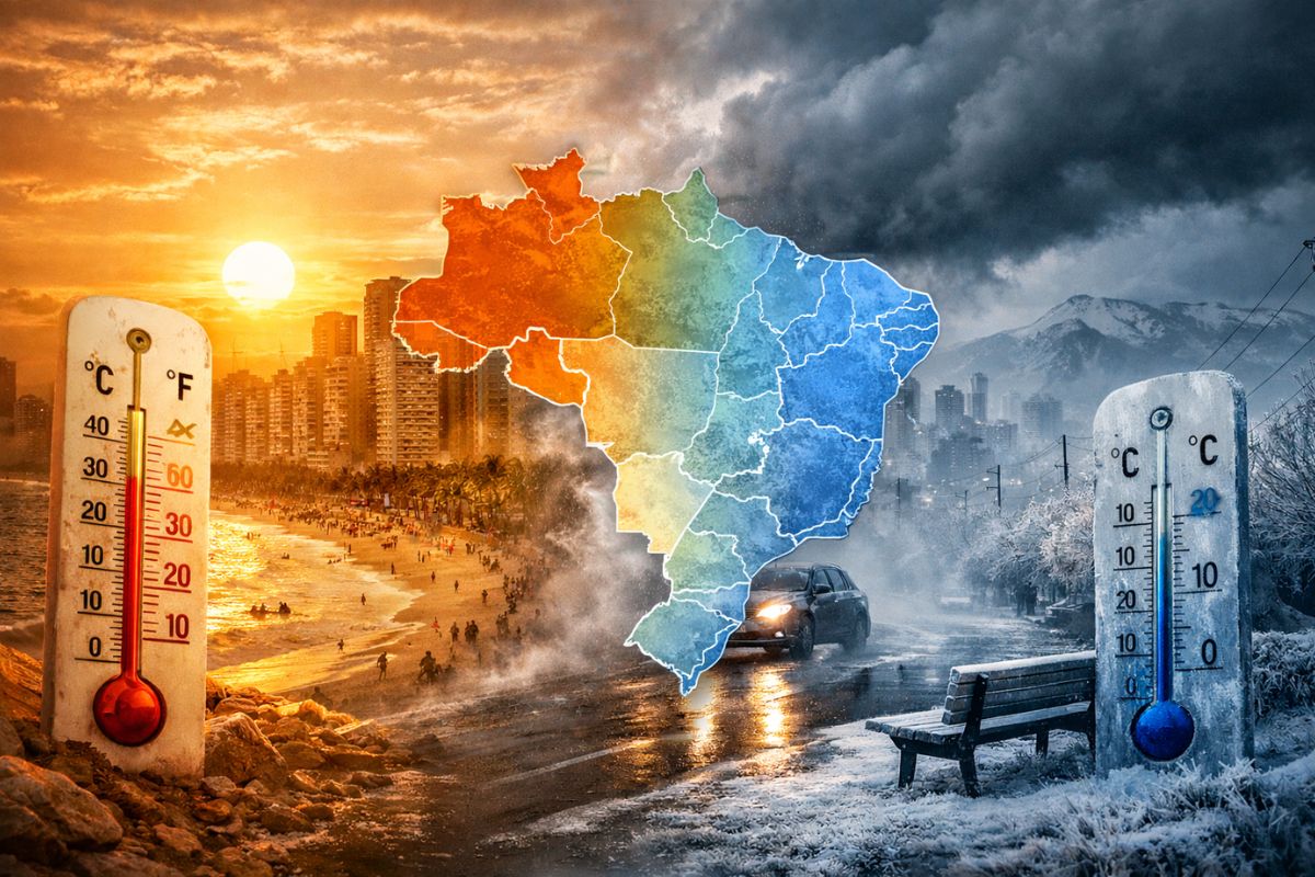
The Cold Air Mass That Arrived Behind a Cold Front Associated with an Extratropical Cyclone Changes the Atmospheric Pattern, Lowers Temperatures in Several Regions, Weakens the Heat Bubble and Opens a Sequence of Cool Mornings, Mild Afternoons and an Anticipated Fall Sensation Throughout Brazil.
The cold air mass began to change the climate scenario in Brazil this Sunday (8), interrupting the dominance of intense heat that had been reinforced by a warm air bubble over the country. The shift in the weather occurs after the passage of a cold front associated with an extratropical cyclone formed on Friday (6), a combination that also caused irregular rains and storms in areas of the South, Southeast, and Central-West.
In practice, what changes is the thermal sensation across various regions, especially in the early hours of the day. The mornings become colder, the highs lose strength and the atmospheric pattern moves away from the prevailing heat, creating an environment closer to what is usually expected on the eve of autumn.
How the Cold Air Mass Changed the Weather Pattern in Brazil
The entry of this cold air mass does not happen in isolation. It occurs behind a frontal system and advances precisely when the heat bubble begins to lose intensity. This helps explain why the change is perceived so clearly: after days marked by strong heat in several cities, the colder air begins to take over and alters the behavior of temperatures, both in the lows and the highs.
-
Scientists have found in the dark depths of the North Sea giant marks from 18,000 years ago left by colossal icebergs, and the discovery could help predict the future of Antarctica.

-
In Mexico, a 3,000-year-old Maya site with the dimensions of an entire city may have been built as a colossal map of the cosmos, created to represent the order of the universe and reveal how this people organized space, time, and rituals.

-
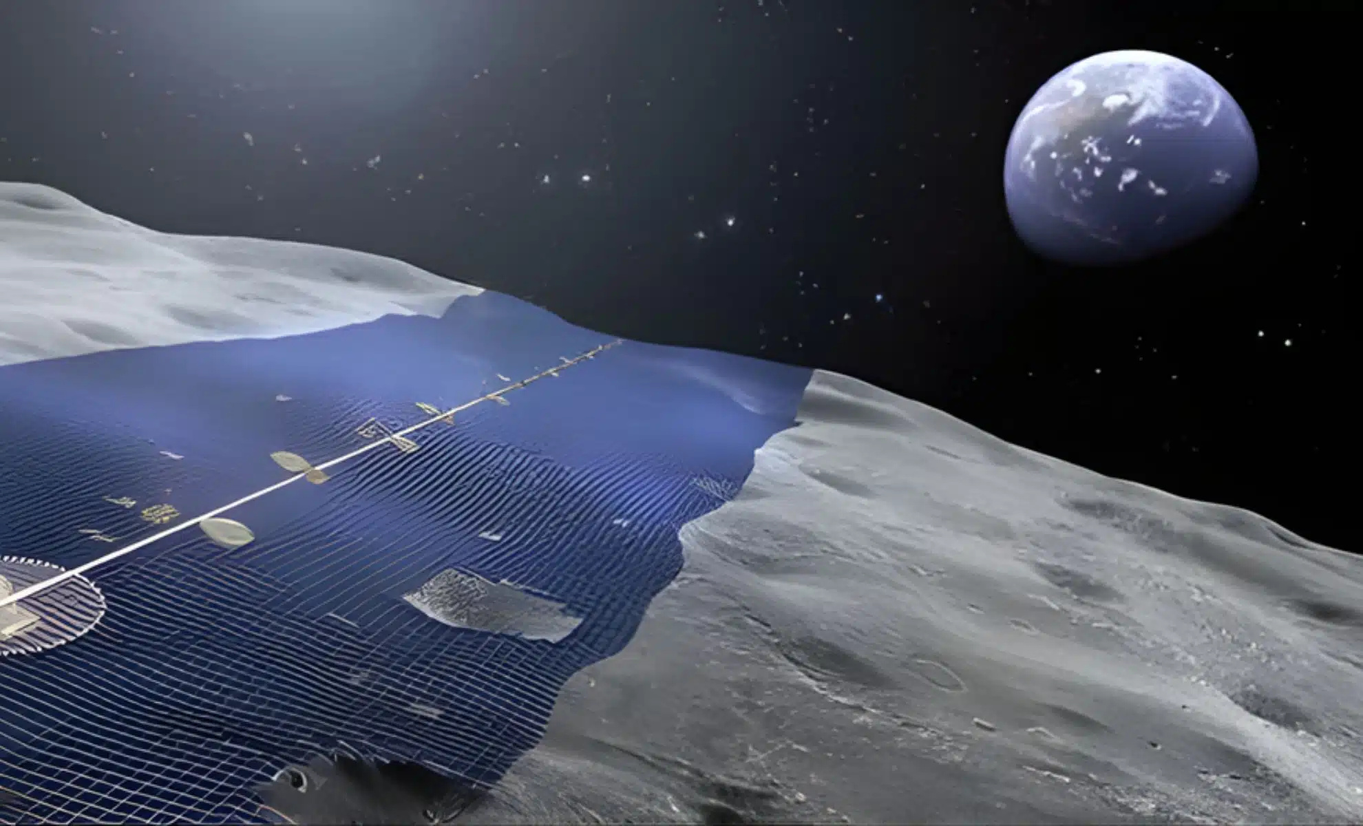
Japan wants to build a solar ring of 10,900 kilometers on the Moon to continuously send energy to Earth.
-
Weighing almost 1 ton, with temperatures of up to 3,000°C, the ability to launch 10,000 fragments within a radius of 1 km, capable of penetrating concrete and melting steel, Turkey’s terrifying bomb emerges as one of the most destructive non-nuclear weapons ever presented.


This movement does not mean a uniform cooling throughout the day in all areas, but represents an important shift in the dominant pattern. The atmosphere stops favoring intense heat and starts to respond to the presence of cold air and rain, which lowers the maximum temperatures over a broad area of the country. It is this combination that makes the thermal relief appear more consistently and gives Brazilians the first more concrete sign of the transition to autumn.
Where the Cold Appears First and Which Regions Are Expected to Feel the Most Temperature Drop
The first areas to register the lowest values are the Gaúcha and Catarinense mountains, where the cold air mass arrives with more intensity. In these regions, already on Monday (9), the thermometers could indicate values up to 8°C below average, and the temperature throughout the day tends to vary little. The cold is not restricted to the morning: in higher areas, the highs also struggle to rise, and the thermometers should not exceed 14°C.
In addition to the mountains, the cooling range spreads over a large part of Rio Grande do Sul, Santa Catarina, and the central-eastern region of Paraná, with mornings close to 15°C. Afterwards, the coverage expands across the South, parts of the Southeast, and the Central-West, especially in the early hours of the morning. The lowest lows, between 10°C and 12°C, remain concentrated in the higher areas, but the cold air also reaches the eastern part of the Southeast, including areas of São Paulo and Rio de Janeiro. That is when the change stops being localized and starts to be felt by a much larger portion of the population.
Why the Morning Will Be Colder and the Afternoon May Still Have Differences Between the Regions
One of the central points of this change is how the cold air mass manifests throughout the day. The strongest impact appears in the morning, when the atmosphere favors lower temperatures and the feeling of cold becomes more evident. This explains why many cities should start the day with much milder marks than those recorded in the previous week, especially after a period of persistent heat.
During the afternoon, however, the behavior varies according to the region. In the higher areas of the eastern part of Rio Grande do Sul, Santa Catarina, and Paraná, the sensation of cold tends to persist for a longer time. In other areas, even with the presence of the cold air mass, the temperatures rise again throughout the day, although without repeating the same pattern of recent intense heat.
This difference between morning and afternoon shows that the system does not operate the same way everywhere, but still imposes a clear retreat in maximum temperatures in a vast area of the country, which should remain between 18°C and 21°C.
How Much the Temperature Can Fall and How Long the System Continues to Act
The numbers help to measure this change. In the higher areas of the South, the lows can range between 10°C and 12°C, while parts of the mountains may register values significantly below the climatic average for the period.
At the same time, in a range that goes from northern Rio Grande do Sul to Santa Catarina, Paraná, and eastern São Paulo and Rio de Janeiro, the highs are expected to oscillate between 18°C and 21°C. After a series of days marked by intense heat, this drop alters the daily routine and changes the thermal perception immediately.
The broader acting of the cold air mass should last until Wednesday (11). On Tuesday (10), the cold is still present, maintaining the lowest lows in elevated areas and supporting milder afternoons in different regions.
From Thursday (12) onwards, the trend is that the cold air will become more restricted to the higher areas of the eastern range between the South and the Southeast. This indicates that the most widespread peak of the change has a relatively short duration, but sufficient to consolidate a span of cool days that breaks the recent dominance of heat.
What This Turn Represents for the Next Days
More than a simple point drop in temperature, the arrival of the cold air mass represents an important inversion in the behavior of the weather in several regions of Brazil.
The country shifts from a scenario dominated by persistent warm air to a period where cooling gains prominence, especially in the mornings, and where rain also helps to keep the highs below average over a large area.
This type of change draws attention because it occurs just on the eve of autumn and reinforces the feeling of seasonal transition.
The heat loses strength, the mornings become harsher in some places, and the country enters, albeit for a few days, a climatic rhythm quite different from what has been observed so far.
In your city, has the cold air mass already changed the morning routine, or does the heat still resist during the afternoon? Share how the weather is there and if this first signal of autumn has already been felt in daily life.


-

Uma pessoa reagiu a isso.