 Portuguese
  English
  Spanish
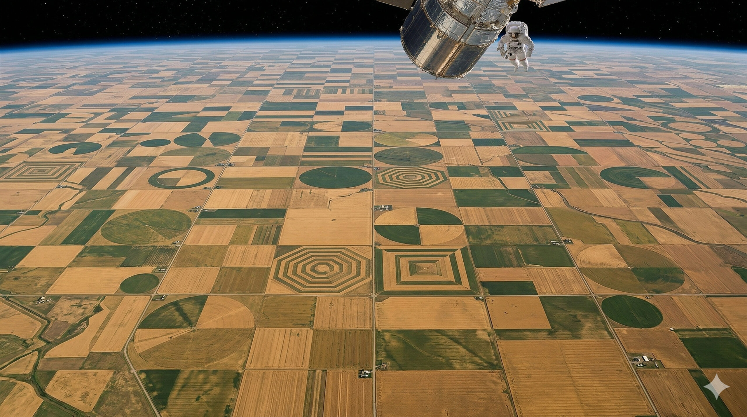
Region with more than 20 thousand km² of wheat in Montana creates geometric patterns so perfect they are visible from space and intrigue scientists.
In 2025, analyses released by the NASA Earth Observatory once again highlighted one of the most unusual agricultural landscapes in the United States: the region known as the Golden Triangle, located in the state of Montana. What sets this area apart from other agricultural regions is not only its productivity but the visual pattern that emerges when the territory is observed by satellites. According to NASA itself, the wheat fields in north-central Montana exhibit striking geometric patterns when viewed from space, forming a composition of squares, rectangles, triangles, and circles that blends with the winding path of the Missouri River and its tributaries.
With about 5 million acres harvested of wheat in Montana in 2024, equivalent to just over 20 thousand km², the cereal remained the crop with the highest economic value in the state, and a significant portion of this production is concentrated precisely in the Golden Triangle. In the images analyzed by NASA, the southern portion of this region appears around Great Falls, Dutton, and Fort Benton, where the combination of dryland farming, localized irrigation, and regular land division produces a mosaic of lines, blocks, and extremely defined geometric figures, often compared to an abstract painting.
According to NASA itself, this effect is not the result of any aesthetic intention but of the interaction between intensive agricultural land use, geometric division of properties, the presence of center pivot irrigation areas, and the physical configuration of the regional landscape. The result is one of the most impressive examples of how large-scale mechanized agriculture can transform territory into a unique visual pattern when observed at an orbital scale.
-
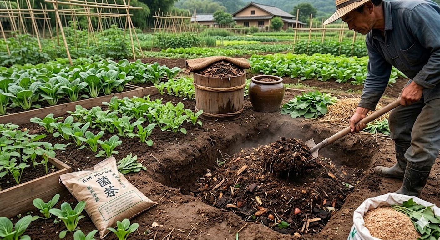
Bokashi, an Asian-origin fertilizer, is formed through the fermentation of husks, organic matter, and microorganisms, gaining traction in agriculture for strengthening beds and accelerating soil life.
-
Money with chickens: how much can 200 laying hens yield per month with eggs at R$ 12 per dozen?

-
As dams and pollution advance, migratory freshwater fish are facing a silent global crisis that has already decimated populations, threatened fisheries, and raised alarms in major basins.

-
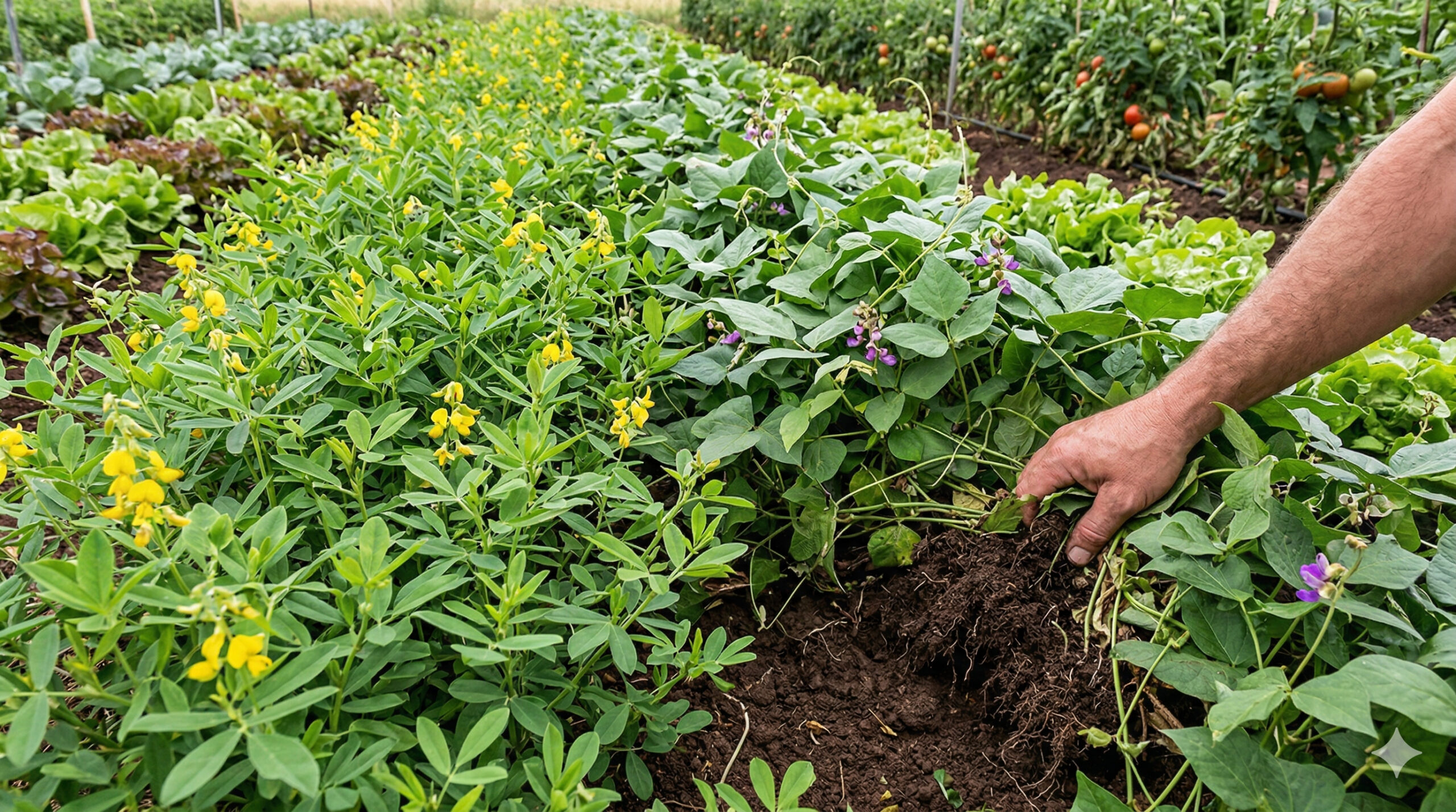
Crotalaria, mucuna, and other cover crops stop being “weeds” between harvests and become central to agriculture by improving the soil, adding biomass, and enhancing green fertilization in vegetable production.

Region of 20 thousand km² places Montana among the largest hard wheat poles in the United States
The Golden Triangle is not only visually striking but also strategic from a production standpoint. The region is one of the main areas for growing hard red spring wheat, a variety highly valued by the food industry due to its high protein content.
This productive scale is sustained by a continuous and relatively homogeneous territory, allowing for highly efficient agricultural operations. Large-scale production in this region supplies not only the internal market of the United States but also global export chains.
The territorial extent directly contributes to the geometric pattern observed from space. Fields that individually occupy hundreds of hectares connect to others with similar shapes, creating a repetitive and highly organized visual system.
Historical division of lands creates agricultural grid that defines the geometric pattern observed by satellite
One of the main factors responsible for the formation of geometric figures is the land division system adopted in the United States since the 19th century. The model known as Public Land Survey System (PLSS) established a parceling pattern based on rectangular grids, which still directly influences agricultural organization today.

This system divides the territory into regular blocks, usually aligned with cardinal points. In the Golden Triangle, this logic translates into:
- rectangular and square fields with well-defined boundaries
- precise alignment between neighboring properties
- visual continuity between different productive areas
This pattern of territorial organization is one of the main reasons for the geometric appearance observed in satellite images, creating a repetition effect that extends over thousands of square kilometers.
Large-scale agricultural machines reinforce straight lines and symmetric patterns in cultivation
Another determining factor for the visual design of the region is the intensive use of large-scale agricultural machinery. Modern equipment, such as planters, sprayers, and harvesters, operate more efficiently in large areas with regular shapes.
These machines follow linear and parallel trajectories during planting and harvesting, which contributes to the formation of extremely organized patterns in the soil. The crop lines, when viewed from above, appear as:
- perfectly aligned parallel strips
- blocks with uniform filling
- straight and continuous boundaries
This systematic repetition creates a visual pattern that, at an orbital scale, resembles artificial structures or even works planned for aesthetic purposes, although it is a direct result of operational efficiency.
Flat topography allows visual continuity and eliminates natural interferences in agricultural design
The geography of the Golden Triangle also plays a fundamental role in the formation of this pattern. The region features flat to gently rolling terrain, with few natural barriers that interrupt the continuity of the fields.

Unlike mountainous or forested areas, where cultivation is fragmented, northern Montana allows for the formation of large continuous agricultural blocks. This favors:
- horizontal expansion of crops
- maintenance of straight lines over long distances
- visual uniformity between different properties
This geographical characteristic is essential for the geometric pattern to become visible on such a large scale.
Color variation throughout the year intensifies the visual effect observed from space
In addition to shapes, the colors of the fields play an important role in the visual perception of the region. Throughout the agricultural cycle, the landscape undergoes changes that reinforce the contrast between different areas.
During the growth of wheat, intense green tones predominate. In the maturation phase, the fields take on a golden color. After the harvest, exposed areas of soil create additional variations in hue.
This alternation generates a dynamic mosaic, where:
- fields at different stages create visual contrasts
- geometric patterns become even more evident
- satellite images capture unique compositions each season
According to NASA, this combination of shape and color is one of the factors that make the region frequently used in Earth observation studies.
Highly mechanized agriculture transforms the region into a global reference for efficient production
The Golden Triangle represents a model of highly mechanized and scale-oriented agriculture. The use of technology allows large areas to be managed with precision, reducing costs and increasing productivity.
This system involves:
- use of agricultural GPS for precise alignment
- monitoring of soil and climate
- automation of planting and harvesting processes
The combination of these technologies contributes not only to productive efficiency but also to the visual regularity that characterizes the region.
Visible pattern from space shows how modern agriculture can redraw the territory on a continental scale
The case of Montana highlights an increasingly common phenomenon: the ability of agricultural activity to alter the appearance of the planet on a scale observable from space. Unlike natural formations, the patterns of the Golden Triangle are a direct result of human action.
This type of landscape demonstrates how technical decisions — such as land division, crop selection, and machinery use — can generate visual impacts detectable by satellites.

The region thus becomes a clear example of how modern agriculture not only produces food but also redefines how territory is organized and perceived.
What this pattern reveals about the future of large-scale agriculture
The geometry observed in the Golden Triangle is not an isolated case but part of a global trend of agricultural intensification. As the demand for food grows, models based on scale, efficiency, and technology tend to expand.
This type of organization can influence:
- land planning in other regions
- adoption of advanced agricultural technologies
- transformation of natural landscapes into productive patterns
The visibility of these systems from space reinforces the magnitude of the changes underway in global agriculture.
Have you noticed that agriculture can create visible patterns from space?
The case of the Golden Triangle shows that agricultural production can go beyond its economic function and generate landscapes that attract attention even from outside the Earth.
In your view, does this type of organization represent only productive efficiency or does it also reveal a new form of human intervention on the planet? Leave your analysis in the comments.


Seja o primeiro a reagir!