 Portuguese
  English
  Spanish
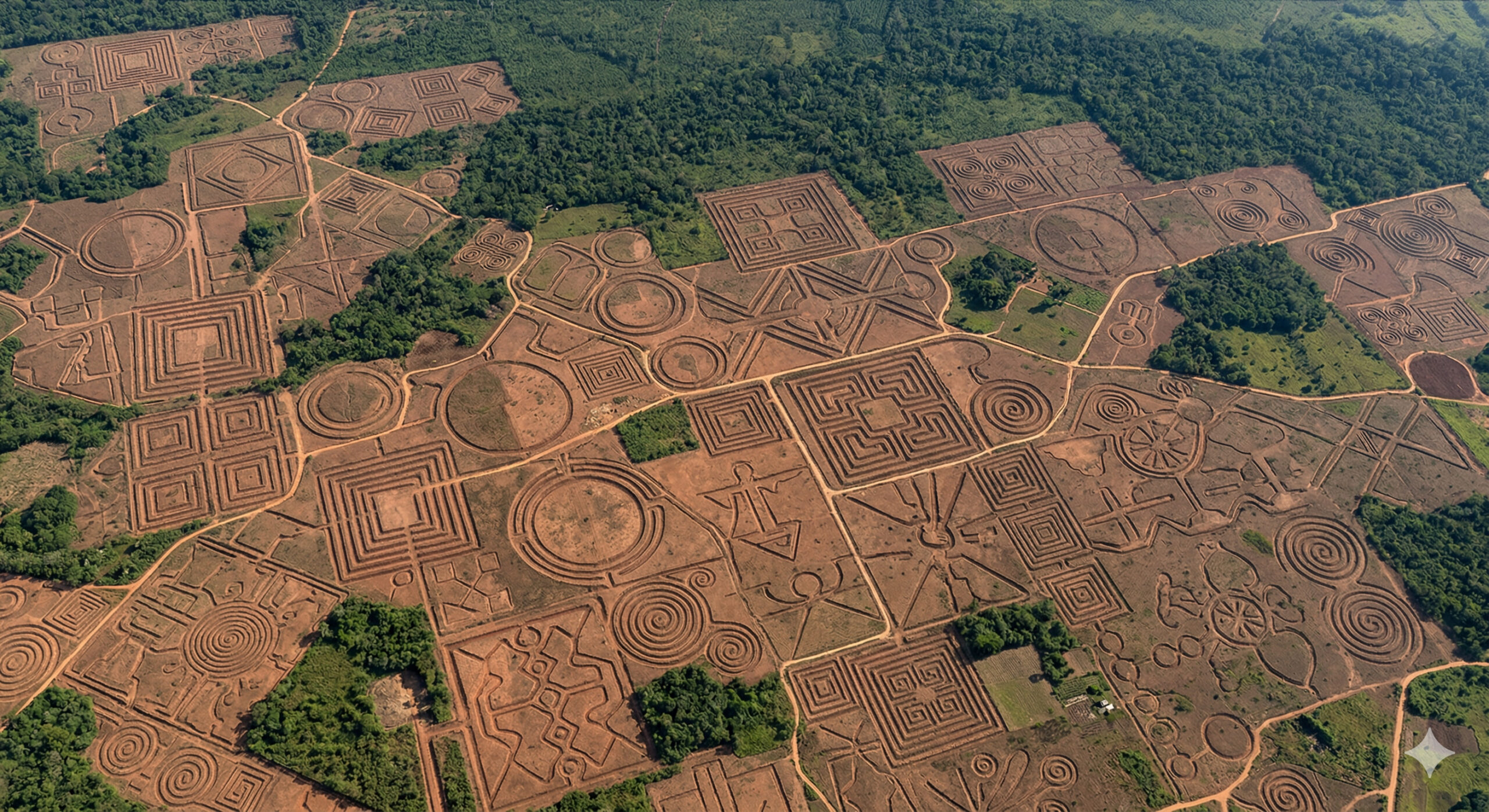
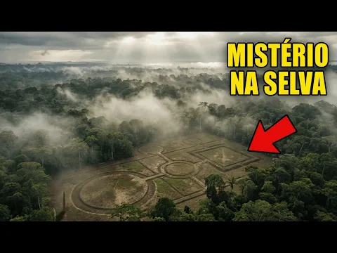
More than 400 geoglyphs in Acre, up to 350 meters, have been hidden for centuries and are now visible from satellite, intriguing scientists.
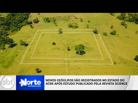
In 2023, new archaeological research supported by remote sensing, aerial images, and high-resolution mapping has once again placed the geoglyphs of Acre at the center of discussions about pre-Columbian human occupation in the Amazon. Concentrated in the state of Acre, especially in the valleys of the Acre, Iquiri, and Abunã rivers, these structures represent one of the most impressive sets of ancient engineering works ever identified in the region. According to a report from Agência FAPESP, more than 450 prehistoric geoglyphs had already been cataloged in Acre, many of them only fully perceptible from high-altitude observations.
The geoglyphs are formed by ditches dug into the ground, creating geometric designs such as circles, squares, rectangles, and concentric circles, which can reach up to 350 meters in diameter. These shapes can only be fully understood when viewed from aerial or satellite images, which explains their international impact. The Agência FAPESP itself describes that, in Acre, these structures vary from 50 to 350 meters in diameter and become visible in aerial flight, reinforcing the role of remote sensing in identifying and studying these archaeological sites.
According to a study published in the journal Nature Communications, the geoglyphs of Acre correspond to geometric enclosures excavated by pre-Columbian indigenous peoples and developed prior to other earthworks in southern Amazonia, flourishing between around 100 and 400 A.D. and showing a clear decline after 1000 A.D.. This evidence has consolidated Acre as one of the key areas to understand that the Amazon rainforest housed societies capable of transforming the landscape on a large scale long before the arrival of Europeans.
-
Few people know, but in Brazil there are cities with curious names like Feliz Natal, Não-me-Toque, and Varre-Sai, which may seem like random names, but originated from real events, local habits, and natural characteristics.

-
No one told you this about rosemary: there is a plant that silently rots its roots, and the place where you plant it makes all the difference between a vigorous herb and a dead plant in just a few weeks.

-
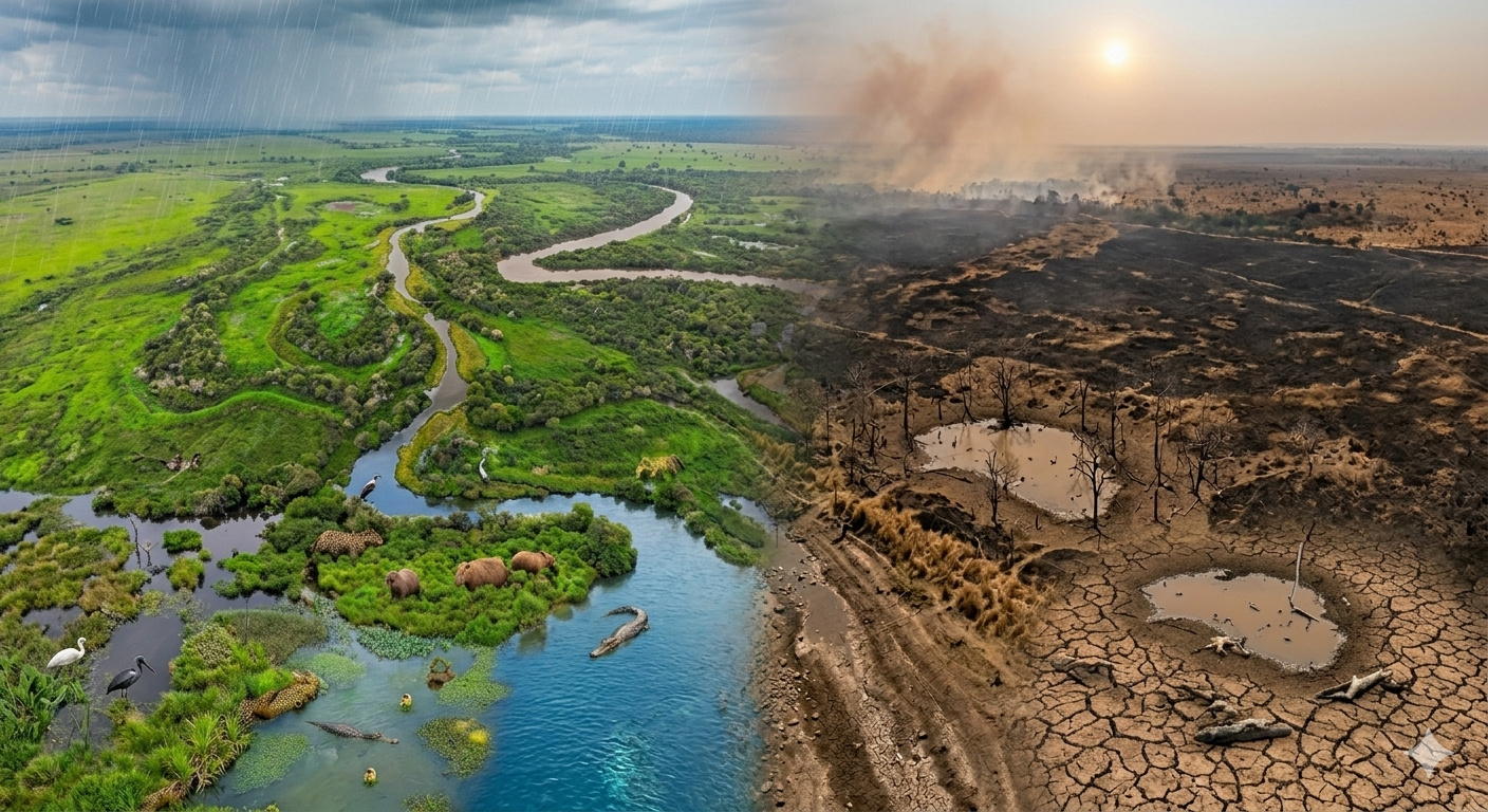
The largest swamp on the planet has lost 57% of its water in less than 12 months, rivers have reached their lowest levels since records began, and NASA satellites have documented in real time the most extreme transformation ever recorded in the Pantanal: the biome, which should be flooded, has turned into a cracked savanna for the first time in 50 years.
-
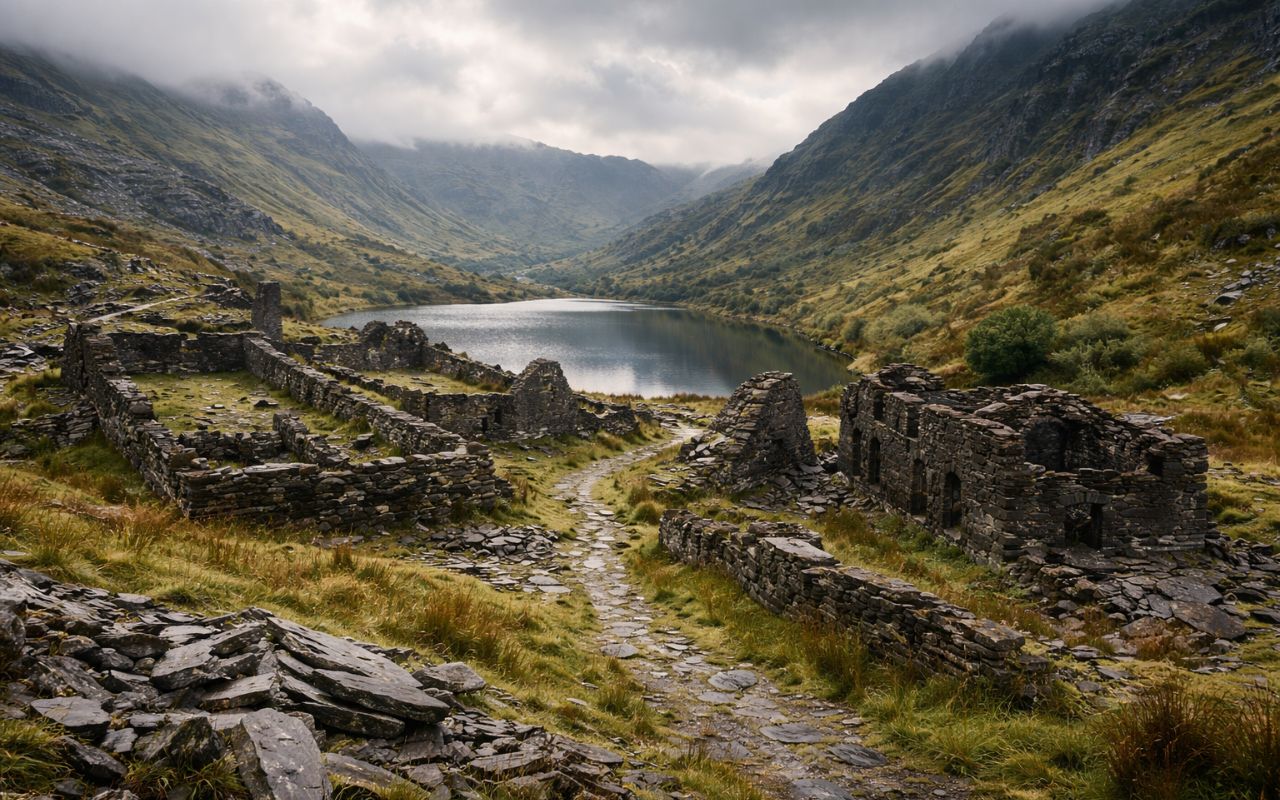
An abandoned villa for over 80 years with underground mines, a 130-meter zip line, historical ruins, and challenging trails makes Cwmorthin, in Wales, an unusual destination.
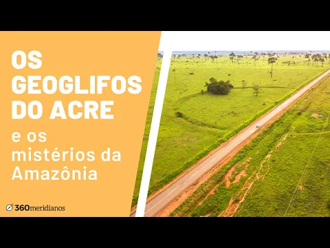
More than 400 geoglyphs have been cataloged and can cover areas equivalent to hundreds of football fields
Currently, researchers have already cataloged more than 400 geoglyphs in the Acre region, although there is evidence that this number may grow with new discoveries. These structures are distributed across dozens of archaeological sites, often connected to each other by elevated pathways or geometric alignments.
The size is impressive. Some geoglyphs reach up to 350 meters in diameter, equivalent to several football fields side by side. The ditches that form the designs can reach several meters in width and depth, requiring a significant volume of manual excavation.
This level of intervention in the soil indicates that the builders possessed:
- technical knowledge of excavation
- collective organization of labor
- advanced spatial planning
The construction of these structures would require not only physical effort but also large-scale social coordination, suggesting the existence of organized and stable communities in the region.
Structures remained hidden for centuries under the forest and were only revealed with deforestation and aerial images
For centuries, the geoglyphs remained invisible beneath the dense cover of the Amazon rainforest. It was only from the second half of the 20th century, with the advance of deforestation and the use of aerial images, that these structures began to be identified.
The discovery process intensified with the use of:
- aerial photographs
- satellite images
- georeferencing techniques
These tools not only allowed the location of the geoglyphs but also mapped their distribution on a large scale. Today, platforms like Google Earth allow anyone to visualize some of these structures, as long as they know where to look.
This late revelation reinforces the idea that the Amazon still holds numerous archaeological traces hidden beneath the vegetation.
Precise geometric shapes indicate planning and are not the result of natural phenomena
One of the main characteristics of the geoglyphs of Acre is the geometric precision of their shapes. Almost perfect circles, well-defined squares, and symmetrical combinations indicate that these structures were carefully planned.
Archaeologists dismiss the possibility of natural origin due to factors such as:
- regularity of the shapes
- repetition of patterns
- alignment between structures
Moreover, the ditches show intentional cuts in the soil, confirming human action. In many cases, there is also evidence of paths connecting different geoglyphs, suggesting an organized network.
Function of the geoglyphs is still debated and there is no scientific consensus
Despite decades of research, the exact function of the geoglyphs of Acre has not yet been fully clarified. Among the main hypotheses raised by experts are:
- ceremonial or ritual use
- social gathering spaces
- territorial markings
- centers of community organization
There is no consistent evidence that these structures were used for permanent habitation. The absence of large quantities of domestic remains reinforces the hypothesis of collective and symbolic use.
This uncertainty is one of the factors that make the geoglyphs one of the greatest archaeological enigmas in South America.
Evidence indicates that the Amazon was densely occupied before the arrival of Europeans
The existence of the geoglyphs challenges an old view that the Amazon was a sparsely populated region before European colonization. On the contrary, these structures indicate the presence of organized populations capable of modifying the environment on a large scale.
Recent studies suggest that these societies:
- practiced sustainable forest management
- modified the soil for agriculture
- built complex structures
This set of evidence reinforces the idea that the Amazon was an intensely occupied and transformed environment by indigenous peoples long before contact with Europeans.
Soil of the region and construction techniques indicate advanced environmental knowledge
Another relevant point is the type of soil used in the construction of the geoglyphs. Excavation was done in areas of dry land, avoiding flooded regions, which demonstrates knowledge about the terrain conditions.
Moreover, there are indications that the builders:
- selected locations strategically
- maintained open areas around the structures
- used the removed soil to form elevations
These practices indicate a mastery of the environment that goes beyond simple occupation, involving planning and adaptation to the ecosystem.
Recent discoveries suggest that hundreds of structures still hide under the forest
With the advancement of technologies such as LiDAR (Light Detection and Ranging), researchers have begun to identify hidden structures beneath the vegetation without the need for deforestation. These studies indicate that the number of geoglyphs may be much greater than currently known.
Areas still covered by forest may hide:
- new geoglyphs
- networks of paths
- associated structures
This reinforces the idea that the Amazon still possesses a vast and partially unknown archaeological heritage.
Some geoglyphs have already been recognized as national archaeological heritage by the IPHAN (Institute of National Historical and Artistic Heritage). One of the most well-known examples is the Geoglyph Jacó Sá, located about 40 km from Rio Branco.
These sites are protected by specific legislation, which prevents their destruction and ensures the continuity of scientific research. Preservation is considered essential, as many geoglyphs are located in areas under pressure from economic activities.
Comparisons with Nazca and other formations reinforce global importance of Amazonian geoglyphs
Often compared to the Nazca lines in Peru, the geoglyphs of Acre present important differences. While Nazca was drawn on the surface of the soil, the Amazonian geoglyphs were excavated, creating structures in negative relief.
This technical difference indicates distinct but equally complex approaches to constructing visible forms from above.
The Amazonian set, however, stands out for its territorial scale and the number of structures distributed across an extensive region.
Do you believe that the Amazon still hides even larger structures under the forest?
The geoglyphs of Acre show that the history of the Amazon is much more complex than previously thought. Giant structures remained hidden for centuries and are only now beginning to be understood.
In your view, how many other works of this type may still be hidden under the forest waiting to be discovered? Leave your analysis in the comments.


Seja o primeiro a reagir!