 Portuguese
  English
  Spanish
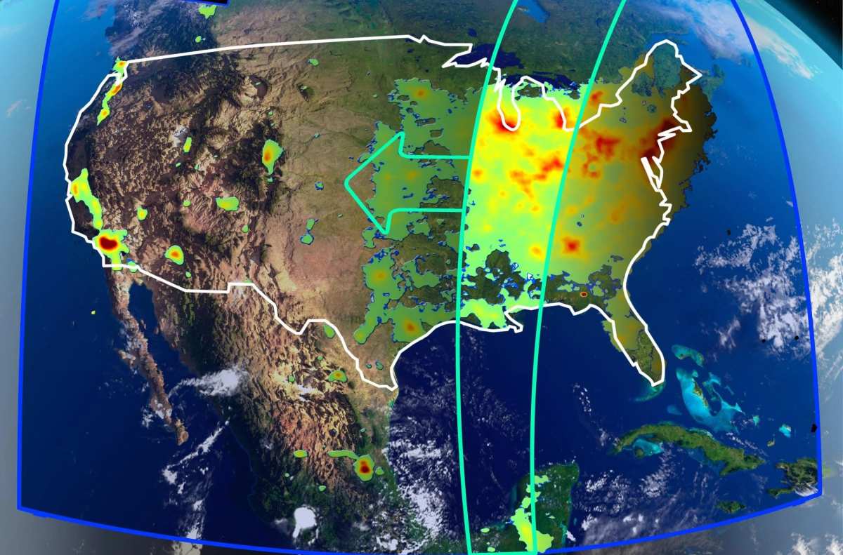
The advancement of NASA’s PACE satellite allows locating, with unprecedented detail and in almost real-time, where air pollution begins in cities, identifying nitrogen dioxide emissions associated with roads, factories, and ports and expanding the database for public health, urban planning, and environmental policies
The NASA PACE satellite has begun to show, with unprecedented detail, where air pollution starts and how it distributes over urban areas. This new capability allows for the identification of nitrogen dioxide emissions associated with roads, factories, and ports on a nearly urban scale, with public data already available.
For years, air pollution appeared in analyses as a broad and diffuse blot over cities. With PACE, this reading gains more precise contours and transforms the problem into a map of specific, recognizable, and measurable sources.
This change represents a shift from general estimates to a much more detailed identification of emission hotspots. In practice, this opens the door for data-driven decisions regarding air quality, urban planning, and public health.
-
Explorers found a colossal underwater mountain hidden in the Pacific, taller than Mount Olympus and nearly four times the Burj Khalifa, and what emerged around it seemed straight out of science fiction, with rare squids, ghost octopuses, and the so-called “flying spaghetti monsters.”

-
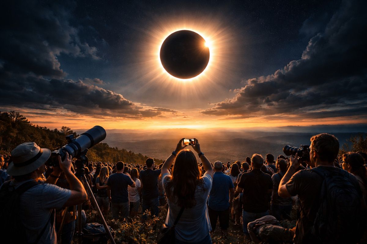
The total solar eclipse in August 2026 will transform the day into “night” for 1 to 2 minutes in the path of totality, when the Moon completely covers the Sun and the perfect alignment creates a rare and highly anticipated spectacle for observers around the world.
-
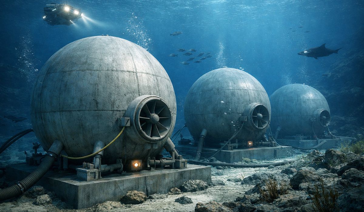
Scientists want to sink giant concrete balls in the sea to transform the ocean floor into a renewable energy storage system that looks like science fiction, using the pressure of the depths as a battery in a kind of invisible power plant underwater.
-
Researchers dive nearly 5,000 meters deep in Japan, discovering a rare “glass castle” inhabited by unknown species and demonstrating that the oceans remain one of the greatest mysteries of the planet.

NASA satellite reveals pollution sources with greater precision
The new maps produced by PACE show NO₂ in distinct plumes, no longer diluted in regional averages. In cities like Los Angeles, emissions appear as bands linked to highways, industrial zones, and port areas.
As a result, pollution is no longer treated as an abstract phenomenon and is instead related to concrete infrastructures and mobility patterns. This type of reading allows for the identification of which areas face worse air quality based on direct observation, rather than assumptions.
The main instrument of NASA’s satellite, the OCI, was not originally developed to detect this pollutant. The initial mission of the equipment was to study oceans, clouds, and aerosols, but the use of machine learning expanded its application.
The advancement was achieved through training using data from the European TROPOMI satellite, which was already conducting large-scale atmospheric measurements. The combination of a sensor created for another function and intelligent data processing allowed for the extraction of new environmental information.
This result also reinforces a trend in environmental science, where progress does not solely depend on hardware. The treatment of data and the refinement of algorithms now play a decisive role in expanding the scientific reach of space missions.
NO₂ helps anticipate risks for cities, crops, and health
Nitrogen dioxide is treated as a direct indicator of combustion processes, such as traffic, power plants, and fires. Additionally, it is one of the main contributors to the formation of tropospheric ozone, associated with the toxic haze that irritates lungs and harms crops.
Understanding the origin of NO₂ allows for earlier predictions of where ozone may arise. This monitoring creates the possibility of more accurate alert systems and near real-time decisions during episodes of elevated pollution.
The potential impact reaches different sectors. Identifying critical emission points can prevent generic measures and favor more targeted actions in areas truly affected.
This more precise reading also improves the evaluation of already implemented policies, such as low emission zones in European cities. Instead of relying solely on fixed monitoring stations, it becomes possible to observe the effect of measures across the entire territory.
In agriculture, the utility of the data also appears directly. As tropospheric ozone affects agricultural production, knowing more precisely where it forms helps anticipate damage.
In the health sector, the gain is linked to the quality of decisions. With more accurate data, the trend is to reduce unnecessary exposures and improve responses in critical pollution scenarios.
Precision, public data, and system limitations
The data obtained by NASA’s satellite were compared with ground measurements. The result indicated a slight underestimation between 10% and 20%, a performance described as consistent.
Even without perfection, the utility of the system lies in the combination of local measurements and a global view. No isolated method can cover the entire dynamics of atmospheric pollution on its own.
The data has been publicly available since March 2024, accelerating use by cities, researchers, and environmental agencies. In some urban environments, this information has already been combined with traffic, climate, and urban planning data.
Despite the advancement, there are significant limitations. Over water, the signal is harder to interpret due to light reflection, while clouds and angles of observation can also compromise readings and generate errors.
The PACE project does not yet operate alone in tracking pollution. It is complemented by the TEMPO satellite, responsible for continuously monitoring the evolution of pollution throughout the day.
The combination of the two systems expands the reach of observation. PACE offers high spatial resolution, while TEMPO provides temporal evolution, allowing us to see where pollution comes from and how it moves.
There is also an additional effect for the mission itself. The measurement of gases like NO₂ and ozone improves the accuracy of other studies conducted by PACE, such as the analysis of ocean color, especially in coastal areas where atmospheric pollution alters sensor readings.
The next step of the mission involves refining algorithms, expanding validations, and reducing errors in complex conditions. Even so, the change is already underway: NASA’s satellite begins to shift the debate from simple pollution measurement to more precise management, connected to public policies, urban planning, and health.
Via NASA


Seja o primeiro a reagir!