 Portuguese
  English
  Spanish
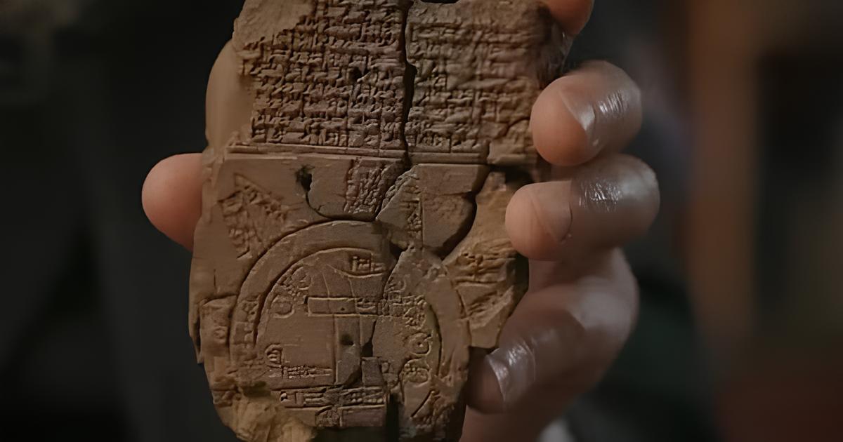
Discover the Ga‑Sur Map, a 4,200-Year-Old Clay Tablet Considered the Oldest Map in the World — a Landmark of Cartography That Reveals How the Sumerians Already Mapped Lands in Ancient Mesopotamia.
Since humans began organizing into societies, the need to represent the world around them became inevitable. The curiosity to understand territories, define borders, and record landscapes gave rise to one of the most transformative inventions in our history: the map. Long before satellites, compasses, or GPS systems existed, early civilizations sought to translate physical space into symbols and lines. Among the oldest records ever found, one piece in particular fascinates historians and archaeologists: the Ga‑Sur Tablet, considered by many to be the oldest map in the world.
Dating back approximately 4,200 years (c. 2,500 BC), the small clay tablet was discovered in the territory that corresponds to modern-day Iraq, in the heart of Mesopotamia, the cradle of some of the earliest human civilizations. More than just an archaeological artifact, the Ga‑Sur map is a testament to how the Sumerians already had an advanced perception of space and territorial organization.
Ga‑Sur Map: The Beginning of Cartography in Ancient Mesopotamia
Found in the ruins of the ancient Sumerian city of Nuzi, near modern-day Kirkuk, the Ga‑Sur map is now preserved in the Ancient Eastern Museum in Istanbul.
-
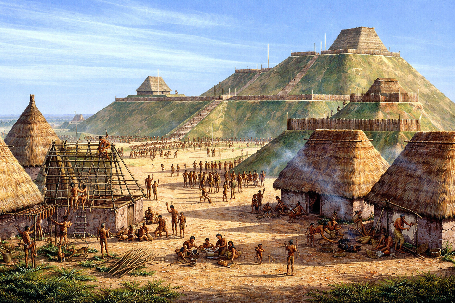
With over 14 million baskets of earth moved, an ancient North American metropolis built a monumental pyramid of 30 meters and established a city with 20,000 inhabitants nearly a thousand years ago.
-
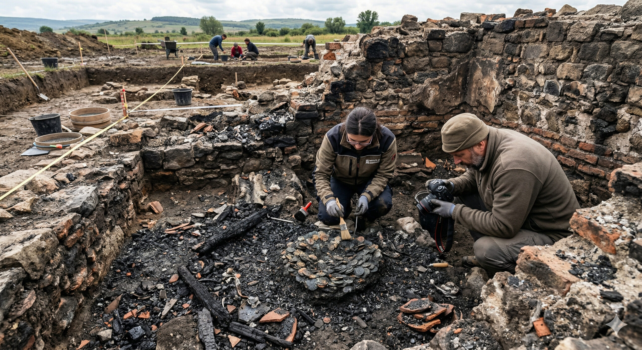
A 1,900-year-old treasure emerges from a Roman house destroyed by fire and sealed since antiquity in Romania, with coins and metals fused among the ashes.
-
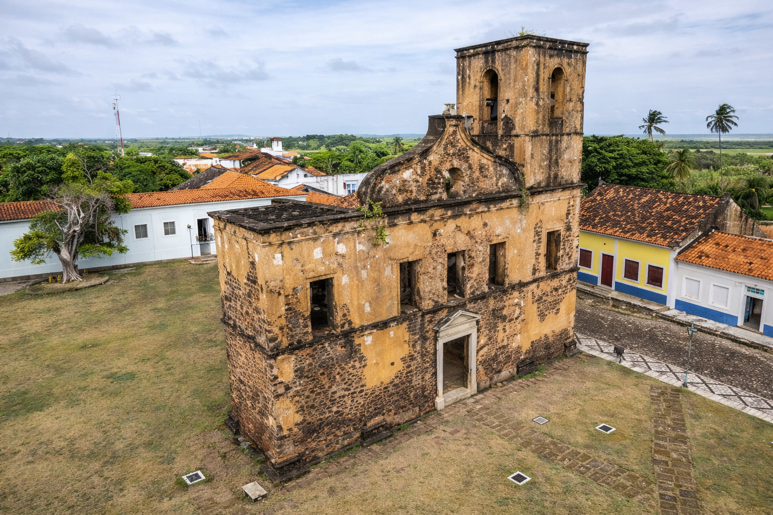
The Brazilian colonial city that stopped in time and shares territory with a rocket launch base.
-
79-year-old woman challenges limits, visits 193 countries in the world after 56 years of planning and reveals the behind-the-scenes of a global journey that few have managed to accomplish.


Despite its modest size and simple lines, what it reveals is extraordinary: agricultural properties, irrigation channels, and land divisions are represented, demonstrating that, even in the Bronze Age, the Sumerians understood the importance of graphically recording the land they cultivated.

More than a practical tool, the map also had a symbolic aspect. It not only showed physical boundaries but also reflected how a society organized itself and viewed the world. It is the seed of what we now call cartography — a concept that would evolve over the millennia, but which had Ga‑Sur as one of its earliest chapters.
Oldest Map in the World: Ga‑Sur or Imago Mundi?
The Ga‑Sur map is considered by many experts to be humanity’s first cartographic sketch. However, there is another famous contender for this title: the Imago Mundi, a Babylonian tablet dated to around 600 BC.
Unlike the Sumerian map, which had a more functional purpose, the Imago Mundi is seen as the first known world map. In it, Babylon appears at the center of the world, surrounded by a large circular river — interpreted as the ocean — and featuring seven “islands” representing distant, often mythical, lands.
The map blends geographical knowledge with cosmology and religion, reflecting how the Babylonians conceived the universe.
Despite the fascination with the Imago Mundi, the Ga‑Sur map remains the oldest evidence of a map with a practical and administrative function, recording space in a rudimentary yet highly significant way.
Ancient Cartography: What Were the First Maps Used For?
The first maps, like the Ga‑Sur, did not have the precision and scale of modern maps. They were simple representations, but loaded with meaning. In Mesopotamia, for example, these records served various functions:
- Managing agricultural properties and irrigation systems, vital for a society that depended on cultivation and flood control of the Tigris and Euphrates rivers;
- Organizing the division of land among temples, kings, and peasants, ensuring that boundaries were respected;
- Expressing beliefs and worldview, connecting geography to local cosmology and religion.
In other words, these maps were both administrative tools and cultural expressions, serving to manage territory while also reinforcing the social and spiritual order of the time.
Clay Map: The Symbolic and Historical Value of the Tablet
The fact that the Ga‑Sur map is inscribed in clay says a lot about the technology and customs of Mesopotamia.
Before the use of papyrus, parchment, and later, paper, clay was the main support for written and graphic records. Inscribed with wooden or metal styluses, these tablets were then fired to ensure durability.
This explains how the map has survived for over four millennia. The durability of the material has preserved not just a trace of cartography but a window into the mindset and needs of one of the earliest organized societies on the planet.
From the Ga‑Sur Tablet to Modern Cartography
From the simple stroke on a clay tablet to digital geolocation systems, the history of cartography has come a long way. After Ga‑Sur came Egyptian maps, Greek and Roman maps, and, centuries later, the groundbreaking works of Ptolemy, Al‑Idrisi, and Mercator, which shaped our worldview.
Today, we use mapping apps with a click, but everything started with artifacts like Ga‑Sur. They show that the desire to represent space and understand our place in the world is an intrinsic human need — as old as civilization itself.
More than the “oldest map in the world“, the Ga‑Sur tablet is a landmark in the history of cartography and a reminder of how human thought has evolved. There, in crude lines etched into clay, lies the beginning of a journey that took us from the first land divisions to real-time satellite images.
The Ga‑Sur map is not just a museum object. It is a link between past and present, showing that, since those early strokes, humans have sought to understand, organize, and leave marks on the world they inhabit.


Seja o primeiro a reagir!