 Portuguese
  English
  Spanish
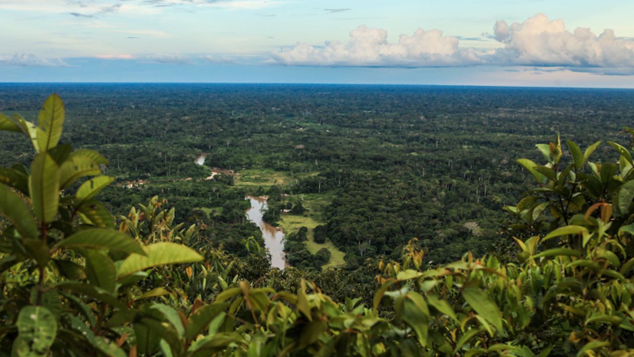
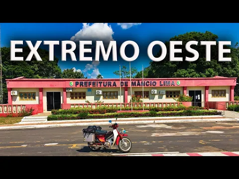
Mâncio Lima (AC) Is Not Just a Dot on the Map: Discover the City’s Routine with 2 Hours Less Than Brasília, the Unique Geology of the Serra do Divisor, and the Challenges of Living at the Country’s Edge.
At the westernmost point of the map, where Brazilian territory bids farewell to the sun daily, lies the westernmost municipality in Brazil: Mâncio Lima, in Acre. Far from being just a geographical curiosity, the city and its surroundings, dominated by the Serra do Divisor National Park, represent a microcosm of the complexities of the Amazon. With its own time zone, defined by a strong local identity, and a landscape that challenges the Amazonian plain, the region serves as a living laboratory for conservation and development.
Life in Mâncio Lima is governed by a clock that shows two hours less than Brasília, a popular achievement that reflects the desire to align official time with the rhythm of nature. This temporal uniqueness serves as the backdrop for a reality of geographic isolation and economic dependence but also of spectacular biodiversity and innovative initiatives that seek a sustainable future for the forest. It is in this remote frontier that Brazil confronts its own views on integration, autonomy, and the value of its natural heritage.
The Geography of the End: Where the Sun Bids Farewell to Brazil
The identity of Mâncio Lima is intrinsically linked to its condition as an extreme point. According to data from the Brazilian Institute of Geography and Statistics (IBGE), the municipality officially holds the title of the westernmost point of the country: the source of the Moa River, in the Serra do Divisor, directly on the border with Peru. However, this landmark is not an easily accessible monument like other national extremes. Its remote and hard-to-reach location has historically limited human presence and infrastructure, a factor that, on one hand, imposed logistical challenges and, on the other, served as a natural barrier for preserving its ecosystems.
-
Iceland accidentally drilled into a magma pocket at 2,100 meters and revealed that the extreme heat beneath the crust could pave the way for a new source of continuous energy.
-
Discovery of a 15-kilometer labyrinth beneath the buildings of Rome raises alarm for collapses and reveals the largest underground network ever found in the Italian capital.
-
A rare storm phenomenon in the United States alerts meteorologists worldwide due to four different forms of water falling from the sky, which freeze immediately upon touching the ground, poles, cars, or trees.

-
He has been using a wheelchair for almost 10 years, lives alone, is independent, and decided to become a delivery driver for an app: Samuel makes up to 6 deliveries a day, covering routes of 1 km in his wheelchair and has even managed to do 2.5 km in a single run.


This physical distance is emphasized by its distance from the center of political and economic power. Mâncio Lima is the Brazilian municipality farthest in a straight line from the federal capital, Brasília. This immense geographical void reinforces a sense of peripherality, shaping the culture, economy, and political relations of the region with the rest of the country. The “last sunset” is therefore not just a beautiful astronomical phenomenon but a powerful metaphor for Mâncio Lima’s position in the national tapestry: a border place, an endpoint, and an identity forged in distance.
Time in Acre: The Struggle for Its Own Time Zone
One of the region’s most peculiar characteristics is its time zone, an issue that evolved from a technical detail into an intense civic battle. Since 1913, Acre was in the GMT-5 time zone, with two hours less than Brasília, an alignment that respected the local solar cycle. However, in 2008, Law 11.662, as reported by the National Congress, moved the clocks forward by one hour, arguing that it would facilitate economic and cultural integration with the rest of Brazil. The change, implemented without public consultation, generated immediate and profound dissatisfaction.
The population felt that the new time disrespected their way of life, forcing children to go to school in the dark and misaligning the workday with natural light. The popular reaction culminated in a referendum in 2010, in which 56.77% of voters opted to return to the old time zone. After a long political impasse, the popular will prevailed with the sanctioning of Law 12.876/2013, which officially restored the time zone of two hours less than Brasília. This struggle was not just about hours but about the affirmation of a regional identity against pressures for uniformity, prioritizing local well-being over forced integration.
Serra do Divisor: An Amazon with Mountain Range Relief
Dominating the landscape of Mâncio Lima is the Serra do Divisor National Park, one of the jewels of Brazil’s conservation system. Established in 1989, the park spans over 843 thousand hectares, making it one of the largest areas of integral protection in the country, according to the Chico Mendes Institute for Biodiversity Conservation (ICMBio). Its importance, however, goes beyond size. The range is a geological anomaly: in a predominantly flat basin, it presents a rugged and mountainous relief, with Acre’s highest point at 609 meters in altitude.
This unique topography is a direct consequence of the uplift of the Andes Mountains. The ICMBio explains that this massive geological event created folds and faults that gave rise to the range, making it a transition zone between the lowlands of the Amazon and the foothills of the Andes. This “Andean feature” within Brazilian territory creates a mosaic of distinct microclimates and habitats. It is this geodiversity that serves as a driving force for the extraordinary biological wealth of the park, making geology the fundamental cause of its hyperdiversity.
A Sanctuary of Biodiversity Under Threat
The Serra do Divisor is globally recognized as one of the areas with the highest biodiversity in the Amazon. Scientific surveys, cited by the ICMBio, reveal an impressive wealth, with over 1,200 recorded animal species, including hundreds of species of birds, amphibians, and mammals. The park serves as a crucial refuge for healthy populations of threatened species, such as the jaguar (Panthera onca), puma (Puma concolor), giant river otter (Pteronura brasiliensis), and the red uakari monkey (Cacajao calvus).
Despite its importance and apparent isolation, this sanctuary faces severe threats. The most serious is the proposed construction of a highway linking Cruzeiro do Sul (AC) to Pucallpa, Peru, whose route would cut directly through the park. Amazonian experience shows that roads are vectors of deforestation, illegal logging, land grabbing, and hunting. The construction of the road would not only fragment Brazilian unity but break a vital ecological corridor connected to the Sierra del Divisor National Park in Peru, causing an ecological impact on an international scale.
The Economy at the Edge of Brazil: Dependence vs. Innovation
The socioeconomic reality of Mâncio Lima reflects the challenges of its location. With a population of just over 19,000 spread across a vast area, the municipality has a very low population density, according to the IBGE. Analysis of the Gross Domestic Product (GDP) reveals a deep dependence on the public sector, which accounts for more than half of the local economy, sustained by federal and state transfers. This structure creates vulnerability to political fluctuations and hinders the development of a robust private sector.
Amid this scenario, initiatives emerge pointing to an alternative path. The industrial complex of the Coffee Cooperative of Juruá (Coopercafé) is one example. It is the largest structure of family agriculture dedicated to coffee production in the North Region, bringing producers together to process high-quality beans with cutting-edge technology. The project stands out for its commitment to sustainability: the entire operation is powered by solar energy and production takes place in previously degraded areas, avoiding new deforestation. This initiative proves that it is possible to reconcile economic growth with forest conservation.
Mâncio Lima is much more than the geographical endpoint of Brazil. It is a critical frontier where the future of the Amazon is decided. Its unique identity, forged by isolation and a strong local culture, alongside the incomparable natural wealth of the Serra do Divisor, represents a heritage of inestimable value. The choice between a development model based on large infrastructure projects, with high environmental risk, and a model focused on standing forest economy, which values biodiversity and generates income for communities, has never been clearer. The path that the westernmost municipality in Brazil will take will be an indicator of the country’s commitment to a truly sustainable future.
Living in a place with its own time zone and such lush nature, but facing so many challenges of isolation and threats, what feelings does it awaken in you? Share your perspective in the comments: what should be the future of the westernmost municipality in Brazil?


-

-

-

-

-

-

93 pessoas reagiram a isso.