 Portuguese
  English
  Spanish
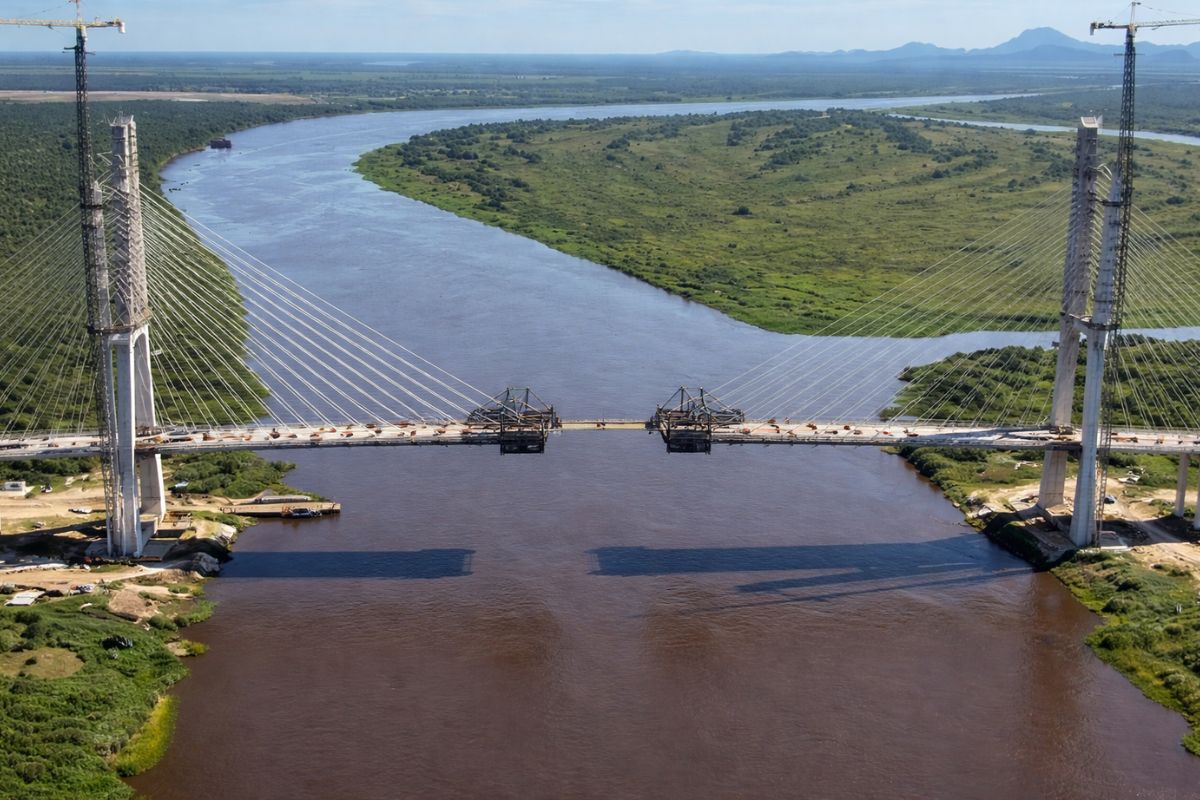
The Bioceanic Route Bridge over the Paraguay River is 46 meters away from connecting Brazil and Paraguay, with structural connection expected in May and inauguration in the second semester, completing the logistical corridor that links the Atlantic to the Pacific by land.
The countdown for one of the most ambitious infrastructure projects in South America has entered its final stretch. Only 46 meters remain for the two ends of the Bioceanic Route Bridge to meet over the Paraguay River, linking Porto Murtinho in Mato Grosso do Sul to Carmelo Peralta in Paraguay. The bridge is the missing link to connect the Atlantic to the Pacific by land. This information was confirmed this week through land records and aerial drone images, which showed the remaining distance equivalent to about a minute of leisurely walking.
The Bioceanic Route Bridge is the centerpiece of a project that aims to connect Brazil, Paraguay, Argentina, and Chile by land, creating a logistical corridor capable of transporting goods to ports in northern Chile on the Pacific Ocean. According to Campo Grande News, the connection between the two ends of the structure is expected to occur in early May, with a total completion date for the project anticipated by August 2026. Work had been temporarily suspended due to the Holy Week holiday, but teams are expected to resume activities focusing on the concreting of the central section over the river.
What is the Bioceanic Route Bridge and why does it change the map of South America

The Bioceanic Route Bridge is not just a crossing over the Paraguay River. It is the missing physical link needed to enable a land corridor between the Atlantic Ocean and the Pacific Ocean, crossing four South American countries.
-
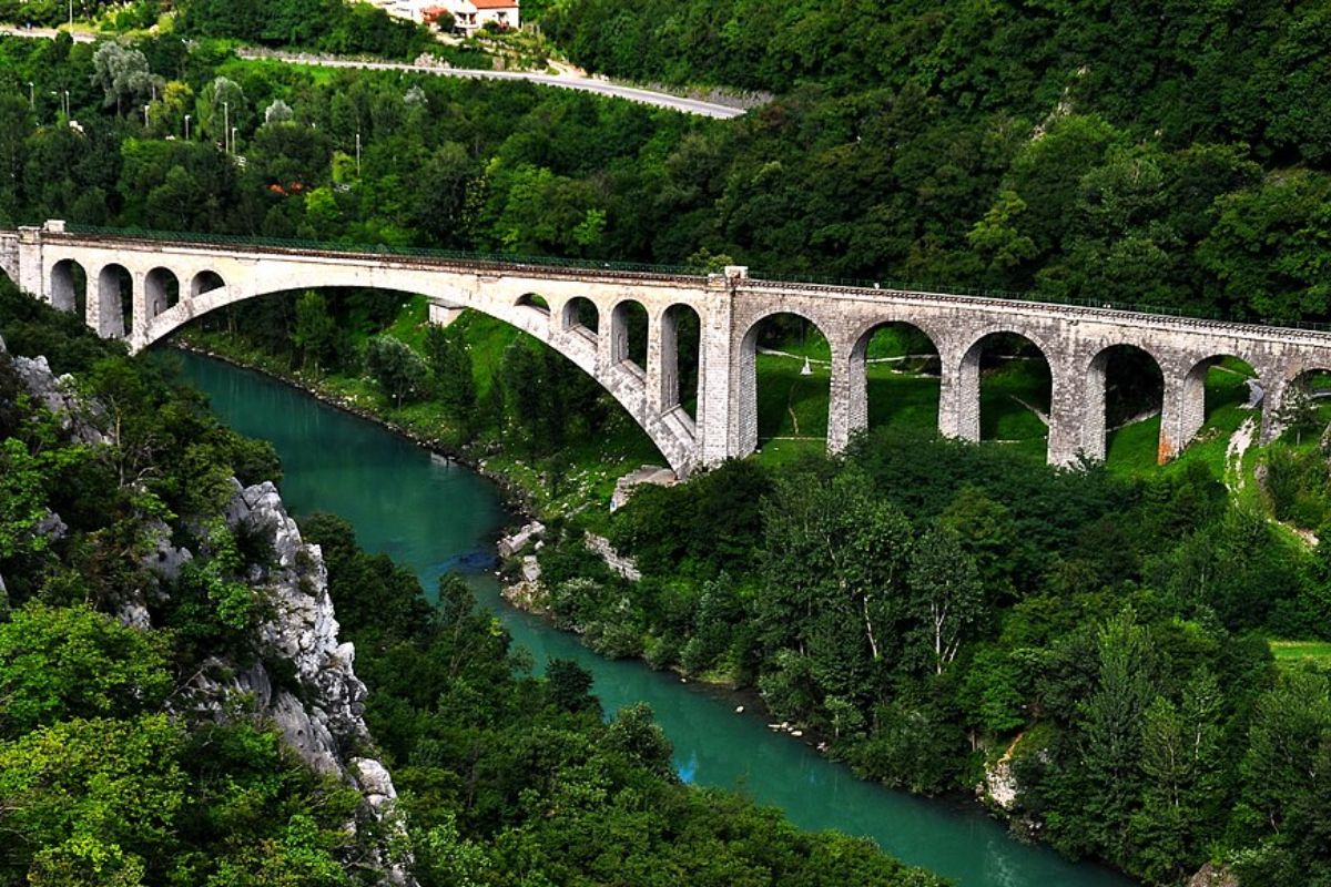
The bridge that holds the largest stone railway arch in the world: built over 100 years ago, destroyed in the war, and rebuilt to continue operating to this day, it still carries trains over the Soča River in Slovenia.
-
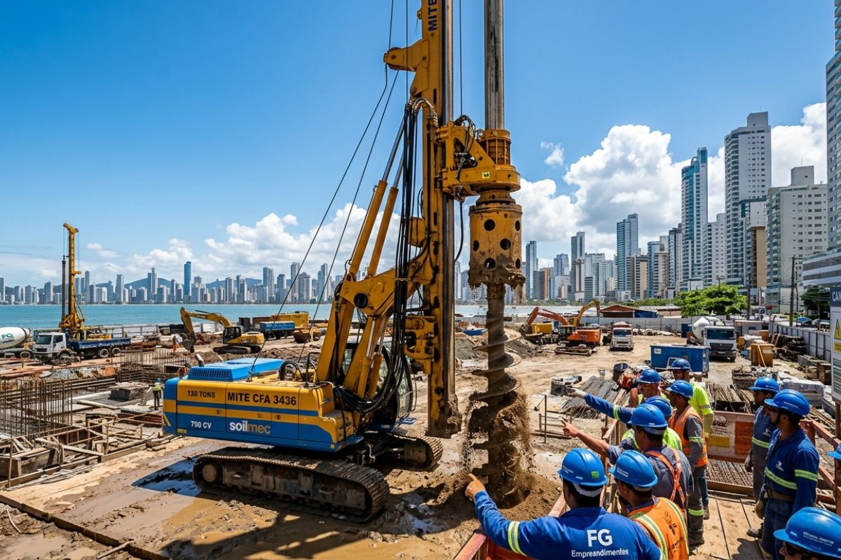
Italian giant of 130 tons arrives at the Senna Tower construction site and accelerates foundations: Mite CFA 3436 drills up to 50 m, 750 hp engine, investment of R$ 20 million, unique in Latin America.
-
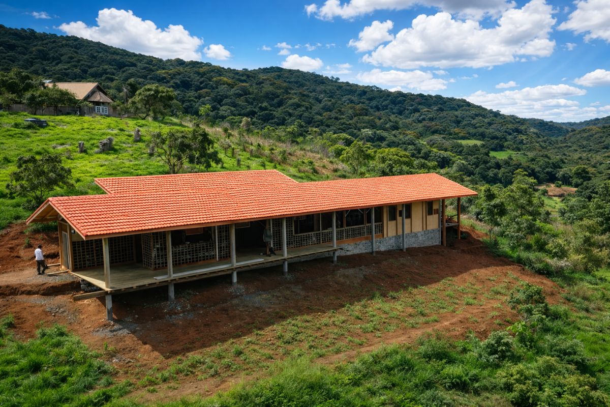
The adobe house in Monteiro Lobato takes shape with bamboo and clay from the land, a stone foundation, and a roof for the wind; cracks are normal, and finishing with lime turns it into a “common house.”
-
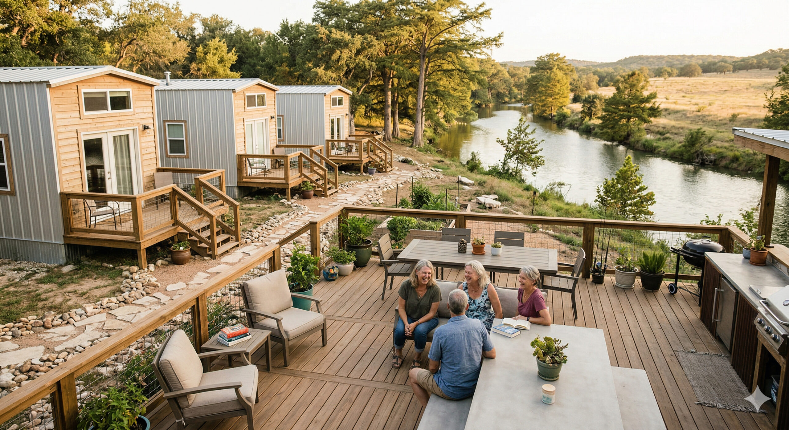
Four friends with over 30 years of friendship built a “mini village” by the banks of a river in Texas to grow old together, with houses of just 32 m² and a shared common space. The Bestie Row project has become a model of alternative living that is starting to spread around the world.

The complete route starts in Brazil, crosses Paraguay and Argentina, and reaches the ports in northern Chile. The proposal is to reduce distances and transportation costs compared to traditional routes that currently rely exclusively on the Atlantic.
For Mato Grosso do Sul, the impact is direct. Porto Murtinho, the city that hosts the Brazilian side of the Bioceanic Route Bridge, is expected to become a regional logistics hub.
The land connection paves the way for agricultural production from Brazil’s Midwest to reach Asian markets through Chilean ports, significantly shortening the maritime journey. For the four involved countries, the bioceanic corridor represents a strategic alternative that could reshape trade flows that have been established for decades.
What is the status of the construction and who is executing the work

The construction of the Bioceanic Route Bridge is being executed by the PYBRA Consortium, under the coordination of Paraguayan civil engineer Renê Gomez. On the Paraguayan side, supervision is carried out by engineering teams linked to the Ministry of Public Works and Communications (MOPC).
Aerial images from the week confirmed that 46 meters remain for the two work fronts to meet, a significant advancement considering the engineering complexity over the river.
On the Brazilian side, the access works to the Bioceanic Route Bridge continue at a parallel pace. The PDC Fronteira Consortium, under the responsibility of DNIT, is working on the assembly of viaducts, pillars, and concrete beams that will compose the structure leading to the crossing.
On the Paraguayan territory, hydraulic filling works are ongoing for the construction of approximately four kilometers of access to Ruta PY-15, the highway that integrates the Bioceanic Route in the Chaco. The informed forecast is that the main structure will be completed between the first and second semesters of 2026.
The logistical corridor that links the Atlantic to the Pacific by land
The concept behind the Bioceanic Route Bridge goes far beyond an isolated bridge. It is a complete logistical corridor that connects Brazilian ports on the Atlantic to Chilean ports on the Pacific, passing through highways in Paraguay and Argentina.
The idea is to provide a land alternative for the flow of commodities, especially grains, meat, and minerals produced in the interior of Brazil.
The route via the Bioceanic Route can reduce transport time to markets in Asia and Oceania by days, which currently depend on ships that navigate around the South American continent or cross the Panama Canal.
For exporters from Brazil’s Midwest, the possibility of shipping goods from Chilean ports represents a logistical change with the potential to reduce costs and increase competitiveness. It is this strategic calculation that justifies the investment of four nations in a project of this magnitude.
The challenges that still exist beyond the 46 meters remaining
Despite the encouraging progress on the bridge structure, the Bioceanic Route as a complete logistical corridor still faces considerable challenges.
Experienced travelers on the route have publicly exposed structural flaws in the road sections that make up the journey, especially in the Paraguayan segment through the Chaco, where paving and signage still require significant investments.
The physical completion of the Bioceanic Route Bridge is a milestone, but the full operation of the corridor depends on complementary infrastructure in all four countries. Border posts, integrated customs, paved access highways, and regulatory agreements between Brazil, Paraguay, Argentina, and Chile are still at different stages of development.
The four-kilometer hydraulic filling section on the Paraguayan side, for example, needs to be completed for vehicles to reach the bridge. These are issues that will determine whether the bioceanic corridor will function in practice with the efficiency that the project promises on paper.
What changes for Brazil when the Bioceanic Route Bridge is complete
For Brazilian foreign trade, the Bioceanic Route Bridge opens a new logistical window.
The agricultural production of Mato Grosso do Sul, Mato Grosso, and Goiás gains an alternative export route that does not depend exclusively on the ports of Santos and Paranaguá, which are currently congested during harvest periods. The diversification of routes is a recurring topic in the debate about the competitiveness of Brazilian agribusiness.
For Porto Murtinho, the transformation has already begun even before the inauguration of the bridge. The city has been attracting investments in logistics, hospitality, and commerce in anticipation of becoming a mandatory passage point for the bioceanic corridor.
The economic movement generated by the project and the prospect of full operation has already altered the local dynamics.
When the last 46 meters are completed and the Bioceanic Route Bridge is finished, four countries will have before them the chance to prove that South American integration can move from diplomatic discourse to real asphalt, concrete, and commerce.
Do you believe that the Bioceanic Route Bridge will truly change the logistical map of South America, or will road and bureaucratic challenges limit the impact of the corridor? It is the type of project that divides opinions between optimists and skeptics. Leave your comment. The discussion about the future of South American integration starts here.


Seja o primeiro a reagir!