 Portuguese
  English
  Spanish
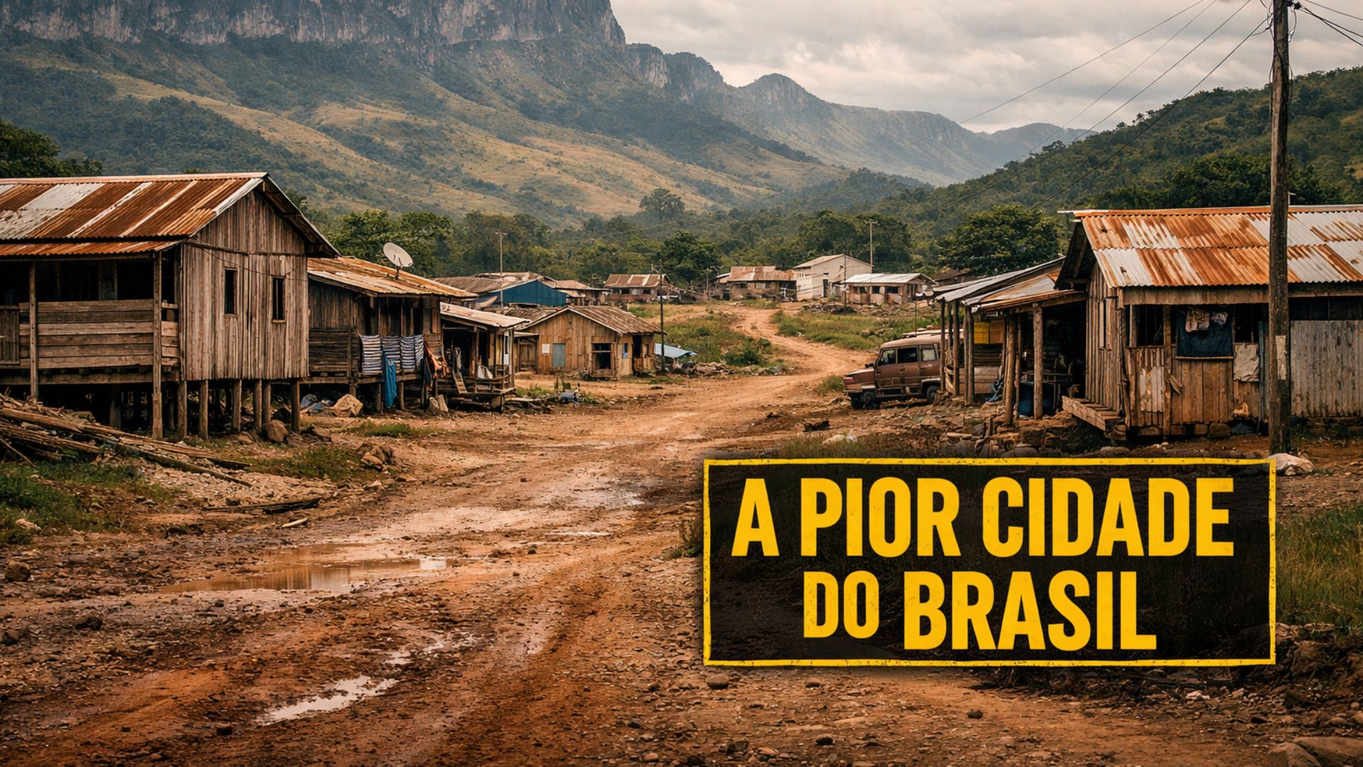
Municipality Located at the Northernmost Point of Brazil Ranks Last on the Social Progress Index, Has a Strong Indigenous Presence, Faces Historical Isolation and Infrastructure Limitations, but Hosts Preserved Landscapes and Ways of Life Deeply Linked to Nature, Revealing Striking Contrasts Between Environmental Wealth and Structural Social Challenges.
Located at the northernmost point of Brazilian territory, the municipality of Uiramutã ranks last in the national ranking of the Social Progress Index.
With about 14 thousand inhabitants and officially created in 1995, the municipality in Roraima scored 37.63 points, the lowest score among all evaluated cities in the country, according to the latest survey of the indicator.
The negative result draws attention not only due to its ranking position but also because of the geographic and social context in which the city is located.
-
He started running at 66 years old, broke records at 82, and is now a subject of study for having a metabolic age comparable to that of a 20-year-old, in a case that is intriguing scientists and inspiring the world.

-
Oldest tree on the planet reappears after 130 years of searches: Wattieza, 385 million years old, was 10 meters tall and had no leaves or seeds; Gilboa fossils in New York solved the mystery in 2007.
-
A 48-square-meter house assembled in hours with 4,000 bricks made of recycled plastic that does not absorb moisture, has natural thermal insulation, and costs less than 90,000 reais in a complete kit.

-
Luciano Hang revealed that Havan’s air fleet has already accumulated more than 20,000 landings, 10,000 flight hours, and 6 million kilometers traveled, and he says that without the planes, the company would never have grown so quickly.


Isolated, hard to access, and distant from major urban centers, Uiramutã faces historical limitations in infrastructure, public services, and opportunity supply, factors that help explain its below-average performance on the indicators assessed by the Social Progress Index.
Young City in an Extreme Border Area
Situated in a border region marked by large expanses of protected areas, the city is located in a territory where the public power coexists with permanent logistical obstacles.
In this scenario, road access is restricted, transportation depends on long distances, and the state’s presence occurs unevenly, which directly affects the quality of life of the local population.
Although it was elevated to municipality status only in 1995, the occupation of the region predates the administrative creation and dates back to historical processes associated with indigenous peoples.
Uiramutã emerged from the subdivision of areas from other municipalities in Roraima and started to have its own management in a predominantly rural territory, with dispersed communities and low population density.
Being located in the extreme north of Brazil gives the municipality a unique geographic singularity.
At the same time, this position imposes additional challenges to regional integration, supply, and the implementation of continued public policies, especially in the areas of health, education, and basic sanitation.
Even with a relatively small population, the municipality presents a significant social complexity, marked by the distance between communities and the administrative center.
A large part of the residents lives in remote localities, which expands the difficulties of service provision, monitoring, and oversight by the public power.
Indigenous Presence Shapes Social Organization

Among the main features of Uiramutã is the significant presence of indigenous peoples, which defines the social and cultural dynamics of the municipality.
The city is among those with the highest proportion of indigenous population in Brazil, predominantly consisting of the Macuxi, Wapichana, Taurepangue, Patamona, and Ingarikó ethnic groups.
This demographic profile directly influences social, economic, and cultural organization, in addition to guiding daily practices deeply connected to the territory.
The traditional way of life, associated with land, subsistence agriculture, and the cycles of nature, coexists with public policies that do not always manage to engage adequately with the local reality.
In many cases, indicators used in national assessments do not fully capture the specificities of indigenous territories, which fuels recurring debates about the interpretation of the results.
Nevertheless, the data from the Social Progress Index reflect objective deprivations in essential areas for the quality of life of the population.
The survey considers variables related to access to health, quality of education, housing conditions, security, individual rights, and social inclusion, aspects that show limited performance in the municipality.
Environmental Wealth Contrasts with Social Limitations
Despite the unfavorable social indicators, Uiramutã hosts an impressive natural heritage, recognized for its environmental preservation.
The region is characterized by mountains, crystal-clear rivers, and preserved landscapes, situated in areas of significant environmental relevance.
These elements reinforce the contrast between the natural wealth of the territory and the social fragility observed in the progress indicators.
The presence of protected areas, while ensuring environmental conservation, also restricts certain conventional economic activities.
As a consequence, income generation alternatives remain limited, and dependence on government support policies becomes more pronounced.
In this context, the absence of adequate infrastructure hinders the sustainable exploitation of the region’s tourism and cultural potential.

Poor roads, limited service supply, and communication difficulties reduce the possibilities of economic integration with the rest of the state and country.
What the Social Progress Index Reveals
The Social Progress Index is a tool that evaluates the quality of life of the population based on social and environmental indicators, without considering economic variables such as per capita income or Gross Domestic Product.
The methodology seeks to measure whether basic needs are met and whether there are opportunities for people to develop their potential throughout their lives.
In the municipal context, the Social Progress Index analyzes dimensions such as nutrition, access to clean water, housing, personal security, basic education, access to information, health, individual rights, and social inclusion.
The score varies from zero to one hundred, allowing comparisons between cities of different sizes and regions of the country.
By recording the lowest national score, Uiramutã highlights a combination of unfavorable structural factors that have accumulated over time.
Population dispersion, distance from urban centers, and historical limitations of public investment weigh significantly on the index results.
Comparison Exposes Regional Inequalities
At the opposite end of the ranking, the municipality of Gavião Peixoto, in São Paulo state, appears as the best-rated in the country, with 74.49 points.
The significant difference between the two cities highlights the regional inequalities that persist in Brazil, particularly between municipalities in the North and the Southeast.
While Gavião Peixoto benefits from consolidated infrastructure, greater service availability, and economic integration, Uiramutã faces historical barriers that exceed the local administrative capacity.
This comparison helps to assess how territorial, logistical, and institutional factors directly influence social progress indicators.
Experts emphasize that rankings such as the Social Progress Index should be interpreted as diagnostic tools, capable of guiding public policies and defining priorities.
In the case of municipalities such as Uiramutã, the data reinforces the need for actions adapted to local realities, especially in indigenous areas and hard-to-reach places.


-

-

-

-

-

-

192 pessoas reagiram a isso.