 Portuguese
  English
  Spanish
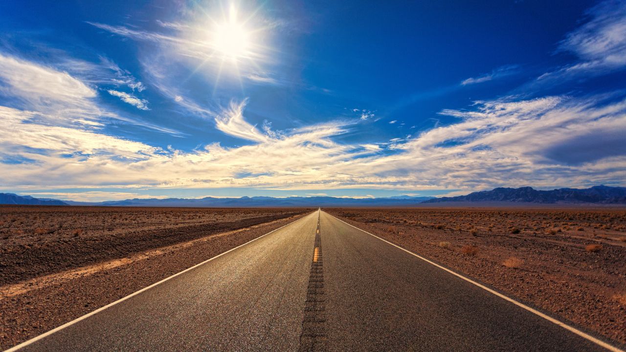
Discover How the Pan-American Route Came to Be, the Longest Highway in the World, at Over 30,000 km. See Where It Passes, Its Environmental and Geopolitical Challenges, and the Countries It Connects.
With over 30,000 kilometers in length, the Pan-American Route is the longest road in the world, connecting Alaska to Argentina and crossing 14 countries in the Americas. The project began to gain momentum in the 1920s and has since become a symbol of continental integration — but also a field of geopolitical disputes and environmental challenges.
Created to strengthen ties between the countries of the continent, the highway had its first milestone at the 1st Pan-American Highway Conference in Buenos Aires in 1925.
Despite its grandeur, the route is not a single continuous road.
-
These living root bridges and ladders are over 700 years old and help indigenous people survive in one of the rainiest regions in the world.

-
From sertanejo star to international investor: Ana Castela invests millions in a mansion in the USA, creates a themed accommodation in Orlando, and shows that the “boiadeira” also wants to grow away from the stage.

-
The 10 most stunning motorhomes in the world: a $3 million trailer with a rooftop nightclub and garage for a Ferrari, “palaces on wheels” with Italian marble, private cinema, and five-star hotel luxury for billionaires.

-
Trump wanted to spend $400 million on the White House, but the courts prohibited the million-dollar construction.

On the contrary: it is a set of interconnected national and state sections, with varying quality and a virtually impassable natural obstacle — the Darién Gap, on the border between Panama and Colombia.
How Did the Idea of the Pan-American Route Arise?
The proposal to build a continental road emerged in 1889 during the First Pan-American Conference held in Washington.
The initial goal was strategic: to facilitate military partnerships and commercial interests, especially of the United States.
Over the decades, the idea evolved. In 1923, in Chile, the plan gained new strength until it was officially approved in 1925 in Argentina for the construction of the Pan-American Route.
The intention was to connect the northernmost and southernmost points of the continent by land.
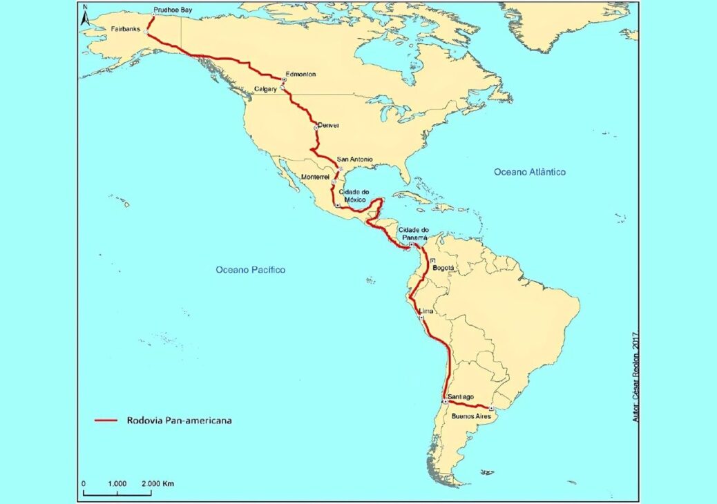
Where Does the Pan-American Route Pass?
Currently, the main highway runs through the following countries:
North and Central America:
- Canada (via CANAMEX Corridor)
- United States
- Mexico
- Guatemala
- El Salvador
- Honduras
- Nicaragua
- Costa Rica
- Panama
South America:
- Colombia
- Ecuador
- Peru
- Chile
- Argentina
In addition, branches connect other countries like Brazil, Uruguay, Paraguay, and Bolivia.
The “Gap” in the Road: The Darién Gap Stalemate
The Pan-American Route presents a critical interruption of about 160 km in the jungle between Panama and Colombia.
This region, known as the Darién Gap, remains roadless for environmental and logistical reasons.
Any attempt to build in this stretch would affect sensitive ecosystems and involve extremely high costs.
Today, those traveling the route need to send their vehicle by ship to Colombia or Venezuela to continue their journey.
Even with this obstacle, the road continues to be used by adventurers, truck drivers, and tourists from all over.
A Road Involved in Political Tensions
Despite its integrative role, the Pan-American Route also encounters geopolitical conflicts. A recent example involves tensions between the United States and Panama.
In 2025, Panamanian President José Raúl Mulino accused the U.S. government of manipulating information about the Panama Canal, suggesting that U.S. military ships would pass through for free.
The controversy, fueled by statements from then-President Donald Trump, reignited the debate over the control and strategic use of essential infrastructures in the Americas — such as the Pan-American highway itself.
The Conditions of the Highway Across the Continent
The quality of the pavement on the Pan-American Route is quite irregular. In regions close to capitals, conditions are good, but in more isolated areas, sections become impassable during rains, with landslides and floods.
In Colombia, in addition to geographical challenges, there is the aggravating presence of armed groups, such as guerrillas and militias. This makes some stretches risky for those intending to cross the continent by land.
One of the Largest Roadworks on the Planet
Even with its challenges, the Pan-American Route ranks at the top of the list of the largest highways in the world, surpassing:
- National Highway (Australia) – 14,500 km
- Trans-Siberian Highway (Russia) – 11,000 km
- Trans-Canada Highway – 7,821 km
- China National Highway – 5,700 km
Its size and reach make it a true milestone in engineering and geopolitics in the Americas.
A Road with an Uncertain Future but Great Symbolism
The Pan-American Route continues to be a promise of continental integration. At the same time, it reflects inequalities and the logistical and political challenges among the countries of the Americas.
Whether for those traveling from end to end or just dreaming of adventure, this road continues to spark imagination and reveal the complex portrait of inter-American relations.
With information from Fórum Magazine.


Seja o primeiro a reagir!