 Portuguese
  English
  Spanish
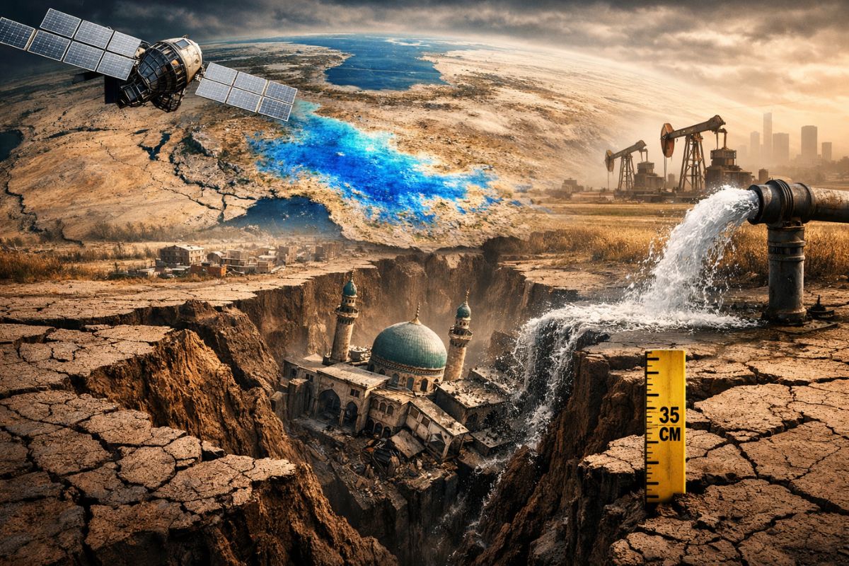
Iran’s Groundwater Is Being Drained at an Unsustainable Rate, and Satellites Show, with Over 6,000 Images Between 2014 and 2020, Extreme Subsidence in Kerman, Pressure on Slowly Replenishing Aquifers, and a National Problem That Already Threatens Territory, Population, and Critical Infrastructure in Several Provinces of the Country.
The groundwater in Iran has entered a critical zone, and the harshest signal of this crisis now appears in the country’s very relief. By cross-referencing data from satellites, geological maps, reservoir information, and gravitational measurements, researchers concluded that Iranian territory loses 1.7 billion cubic meters per year, at a rate considered unsustainable.
The most visible effect of this draining is the subsidence of the soil, which already affects large areas of Iran and, in points of the Kerman province, exceeds 35 centimeters annually. This means not only a lack of water, but also compaction of the aquifers, risk of permanent loss of storage capacity and a direct threat to millions of people and essential structures, such as airports and railways.
What Satellites Measured Under Iranian Territory

The extent of the problem was detailed by Mahmud Haghshenas Haghighi and Mahdi Motagh, affiliated with Leibniz University Hannover and the German Research Centre for Geosciences.
-
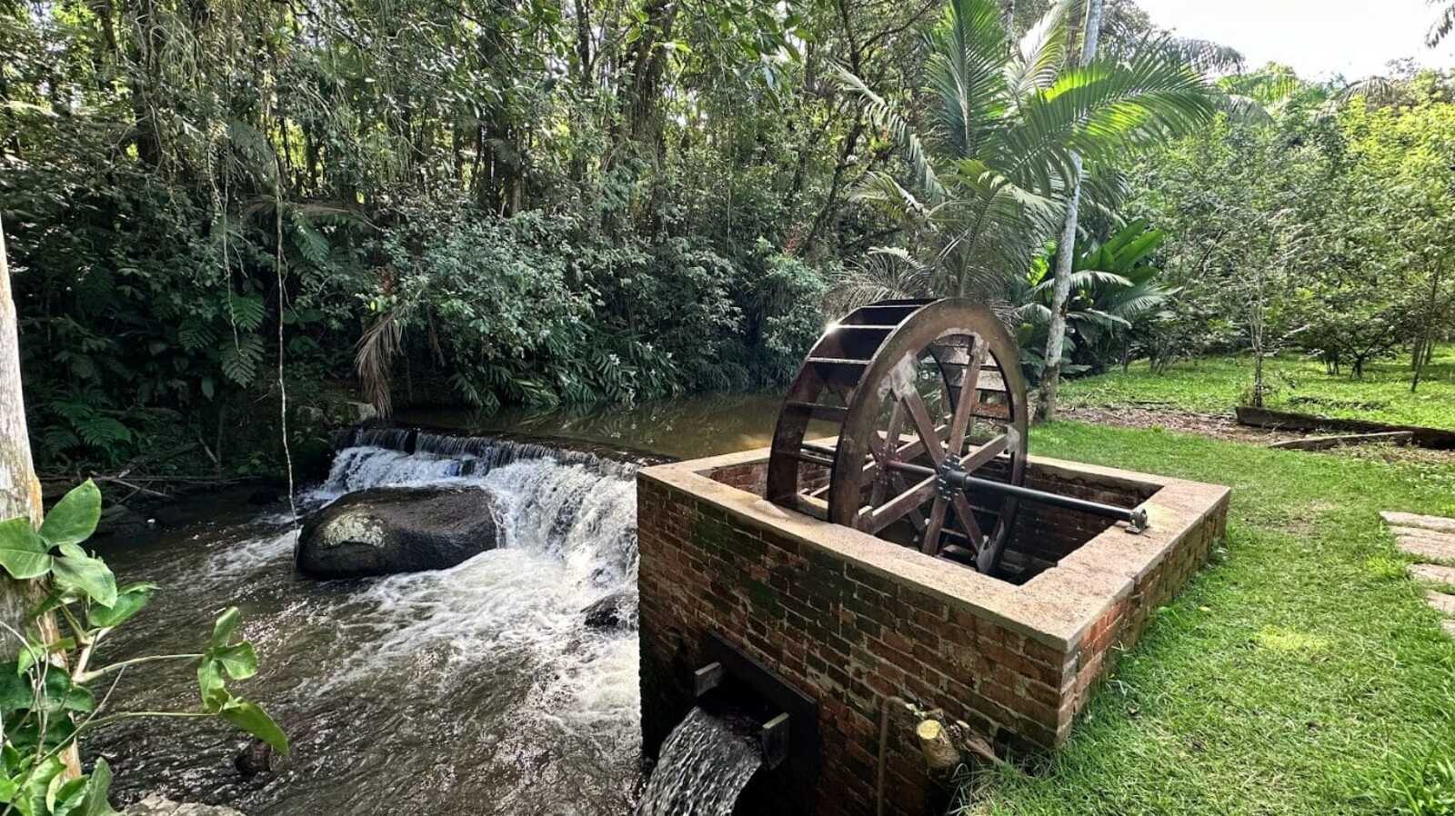
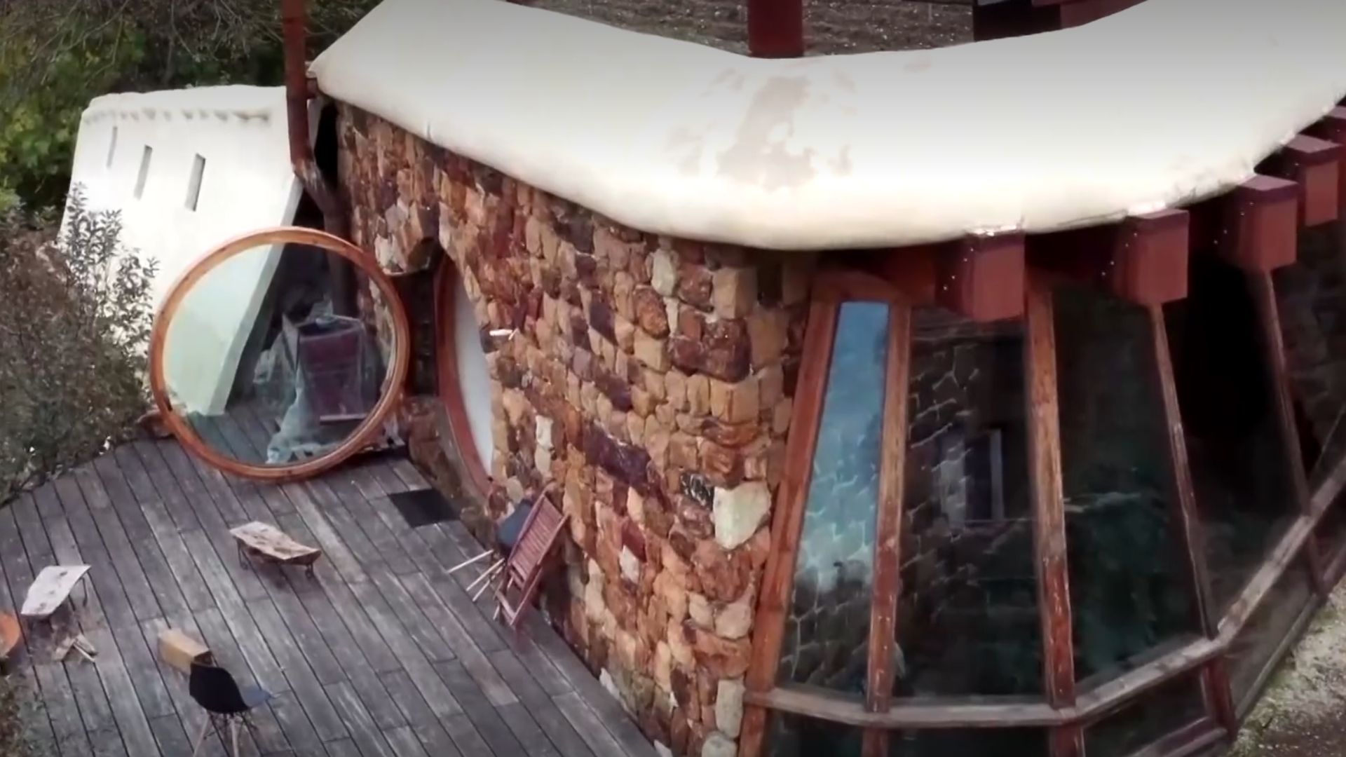
While restoring a historic mansion from 1910, a brick structure with an old turbine that generated energy from the Rio do Testo emerged, along with a hidden door and a rare floor concealed under layers of wax.
-
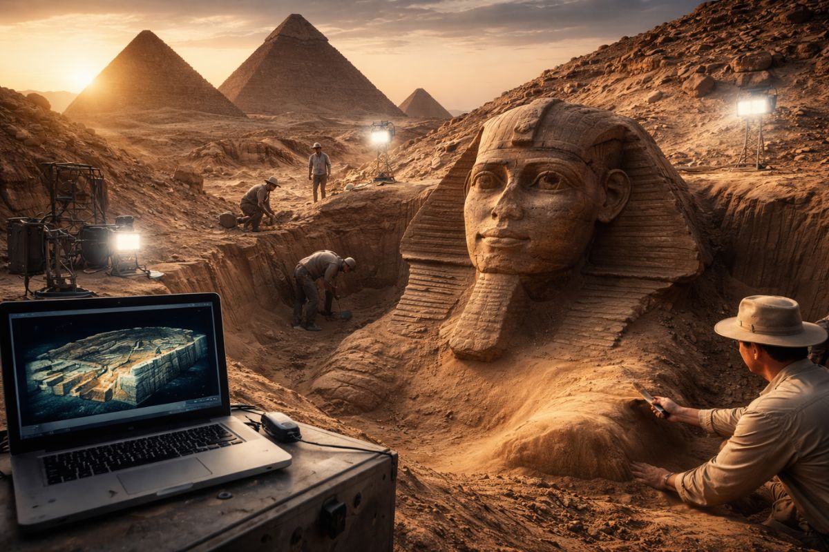
Italian researchers have detected what appears to be a second Sphinx buried under the sands of Egypt, and satellite scans reveal a gigantic underground megastructure hidden beneath the Giza Plateau for over 3,000 years.
-
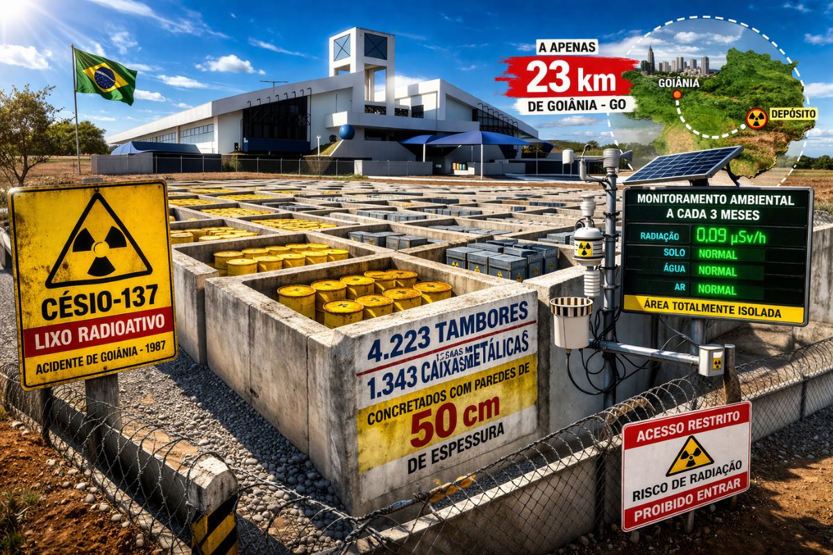
There are 4,223 drums and 1,343 metal boxes concreted with 50-centimeter walls that store the radioactive waste from Cesium-137 in the worst radiological accident in Brazil, just 23 kilometers from Goiânia, with environmental monitoring every three months.
-
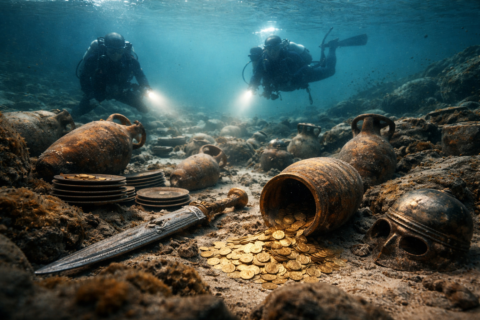
Giant Roman treasure found at the bottom of Lake Neuchâtel in Switzerland reveals an advanced trade system, circulation of goods, and armed escort in the Roman Empire about two thousand years ago.

To measure subsidence in Iran, they used Interferometric Synthetic Aperture Radar, InSAR, based on over 6,000 images from Sentinel-1 obtained between 2014 and 2020.
The result was a national map with a resolution of 100 meters, described as unprecedented for the country.
This survey by satellites was not read in isolation. The authors compared the data with geological maps, information on groundwater reservoirs, and data from the GRACE mission.
This cross-referencing revealed a trend more severe than a simple local oscillation: several Iranian provinces are heading toward irreversible depletion and permanent damage to the aquifers, with losses that may not be recoverable even over very long periods.
Kerman Exposes the Most Extreme Face of Subsidence

The province of Kerman, in southeastern Iran, stands out as the most alarming case.
In the Rafsanjan district, the center of pistachio production in the country, researchers measured subsidence rates that, in some points, exceed 35 centimeters per year.
This level places Kerman among the areas with the most severe subsidence observed in the world.
But Kerman is not alone. The authors highlight that provinces such as Tehran, Isfahan, Kerman, and Khorasan Razavi contain significant shares of the population living in areas at risk of subsidence to varying degrees.
In some of these areas, more than a quarter of the inhabitants are exposed to this process.
When subsidence reaches several centimeters per year, the problem ceases to be technical and becomes territorial.
Why Is Groundwater Being Lost at Such a High Rate
Researchers point to unsustainable irrigated agriculture as the main driver of this loss of groundwater in Iran.
This process is aggravated by population growth and industrialization, which increase water demand and further pressure underground reservoirs.
The result is continuous extraction far above the natural replenishment capacity.
The scale of the loss helps measure the severity. The study mentions 1.7 billion cubic meters per year in a country with about 84 million inhabitants.
The replenishment of volumes of this size could take hundreds or even thousands of years, if it is still possible in some areas.
Subsidence, in this context, acts as the visible mark of an invisible collapse: the aquifer loses water, compacts, and ceases to have the same capacity to store what it once stored.
What Is at Risk When Aquifers Begin to Collapse
The study estimates that about 3.5% of the land area of Iran is already affected by ground subsidence, impacting millions of people and critical infrastructure.
Airports and railways are among the systems threatened by this land deformation.
In other words, the groundwater crisis is no longer restricted to rural areas or local supply.
It encompasses logistics, mobility, and territorial security.
The most serious point is that not all losses will be recoverable. When aquifer compaction progresses too far, storage capacity may be permanently damaged.
This means that Iran could lose twice: it loses water now and also loses part of the underground space that would allow storing water in the future.
Therefore, the authors advocate for immediate action and a coherent policy for groundwater, treating the problem as a national crisis, and not as a sum of regional episodes.


-

-

4 pessoas reagiram a isso.