 Portuguese
  English
  Spanish
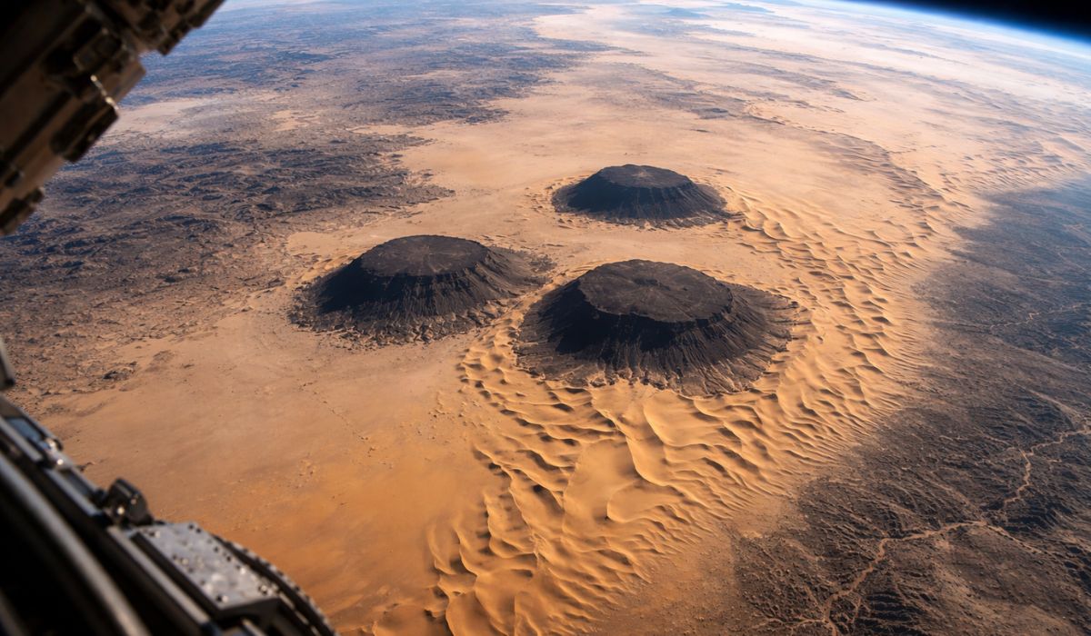
Three dark mesas in the Sahara help reveal, in images seen from space, how ancient rock formations still interfere with the shape of the dunes and the movement of sand in one of the planet’s most arid landscapes.
A photo taken by an astronaut aboard the International Space Station on May 3, 2023, shows three dark mesas aligned in southern Mauritania, in the Sahara, surrounded by dunes that concentrate on one side and almost disappear on the other.
The record, made near Guérou, gathers remnants of an ancient sandstone formation from the Paleozoic era and helps visualize how the terrain can interfere with wind circulation and sand distribution in a desert area.
The structures are located about 13 kilometers northwest of Guérou and stand out for their flat tops and steep slopes.
-
Mason teaches technique to make the “perfect mix”: simple method reduces cement waste and prevents structural problems in the construction.

-
With up to 1,100 tons of gold and an estimated value of $83 billion, a supergiant deposit discovered in China could become the largest in the world and reignite the race for an underground fortune that promises to go down in the history of modern mining.

-
Simple technique with cheap fiber cement tiles is changing the way roofs are made and reducing costs in construction projects.

-
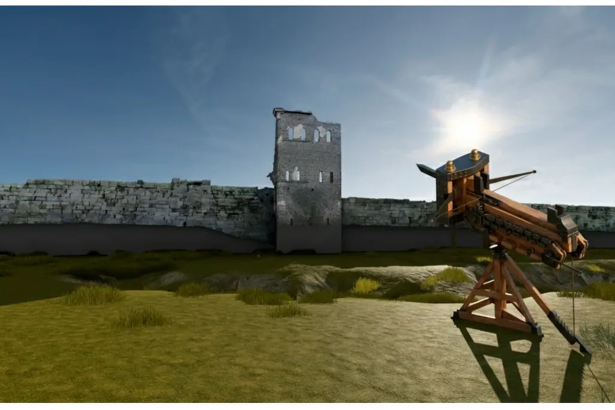
The archaeologists did not expect to find anything at this archaeological site – Then, they came across a Roman village and a bronze artifact.

According to NASA, these mesas rise between 300 and 400 meters above the surrounding plain.
The largest of them reaches approximately 9.5 kilometers at its widest point, a dimension that explains the visibility of the group in images taken from space.
Dark mesas in the Sahara and the geological formation in Mauritania
The dark coloration observed on the rocky surface is associated with the so-called rock varnish, a film typical of arid environments, enriched with manganese and other minerals.
The Earth Observatory from NASA describes this coating as common on rocks exposed for long periods in deserts.
Reference studies on the subject also point out that this varnish has very thin layers and a composition linked to clays and oxides, especially of manganese and iron.
In addition to the darkened aspect, the geological origin of the group helps explain the current landscape.
According to NASA, the three mesas are remnants of an ancient sandstone formation from the Paleozoic era, a geological interval that extended from 541 million to 251.9 million years ago.

Over millions of years, erosion caused by water and wind fragmented this larger rock block, leaving isolated portions on the desert surface.
These formations fit the geological definition of a mesa, an isolated landform with a relatively flat top and steep sides, shaped by erosive processes.
The phenomenon is not exclusive to Mauritania and appears in other arid regions of the planet.
In this case, however, the arrangement of the dunes around the rocks is the point that most attracts researchers’ attention because it allows for a broad-scale observation of the relationship between terrain, wind, and sediment.
How the terrain alters the path of sand in the desert
In the image, the most evident difference appears in the distribution of sediments.
To the east and northeast of the mesas, the surface displays sandy deposits in yellowish to reddish tones.
On the opposite side, however, the rocky terrain remains with little visible sand.
This contrast is linked to how the terrain modifies the behavior of surface winds.
According to NASA, the prevailing winds in this part of the Sahara blow from the Northeast.
When the sand-laden air current encounters the slopes and elevations associated with the mesas, part of this material loses speed and settles.
The process favors the formation of dunes along the slopes and in areas close to the rocky group.
The record allows for the identification of at least two types of dunes.
The largest, accumulated along the slopes, are classified as climbing dunes.

The smaller, more distant ones have a crescent shape and belong to the type known as barchan, common in deserts with limited sand supply and prevailing wind in one direction.
In practice, the image shows two distinct responses of the landscape to the same air flow.
Near the rocky walls, sand accumulates in areas where the wind loses strength.
Further along, it reorganizes into smaller and repeated shapes, aligned according to the dominant direction of atmospheric circulation.
According to the Earth Observatory, the influence of these mesas on sediment transport can extend up to 15 kilometers.
This means that the effect of the terrain is not restricted to the immediate surroundings of the rocks and can shape the surface over a broader area of the desert plain.
Why one side of the mesas almost does not accumulate sand
If on one face of the mesas sand accumulates, on the other the opposite process occurs.
The absence of dunes on the opposite portion is linked to a mechanism known as wind scour, a term used to describe the removal of sediments by the wind.
In this case, the shape of the elevations favors the formation of whirlwinds and vortices after the air passes over the rocky obstacle.
These movements can accelerate the wind flow instead of slowing it down.
When this occurs, the grains stop settling and begin to be removed from the surface.
That is why the rocky plain to the west of the mesas appears with less sand than the area directly influenced by the prevailing winds.
The contrast observed in the photo, therefore, not only indicates the presence of dunes on one side and their absence on the other.
It also reveals two distinct behaviors of the same physical system.
On one side, the terrain creates conditions for sediment retention; on the other, it favors the removal of that material.

What the orbital image reveals about the dynamics of the Sahara
Another astronaut photo, taken in 2014, had already shown a broader area of this sector of the Sahara, with a larger extent of barchans and the presence of other similar elevations in the surroundings.
The 2023 record, however, highlights more clearly the relationship between the dark surfaces of the mesas and the surrounding sand deposits, offering a more precise visual example of this geomorphological process.
The comparison between these images helps to situate the trio within a broader geological framework.
NASA relates the mesas to an ancient sedimentary formation dismembered by erosion, a process that also helps explain other striking features of Mauritania.
Among them is the Richat Structure, known as the “Eye of the Sahara,” described by the space agency as a set of rocky rings about 45 kilometers in diameter, also visible from space.
Mesas exist in various parts of the planet.
The National Park Service of the United States highlights the presence of this type of terrain in states like Colorado, New Mexico, Utah, and Arizona.
In all these cases, they are forms associated with differential erosion, when more resistant materials remain prominent while neighboring areas undergo greater wear over time.
In the Mauritanian desert, the image draws attention because it brings together, in the same frame, different layers of geological history and the current dynamics of the surface.
The dark rocks record slow processes developed over millions of years.
Meanwhile, the dunes reveal continuous changes, guided by the transport of sand and the persistent action of the wind.
This type of record often interests science because it allows for the observation of large-scale phenomena with uncommon clarity.
Seen from space, the three mesas near Guérou serve as an example of how ancient landforms continue to influence the organization of the current landscape in the Sahara.


Seja o primeiro a reagir!