 Portuguese
  English
  Spanish
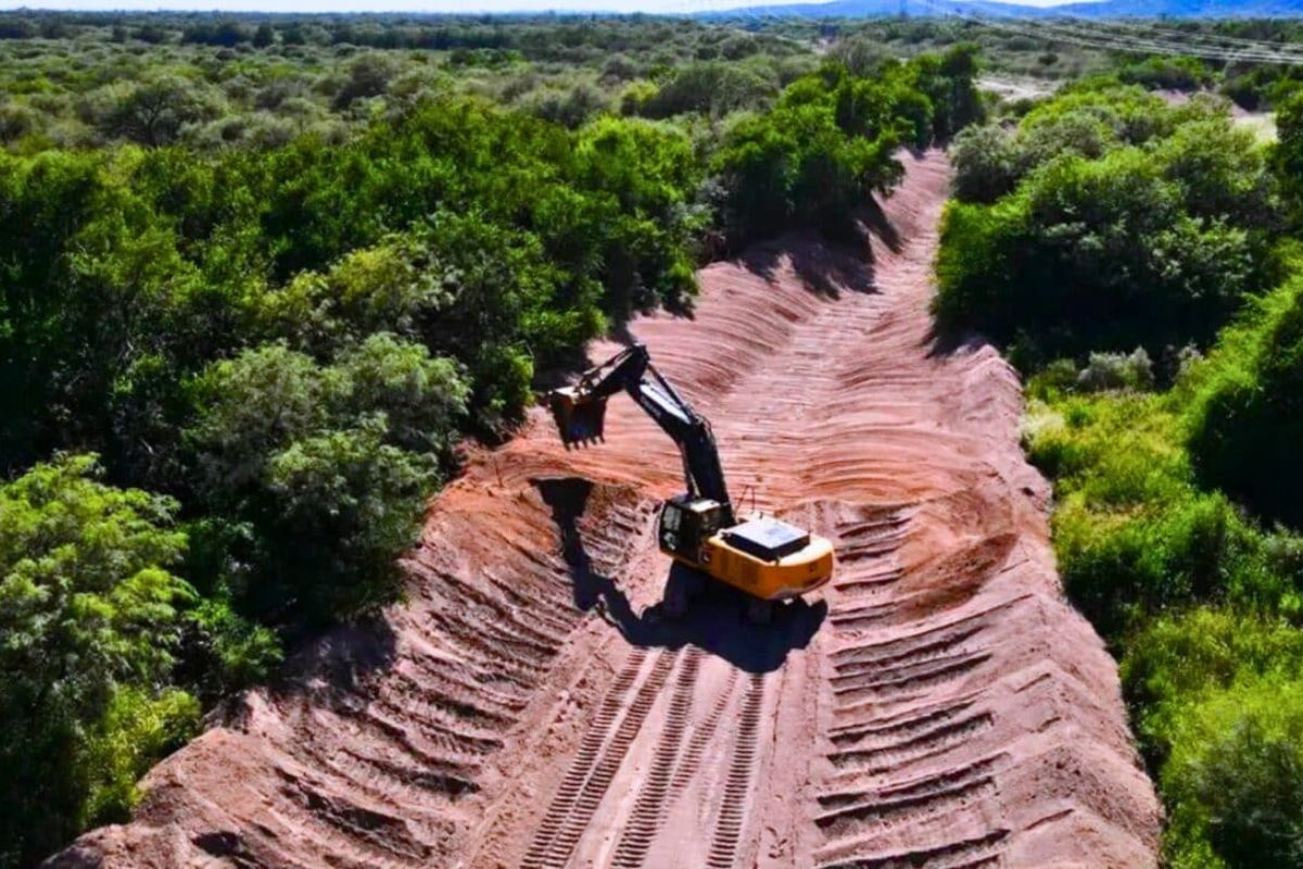
The program led by San Luis Water is not damming or draining rivers: it is clearing waterways suffocated by decades of sediment and accumulated vegetation to restore drainage capacity, protect fish habitats, ensure supply in a semi-arid province, and shield agricultural lands against floods.
San Luis is a semi-arid province in the central-west of Argentina. It does not have the luxury of wasting water. Every overflowing river takes away fertile soil, floods roads and homes, and destroys the economic base of rural communities that rely on agriculture and livestock. And that is exactly what has been happening for decades.
The rivers of the province were suffocated. Accumulated sediment over the years reduced the depth of the beds. Invasive vegetation took over the banks and the channel. The result was predictable: with each heavy rain, the water no longer fit in the river and overflowed in all directions.
The province decided to fix this, river by river.
-
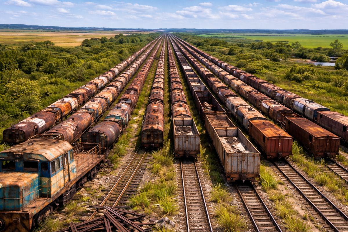
Train without a destination in RS has turned into scrap, 75% of the tracks have disappeared and 500 wagons are stuck in a 3 km queue, the network has dropped to 900 km and the government promises recovery by 2026.
-
After sinking 500 years ago with 200 tons of gold, diamonds, and jewels, a Portuguese ship has become the most valuable and sought-after shipwreck of all time.

-
Costco will open the first independent gas station in the company’s history with 40 pumps and no store around it on a 1,500 m² lot where a Bed Bath and Beyond used to operate in California, as fuel prices in the U.S. approach $6 per gallon.

-
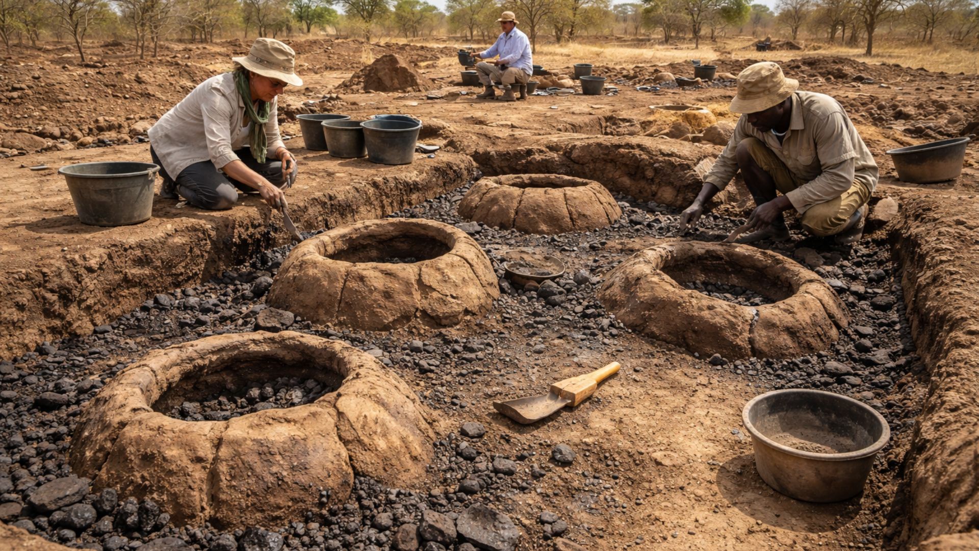
Discovery in Senegal reveals iron factory that operated for 800 years without changing technology, with advanced furnaces, surprising thermal control, and continuous production since the 12th century, challenging everything we knew about ancient innovation.
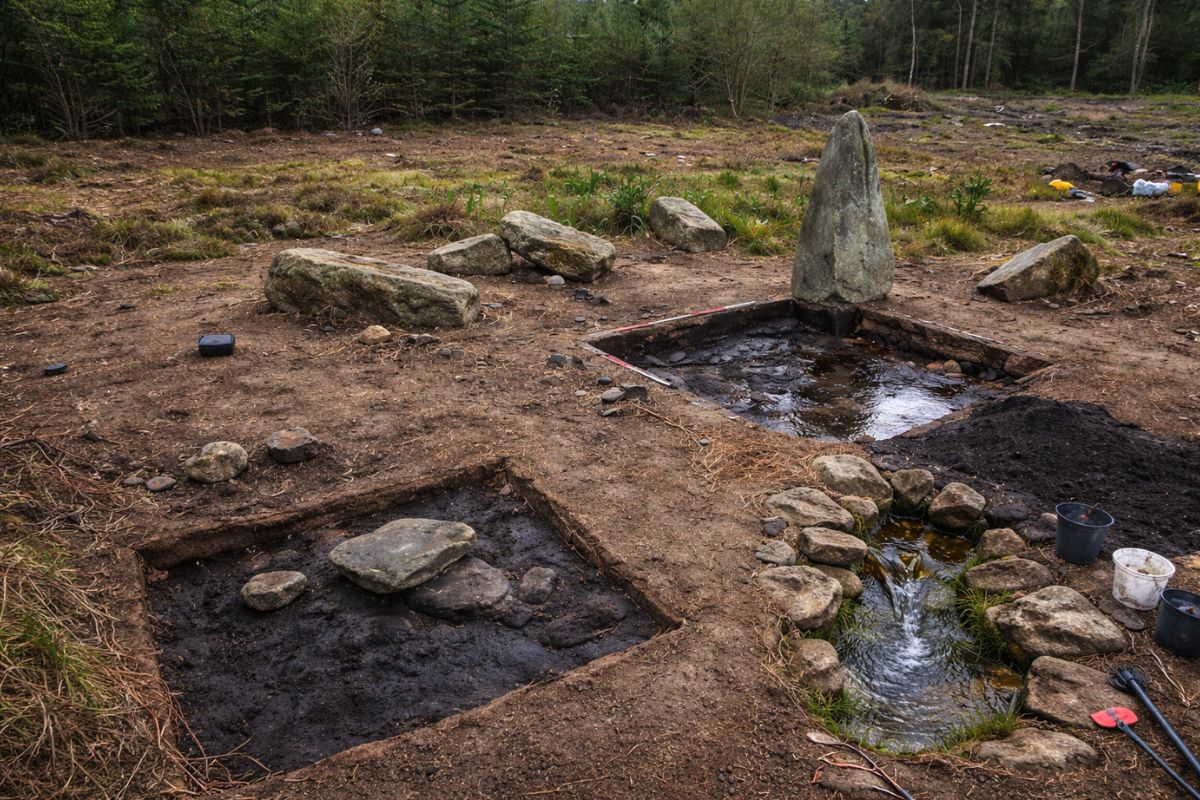
How does the rechanneling program work?

. Credit: San Luis Agency
San Luis Water, the provincial water management authority, coordinates a program that is already reconstructing over 18,000 linear meters of rivers throughout the province. The work consists of removing accumulated sediment, clearing vegetation that blocks flow, and reconfiguring the banks so that the river functions again as a drainage channel.
The model is unusual. Local mining companies carry out all the physical work at no cost to the provincial government. In return, they take advantage of the extracted material. State technicians accompany each step, assessing sediment depth, flow patterns, and land use around before starting any intervention.
The supervision ensures that the rechanneling improves drainage without destabilizing the banks or harming downstream ecosystems.
Has the system been tested in real conditions?
Yes. And it passed the test.
The Conlara River was the first rechannelized river to face heavy rains. Between March 4 and 5, 2026, an intense storm hit the region. Before the intervention, the same area suffered repeated flooding. This time, the water stayed within the riverbanks and flowed normally downstream.
The clean channel moved the volume of water efficiently, without overflowing onto roads, crops, or residences. Local authorities confirmed that the same rain would have caused significant flooding before the rechanneling work.
Why does the program have four layers?

. Credit: San Luis Agency
The rechanneling is not just about floods. The program was designed with four simultaneous objectives.
The first layer is flood control. Unobstructed rivers can absorb larger volumes of water without overflowing, protecting urban and rural communities along the basins.
The second layer is ecosystem protection. The program specifically aims to protect fish habitats and lake systems connected to the river network. Silted rivers lose depth, flow speed, and oxygenation, which eliminates aquatic species that depend on minimal conditions to survive and reproduce.
The third layer is economic protection. Farmers and ranchers depend on stable lands. Erosion caused by repeated flooding consumes fertile soil and compromises the productive base of the province. The rechanneling also protects urban infrastructure, including schools and residences near the basins.
The fourth layer is water security. San Luis is a semi-arid province and cannot afford to lose water or suffer avoidable damage. The rechanneling of the Curtiembre River, for example, ensures that water flows continuously to the purification systems and irrigation networks, combining flood prevention with water resource management.
What makes this model different?
Most river restoration projects in the world rely on heavy public funding or international partnerships. San Luis found a shortcut: using mining companies that already operate in the region and have an interest in the material extracted from the rivers.
The cost to the government is essentially zero on the execution side. The investment is in technical supervision and planning. It is a replicable model for any province or state that has silted rivers and local mining activity.
If the Conlara River test during the March storm is repeated in other rechannelized rivers, San Luis will have proven that it is possible to fix entire rivers in a province spending almost nothing, protecting fish and lakes at the same time, and using the local industry itself as a driver of restoration.
With information from Indian Defence Review and San Luis Agency.


Seja o primeiro a reagir!