 Portuguese
  English
  Spanish
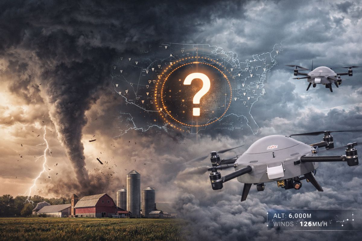
The United States faces a critical gap in meteorological observation: hundreds of kilometers separate one data collection point from another, precisely in the layer of the atmosphere where tornadoes form. Now, drones capable of flying at more than 6 thousand meters altitude in strong winds are being used to fill this gap and improve severe storm forecasting.
Between the Earth’s surface and the first few hundred meters above ground lies a zone of the atmosphere that meteorologists call the data gap, and it is precisely there that the most dangerous weather phenomena in the United States form. Drones are changing this. Researchers from the University of Oklahoma and the NOAA National Severe Storms Laboratory have begun using unmanned aircraft to collect vertical atmospheric data in locations where weather balloons do not reach and where ground vehicles cannot go.
The problem that drones solve is straightforward: meteorological observation points in the United States are hundreds of kilometers apart. Oklahoma, which records one of the most severe climates on the planet, has a weather balloon station in Norman, but the nearest station is in Texas or Kansas, with a vast empty space between them. It is in this void that tornadoes form without warning, and it is in this void that drones are being positioned to capture data that can save lives.
The invisible hole in tornado forecasting

Most of the meteorological data that feed forecasting models in the United States still comes from weather balloons, the so-called radiosondes.
-
The most famous volcano in the world could paralyze one of the largest metropolises on the planet: Japan accelerates emergency plans for the eruption of Mount Fuji, which could bury Tokyo in ash for over two consecutive weeks.

-
The United States has a serious problem with its F-35s: China is already producing fighters at a pace that exceeds American capacity and could manufacture up to 300 aircraft per year before the end of the decade, shifting the global military balance.
-
Remains with battle wounds of over 100 soldiers from the Roman Empire are found beneath a football field in Vienna, leaving everyone surprised.
-
Elon Musk notes Brazil and lowers the price of his internet, Starlink, promising to connect all corners of the country with affordable plans, 10,000 satellites, and 1 million active users in the national territory!


A helium balloon is launched, rises to about 30 thousand meters, collects data on temperature, humidity, and pressure during ascent, and then bursts. The results are distributed randomly, and the equipment is not recoverable.
The problem is that there are very few launch points scattered across the American territory. The distance between one station and another can reach hundreds of kilometers, leaving entire areas without vertical atmospheric data.
And it is not a minor issue: tornadoes, hailstorms, and destructive winds form precisely in the lower layers of the atmosphere that remain unmonitored.
To make matters worse, recent cuts in the National Weather Service of the United States have halted balloon launches at some stations, further widening the gap.
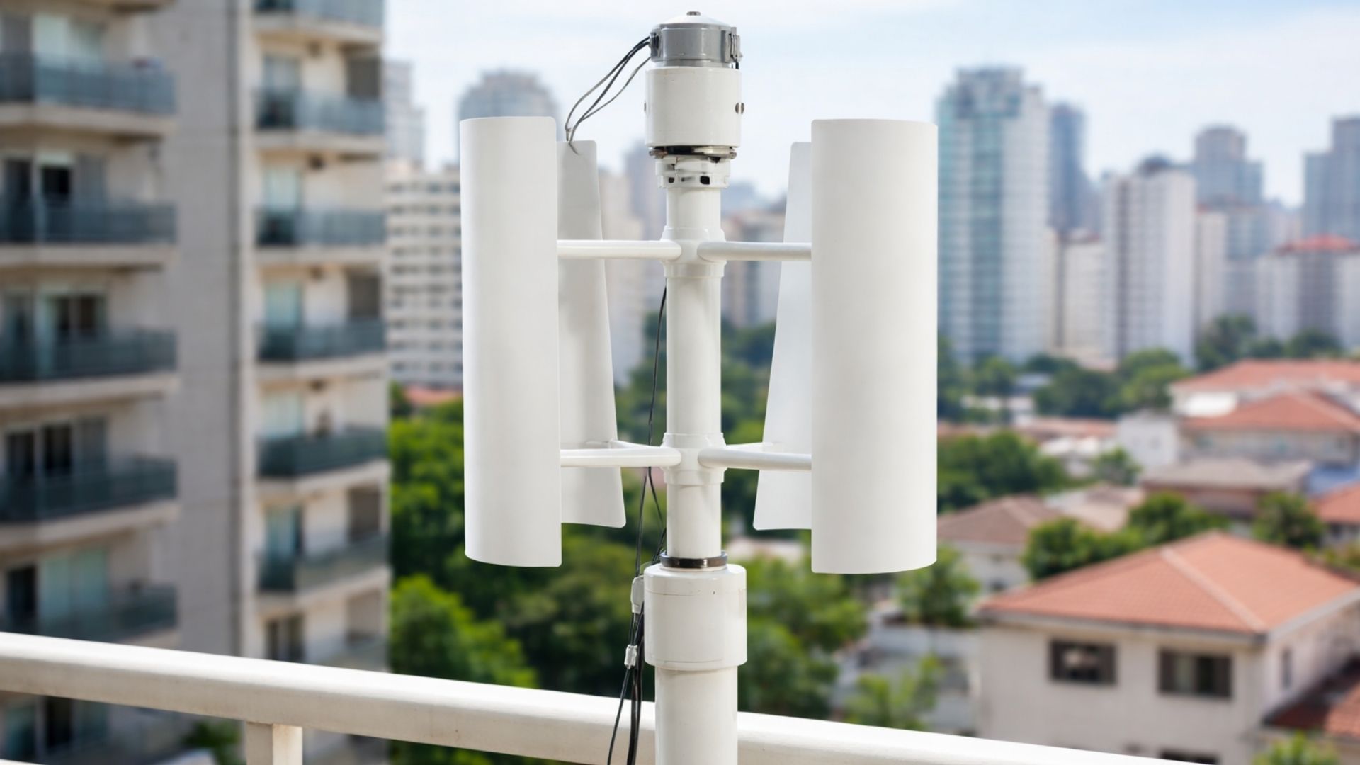
How drones fly at 6 thousand meters in strong winds

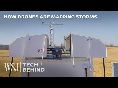
The drones developed to fill this gap are not toys for hobbyists. The most established model, called BDO, is a hexacopter with a circular fuselage and a set of sensors that has already been tested at altitudes of up to 6 thousand meters or 20 thousand feet and is capable of operating in relatively strong winds, conditions that would be dangerous or impossible for conventional balloons.
The operation is similar to that of a weather balloon profile: the drones ascend vertically from a single geographical position, measuring temperature, humidity, pressure, and wind speed along the ascent.
The difference is that drones can repeat the flight as many times as necessary, at the same point, without relying on helium or generating atmospheric waste.
A second model, called Coptersonde, was designed to be cheaper and more accessible to researchers and government agencies. It aligns with the wind like a weather vane and ingests air from the front to measure atmospheric parameters accurately.
The data that drones capture and balloons cannot
Placing sensors on drones seems simple, but it involves technical challenges that have taken years to resolve.
The drone rotors generate turbulence and the motors heat up, creating interferences that can distort measurements if the sensors are not positioned correctly. The team from the University of Oklahoma has developed solutions to isolate the instruments from these interferences.
Currently, drones routinely reach about 1,500 meters or 5 thousand feet in operations at the Kessler Farm research field operated by the university.
This altitude is extremely useful for monitoring the lowest layer of the atmosphere, where severe storms originate. The future goal is to reach 3 thousand meters, about 10 thousand feet operationally, an altitude considered ideal for tornado forecasting.
The data collected by the drones are compared in real-time with the forecasts from computational models, allowing meteorologists to identify errors and biases before a storm hits populated areas.
Oklahoma set a record for tornadoes and drones were already in the air
The timing could not be more relevant. Oklahoma recorded a record number of tornadoes in March of the last season, confirming that climatic severity in the region is intensifying. The drones were already operating during this period, collecting data that was integrated into the work panels of meteorologists from the National Weather Service.
The transition of drones from research tools to operational forecasting instruments is underway. Instead of being used only in isolated scientific campaigns, drones are now operating routinely, generating data that meteorologists can trust and directly incorporate into their workflows.
This represents what researchers call a paradigm shift in how we observe the atmosphere, moving from reliance on balloons launched twice a day to a flexible system that can fly on demand.
The ultimate goal: to forecast tornadoes before they kill
All the work of the NOAA National Severe Storms Laboratory has a clear purpose: to improve alerts so that people can act in time to protect their lives and property. Every additional minute of advance warning in a tornado alert can mean the difference between seeking shelter and being caught off guard.
The drones contribute to this by filling with real data the space that was previously covered only by estimates and computational models.
When meteorologists can see what is actually happening in the lower layers of the atmosphere in real-time and not what a model predicts should be happening, the accuracy of alerts improves.
The technology does not replace balloons, satellites, or radars, but adds a layer of observation that did not exist before. And in a state where tornadoes are part of life, every additional layer of information can save lives.
With information from the Channel The Wall Street.
What do you think about the use of drones to forecast tornadoes? Do you believe that technology can really save lives, or are the challenges still too great? Leave your opinion in the comments.


Seja o primeiro a reagir!