 Portuguese
  English
  Spanish
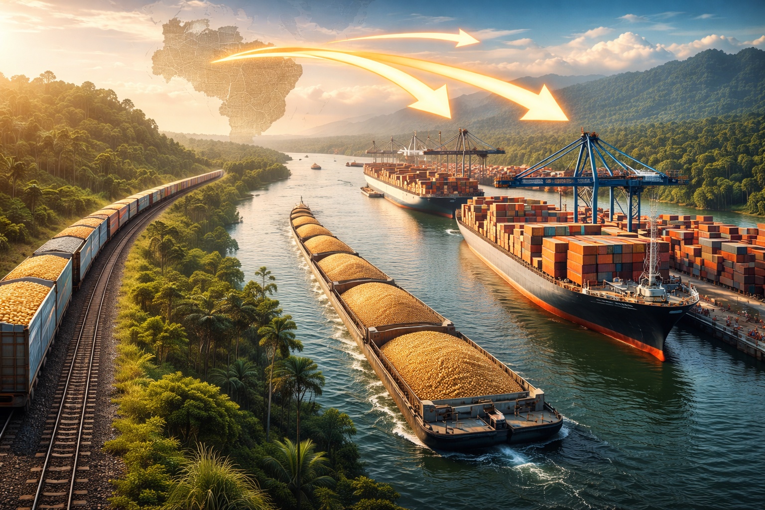


A Corridor Of More Than 7,000 Km Between Cerrado, Amazon, And Maritime Routes To Asia Revolutionizes The Flow Of Brazilian Soy With Hydrovias, Railways, And Strategic Ports.
According to consolidated data from the Ministry of Infrastructure, the ANTAQ (National Agency for Waterway Transport) and the MAPA (Ministry of Agriculture), the structure that today allows Cerrado soy to reach Asia on giant ships began to take shape in the 1990s, when the federal government and private companies started to create what would later be called the North Arc, a set of hydrovias, highways, and ports capable of reducing dependence on the Santos–Paranaguá axis.
Until the end of the 1980s, practically all soy exported by Brazil left from ports in the South and Southeast. By the beginning of the 1990s, this route already showed logistical bottlenecks, truck queues, and high costs. The geoeconomic response was to open a corridor directly through the Cerrado and the Amazon, and connect this production to Asian markets using hydrovias and long-haul ocean routes.
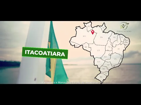
What Exactly Is The North Arc Corridor Of More Than 7,000 Km
The stretch of more than 7,000 km is not a single railway or hydrovia. It is the sum of:
-
The eggshell that almost everyone throws away is made up of about 95% calcium carbonate and can help enrich the soil when crushed, slowly releasing nutrients and being reused in home gardens and vegetable patches.

-
This farm in the United States does not use sunlight, does not use soil, and produces 500 times more food per square meter than traditional agriculture: the secret lies in 42,000 LEDs, hydroponics, and a system that recycles even the heat from the lamps.
-
The water that almost everyone throws away after cooking potatoes carries nutrients released during the preparation and can be reused to help in the development of plants when used correctly at the base of gardens and pots, at no additional cost and without changing the routine.

-
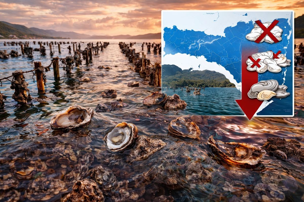
The sea water temperature rose from 28 to 34 degrees in Santa Catarina and killed up to 90% of the oysters: producers who planted over 1 million seeds lost practically everything and say that if it happens again, production is doomed to end.

- Land Sections (Highways and Railways) Between Mato Grosso, Goiás, and Pará
- Navigable Hydrovias On The Tapajós and Amazon Rivers
- Ocean Routes That Depart From The Mouth Of The Amazon To Asia

When you add up the route from the production fields to the Asian ports via rivers, maritime routes, and international canals, the North Arc corridor easily exceeds7,000 km, depending on the origin in the Cerrado and the destination port in Asia.
In practice, this corridor has an operational name: North Corridor / North Arc, formed by the following real systems:
- BR-163 (Cuiabá–Santarém)
- Tapajós–Amazon Hydrovias
- Miritituba Port Terminals
- Ports of Barcarena/Vila do Conde, Santana, and Itaqui
- Ocean Routes Via The Panama Canal To China, Korea, Vietnam, and Indonesia
The Mathematics That Makes Everything Gigantic
Agricultural Production
According to the MAPA, Brazil produced about 196 million tons of soy in 2023, with Mato Grosso being the largest individual producer.
North Arc Participation
The North Arc, which in 2008 represented less than 10% of grain exports, surpassed 35% in 2023. In absolute numbers, this amounts to more than 40 million tons of soy and corn shipped by Amazonian ports.
Logistical Extension
From the production center to Asia, we have:
- Cuiabá → Miritituba (Highway/Railway): ~1,800 km
- Miritituba → Barcarena (Hydrovia): 1,100 km
- Barcarena → Panama Canal (Ocean Route): ~3,700 km
- Panama → China (Open Ocean): ~13,500 km
Which varies between 7,000 km and more than 18,000 km depending on the final destination. The number 7,000 km is conservative when considering only production → North Arc → Asia via Panama to the Pacific Ocean. If you consider a specific final port (like Shanghai), the value rises considerably.
Technologies Used To Cross The Amazon And The Cerrado
The operation would not be possible without three pillars:
Amazonic Hydrovias
The Tapajós–Amazon Hydrovias made it possible to replace hundreds of trucks with barge convoys. A standard convoy carries between 30,000 and 40,000 tons of grains — equivalent to more than 800 trucks.
The operational gain is so great that logistical costs decrease by about 30% to 50% compared to the exit via the Southeast, according to data from ANTAQ.
Specialized Ports
The North Arc terminals operate with deep drafts and transshipment systems for large vessels, such as Panamax, Post-Panamax, and even Capesize, depending on the port.
The port of Vila do Conde (Barcarena), in Pará, has become one of the main hubs of the region and also operates fuels, fertilizers, and supporting cargo, which closes the agro-export cycle.
Road And Railway Corridors
The BR-163, paved all the way to Miritituba, was a watershed moment for the flow of goods. Before that, during the rainy season, entire stretches turned into mud and trucks got stuck for days — something widely documented by newspapers and federal agencies.
The Role Of The Panama Canal In The Equation
According to the Panama Canal Authority, ships passing through the canal linking the Caribbean and the Pacific save between 12 and 22 days compared to routes that go around Cape Horn or the Cape of Good Hope.
For Brazilian soy, this allows the cargo to leave Brazil and reach China, Japan, Vietnam, Indonesia, and South Korea with a significant advantage over competitors.
Economic And Geopolitical Impact
The 7,000+ km corridor is, at its core, an invisible bridge between Cerrado, Amazon, and Asia. It not only moves soy but also fertilizers, fuels, and industrial products — all in a permanent cycle.
The result of this logistical engineering can be observed in three lines:
Global Competitiveness
Brazil gained ground in Asia because transport time decreased and logistical costs fell.
Change In Fertilizer Flows
Since Asia supplies a large part of the fertilizers used in the Cerrado, the same ships that carry soy return loaded with urea, MAP, DAP, and KCl, coming mainly from China, Russia, and Arab countries.
Brazilian Territorial Integration
The existence of this corridor has led cities in the Amazon and the Midwest to gain infrastructure, energy, services, and specialized jobs.
Environmental Impacts And Challenges
The corridor also brought complex and real environmental issues:
- Pressure For Land Regularization
- Logistical Expansion Over Sensitive Areas
- Need For Hydrological Monitoring Of Rivers
- Dependence On Flood Periods For Navigation
These discussions are not theoretical and are handled by ANA (National Water Agency), IBAMA, SEFAZ-MT, SUDAM, and Ministry of Infrastructure.
The corridor of more than 7,000 km that connects Cerrado, Amazon, and Asia is not a future project; it is a reality built over more than 30 years of logistical decisions, public and private investments, environmental adaptations, dredging, ports, highways, and hydrovias.
It shows that the geography of Brazil is not an obstacle, but an engine of economic power when combined with engineering, hydrovias, and ocean. And it also shows that the great logistical corridors of the 21st century will not just be routes; they will be continental machines that connect energy, food, diplomacy, ships, and rivers on a global scale.


Existe uma opção mais eficiente,produtiva,rápida se for concretizada que é a ferrovia aproveitando a FIOL, a FICO alongando-se até o porto, já existente, no Peru.
Excelente conteúdo sobre pauta que a pouco mais de 15 anos, era discutida e avaliada somente com interesse político. No governo anterior ao atual é que definitivamente se completou esse corredor, com o asfaltamento e viabilidade do trecho da BR 163 até Miritituba. A depender do desgoverno atual a logística no Brasil voltará ao tempo das carroças.
Muy bien!!