 Portuguese
  English
  Spanish
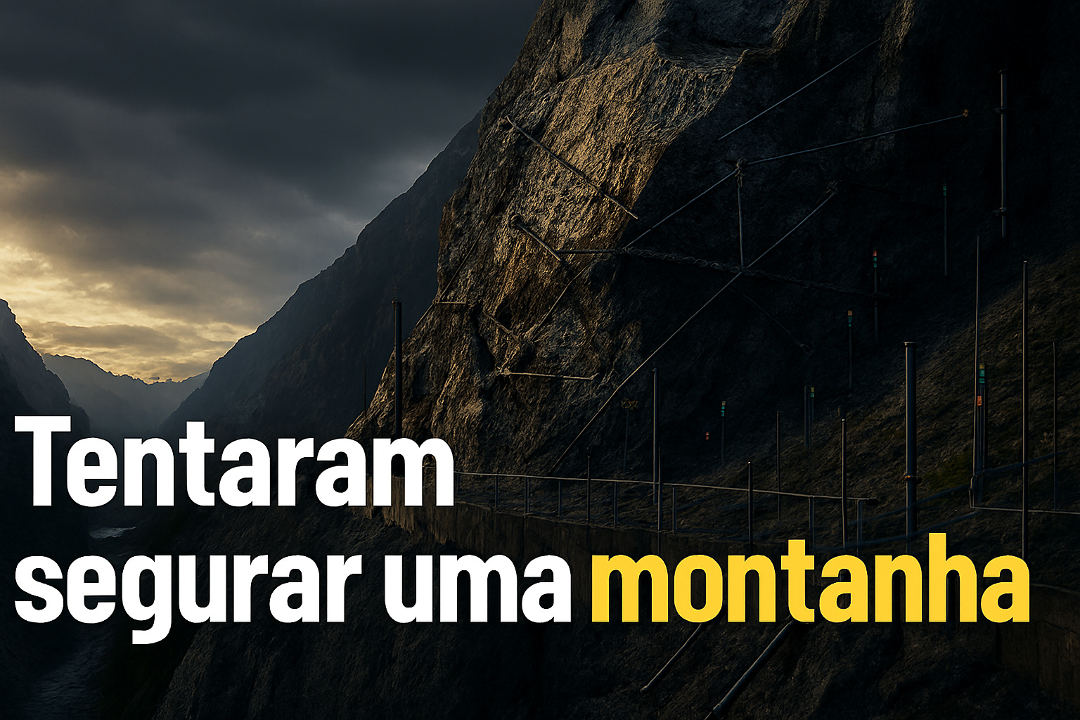
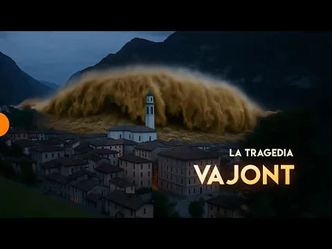
After the Vajont Disaster, Italy Stabilized an Entire Mountain with Deep Anchors, Continuous Sensors, and Extreme Geotechnical Engineering to Contain New Collapses.
According to technical documents from the Italian government, the Consiglio Nazionale delle Ricerche (CNR), and specialized universities in alpine geotechnics, the slope of Monte Toc in northern Italy came to be treated as a permanently unstable structure after the Vajont disaster, which occurred on October 9, 1963. That night, approximately 270 million cubic meters of rock moved in a few seconds, entering the reservoir of the Vajont dam and generating a wave that surpassed the dam, devastating villages and killing nearly 2,000 people.
Although the dam remained structurally intact, the event revealed something even more unsettling: an entire mountain had slid as a single block. From that moment on, Italian engineering faced a rare challenge — how to stabilize, monitor, and coexist with a rock mass that had already proven capable of moving on its own.
What Made Vajont a Unique Geotechnical Problem in the World
Unlike conventional landslides, the collapse of Monte Toc was not a superficial slip. Subsequent studies demonstrated that the slope moved along a deep rupture surface, lubricated by clay layers interleaved within the limestone rock.
-
Created by George Lucas with over $1 billion, a futuristic museum in the shape of a spaceship with 1,500 curved panels is about to open in Los Angeles and will house one of the largest private collections of narrative art in the world.
-
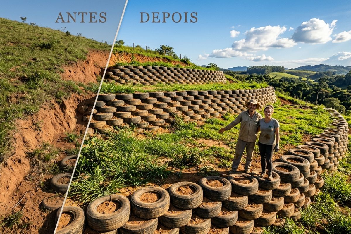
Couple shows how they built a retaining wall on their property using 400 old tires: sloped land turned into plateaus, tires are aligned, filled, and compacted with layers of soil, with grass helping in support and at almost zero cost.
-
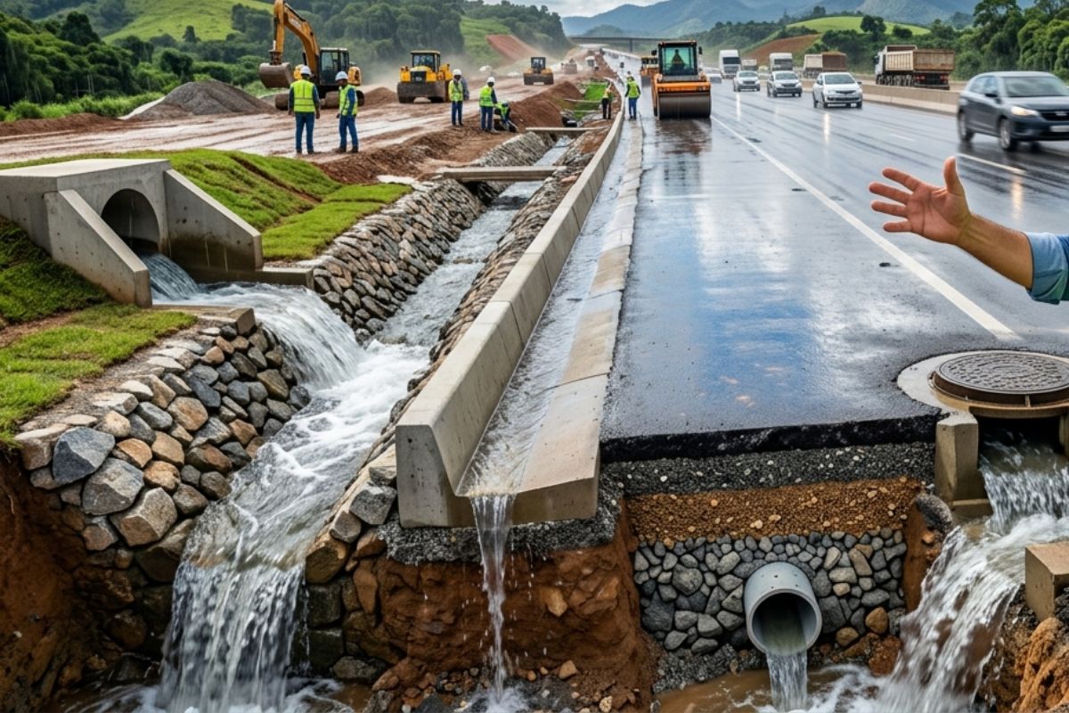
Engineer explains drainage during the rainy season: the difference between surface water and deep water, ditches, gutters, and water outlets on the road, as well as drains and drainage mattresses, to prevent erosion, aquaplaning, and flooding at the construction site today.
-
With 55 floors, 177 meters in height, a 15-meter walkway between the twin towers, ventilated facade, and 6,300 m² of leisure space, Ápice Towers already has one tower completed and another nearly at the top.


The movement occurred almost planar, as if the mountain were sitting on a “geological rail.”

This meant that the risk did not disappear after the disaster. A significant portion of the mass remained unstable, internally fractured, and sensitive to variations in water, temperature, and pressure. The area could not simply be abandoned without monitoring, as new movements could occur, threatening neighboring valleys, waterways, and existing infrastructure.
From the 1970s onward, the region became a living laboratory of real-scale geotechnical engineering.
How Italy Tried to “Anchor” an Entire Mountain
The stabilization works at Vajont did not follow a single closed project, but rather a progressive strategy of containment, monitoring, and risk mitigation that spanned decades. Engineers began to treat the slope as an active structure, rather than a static terrain.
Deep underground anchors were installed, driven dozens of meters into the stable rock below the rupture surface. These anchors function as permanent tensile elements, attempting to reduce the mass’s mobility and redistribute internal stresses. In some sections, multiple rows of anchors were used together, creating a kind of invisible “geological seam.”
In addition to the anchors, deep drains were drilled to reduce water pressure on the sliding planes. The experience of Vajont showed that water was one of the main factors of instability, and controlling its presence became as important as containing the rock.
Continuous Monitoring: The Mountain Has Never Stopped Being Monitored
Perhaps the most impressive aspect of the post-Vajont era is not the amount of concrete or steel used, but the level of permanent vigilance imposed on the mass.
The slope was equipped with a dense network of geotechnical sensors, including inclinometers, extensometers, piezometers, and interferometric radar measurement systems.

These instruments allow for the detection of millimeter displacements, variations in internal pressure, and changes in the structural behavior of the mountain in almost real-time.
In some areas, the instrumentation is capable of recording movements of less than one millimeter per year, which is essential for anticipating any reactivation of the slide.
Vajont has become, in practice, one of the most monitored areas in the world in terms of slope instability.
Why the Vajont Case Changed Dam and Slope Engineering
The disaster did not only lead to local interventions. It redefined international engineering protocols. Before Vajont, the focus of large dams was almost exclusively on the structure of the work: concrete, foundations, spillways. After 1963, the geology of the surroundings began to be treated as an integral part of the system.
Today, studies on slope stability, three-dimensional geomechanical modeling, and simulations of extreme scenarios are standard requirements in dam, tunnel, and reservoir projects in mountainous regions. Vajont has become a classic case in civil and geotechnical engineering courses worldwide.
The concept that “it is not enough for the dam to withstand; the entire valley needs to be stable” originates there.
A Structure That Cannot Fail Even Decades Later
More than 60 years after the disaster, Vajont is not treated as a solved problem, but as a system under permanent management.
The original reservoir has never been reactivated. The dam remains a technical monument and historical alert, while the mountain continues to be under continuous surveillance.
Italian engineering knows that there is no absolute guarantee when it comes to containing geological masses of this scale. The goal is not to prevent any movement, but to detect, anticipate, and reduce risks before they become catastrophic.
In this sense, Vajont represents an extreme limit of engineering: the point where humanity tries to engage with geological forces that operate on time and energy scales far beyond conventional structures.
The Symbolism of Trying to “Hold” a Mountain
Few projects so well synthesize the relationship between engineering, nature, and human limits as Vajont. It is not a work celebrated for its efficiency or beauty, but for its brutal technical honesty. There, engineers did not try to hide the mistakes of the past, but to coexist with them, measuring, anchoring, draining, and continuously observing.
The attempt to stabilize Monte Toc is not just a local solution. It has become one of the largest geotechnical engineering experiments ever conducted in a real environment, with data collected over decades and used today to prevent tragedies in other parts of the world.
In the end, Vajont is not just the story of a dam or a landslide. It is the story of a mountain that moved, of an engineering that failed to foresee this, and of another engineering that came into being precisely to never ignore such signals again.


Seja o primeiro a reagir!