 Portuguese
  English
  Spanish
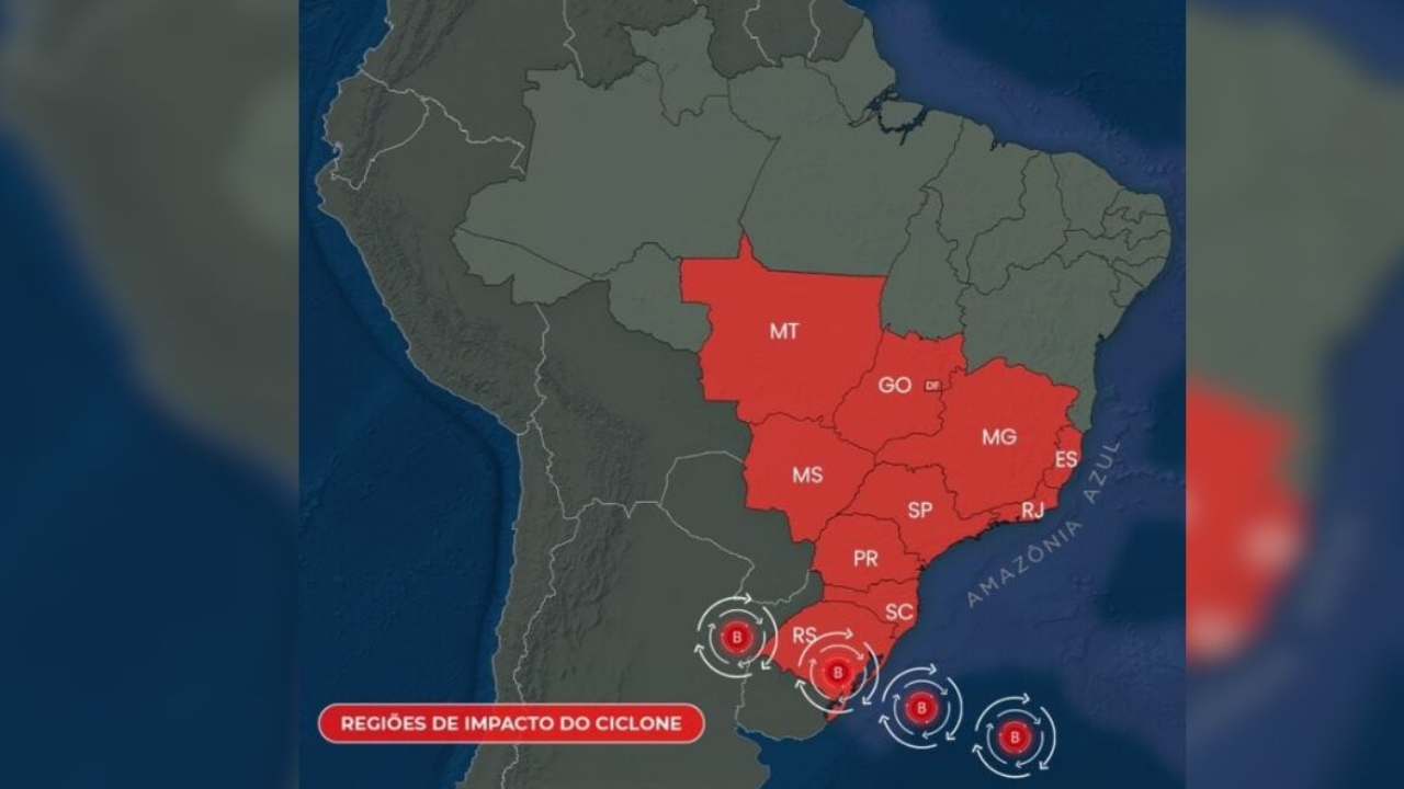
Formation of Extratropical Cyclone and Cold Front Alerts Southern Brazil and Parts of the Southeast and Midwest, with Risk of Storms and Winds of Up to 120 km/h. Meteorological Phenomenon Expected to Act Stronger Between Tuesday (9) and Thursday (11) Over the Central-South of the Country.
The formation of an extratropical cyclone combined with the passage of a cold front between this Monday (8) and Tuesday (9) puts Southern Brazil on alert for storms, strong winds, and a drop in atmospheric pressure. The system is also expected to cause significant impacts in areas of the Southeast and Midwest throughout the week.
According to Climatempo, the effects of the extratropical cyclone and the cold front will be felt in much of the Central-South of the country until Thursday (11). The forecast indicates that the cyclone will have strong intensity, with atmospheric pressure below 1000 hPa, a condition that favors the formation of heavy clouds, storms, and wind gusts that can reach around 100 km/h in various locations.
When fully organized, between Wednesday and Thursday, the extratropical cyclone could cause even more intense gusts, between 90 and 120 km/h, especially in coastal areas and higher regions of the Serra do Rio Grande do Sul and Santa Catarina, which increases the risk of damages and disruptions.
-
The oceans are darkening all over the planet – what is happening?

-
An engineer designs a solar plane to fly on Mars at an altitude of 1,000 meters and a speed of 300 km/h, covering 16,000 kilometers in a Martian year, 900 times the distance traveled by the Ingenuity helicopter in three years on the planet before experiencing a rotor failure, and NASA is already funding the feasibility study.

-
A new phenomenon of contactless magnetic friction intrigues scientists and questions a theory that has been valid since the 17th century.

-
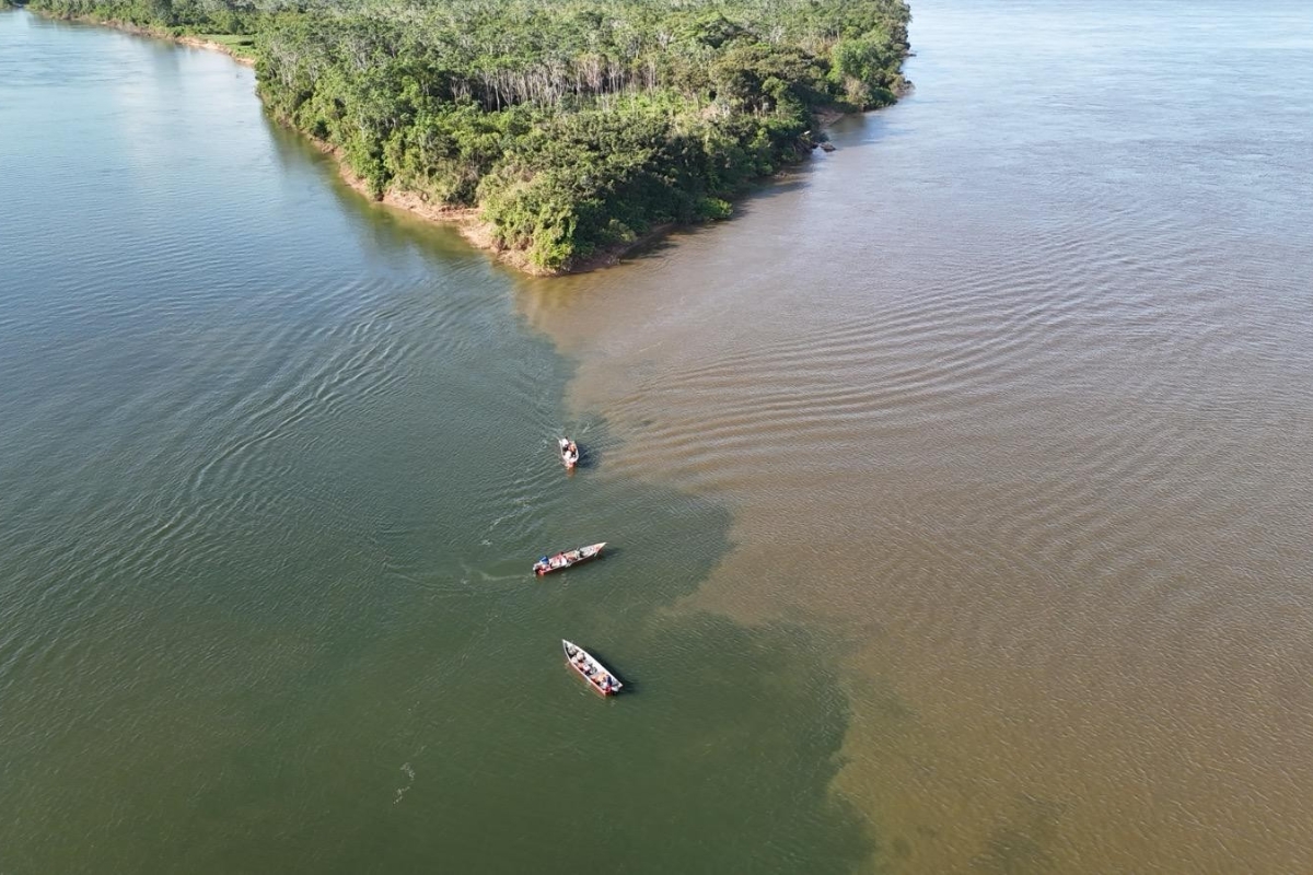
An impressive phenomenon in Northern Brazil causes rivers of different colors to flow side by side, revealing secrets about sediments, currents, and biodiversity.

How the Extratropical Cyclone Forms and Where It Operates
According to Climatempo, the formation of the extratropical cyclone begins on the afternoon of this Monday (8) between southern Paraguay, northeastern Argentina, and the state of Rio Grande do Sul. From this initial nucleus, the system begins to deepen and organize the low-pressure area that characterizes the cyclone.
In the early hours of Tuesday (9), the center of the cyclone shifts to the west of Rio Grande do Sul, advancing towards the Greater Porto Alegre region throughout the day. The atmosphere becomes more unstable, with increased cloud cover, rainfall, and strong winds associated with the passage of the cold front.

Between the early hours and the morning of Wednesday (10), the center of the extratropical cyclone is expected to reach the coastal region of Rio Grande do Sul. By Thursday (11), the system is likely to continue advancing further out to sea, starting to move away from Southern Brazil, although it may still maintain strong winds in areas near the coast.
Strong Winds and Storms in Southern Brazil
Between this Monday (8) and Thursday (11), all states in Southern Brazil are subject to heavy rainfall, storms, and winds with strong to very strong gusts due to the extratropical cyclone. The combination of the cold front, temperature contrast, and drop in pressure helps to intensify wind gusts.
In Greater Porto Alegre, the risk of storms is already expected to be high from the early hours of Tuesday (9), with intense rain and strong winds. However, the worst wind conditions are anticipated for Wednesday (10), when the cyclone will be more organized and closer to the coastal region of Rio Grande do Sul.
In Florianópolis and other areas of Santa Catarina, the weather will remain unstable between Tuesday and Wednesday, with a higher risk of heavy rain and strong winds during the peak intensity phase of the system. In the mountains of Rio Grande do Sul and Santa Catarina, wind gusts can vary between 90 and 120 km/h, especially in higher and exposed locations.
Impacts of the Extratropical Cyclone in the Southeast and Midwest
Although the process of formation of the extratropical cyclone and the cold front stimulates strong winds and storms in areas of the Southeast and Midwest, Climatempo emphasizes that the center of the cyclone will not pass directly over any area of these regions. The effects felt will be reflections of the system’s activity in Southern Brazil and the associated cold front.
Even so, the forecast indicates a significant change in wind patterns, increased cloud cover, and occurrence of rain showers, in some cases with high intensity and risk of isolated storms.
Most Affected Regions in the Southeast
In the Southeast, the greatest impacts of the extratropical cyclone and the cold front are expected to be felt primarily in the state of São Paulo, in the south-central region of Rio de Janeiro, and in parts of Minas Gerais.
In Rio de Janeiro, the repercussions are concentrated in the south-central region of the state, including Greater Rio and the mountainous region of State, where wind gusts tend to be stronger and the risk of heavy rain increases. In Minas Gerais, the most affected areas are the south-central and southwest regions, which include Southern Minas, the Zona da Mata Mineira, Greater Belo Horizonte, and the Triângulo Mineiro.
The strongest wind gusts in the Southeast region are mainly expected for Wednesday (10), when the extratropical cyclone will be more organized and operating with greater force over Southern Brazil.
Effects in the Midwest, with Focus on Mato Grosso do Sul
In the Midwest, the state most impacted by the extratropical cyclone is expected to be Mato Grosso do Sul, as it is closest to the area of operation of the system passing through Southern Brazil. As early as this Monday (8), some moderate wind gusts may be observed in parts of the state.
However, the most intense gusts are expected for Tuesday (9), when the wind circulation associated with the extratropical cyclone and the cold front gains strength and causes greater atmospheric instability, with the possibility of rain and strong winds in different regions of Mato Grosso do Sul.
When the Cyclone Begins to Weaken Over Brazil
Climatempo’s projection indicates that, between Wednesday (10) and Thursday (11), the extratropical cyclone will be fully organized and acting in its phase of greatest intensity over Southern Brazil and nearby areas. After this period, the system will move further out to sea, shifting away from the Brazilian coast.
With this distancing, the tendency is for a gradual decrease in the direct effects of the cyclone over the Central-South of the country, although the sea will likely remain agitated for some time in areas along the coast, especially in the southern region.
According to the available information, the coming days require increased attention from residents, authorities, and infrastructure sectors throughout the Central-South of Brazil, due to the potential for damages caused by strong winds, falling trees, power outages, and transportation disruptions.
In your case, have you prepared for possible storms and strong winds in your region during the passage of this extratropical cyclone through the Central-South of the country?


Seja o primeiro a reagir!