 Portuguese
  English
  Spanish
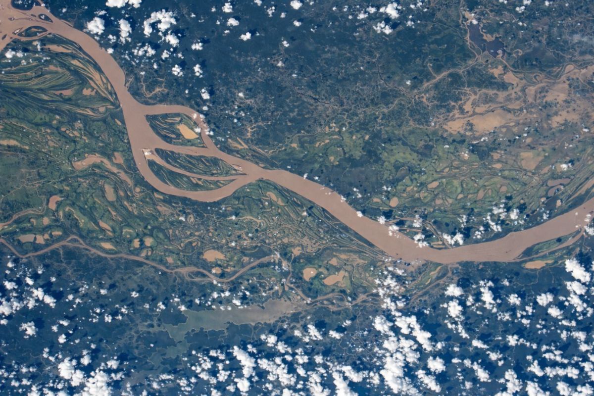
The List Of The Largest Rivers In Brazil Is Impressive Not Only For The Numbers In Kilometers But For The Way Xingu, Araguaia, Tocantins, Paraguay, São Francisco, Juruá, Madeira, Purus, Paraná, And Amazonas Organize The Life, The Economy, And The Nature Of An Entire Country.
More Than Blue Lines On The Map, These Rivers Connect Biomes, Carry History, Drive Energy, Transportation, Fishing, And Culture. Knowing The Largest Rivers In Brazil In Detail Is Understanding Why The Country Is A Global Water Powerhouse And How This Water Shapes Cities, Forests, Farms, And Riverine Communities From North To South.
10. Xingu River – About 1,870 Km

Kicking Off The List Of The Largest Rivers In Brazil, The Xingu River Travels Approximately 1,870 Km Between The States Of Mato Grosso And Pará.
It Begins Between The Formosa And Roncador Mountains In Mato Grosso And Moves North Until It Flows Into The Right Bank Of The Amazon River.
-
Home environment can influence the brain, mood, and well-being: studies indicate an increase of up to 15% in productivity, a reduction of 12% in stress with plants, and a direct impact of the circadian rhythm on the 24 hours of the day.

-
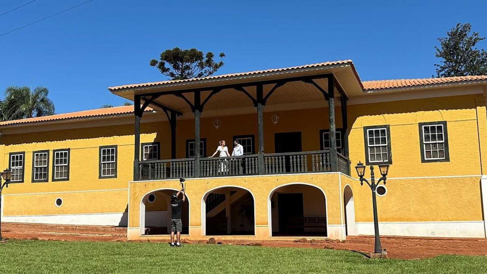
A Brazilian millionaire couple restores a farm over 150 years old in the interior of São Paulo and transforms the historic property with Portuguese tiles, antique furniture, and new spaces into a refuge that blends tradition, comfort, and sophistication.
-
Submerged city in a lake in Minas reveals intact streets, preserved vehicles, and houses after more than 60 years, impressing divers.

-
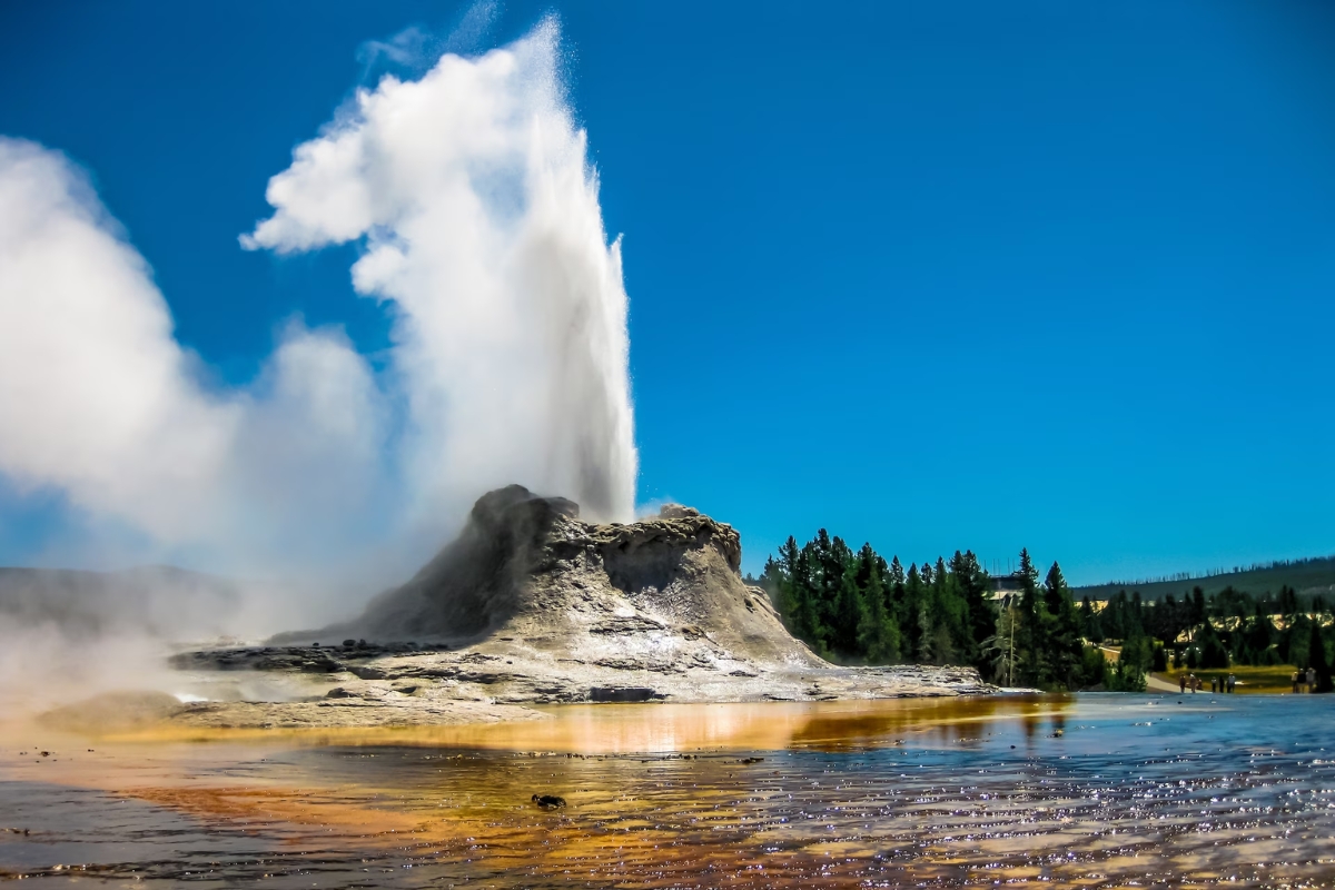
Yellowstone has started to rise again in an area of the caldera, and the movement rekindles fears surrounding the U.S. supervolcano, as scientists monitor the deformation and try to understand what is happening underground.

Along The Way, The Xingu Crosses The Amazon Region, Houses Indigenous Peoples, Cuts Through Dense Forest Areas, And Passes Through Cities That Directly Depend On Its Waters.
On Its Banks Lies The Xingu Indigenous Park, One Of The Most Emblematic Areas For Protecting Indigenous Peoples In The Country, As Well As The Belo Monte Hydroelectric Plant, Located Near Altamira In Pará, One Of The Largest Hydroelectric Plants In Brazil.
9. Araguaia River – About 2,115 Km
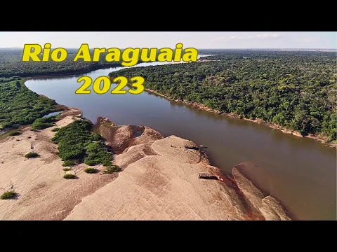
The Araguaia River Is One Of The Highlights Of The Midwest And The North, Measuring About 2,115 Km In Length. It Cuts Through Parts Of Goiás, Tocantins, Mato Grosso, And Pará.
Its Sources Are Located In Mineiros, Goiás, And Alto Taquari, Mato Grosso. From There, The Araguaia Acts As A Natural Boundary Between States And Flows Into The Tocantins River, Forming One Of The Most Important Waterway Axes In The Country.
In Addition To Transportation And Supply, The Araguaia Is Known For Tourism: River Beaches, Sport Fishing, And Landscapes That Attract Visitors From All Over Brazil.
Together With The Javaés River, It Houses The Bananal Island, Considered The Largest Fluvial Island In The World, Which Contains The Araguaia National Park And The Araguaia Indigenous Park.
8. Tocantins River – About 2,460 Km

With About 2,460 Km, The Tocantins River Is Another Heavyweight Among The Largest Rivers In Brazil. It Flows Through Goiás, Tocantins, Maranhão, And Pará.
Its Source Is Near The Serra Dourada In Goiás, And The River Flows North In A Route Parallel To The Araguaia Until It Reaches Its Mouth Near Belém In Pará, Connecting To The Amazon System.
Together With The Araguaia, The Tocantins Forms The Araguaia–Tocantins Watershed, Considered The Largest Watershed Entirely Located Within Brazilian Territory, Even While Integrating The Larger Amazon Basin System.
This River Is Vital For Energy, Transportation, Supply, And Navigation, As Well As Being A Development Hub For Several River Towns.
7. Paraguay River – About 2,621 Km

The Paraguay River Appears On The List Measuring About 2,621 Km, Flowing Through Parts Of Mato Grosso And Mato Grosso Do Sul And Continuing Outside The Country.
It Starts In The Chapada dos Parecis Region In Mato Grosso And Flows South Until It Joins The Paraná River, Of Which It Is The Main Tributary.
Along The Way, It Crosses The Territory Of Brazil, Paraguay, Argentina, And Bolivia, Being Highly Navigable.
The Paraguay Is Essential For The Pantanal, One Of The Largest Continuous Flooded Areas On The Planet. Its Floods Help Shape The Rhythm Of The Biome, Influence Fishing, Wildlife, Tourism, And Livestock.
It Also Integrates The Plate River Basin, One Of The Largest And Most Important In South America And The World.
6. São Francisco River – About 2,863 Km

Known As The Old Chico, The São Francisco River Measures About 2,863 Km And Is One Of The Most Symbolic Among The Largest Rivers In Brazil. It Flows Through Parts Of Minas Gerais, Bahia, Pernambuco, Sergipe, And Alagoas.
Its Geographical Source, According To The Ministry Of The Environment, Is In Medeiros, Minas Gerais, While The Historical Source Is Associated With The Serra da Canastra National Park In The Municipality Of São Roque De Minas.
From There, The São Francisco Crosses Minas And Bahia, Marks The Boundary Between Bahia And Pernambuco, And Then Divides Sergipe And Alagoas Until It Flows Into The Atlantic Ocean.
The Old Chico Waters Around 500 Municipalities, Supplies Water For Agriculture, Human Consumption, Energy Generation, And Regional Navigation. At The Same Time, It Is A Hub Of Culture, Faith, Music, Legends, And Stories That Mark The Northeast And Southeast.
5. Juruá River – About 3,283 Km

Moving Up The List Of The Largest Rivers In Brazil, The Juruá River Total Approximately 3,283 Km, Crossing Acre And Amazonas.
It Begins In The Andes Mountains In Peruvian Territory And Continues Its Path Until It Flows Into The Solimões River In Brazilian Territory.
Throughout Its Course, The Juruá Features A Large Floodplain, Typical Of Amazonian Rivers.
Due To The Dry And Flooding Regime, The Juruá Creates Thousands Of Lakes Every Year, And Its Water Level Can Vary Between 12 And 15 Meters.
In An Area Where Highways Are Nearly Nonexistent, The River Serves As An Essential Waterway For Riverine Communities, Transporting People, Food, Fuel, And Basic Products.
4. Madeira River – About 3,315 Km

The Madeira River Travels Approximately 3,315 Km Between Rondônia And Amazonas, Receiving Waters That Come From The Andes Mountains In Bolivia.
It Flows North Until It Joins The Amazon River, Being One Of Its Main Tributaries. The Name Madeira Comes From The Phenomenon That Occurs During The Rainy Season When The River Rises Significantly, Flooding Forested Plains And Dragging Logs And Whole Trees Downstream.
Besides Its Natural Beauty And The Strength Of Its Waters, The Madeira Is An Economic Giant: It Serves For Cargo Transport, Regional Navigation, And Houses Important Hydroelectric Plants, Integrating The Energy Generation System Of The Northern Region And The Amazon Basin.
3. Purus River – About 3,379 Km

In Third Place Among The Largest Rivers In Brazil Is The Purus River, Measuring Approximately 3,379 Km. It Also Traverses The States Of Acre And Amazonas.
Its Source Is Located In The Peruvian Andes, Close To The Source Of The Juruá River. From There, The Purus Flows Through The Northern Brazilian Region Until It Joins The Right Bank Of The Amazon River.
The Purus Is Recognized As One Of The Great Rivers In South America And The World. Its Waters Sustain Fishing, Transportation, Traditional Communities, And Areas Of Nearly Intact Forest.
In Manaus Alone, About A Significant Portion Of The Fish Sold Comes From Its Waters, Highlighting The Economic Importance Of This River For The Region.
2. Paraná River – About 4,880 Km

The Paraná River Comes In Second Place, Measuring About 4,880 Km In Length, Flowing Through Parts Of São Paulo, Minas Gerais, Mato Grosso Do Sul, And Paraná, As Well As Flowing Through Other Countries In The Region.
It Begins At The Confluence Of Two Major Brazilian Rivers: The Grande River And The Paranaíba River, At The Border Between Minas Gerais, Mato Grosso Do Sul, And São Paulo.
From There, The Paraná Flows South Until It Joins The River Plate Between Argentina And Uruguay, Near The Atlantic Ocean.
The Paraná Is A Continental Hub: It Generates Energy, Enables Navigation, Assists In The Flow Of Agricultural And Industrial Production, And Marks Borders. Along Its Course Lies The Itaipu Dam, A Binational Dam Between Brazil And Paraguay, Ranking Among The Largest In The World In Terms Of Energy Production.
1. Amazon River – About 6,992 Km

At The Top Of The List Of The Largest Rivers In Brazil Is The Amazon River, Measuring About 6,992 Km In Length. This Giant Primarily Flows Through The States Of Amazonas And Pará In Brazilian Territory.
The Amazon Rises In The Western Portion Of The Andes Mountains In Peru And Flows Toward The Northern Region Of Brazil, Receiving Water From Over A Thousand Different Tributaries Until It Flows Into The Atlantic Ocean.
The Amazon River Is The Longest River In The World In Length (By Various Measurements) And Also In Water Volume, With A Discharge That Can Be More Than 60 Times Greater Than That Of The Nile.
Its River Basin, The Largest On The Planet, Concentrates Alone About 20% Of The Earth’s Surface Fresh Water.
Besides Its Physical Scale, The Amazon Is A Climate, Ecological, And Economic Pillar: It Influences Rainfall In Other Regions Of Brazil, Sustains Fishing, Transportation, Tourism, Extractivism, And Houses A Biodiversity That Is Still Far From Being Fully Known.
What The Largest Rivers In Brazil Reveal About The Country
Looking At Xingu, Araguaia, Tocantins, Paraguay, São Francisco, Juruá, Madeira, Purus, Paraná, And Amazonas Is To Understand That The Largest Rivers In Brazil Are Much More Than Records In Kilometers.
They Show A Country Of Continental Dimensions, Where Rivers Function As Natural Avenues, Define Borders, Sustain Cities, Nourish Forests, And Connect Cultures And Economies.
Protecting These Rivers Means Protecting Water, Climate, Biodiversity, Energy, And Quality Of Life For Millions Of People.
And You: Which Of These Largest Rivers In Brazil Surprises You The Most In Size Or Importance, And Why?


-

-

3 pessoas reagiram a isso.