
 Portuguese
  Spanish
One Of The Shortest Highways In Brazil Surprises By Its Strategic Function: In Just A Few Kilometers, It Guides Millions Of Visitors To The Main Religious Tourism Pole In The Country, Uniting Faith, Logistics And Intensive Annual Flow
The Brazilian road network forms the backbone of transportation in the country. The Federal Highway connects entire regions, sustains the economic flow, and ensures that people, goods, and services circulate between distant territories.
Among mountains, urban areas, agricultural zones, and border regions, these roads shape the national routine and directly influence the lives of millions of drivers and workers who depend on this system every day.
Within this extensive network, there are routes that stand out for their grandeur.
-
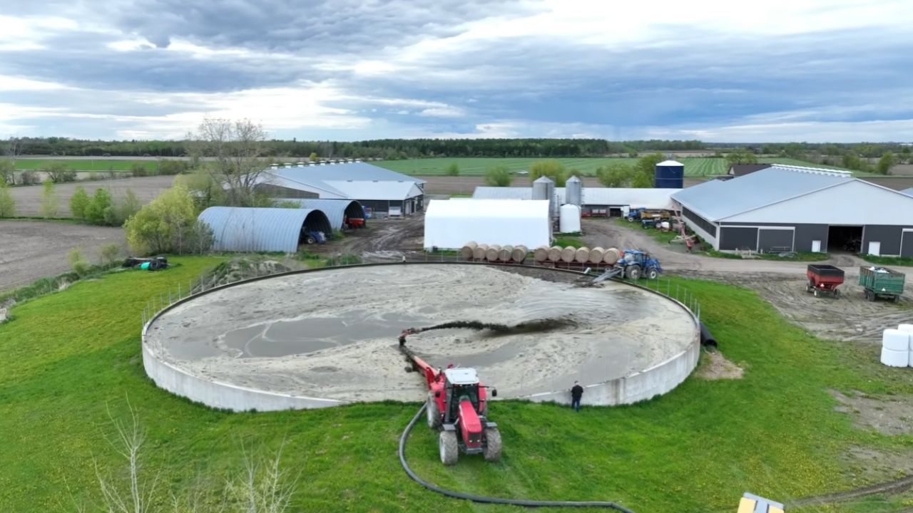
Dairy Farm Prevents Manure Lagoon Overflow with High-Powered Tractors and Industrial Pumps, Turning 100,000 Gallons of Waste into Fertilizer

-
Masked Man Claims to Have Traveled to 2118, Predicts World War Starting with North Korea and Reveals Secret CIA Technology

-
At 54, Brazilian Artisan Turns Textile Waste into a Successful Handbag Brand, Earning Over $6,000 Monthly

-
Brazilian Entrepreneur Sells $50,000 Monthly in Sustainable Luggage Made from Recycled Bottles, Eyes International Market


These are roads that cross states, traverse biomes, and serve as strategic axes for the transportation of goods that drive the Brazilian economy.
At the same time, there are routes that stand out not for their size but for their function. These are small sections that, even if discreet on the map, play essential roles in connecting cities, parks, tourist areas, and religious destinations.
This combination of giants that cut across the country and compact routes that serve specific functions reveals the diversity of Brazil’s road infrastructure.
Some roads stretch thousands of kilometers, while others can be traveled in just a few minutes. This contrast shows that each stretch, regardless of length, carries its own importance within the national dynamics.
What Is The Shortest Highway In Brazil?

There is no official information regarding which is the shortest highway in Brazil. However, Click, Petróleo e Gás analyzed and among the plethora of highways, BR-488 appears as one of the most curious in the federal network.
The stretch of about 6 kilometers, more precisely 5.9 km, connects the junction of BR-116 to the National Sanctuary of Our Lady Aparecida.
Even though it is so short, this connection serves an essential function for millions of visitors who arrive daily in the São Paulo city.
The route gains relevance because it concentrates the flow of pilgrims heading to one of the largest Catholic pilgrimage sites in the Americas.
The short distance does not diminish its practical and symbolic value. On the contrary, it transforms this highway into a corridor of faith and logistics that marks the arrival at the religious destination.

Direct Link Between Dutra And The Aparecida Sanctuary
BR-488 acts as a quick access route for those coming from São Paulo or Rio de Janeiro via the Dutra highway. The road shortens the distance and directs travelers straight to Aparecida.
This simple connection stands out for facilitating the movement of tourist buses, pilgrimage vans, and cars that circulate year-round.
The landscape near the Serra da Mantiqueira complements the region’s scenery. At the same time, the urban limitations of Aparecida make the management of the stretch even more careful due to the constant flow of visitors.
A Short Journey With Religious And Emotional Significance
The highway does not impress by its length, but by the destination it serves. The journey of just a few minutes represents, for many pilgrims, the conclusion of long journeys of devotion. This feature transforms BR-488 into a route imbued with symbolism.
The simplicity of the route combines with the cultural strength of the sanctuary. Thus, the short road becomes a link between faith and daily commuting.
Other Highways That Stand Out For Their Short Length
BR-363, in Fernando de Noronha, is 8 kilometers long and is often pointed out as the second shortest highway. BR-498 spans 15 kilometers between BR-101 and Monte Pascoal.
BR-499 measures 18 kilometers to Cabangu. BR-485 runs for 24 kilometers to the Itatiaia National Park. BR-469 connects Foz do Iguaçu to the Iguaçu National Park over 29 kilometers.
BR-495 has 30 kilometers between Teresópolis and Itaipava. BR-465 reaches 31 kilometers in Santa Cruz, Rio de Janeiro. Meanwhile, BR-410 totals 34 kilometers between Tucano and Ribeira do Pombal.
The Main Highways In Brazil And Their Characteristics
In addition to short roads, the country features highways that connect regions and sustain a large part of the national economy. These routes allow for the transportation of goods, the movement of people, and the integration between producing areas and urban hubs.
BR-101: Extensive Route Along The Brazilian Coast
BR-101 stretches 4,650 kilometers along the eastern coast. The highway links Rio Grande do Sul to Rio Grande do Norte and passes through tourist cities, industrial areas, and producing zones.
Its economic role is central. It facilitates the transportation of agricultural, industrial, and mineral products. It also boosts jobs and investments in the areas it traverses, creating opportunities and strengthening the regional economy.
BR-116: Direct Link Between São Paulo And Rio de Janeiro
BR-116 starts in Ceará and ends at the border with Uruguay. The best-known stretch connects São Paulo and Rio de Janeiro. With about 400 kilometers, the route facilitates travel between two of the country’s most urbanized and influential regions.
The highway includes segments like the Presidente Dutra and Régis Bittencourt. Besides its economic role, it passes through tourist destinations and historic cities.
BR-153: The Transbrasiliana That Cuts The Country From South To North
BR-153 stretches 3,585 kilometers between Rio Grande do Sul and Pará. It crosses Santa Catarina, Paraná, São Paulo, and Tocantins. The road connects producing areas to important industrial hubs and ports.
This integration favors the transportation of goods. Additionally, it brings municipalities from inland closer that depend on this infrastructure to access markets and services.
BR-381: Strategic Traffic Between Belo Horizonte And São Paulo
BR-381 starts in Espírito Santo and continues to São Paulo. The busiest stretch links Greater São Paulo to Greater Belo Horizonte. Known as Fernão Dias, this portion totals 562 kilometers.
The highway measures 1,220 kilometers in total. Some segments, particularly between Espírito Santo and Minas Gerais, require more attention due to curves and winding stretches.
BR-320: The Road That Crosses The Amazon Forest
BR-320 starts in Paraíba and reaches Amazonas. Its passage through the Amazon region makes the highway challenging. Despite infrastructure limitations, the road connects distant areas and allows for linkage between the Northeast and North of the country.
BR-262: Transversal Route Between Four States
BR-262 connects Espírito Santo, Minas Gerais, São Paulo, and Rio Grande do Sul. The highway spans 2,213 kilometers. It begins in Vitória and ends at the border with Bolivia, in Mato Grosso do Sul.
In part of Minas Gerais, BR-262 shares its path with BR-381. This feature reinforces its function as a link between diverse states and regions.
BR-364: Extension That Reaches The Far West
BR-364 stretches 4,230 kilometers. It starts in the interior of São Paulo and reaches Acre.
The highway is vital for the supply and transport of goods in the North and Central-West regions. Its length enhances territorial integration and connects productive areas to distant regions.
The Importance Of Long And Short Highways In The Brazilian Dynamics
The Brazilian road network supports a large part of the circulation of goods and ensures the connection between different regions. Long highways strengthen national transport. Meanwhile, short stretches, like BR-488, show that each highway fulfills a unique role.
The shortest federal highway in Brazil summarizes this importance. While other routes stretch for thousands of kilometers, it stands out for its simplicity. By linking the Dutra to the Aparecida Sanctuary, the short road transforms into a route of faith, mobility, and collective significance.
If you want, I can generate a version with a journalistic title, a shorter version, a version for social media, or even an adaptation for video.


O último parágrafo do texto mostra quem realmente pesquisou e redigiu o texto. #IA
Infelizmente essa é a nova realidade a que estamos submetidos. E pelos comentários, vemos que não foi feita nem a revisão das informações para confirmar se estava tudo certo.
A BR que vai da Paraíba ao Amazonas é a 230, e não 320.
Quem produziu o texto da Br 262 atingindo o Rio Grande do Sul precisa observar melhor o mapa do Brasil. A rodovia atinge o Mato Grosso do Sul. “Só se os estados tenham mudado de localização.”