 Portuguese
  English
  Spanish
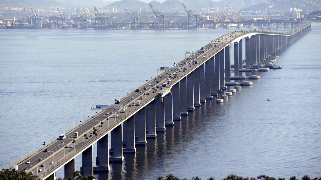


Inaugurated in 1974, the Link Changed Mobility Between the Two Cities and Became a Key Piece for Logistics and Daily Commuting
The Rio-Niterói Bridge is not just a postcard. It functions as one of the main traffic corridors in the state of Rio de Janeiro, connecting the capital to Niterói and helping to distribute flows to other regions.
Before the bridge, the crossing depended on slower alternatives subject to operational limitations. With the structure installed over Guanabara Bay, commuting gained predictability and began to influence where people live, work, and consume services.
13.2 km That Carry Mobility, Work, and Production
The reported length of the bridge is 13.2 km, a number that helps characterize the engineering challenge and the role the road plays. It facilitates access between Rio de Janeiro and Niterói and reduces travel time in an area where every minute lost in traffic has an economic cost.
-
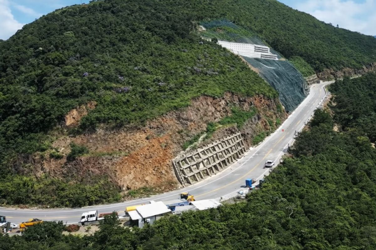
The section of Serra da Rocinha on BR-285 is now open in Timbé do Sul: 50 m tensioned curtains and top-down technique stabilize the slope, with a stairway duct controlling the water.
-
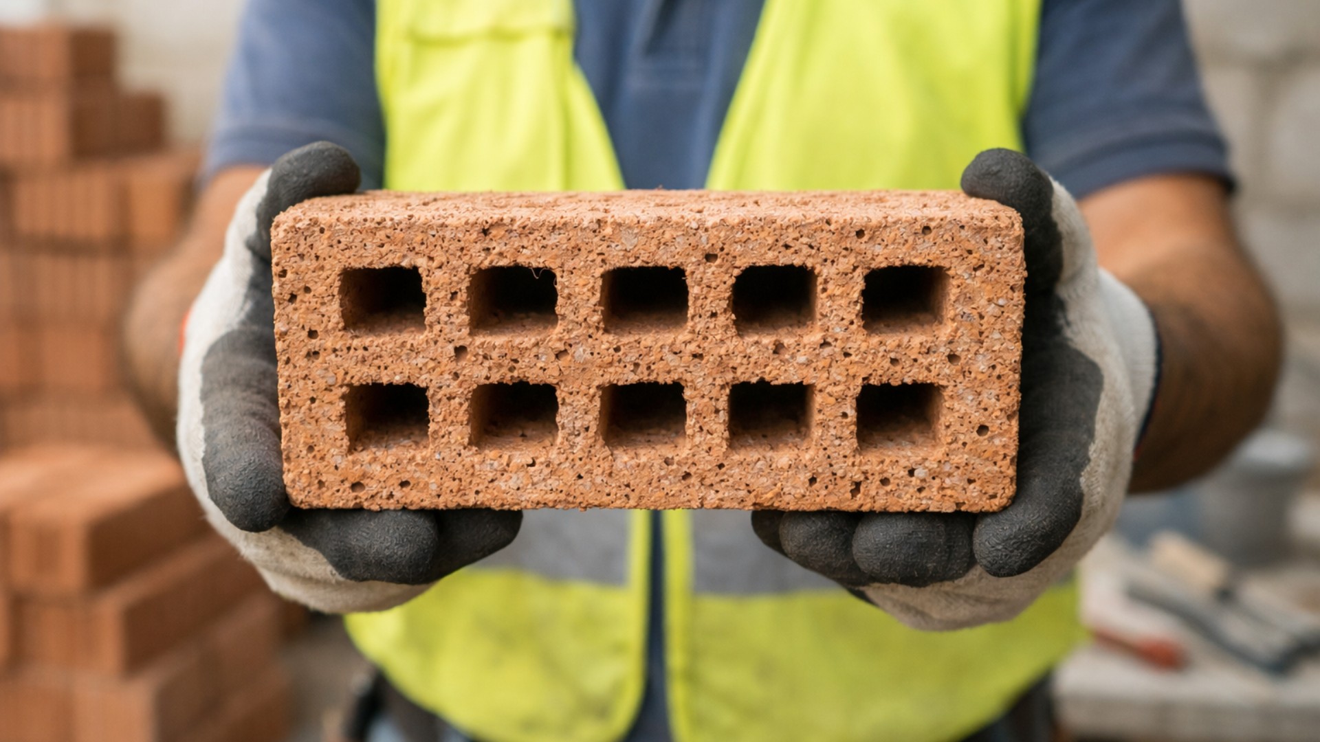
Scientists use sawdust mixed with clay to create a lighter brick, promising efficient thermal insulation and impressing by transforming waste into a solution for construction.
-
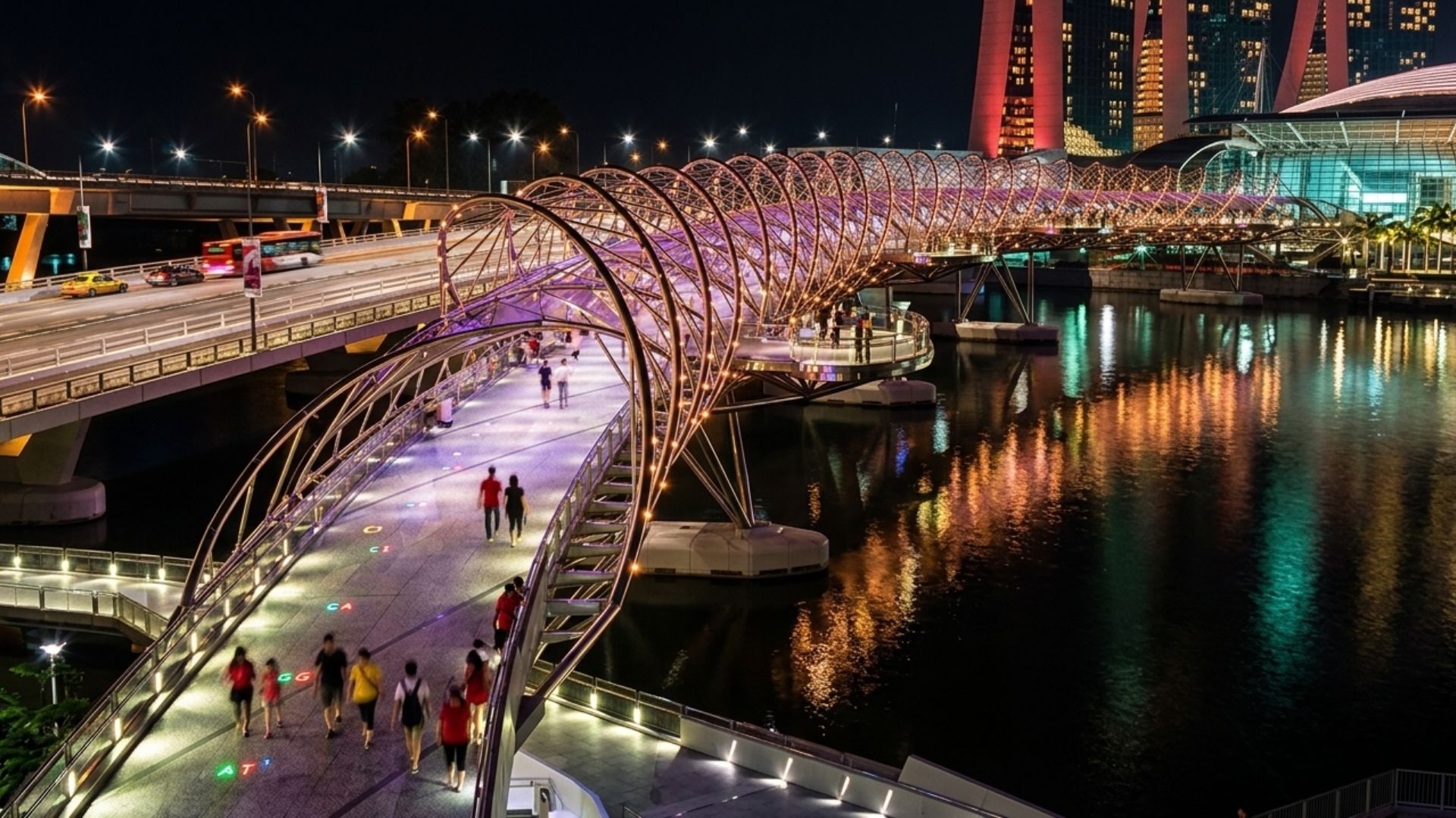
With a DNA shape, this bridge in Singapore draws attention in modern architecture and surprises tourists by transforming a simple crossing into an unforgettable visual experience in the urban heart.
-
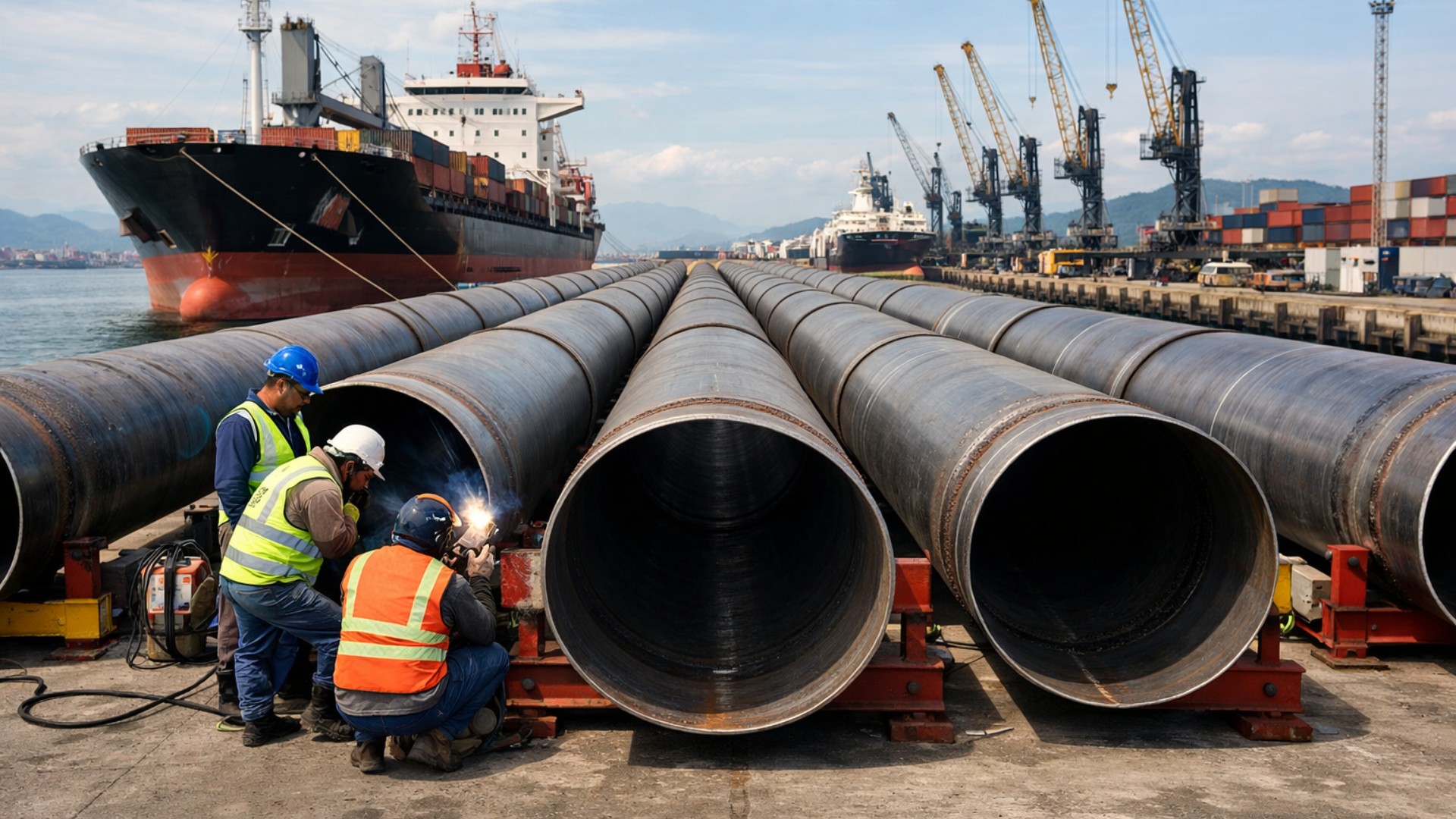
Giant underwater pipeline begins to take shape with a R$ 134.7 million project at the Port of Santos: the 1.7 km structure uses 12-meter and 700 mm pipes to supply water to 450,000 people in Guarujá.

The bridge is also treated as a route for moving production. This frequently appears when discussing commuting to the Lagos Region and the northern coastline of Rio de Janeiro, as well as connections with other states.
The result is a structure that serves individual transportation, public transport, and cargo flow, creating a ripple effect on supply, tourism, and industrial activities.

The Inauguration in 1974 and the Symbol of Integration
The historical landmark cited for the bridge is March 4, 1974, the date of inauguration after years of construction. The event consolidated a physical link that had been dreamed of for decades and helped rebalance the urban dynamics between the two shores of the bay.
Over time, the bridge has transformed into a reference for infrastructure in the country. It appears in discussions about concessions and traffic management, as the operation of a road of this size requires continuous planning.
The presence of the bridge has also reinforced an axis of economic integration. Services, universities, job centers, and commercial activities began to interact more directly, enhancing the daily exchange of people.
The Weight of Operation and the Need for Continuous Maintenance
A bridge that receives a high volume of vehicles needs to be monitored and maintained permanently. This involves inspections, scheduled works, safety interventions, and measures to reduce risks during periods of higher demand.
When there are incidents or restrictions, the effects are immediate. The impact manifests in traffic congestion, delays in the transport of goods, and increased commuting time for workers, reinforcing the idea of critical infrastructure.
For this reason, public debate often revolves around two fronts. The first is the quality of operation, with measures for fluidity and safety. The second is the capacity to absorb growing demand, something that depends on urban policies and mobility alternatives.

What May Come Into Focus Moving Forward
As it reaches half a century, the bridge tends to return to the news whenever discussions arise about modernization, operational improvements, and integration with other transport solutions. In metropolitan areas, changes in commuting patterns may increase pressure on strategic roads.
Another point that should gain attention is the relationship between infrastructure and resilience. Climate events, increased traffic, and large-scale construction require response and communication protocols to minimize impacts and guide those who depend on the crossing.
Ultimately, the Rio-Niterói Bridge continues to be a structure that blends engineering, economy, and everyday life. It connects cities, but also connects production chains, jobs, and urban planning decisions that go far beyond the crossing.


JÁ ESTÁ NA HORA DE OUTRA PONTE PARALELA À ATUAL!
O projeto da ponte era com o metrô passando em baixo de toda a sua extensão, como existe em diversos países, melhor solução do que a linha três do metrô, que ficará bem mais caro para os órgãos públicos.
A solução é construir uma linha de metro da Praça XV para Niterói! O resto é conversa fiada! Uma linha 3 do metrô ligando a Pça Arariboia a São Gonçalo…. É isso…