 Portuguese
  English
  Spanish
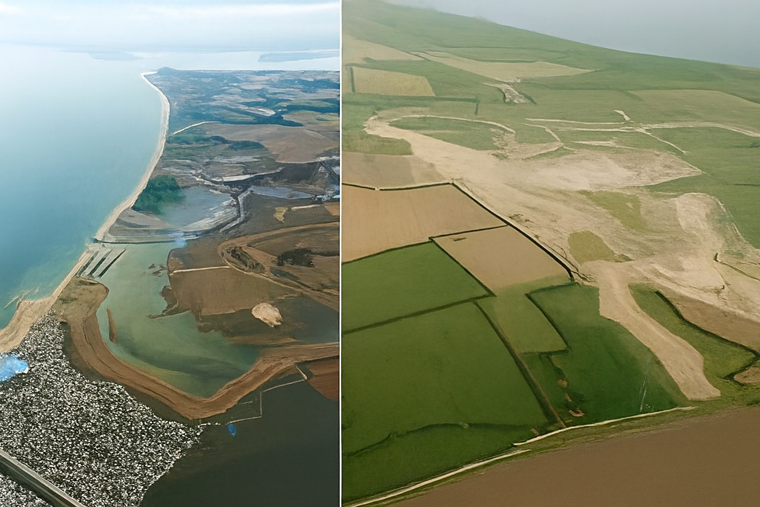
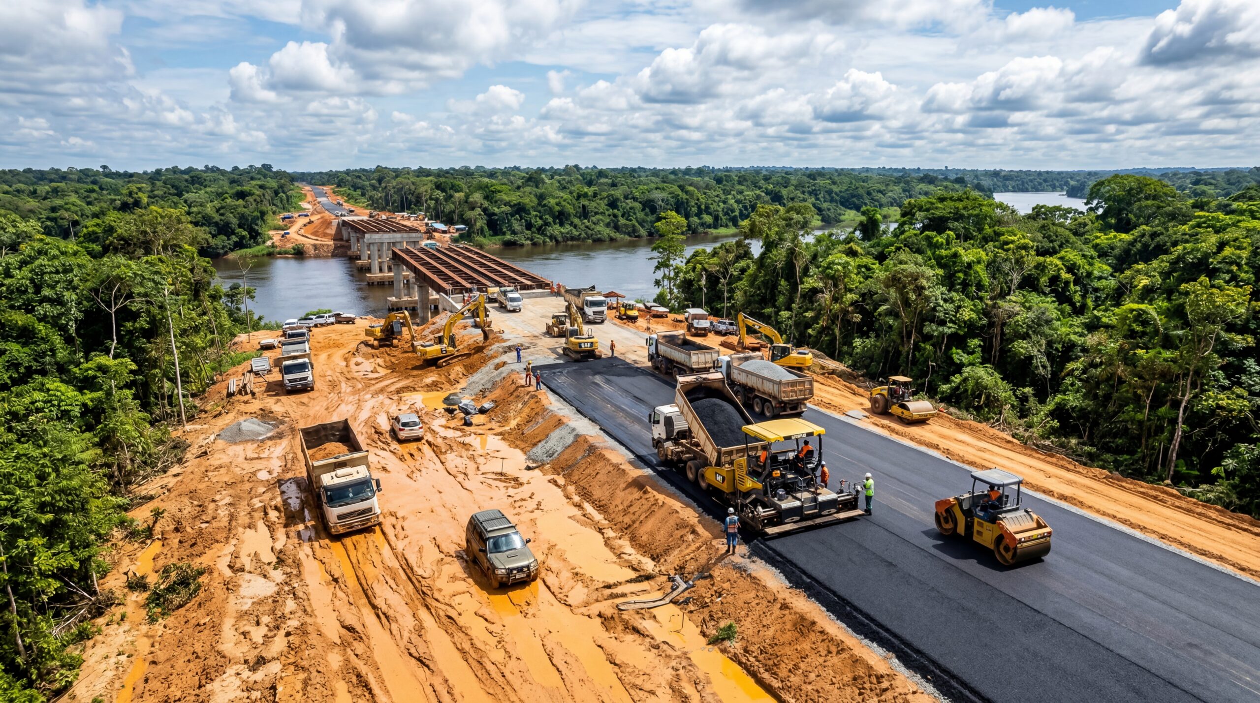
England Invests £28 Million and Releases 180 Hectares to the Sea to Reconstruct Salinas and Marshes That Reduce Waves, Flooding, and Protect Coastal Villages from Extreme Weather.
Few people imagine that one of the boldest solutions against rising sea levels in Europe does not involve bigger walls or reinforced concrete, but rather the opposite: making space for the ocean to re-enter land. This is exactly what England did in the project known as Medmerry Managed Realignment, in West Sussex County, by retreating coastal defenses, allowing controlled flooding of agricultural areas, and creating a natural shield formed by salinas, marshes, and coastal wetlands. The goal was simple yet ambitious: to adapt towns and villages to rising sea levels, reduce flood risks, and recreate intertidal ecosystems that have almost disappeared throughout the 20th century.
The project cost around £28 million and is now considered the largest open coast realignment in Europe, according to the Institution of Civil Engineers of the UK. More than engineering, it has become a laboratory for nature-based climate adaptation, showing that in some places, the ocean needs to advance for people to remain.
How the Sea Came Back In and Became a Natural Protection
For decades, the southern English coast was defended by dikes and coastal barriers that tried to contain erosion and prevent storms from reaching communities like Selsey. These barriers suffered constant wear and tear and required expensive maintenance.
-
Created by George Lucas with over $1 billion, a futuristic museum in the shape of a spaceship with 1,500 curved panels is about to open in Los Angeles and will house one of the largest private collections of narrative art in the world.

-
Couple shows how they built a retaining wall on their property using 400 old tires: sloped land turned into plateaus, tires are aligned, filled, and compacted with layers of soil, with grass helping in support and at almost zero cost.
-
Engineer explains drainage during the rainy season: the difference between surface water and deep water, ditches, gutters, and water outlets on the road, as well as drains and drainage mattresses, to prevent erosion, aquaplaning, and flooding at the construction site today.
-
With 55 floors, 177 meters in height, a 15-meter walkway between the twin towers, ventilated facade, and 6,300 m² of leisure space, Ápice Towers already has one tower completed and another nearly at the top.


With each more aggressive winter, the combination of rough seas and high tides required emergency reinforcements. It was a containment game with an expiration date.

In the early 2000s, the technical discussion changed. With rising sea levels recorded in the region and the intensification of storms, engineers and ecologists concluded that insisting on rigid walls and dikes would worsen the so-called coastal squeeze, a phenomenon where coastal habitats are squeezed between rising seas and artificial barriers.
Instead, it was decided to retreat the coastal defense, open new areas for intertidal flooding, and let natural processes reconstruct a buffer zone between the sea and human communities.
To that end, a new, more internal dike was built in a safe position, and the old dike was partially removed. The sea then filled the area between the two lines of defense, transforming about 183 hectares into intertidal wetlands composed of salinas, marshes, and winding channels that formed over the following months. It is this natural mosaic that today absorbs wave energy, dissipates storms, reduces erosion, and drastically lowers flood risks in populated areas.
The Technical Logic Behind Coastal Realignment
The concept applied in Medmerry is called managed realignment. Unlike the large dredging and landfill projects of the past, this approach works with natural processes. The sea is not fought against, but guided.
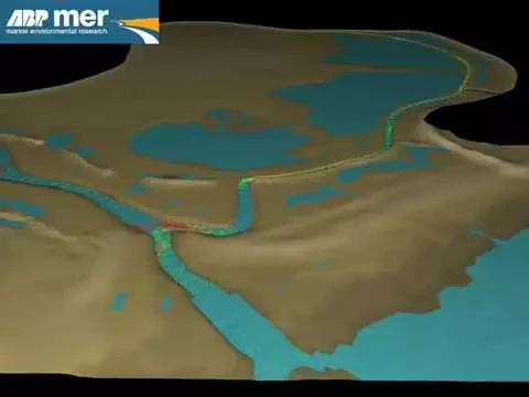
This strategy involves three main pillars. The first is to reposition coastal defenses, creating space for intertidal zones. The second is to allow controlled sea entry to form salinas and brackish marshes, which act as natural buffers. The third is to monitor the area to ensure sediment stability, water quality, and safety of nearby communities.
This ecological engineering benefits from the physical characteristics of saline marshes. The vegetation, adapted to the saline environment, reduces water speed, captures sediments, and reinforces the soil. This causes wave energy to gradually diminish before reaching the inner dikes. The greater the width of the marsh, the greater the energy dissipation.
The Return of Life and the New Natural Infrastructure
One of the most visible consequences of the project was the return of wildlife. Before the intervention, the area was dominated by agriculture and rigid dikes, with little ecological diversity.
Just a few months after the opening, migratory birds, juvenile fish, crustaceans, and plants specialized in salinas began to colonize the environment. Today, Medmerry is also a reserve managed by the Royal Society for the Protection of Birds, attracting observers from all over the UK.
The restoration of habitats has brought other benefits. Marshes and salinas function as carbon sinks, retaining organic material in the sediment. They also serve as nurseries for marine species that depend on shallow, protected waters. The reverse trail, which was once dominated by tractors and agricultural production, is now crossed by researchers with binoculars and cameras.
Socioeconomic Impacts and Water Security
The coastal realignment was not just an ecological response; it was also an economic and social solution. The old coastal defenses required constant maintenance, with rising costs year after year. By retreating the dikes, the government reduced expenditures on emergency reinforcements, gained a long-term natural barrier, and even created a tourist attraction.
With the stabilization of internal defenses, adjacent communities are protected from storms that previously required frequent alerts.

The new internal dike was designed to withstand events that, statistically, would only occur once every century, increasing the safety of housing and critical infrastructures. The very logic of the project reverses a historical idea: the sea has ceased to be viewed as an inevitable threat and has become incorporated into the protection strategy.
A Reference for the Coastal Future of Europe
Medmerry has become emblematic because it was the first large-scale project to transform climate adaptation policy into concrete works. This was not a theoretical exercise but applied engineering to solve a real problem: how to live with rising sea levels without building endless walls.
This is why the project is studied by coastal engineers from the Netherlands, Germany, and Denmark, countries that also face similar challenges.
While many cities still discuss what to do, Medmerry has already accumulated a decade of data on sedimentation, fauna, safety, and public acceptance. It is a living example of how cities can coexist with the ocean instead of confronting it head-on.
The future of European coastal areas is likely to increasingly depend on these hybrid solutions of engineering and nature. The question is not whether the sea will advance, but what communities will do when it does.
Medmerry points to a pragmatic direction: making room for natural processes to do what they do better than any wall, while people and infrastructure remain safe.
In an era of more violent storms and higher seas, it may be that saline marshes, salinas, and wetlands become the continent’s most valuable defense structures. And, ironically, it all began when engineers decided to stop fighting the sea and invited it to come in.


-

3 pessoas reagiram a isso.